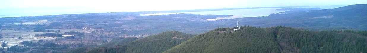
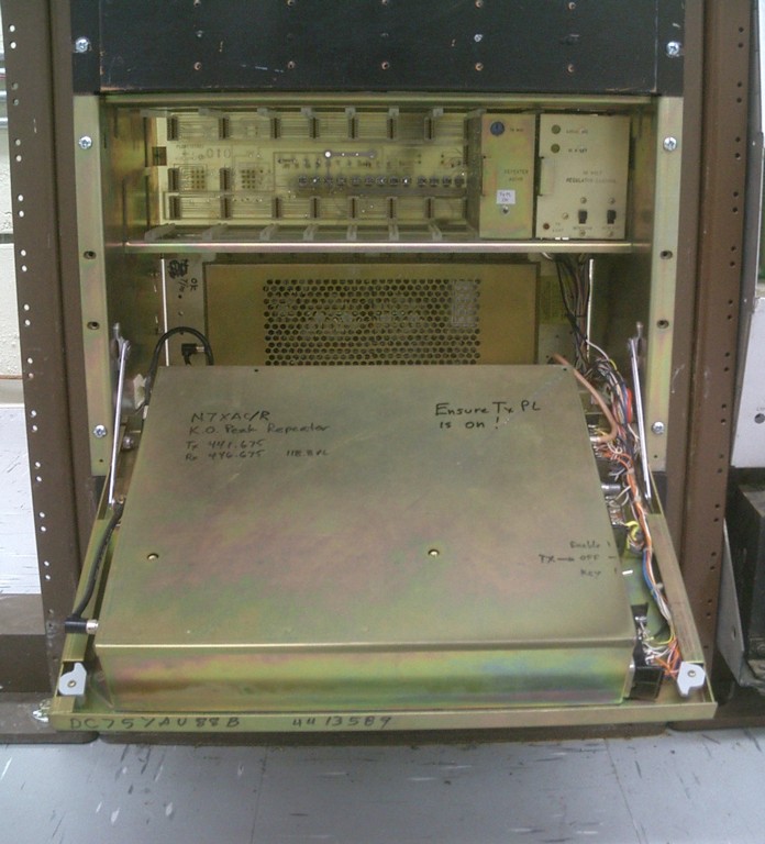
KO Peak
Pacific County, WA
46.461068, -123.550658
2900 Feet
Call: N7XAC
224.040 -1.6MHz 118.8Hz
441.675 +5MHz 118.8Hz
KO Peak 1.25m Repeater
KO Peak UHF Repeater
|
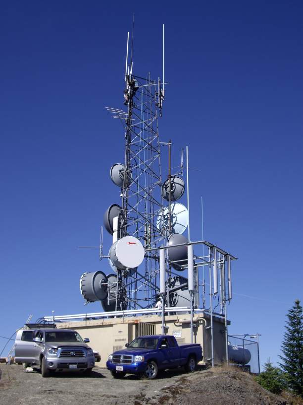
Location: KO Peak is the highest radio site in Pacific County, and
is located 6 miles south of Lebam, WA. It is 12 miles by logging road
from the highway, and can be inaccessible much of the year due to
lingering snow because the road climbs the northern face of the mountain
and much of the road is in shadow nearly all the time.
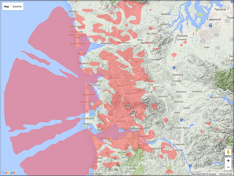
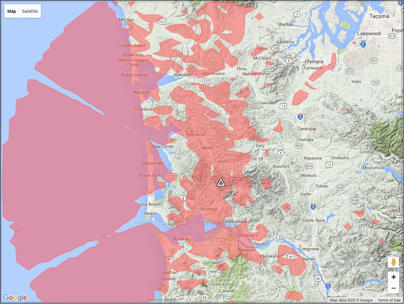
Coverage: KO Peak is a great long-range site, and both repeaters
can be worked directly from Tacoma, Olympia and northern Grays Harbor County
on the north; Vancouver, WA, and Seaside, OR on the south and well out to sea
to the west. The intra-county coverage within Pacific County can be spotty, with
some very good locations and some not so good. The "KO" repeaters are
very strong in the Menlo
Valley, and northern Pacific County, as well as portions of Grays Harbor
County, along the Interstate-5 corridor, and on the Long Beach Peninsula.
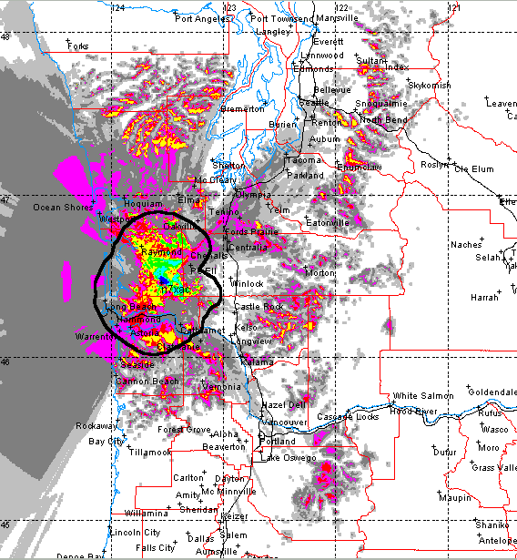
Click here for a site plot for the UHF machine,
but representative of the coverage from both repeaters, with the 224.040
being moderately better.
The KO Peak site is instrumental in conjunction with the
BeachNet
linking system to knit the network together. The UHF and VHF repeaters
each have their role, and both can be accessed directly from the
Washington State Emergency Command Center at Camp Murray. This is a
keystone of the Pacific County ARES/RACES Emergency Plan.
The 224.040 repeater normally operates independently, as a stand-alone
resource. From an Emergency Communications
standpoint, it is routinely used as a conduit for connecting the Emergency
Operating Centers of the Southwestern Washington counties to Camp Murray
in times of disaster. It is also used within Pacific County to provide an
intercom between their two EOCs. Since most scanners don't cover the 220-band,
its use reduces the number of ears listening.
The 441.675 repeater operates permanently linked as part of the
BeachNet
system of repeaters, and incorporates a remote base station,
allowing frequency agile use of the FM portions of the 10-, 6-, 2-,
and 1.25-meter,
and 70-centimeter bands. This is available for communications with
other repeaters or simplex frequencies, with a very favorable range
afforded by the 3000-foot altitude of the antennas. The entire network
can be connected to these flexible links.
The KO Peak station took
a direct lightning strike
on November 7, 2009,
vaporizing the
UHF antenna,
damaging the
nearby 220-MHz antenna,
and taking out the
isolator, preamp, and
power supply.
To make matters worse,
the site was inaccessible
under deep snow.
This is arguably the
"worst case
scenario"
as far as a repeater
station on a high,
remote site.
Fortunately, the
site structures and
our repeater equipment were
properly grounded.
Thanks to our loyal
users, contributing
in support of network
maintenance,
spares were on
hand to
replace the
destroyed components.
The UHF station was
back on the air
by December
The 220 antenna
was replaced in May, 2010.
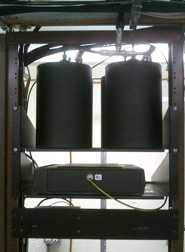
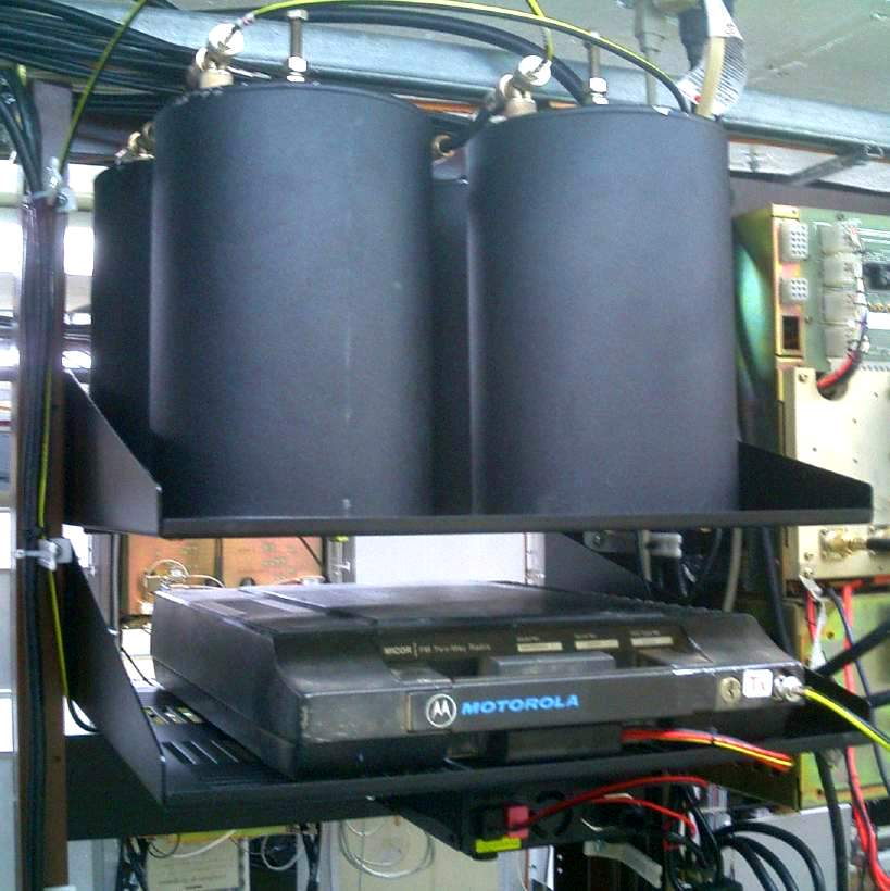
Hardware: The UHF station consists of a GE Mastr-II continuous duty
base station running 80-watts through a circulator, a low-pass filter,
and a Phelps-Dodge
6-cavity bandpass-notch duplexer to a "Stationmaster" style gain
vertical at the top of the
tower through 100-feet of LDF5-50 7/8-inch hardline. The controller is an
ACC RC-850 with Digital Voice Recorder and an FC-900 interface for the remote
base. The 140, 220 and 440 remote base radios share a Comet CX-333 tri-band antenna
through a triplexer, while the 6-meter radio uses a ground-plane vertical
on the fence and the 10-meter radio uses a vertical dipole on the side of the tower.
There is a dedicated control receiver and a second, single channel receiver
that only "presses the reset button" on the controller as a back-up.
The 224.040 repeater is a converted Motorola mobile, with an
internal controller and a switching power supply feeding a
(new May 2010) Stationmaster gain vertical at the top of
the tower through 7/8-inch hardline.
|