
 The Ionosphere and Skywave PropagationIonization of D, E and F regions
  Free-electron density Skywaves
Free-electron density SkywavesThe atmosphere is classified into layers based on its physical properties and functions.
Here, we focus on the mesosphere and ionosphere, which are located between 50 to 700 kilometers above Earth's surface:
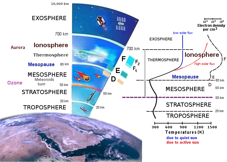
Figure 1: Ionosphere (Thermosphere) is part Earth's Atmosphere
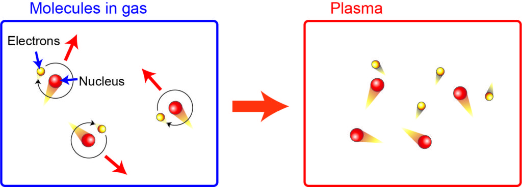
EUV sunlight ionizes atoms and molecules, releasing free electrons and ions that combine to form plasma. Hence the name Ionosphere.
The ionosphere is divided into regions that range in altitude from 48 to 600 kilometers above the earth's surface.
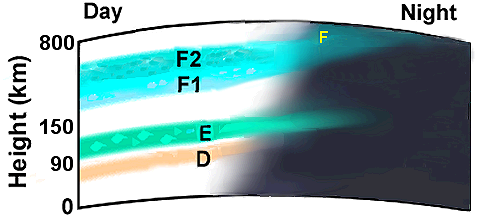
Figure 3: Ionospheric regions illustration
This figure shows ionospheric regions, labeled D, E, F1, and F2, with an additional label F on the night side. It highlights the variation in ionosphere regions between day and night, with the day side on the left and the night side on the right. This visual representation helps understand how the ionosphere's structure changes with the time of day.
These regions are distinguished by their free-electron densities.
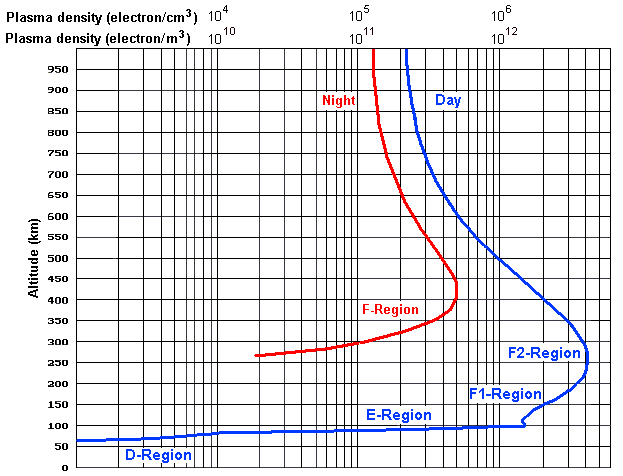
Figure 4: Typical Distributions of Free Electrons in the Ionosphere
The above graph is based on a review from U.C.Berkeley by Bob Brown Ph.D, NM7M (SK) ↗
HF radio waves aimed at the inosphere can be bounced, allowing for global communication channels.
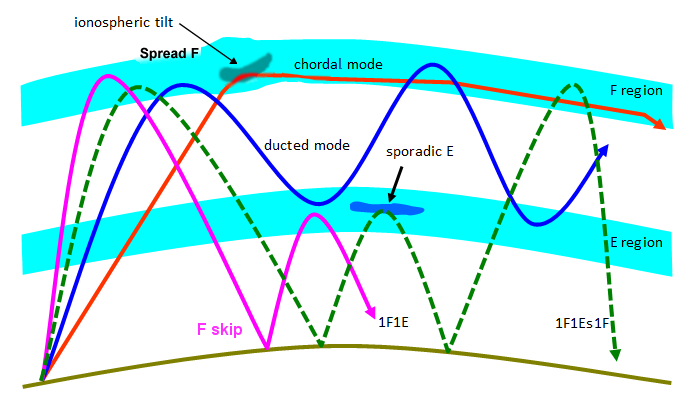
Figure 5: Complex skywave modes:
F Skip / 1F1E, E-F Ducted, F Chordal, E-F ocasional and sporadic E↗.
Diagram courtesy of ASWFC↗ ibid Section 2.4, Fig.2.4.
Figure 5 shows different modes of radio wave propagation in the ionosphere, including ionospheric tilt, chordal mode, ducted mode, sporadic E, F skip, 1F1E, and 1F1Es1F. It highlights how radio waves interact with the E and F regions, illustrating their travel paths over long distances.
Summary:
This page explains how the ionosphere enables HF radio communication by forming plasma layers (Figures 1–2) and organizing into distinct regions—D, E, and F (Figure 3). Changes in electron density with altitude and time (Figure 4) allow various skywave propagation modes, including skip, ducted, and chordal paths (Figure 5).
Real time radio propagation map
Current solar conditions Ham radio
Current Ham Radio HF Propagation
HF Radio Propagation Search Terms
Current HF Band Conditions Online Map
Current Ham Radio Propagation Conditions
Real-time watching of worldwide ham activity
How does the sun affect radio communication?
Real-time watching of worldwide activity of hams
The Fascinating World of HF Skywave Propagation