
Amateur radio operators throughout Hawaii prepare to respond to Hurricane/Tropical Storm Ignacio that arrives in Hawaiian waters on TBD. This page provides progress information on the event. It is updated infrequently, so check the latest advisories from the National Weather Services and Emergency Management agencies. Last update is Fri Sept 4, 8:00 pm
Activities are chronicled here. It's not a question of "If", it's a question of "When".
Enjoy, and feel free to drop me an e-mail if you have any questions.
Overview
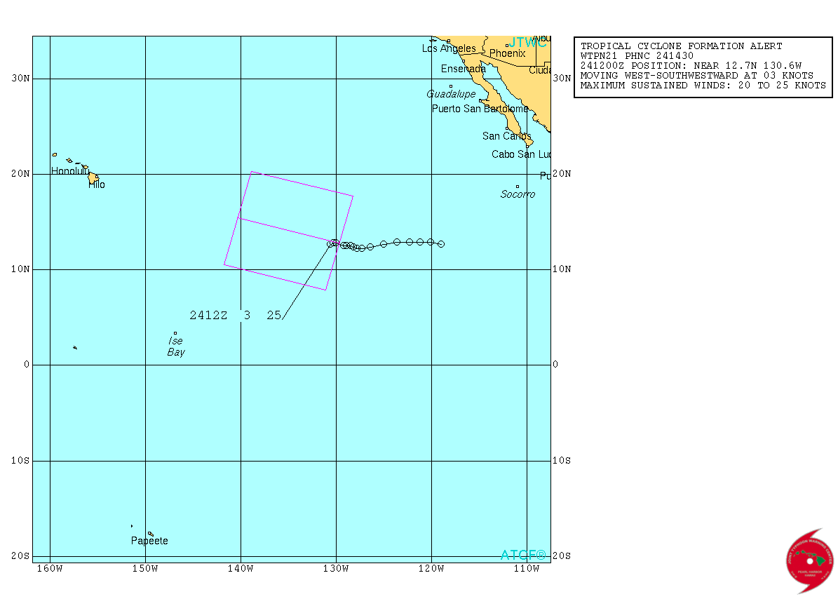
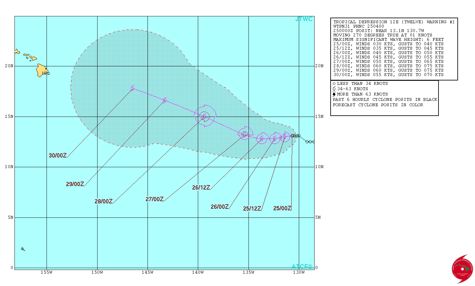
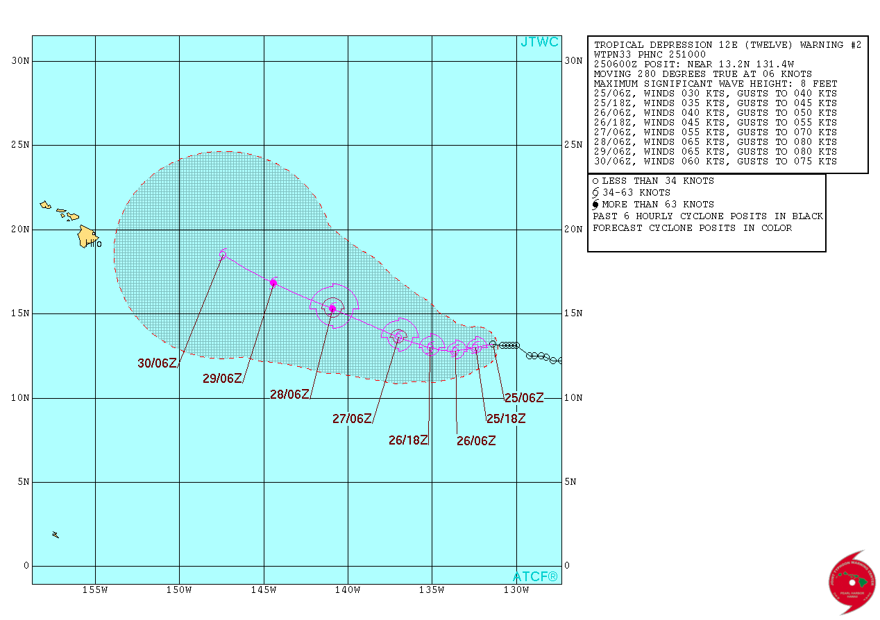
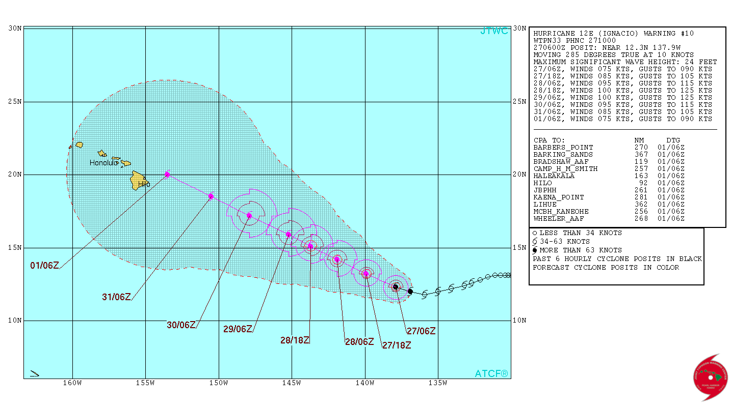
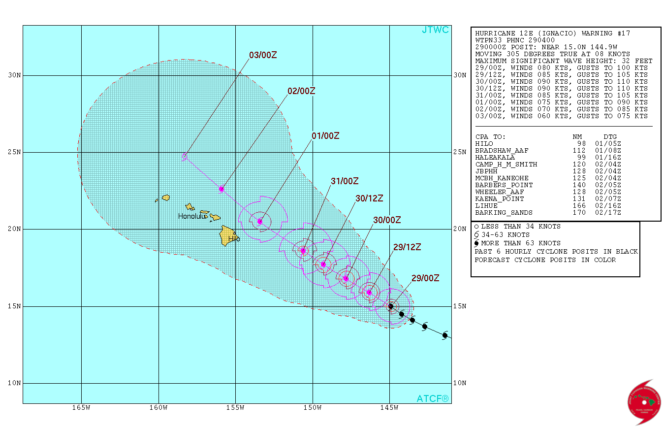
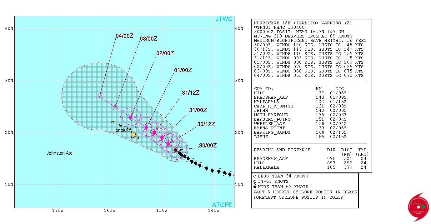
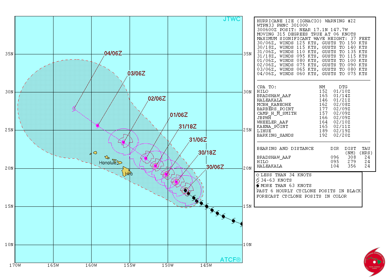
Early storm track forecasts had the track varying on the approach to the Hawaiian islands.
|
|
|
|
|
|
|
|
|
|
|
|
|
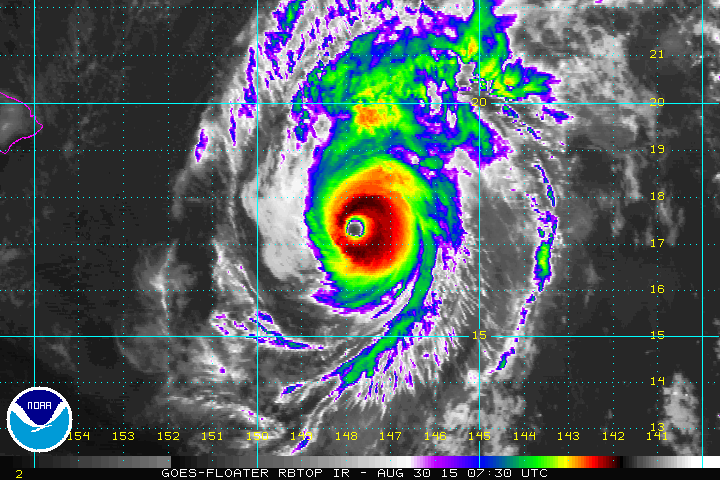
NOAA enhanced color photo showing the intensity of the eye, plus the cloud tops surrounding it. The tops of the thunderstorm cloud are extremely high as noted in the areas of black surrounding the eye, resulting from the immense heat content and humidity below. That means it's bearing an incredible amount of rainfall. Compare that against the size of the Big Island, and you'll see why it has emergency management officials concerned. Prepare for high winds, flying objects, excessive rain, flooding, debris, utility outages and road closures. Plan accordingly. If you need it, make sure you have it. Make sure you're in a sheltered location BEFORE winds exceed 39 MPH. |
|
|
|
|
|
|
|
|
|
|
|
|
|
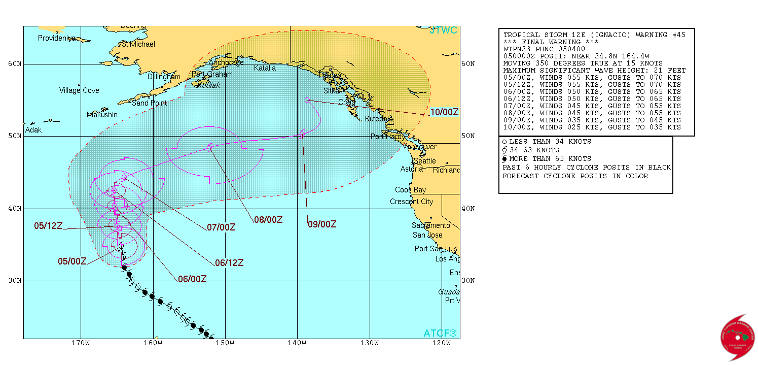
Click this link to get the latest forecast track from Joint Typhoon Warning Center, Pearl Harbor. |
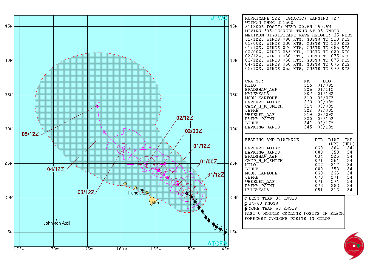
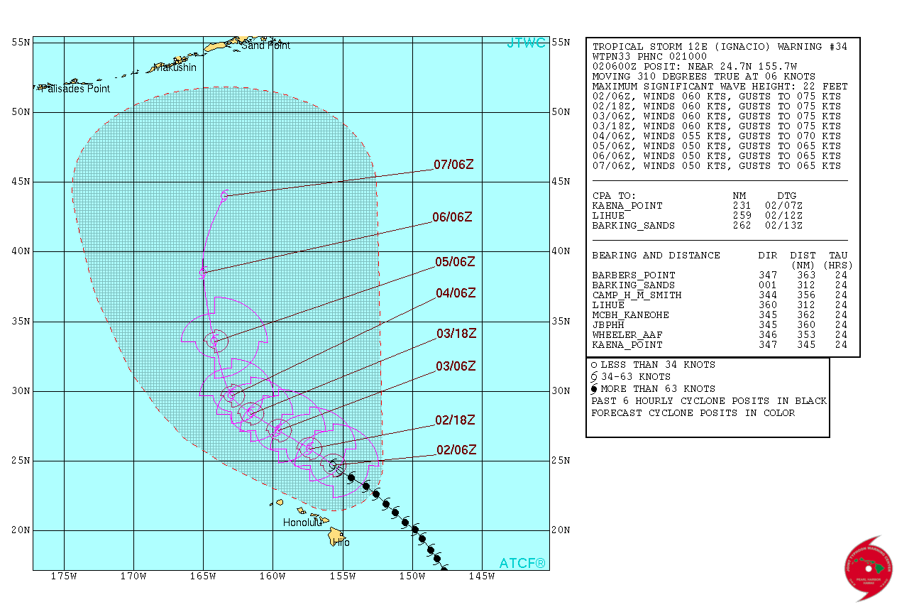
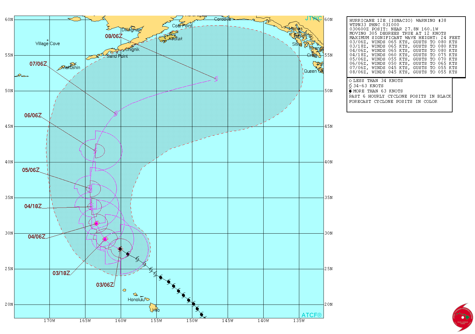
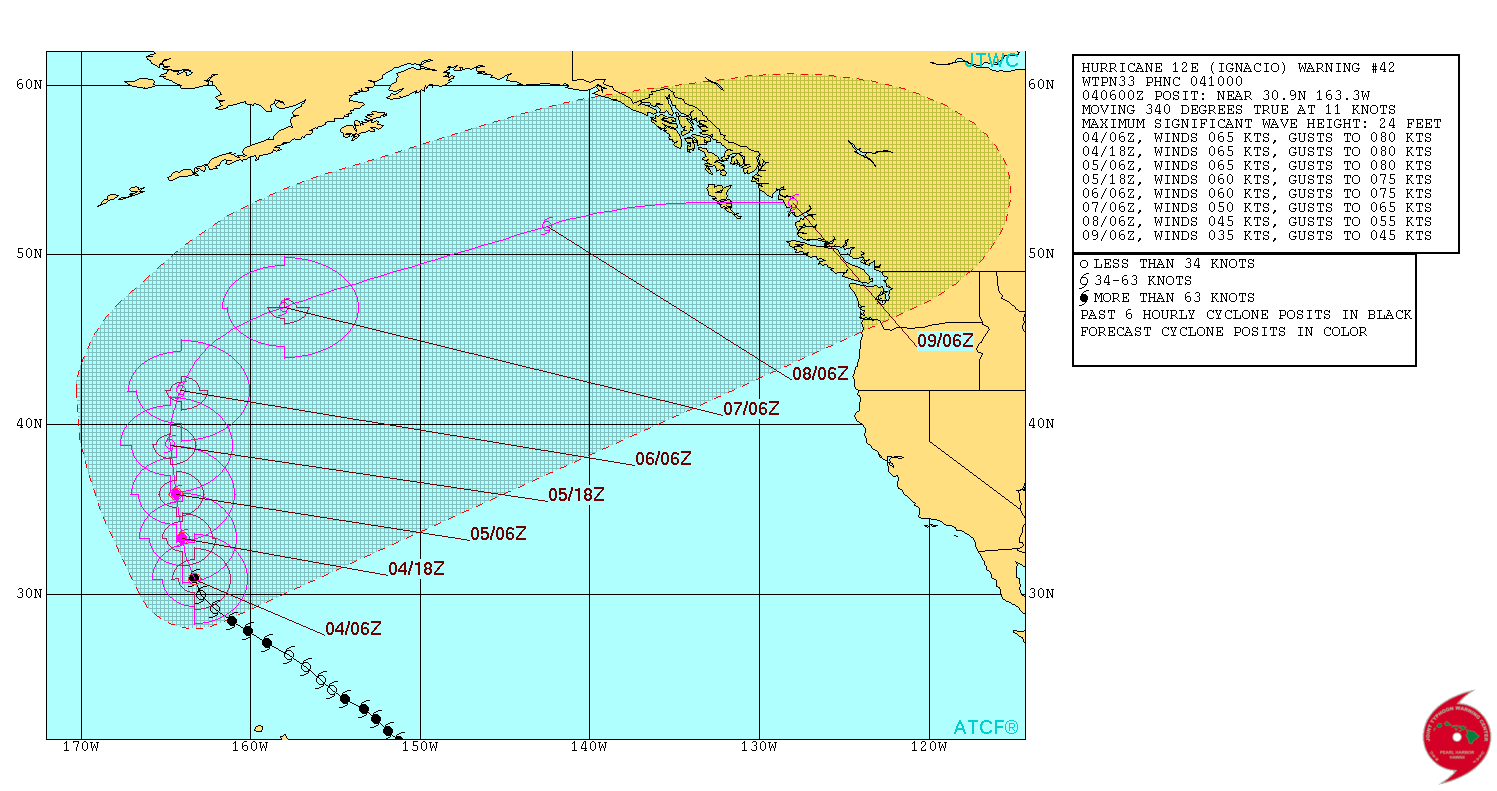
Hurricane/Tropical Storm Ignacio information
Information on Hurricane/Tropical Storm Ignacio and personal preparations can be found at these links:
- Central Pacific Hurricane Center
- NWS Forecast Office, Honolulu Watches and Warnings
- NWS Forecast Office, Honolulu
-
NOAA Satellite Floater Channel assignment for TS Ignacio

- Upper Level WV/IR - East Pacific - Latest Available - Large Scale
- Deep-Layer Wind Shear - East Pacific - Latest Available - Large Scale
- Computer Models for TS Ignacio
- JTWC Graphic
- University of Hawaii Meteorology Department
- Weather Underground NEXRAD, Kauai
- Weather Underground NEXRAD, Molokai
- Weather Underground NEXRAD, North Hawaii
- Weather Underground NEXRAD, South Hawaii
- NWS WFO HNL, Surf Forecast
- NWS WFO HNL, Local Storm Reports
- USGS Hydrological Data
- Honolulu International Airport Information
- FEMA
- Hawaii Emergency Management Agency
- Kauai Civil Defense
- (Oahu) Department of Emergency Management
- Maui County Civil Defense
- Hawaii County Civil Defense
- American Red Cross, Hawaii Chapter
- HAH Healthcomm
- Dept of Education Schools
- Hawaii's Boater's Hurricane and Tsunami Safety Manual
- Travel Smart Hawaii
- Travel Safety Brochure, Travel Smart Hawaii
- NWS CPHC Hurricane Ignacio Archive
- Upper Level WV/IR - East Pacific - Latest Available - Large Scale
Amateur Radio
The amateur radio leadership of NWS SKYWARN and Hawaii (State) Emergency Management Agency RACES are coordinating a joint net on the state-wide VHF Repeater system for passing storm information to the National Weather Service Honolulu Forecast office at HIG Building, University of Hawaii at Manoa campus, with supplemental traffic for SCD and DEM. The repeaters of DEM RACES (Oahu County) and SCD were linked using ALL-STAR VOIP linking to create a eight node repeater cluster of both State-wide and around-the-island repeaters for Oahu for reporting and monitoring purposes.
The repeaters linked from State Civil Defense
- 147.02+ PL 103.5, Mt Haleakala, Maui 9,769 ft, currently standalone
- 147.04+ no PL, Mauna Loa, Big Island 8,200 ft, currently standalone
- 147.04+ PL 103.5, Lihue, Kauai, currently standalone
- 147.06+ PL 103.5, Diamond Head, Oahu
- 444.325+ PL 103.5, Waimanalo, Oahu
- 444.350+ PL 103.5, Diamond Head, Oahu
and Department of Emergency Management, Oahu County
- 146.76- no PL, Mokuleia, Oahu
- 146.98- PL 88.5, Frank Fasi Municipal Building, Oahu
Big island operations scheduled for:
- 146.82-, BIWARN Mauna Loa
- 146.76-, BIWARN Kulani Cone is currently stand-alone
- 146.86- PL 100.0, Naalehu
- 146.72-, HSVOAD Mauna Kea
HF operations were scheduled for:
- 3888 kHz LSB, Hawaii County
- 3993.5 kHz LSB, State Civil Defense RACES
- 7080 kHz USB, SKYWARN (Monitor this frequency first)
- 7088 kHz LSB, HI EMA/State Civil Defense RACES
- 7095 kHz LSB, Hawaii County
- 7178 kHz LSB, HI EMA/State Civil Defense RACES alternate
- 7195 kHZ LSB, Hawaii County
- TBD, DEM RACES
- TBD, American Red Cross
- TBD, Healthcomm
NWS SKYWARN
NWS SKYWARN is not scheduled to activate at this time.
Encourage all amateur radio operators, whether SKYWARN or not,
to call in reports of significant weather giving the following information:
Operators scheduled are:
HI EMA RACES operations is not scheduled at this time.
CERT operations is TBD.
DEM RACES operatons to start at TBD.
Information from City and County of Honolulu.
Healthcomm is TBD.
Healthcomm to be operational post-landfall.
A reminder: Being prepared is a personal responsibility.
Stock up ahead of time, and don't get caught in the mad rush to the store to buy stuff.
The
Star-Advertiser
offers a list of items for preparedness and planning.
A reminder for the general population (and amateur radio operators alike) that the primary means of
timely notification of an alert is via the NOAA
National Weather Service Weather Alert radios.
These are links to articles from The Star-Advertiser.
These are links to stories from Hawaii News Now.
Shift
Operators
TBD
TBD
Hawaii State Emergency Management Agency
Hawaii County
Maui County
Oahu County
Kauai County
Healthcomm
Reminder
The Star-Advertiser Reporting
Hawaii News Now Reporting
Copyright © 1997-2015 Ron Hashiro
August 23, 2015. Updated: September 4, 2015
any of the external sites that we link to and therefore
are not necessarily endorsed by us.