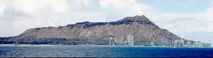
The NOAA Inouye Regional Center, located at Ford Island, Pearl Harbor, Oahu, Hawaii
The late Senator Daniel K. Inouye had a vision of gathering the various NOAA offices around Honolulu and consolidating the operations at Ford Island, in Pearl Harbor. In doing so, he improved the efficiency of NOAA while preserving two World War II aircraft hangars by converted them into a beautiful, state-of-the-art building with office, operations and conference space for 600 people.
National Weather Service Acting Regional Directory Ray Tanabe WH7IH took time on a Saturday morning to give SKYWARN members a tour of the NOAA Inouye Regional Center, and a preview of the upcoming Pacific Tsunami Warning Center operations area.
Historical Background of Ford Island and Hangar Buildings 175 and 176
The NOAA Inouye Regional Center (IRC) is located on the northwest corner of Ford Island. Ford Island is in the middle of Pearl Harbor, and features a single runway. Two aircraft hangars, Building 175 and 176, were built in 1941.
Life on Ford Island changed on the Sunday morning of December 7, 1941. The surprise attack of Pearl Harbor by the Japanese naval aviators started in motion changes to the island. After World War II, the runway, hangars and other infrastructure fell into disrepair.
The completion of the Ford Island Bridge, also known as the Admiral Clarey Bridge, in 1998 opened the opportunity to renovate and rehabilitate areas of Ford Island to suit current and future needs.
As preparation for the new uses of the hangars, the Naval Facilities Engineering Command (NAVFAC) replaced water lines originally installed in the 1920's with a new 10-inch line to provide reliable potable water to the new building.
The IRC, a LEED Gold Building
The Inouye Regional Center is a LEED (Leadership in Energy & Environmental Design) Gold rated building. The NOAA Corporate Services office has a description of the architecture of the building, and how it incorporates the two hangars with an interconnecting Building A. It uses unconventional means to cool and air condition the building, and capture rain water for irrigation and use in the restroom facilities.
 |
Welcome to the lobby of the NOAA Inouye Regional Center. |
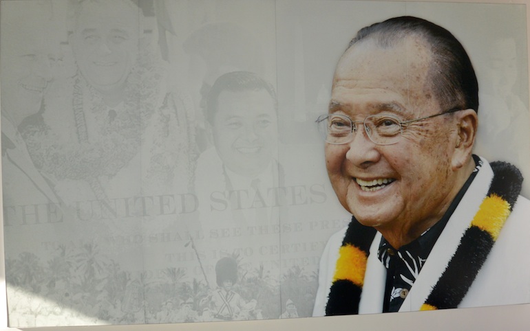 |
To the left is a mural of the late Senator Daniel K. Inouye. |
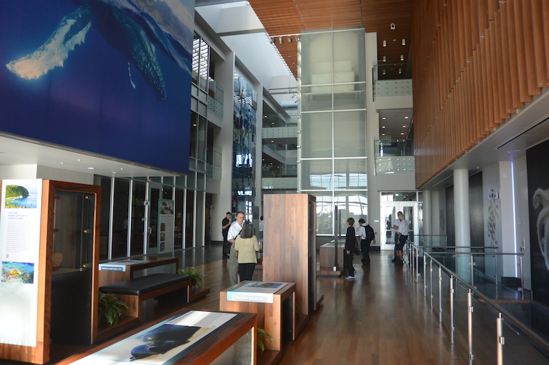 |
The ground floor lobby, exhibits, library, restrooms and dining facility are a large part of the Building A, which interconnects the space between the two renovated hangars. |
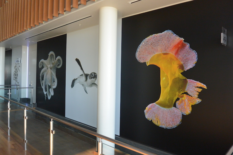 |
To the mauka or mountain side of the lobby are beautiful photos of some of the sea creatures that benefit from care taking oversight provided by the NOAA Pacific operations. |
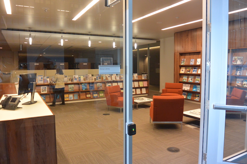 |
Opposite the mural photos is the NOAA library and visitor room, with publications and other informational products. |
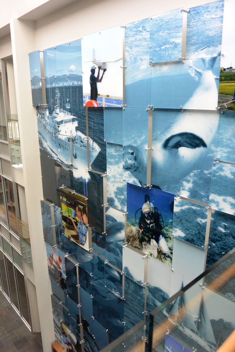 |
To the makai or ocean side of the lobby is "The Wall" containing photos representing each of the line offices housed at the IRC. |
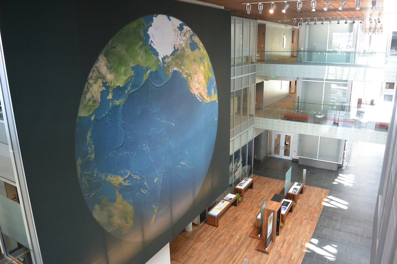 |
The ewa or west side of the lobby features a large picture of the Pacific region. On the floor are exhibits, such as an early grandfather clock-siesmograph mechanism used at Kipapa Gulch as an early means of recording earthquake information. |
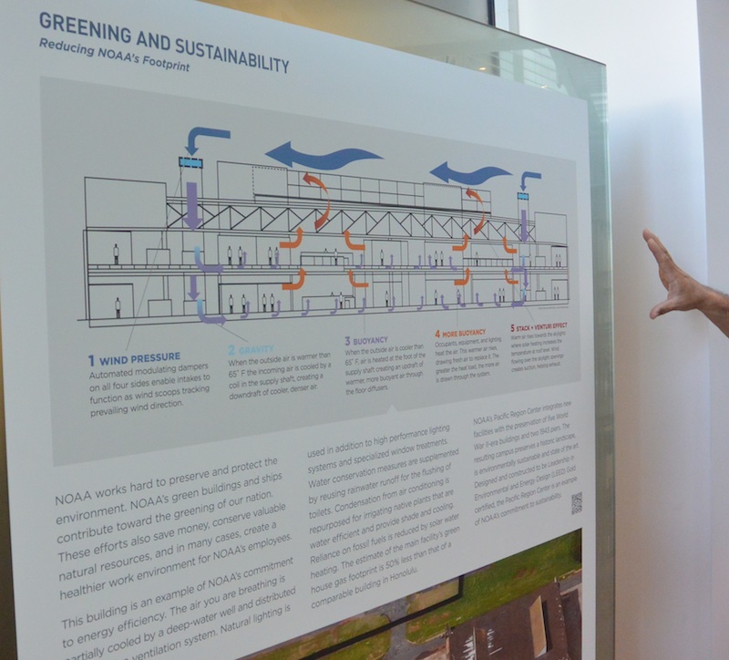 |
One of the exhibits depicts the LEED features of the building. The diagram shows the air cooling and ventilation system within the building. Cold air from the cooling towers on the roof flow downward into a main shaft in each hangar building, travels under a raised floor and is vented into the office space. Warm air rises and is carried out by the ducting in the false ceiling. |
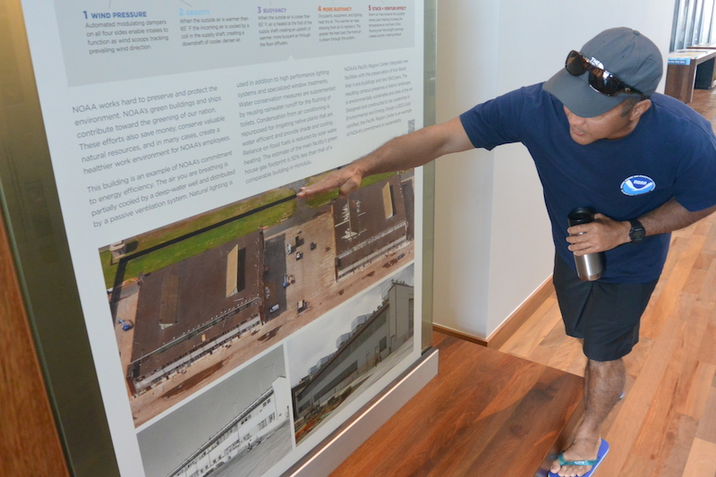 |
Here Ray Tanabe explains the location of Building A situated in the former open space between hangar buildings 175 and 176. Ray also explains that the parking lot serves as a catchment for collecting rain water to be used for irrigation and for flushing the toilets. |
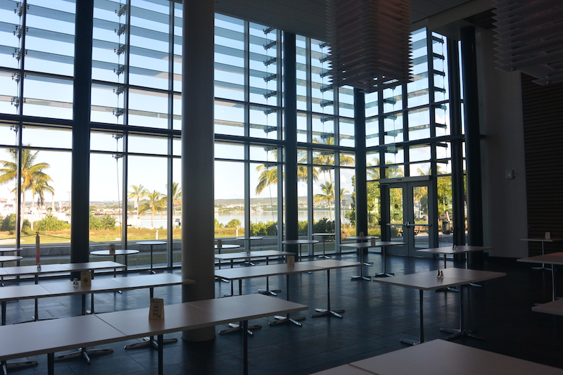 |
The ewa side of the lobby is the dining area for the cafeteria. The dining facility is open to the public, and quite a number of people from the nearby residential and work areas patronize the facility. |
The Exterior, Interior, Preservation and LEED features
The exterior of the building has been restored to the appearance during the days of World War II. Similarly, the structural elements of the hangar such as the beams have been reconditioned and painted.
The interior of the hangar allowed the construction of two floors of interior space. Within that space, a number of features were incorporated to provide efficiency in energy usage, water and forestry sustainability.
|
|
|
 |
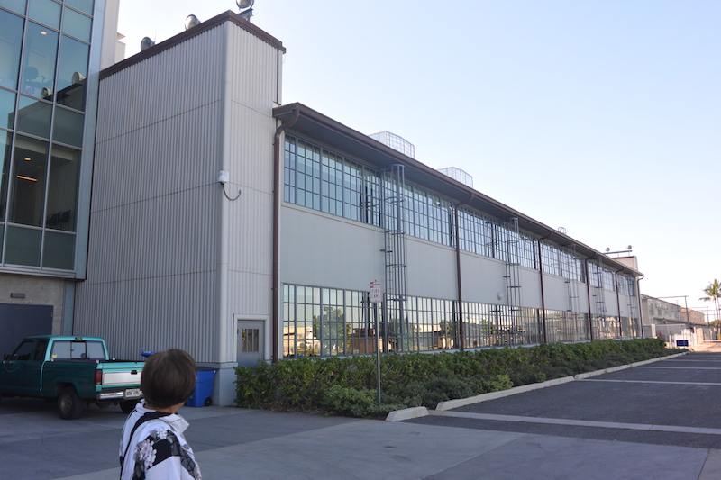
The Diamond Head side of the hangar building. You can see that the details have been restored, including the fire alarm bells, lights and ladders. The fire alarm bells and lighting fixtures are non-operable. |
 |
A close-up of the hangar door. You can see the hexagonal embedded wire within the hangar glass window. The windows with the hexagonal wire is the original windows for the building. |
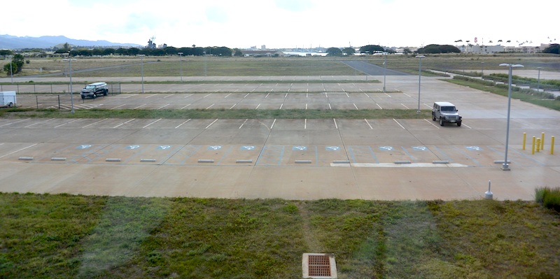 |
The parking lot in front of the building serves a double purpose. In addition to being a parking lot, it captures rainwater and routes it to collection tanks that provide water for irrigation and flushing the toilets in the restrooms. |
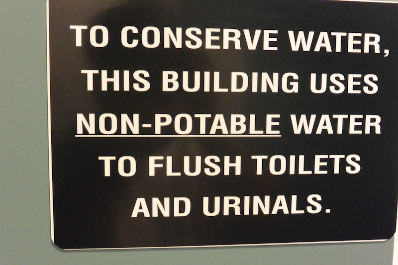 |
The use of the captured rain water is exhibited by this sign in the restroom. |
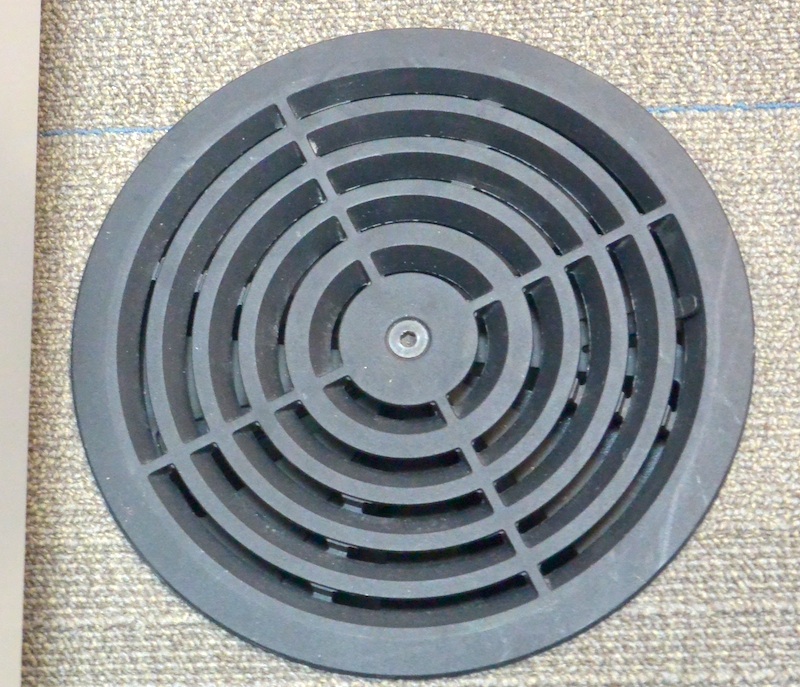 |
Under the flooring is a space that allows cooled air to flow to the offices and conference rooms. The cooled air surfaces through vents in the floor and provides cooling. |
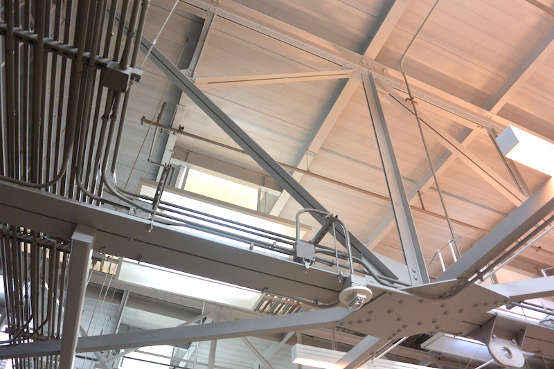 |
This is a view of the interior of the hangar roof, complete with the original beams and conduits. The figures were cleaned and painted and otherwise were left unmodified. This open air space and false ceilings duct the warm air away from the occupants and equipment. The building also features automatic blinds on the Diamond Head and Ewa windows which vary and adjust with the time of day. This controls the direct sunlight entering the building and also contributes to the air conditioning and energy management. |
 |
This is the main satellite dish, for receiving communications and sensor data from various sources around the Pacific. The dish is partially hidden by trees and other objects on the ground, in keeping with the aesthetics and agreements on historical preservation. |
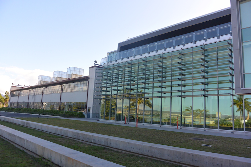 |
This is a view of the Ewa (west) side of the building, looking towards the left. |
 |
This is a view of the Ewa (west) side of the building, looking towards the right. |
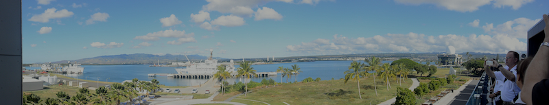 |
The Ewa side of the third floor of Building A features a dining/break area with a beautiful view of mountains above Makakilo to the left, Waipahu in the middle, and Pearl City on the right. To the right, you can see the Sea-based X-band ballistic radar moored. |
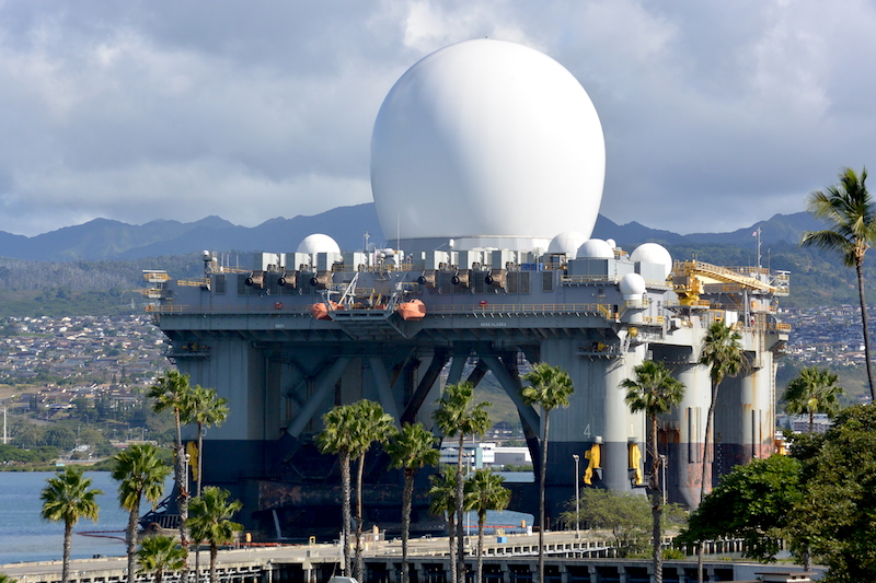 |
The Sea-based X-band Radar SBX-1 is moored and viewable to the right, just north of the resting place of the USS Utah target ship. The SBX-1 is a mobile ballistic missile system radar built on a converted deep water oil drilling rig, capable of detecting and tracking an object the size of a baseball at a distance of 2,500 miles. Air pressure within the white plastic dome keeps the dome inflated and protects the X-band phased array radar antenna from the elements. |
NOAA Oceanic Vessels
The NOAA operates a number of ships that conduct scientific research. The piers just outside of the IRC offer a convenient base of operations to equip and provision the ships as they fulfill their mission of science and service.
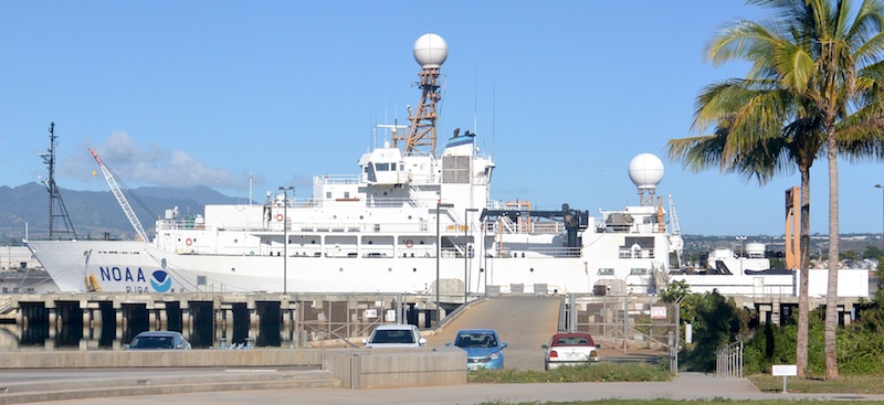 |
The NOAA ship Ronald Brown is in port docked at Pier F-10. The Ronald Brown is the largest ship in the NOAA fleet providing scientific research and maintenance of scientific equipment. Among the missions of the Ronald Brown is to service the TAO (Tropical Atmospheric Ocean) array buoys near the equator, which are out of range of other ships in the NOAA fleet. |
 |
The Hi'ialakai and another NOAA vessel were also in port. These three ships are docked where the normal mooring position of the USS Lexington and Saratoga during the days of the December 1941. |
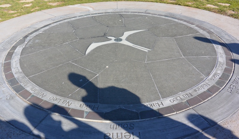 |
Nearby is a Hawaiian Star Compass reconstructed and designed by Nainoa Thompson. Click on the link to get a primer on Polynesian ocean navigation. |
 |
This is a close-up of the West side of the star compass. |
PTWC (Pacific Tsunami Warning Center)
The future home of the PTWC operations is located on the third floor. It is undergoing a final series of equipment installation and tests prior to cutting over service from the existing Ewa Beach facility to the new third floor location in February 2015.
|
|
|
 |
Welcome to the Pacific Tsunami Warning Center on the third floor. |
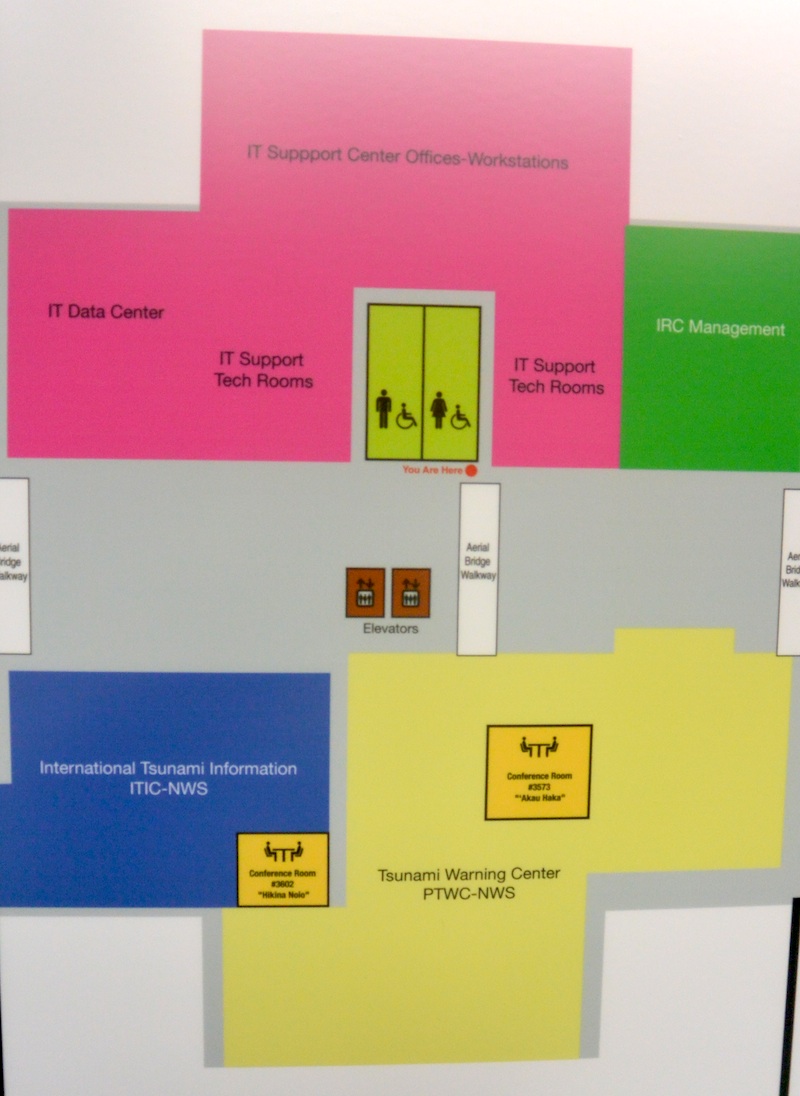 |
This is the layout of the third floor. The top is facing the ocean; the bottom is facing the mountains. The PTWC area is on the bottom. |
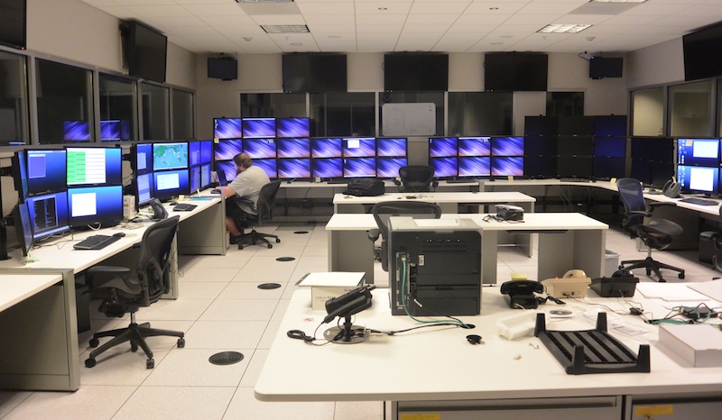 |
This is the main operations area for PTWC. The horseshoe configuration of workstations is symmetrical, with identical workstations on the left and right — serving as hot backup equipment for each other. In the event of a problem with a piece of equipment, the scientist merely walks over to the other part of the horseshoe and continues his work. The analysis of the sensor information and preparations of the notification bulletins are highly automated. The area is normally staffed by one scientist and within a couple minutes of an earthquake event, the scientist is ready to approve the transmission of the notification bulletins. Another scientist is in the building, and available within a five minute response time to assist the scientist-on-shift. |
 |
This map shows the sensors used by PTWC to detect earthquakes and wave action and determine if a destructive tsunami exists. The sensor network is comprised of deep ocean DART bouys, coastal tidal gauges and seismic stations. Data from these sensors are fed into the computers in the data center to provide an analysis of conditions and determination on the nature of notification bulletins to issue to the countries served by the PTWC. |
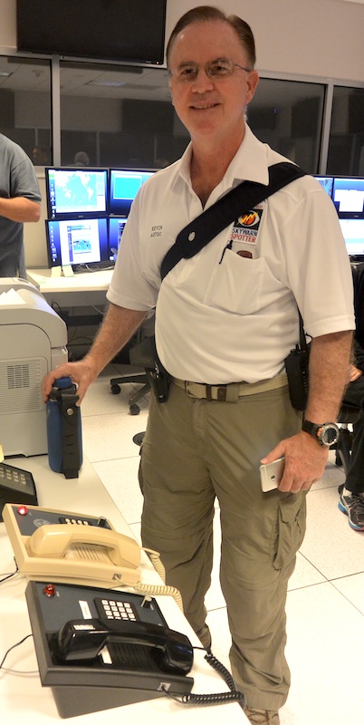 |
Here, Kevin Bogan AH6QO, Hawaii State Warning Point Officer stands next to the HAWAS (Hawaii WArning System). Kevin normally mans and operates the same phones located at the State Warning Point at the Hawaii Emergency Management Agency's State Warning Point in Birkheimer Tunnel in Diamond Head crater. During a tsunami event, the PTWC staff uses the HAWAS phone to notify the Warning Points at each County and the State, the NWS Forecast office in Honolulu and other locations of the event and the new bulletins. When Kevin talks with the staff at PTWC during an event using the HAWAS phone at State Warning Point, the PTWC staff responds using the phones in this photo. |
National Weather Service
Several offices of the NWS (National Weather Service) are located on the second floor. In addition to the Regional Director, the staff of other affiliated programs are located nearby on the second floor.
|
|
|
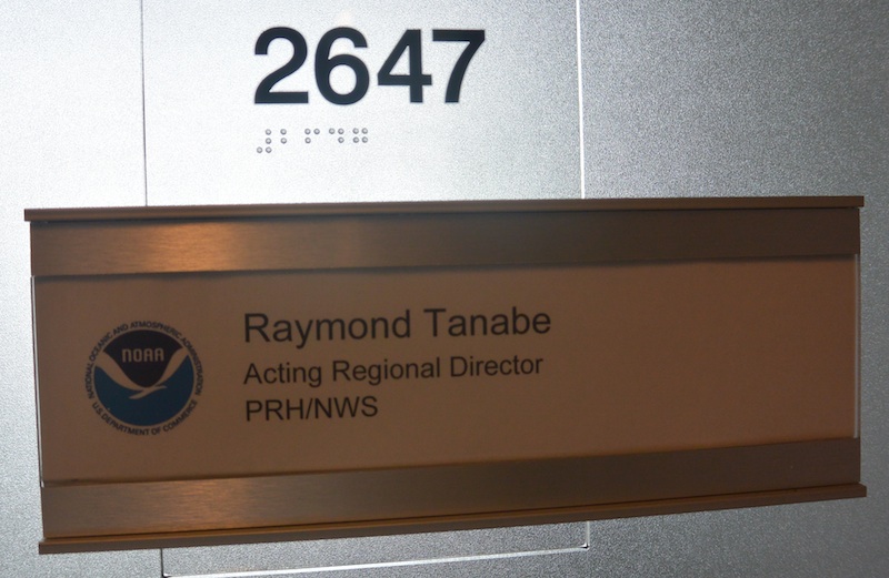 |
Welcome to the Regional Director's office on the second floor. |
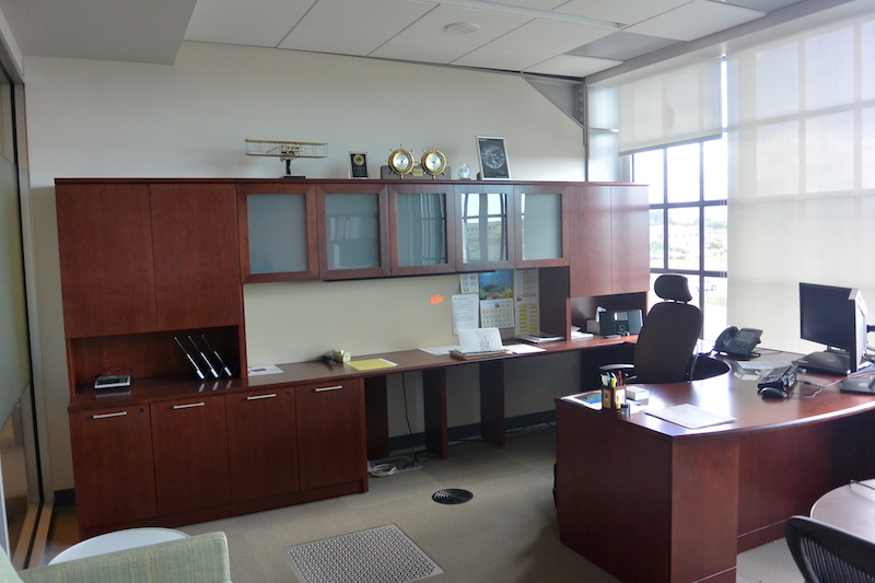 |
The office of the Regional Director of the National Weather Service in Hawaii is located on the second floor. On the floor you can see the floor vent, and the register cut-out for the added cooling for offices that are at the perimeter of the building. |
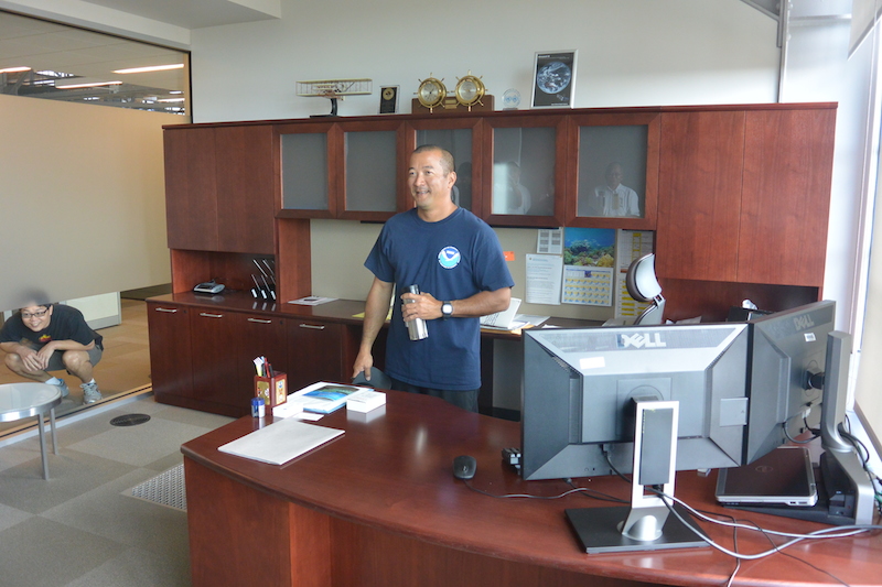 |
Ray Tanabe in his office. You can see the privacy screen along the hallway. |
Acknowledgements
The 2015 SKYWARN group would like to thank Ray Tanabe for opportunity to tour the new NOAA Inouye Regional Center.

Copyright © 1997-2015 Ron Hashiro
January 10, 2015 Updated: January 12, 2015 DISCLAIMER: Ron Hashiro Web Site is not responsible for the content at
any of the external sites that we link to and therefore
are not necessarily endorsed by us.