|
|
|||||||||||


|
Stark County Skywarn INTRODUCTION
Stark County falls under the careful watch of the Cleveland National Weather Service, who is responsible for a 30 county area covering northern Ohio and western Pennsylvania. Each county has an established Skywarn program involving amateur radio operators who act as spotters for reporting critical weather information to the National Weather Service. In the event the NWS issues a watch or warning for our county, you are advised to listen to the 147.12 repeater. This repeater serves Stark County for emergency purposes, and is used for all Skywarn nets. Here you will be able to obtain current weather information, and relay relevant information to net control, using your skills as a spotter. In the event the 147.12 repeaters is down or deemed unusable, all Skywarn operations will switch to the back-up repeater which is the 147.18 repeater owned and operated by the Massillon Amateur Radio Club. Stark County serves under the direction of our Emergency Coordinator, David Beltz - WD8AYE, with assistance from John Sedlak - N8WHH, Paul Burke - KB8VAS, and Terry Russ - N8ATZ. If you have any questions about the Skywarn Program here in Stark County or if you have any comments, we invite your call. MARC & Stark Co ARES Activate During Tornado Touchdown
David Beltz, WD8AYE, Stark County ARES Emergency Coordinator quickly activated an ARES net on the 147.12 repeater and summoned volunteers for what was to become a full week of activities for area amateurs. Amateurs were dispatched to the county Emergency Operations Center, area hospitals and the county 911 center. Township fire officials also requested assistance when it became clear that a multi-agency effort would soon commence. The 911 centers phone lines quickly became jammed with concerned callers and at one point Amateur Radio was utilized to dispatch public safety forces to several serious incidents that resulted from the storms fury. Amateur operations also involved the Western Stark County Chapter of the American Red Cross when a relief center was established at John Knox Presbyterian Church in Jackson Township. Operations shifted on Monday morning as amateurs active with the Red Cross sent Disaster Assessment Teams into the effected areas to determine the extent of the damage. Amateurs also rode with Red Cross Emergency Response Vehicles (ERV�s) providing meals and assistance to both area residents hit hardest by the storm and clean-up crews. Operations continued throughout the week until Thursday afternoon. Stark County ARES Assistant EC Terry Russ, N8ATZ indicated this was the worst disaster to hit this area on record and involved more than 50 local amateurs. Township officials also praised amateurs efforts during this crisis and are already revising their local disaster plans to increase the involvement of amateur radio operators. The History of Northeast Ohio Skywarn The National Weather Service developed the Skywarn program out of a need for quick, reliable information to augment the remote sensing tools they already had in place. Through the training of civilians, they achieved part of their goal. Spotters used telephones to relay reports of severe weather to their regional NWS Office. However, a problem arose during large outbreaks of severe weather. When many spotters tried to call in at the same time, the telephones were always busy. As a result, the information didn't come in as quickly as desired. The idea of using amateur radio to relay the reports came into play. It was a great idea at first, reports came in as quickly as they could be radioed in. However, as Skywarn gained rapid popularity with hams, it became less efficient, and relationships among those involved deteriorated. Suddenly, it seemed as though it was a status symbol to have been heard on the local weather net. A clear need for structure, organization became apparent. This led to the development of controlled nets for amateur radio Skywarn. During 1993, this need for structure and organization was deepened by the modernization of the National Weather Service. The strategy was to consolidate the regional NWS Offices, as well as their warning areas. In northern Ohio and northwestern Pennsylvania, NWS Offices in Toledo, Mansfield, Akron-Canton, Youngstown and Erie were closed. Most of the County Warning Areas (CWA's) of these offices were combined into the current, large CWA that is now served by NWS Cleveland. The combining of these CWA's threw a huge wrench into the Skywarn machine. However, instead of complaining about it, a solution was started to solve the problem. The Backbone was the solution to the problem. Through the generosity of the Six-Meter Amateur Repeater Team, the use of a wide-area repeater on the six-meter amateur band was donated to the NWS Cleveland Skywarn program as the primary means to connect the old weather offices' CWA's. This worked sufficiently until the popularity of the Backbone increased. This resulted in a clear need for increased structure and organization. As Skywarn continues to gain popularity and evolve in structure, remember that NWS Cleveland Skywarn serves thirty primary counties and an additional sixty-one counties containing over fifteen million people across four states. There are numerous local and district level groups within this area, each with a different set of operating procedures. Here in Stark County, we are part of District 4, South Central which is comprised of Ashland, Wayne, Holmes, Summit and Stark Counties. Each county holds its own local weather net in the event of a NWS issued "Watch" or "Warning". Ours is of course held on the 147.12 repeater. We report to a "District Net". District Nets act as data collection points for local nets. They collect the most significant information from their local nets via their local liaison stations. The district nets also provide warning and watch information as well as other information from the NWS and other public safety agencies back to the local nets. In some cases, the district net and local net are one in the same. Once weather traffic reaches the point where it is ready to be passed on the Backbone, Cleveland Weather Skywarn takes over and determines how the information gets to the forecasters. Cleveland Weather Skywarn operates the Backbone and staffs the NWS radio station. The Backbone is the final data collection point, serving the district nets. It collects the mot significant data from the district nets. This information is then passed on to the weather forecasters, who use the information in issuing and verifying warnings and preparing forecasts. This is a brief explanation of how Northeast Ohio Skywarn operates, but it still depends on accurate, well trained spotters in order to be a success. You are encouraged to become part of this important effort. Contact your local coordinators if you would like additional information. There are 30 counties under the jurisdiction of the Cleveland National Weather Service Forecast Office. Click here to see a map showing the county warning area and the 2 meter frequency of each counties' local Skywarn net. Weather traffic is then passed between the district net and the Cleveland National Weather Service on a wide area 6 meter repeater on 52.68 Mhz. Trained Severe Storm Amateur Radio Spotters are located throughout Northeastern Ohio but many areas are still seriously understaffed. The map below shows in green stars where the heaviest concentration of spotters are located. Please review the map below and consider joining this important program if you live in one of the sparsely populated areas. CLICK HERE to view the map. Do You Have Something To Report Directly To The National Weather Service ?
Skywarn News
Cleveland Weather Coordinating Meteorologist Gary Garnet who returned for his third year of training also was pleased, "The amateurs of this area are some of the strongest supporters of the Skywarn Program", said Gary, they have also been instrumental in reorganizing the Spotter Program after last seasons problems."
Marvin Secrest of M & K Engraving was also in attendance this year to make official Skywarn ID badges for new spotters. The evening was another unqualified success and Stark County ARES Emergency Coordinator David Beltz - WD8AYE concluded the evening by thanking Gary Garnet for his excellent training program as well as the tremendous outpouring of Amateur support to this vital community program. The biggest and most positive new of the evening was the announcement that the Cleveland Skywarn program at the National Weather Service was quickly recovering from the unfortunate turmoil that left it in a state of uncertainty over these last few months. Gary Garnet praised the efforts of several northeast Ohio Amateur Radio groups including Stark County Coordinator Paul Burke - KB8VAS who has devoted many hours assisting with the training of a new corps of volunteers who will man the NWS office in the event of severe weather. New equipment and procedures have been put into place and is ready to go when necessary. Click Here to see an excellent article from the Canton Repository on Wednesday nights program. Spotter's Guide Now Available After many requests for copies of the official Severe Storm Spotter's Guide, we have made it available as an Adobe pdf document. Click on the button below to download your copy !
Special Feature Story Doppler Radar : How Does It Work ? 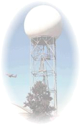 To explain, let's use the example of the most powerful coast-to-coast Doppler radar network, operated by the National Weather Service (NWS). These radars make up the WSR-88D network that stretches across the United States, including Alaska, Hawaii and U.S. territories. The Doppler radar is named as such because it employs the Doppler effect. This effect, takes its name from the man who discovered it, Austrian physicist Christian Johann Doppler. It states that an object moving away from a certain point gives off a different "frequency" than an object moving towards that same point. This can be best illustrated by the sound a car makes as it approaches blowing its horn. As the car comes toward you, a higher horn pitch is heard than when it moves away. Listen for this the next time you are stuck in traffic. In the past, older radars sent out radio waves into the atmosphere. The radar would measure the time between pulses and the amount of time it took these radio echoes to bounce back from precipitation. The radar then calculates the distance of the raindrops falling from the clouds. What sets the new Doppler radar apart is that by using the Doppler principle, the speed and direction of these drops can be determined. This allows Doppler radars to determine if storms contain dangerously strong winds and even tornadoes. The power of these radars enables them to determine the size of the droplets, potential flooding and even the presence of hail in a storm. Together, The NWS radar network and local Doppler radars create a powerful tool for meteorologists to understand and forecast local weather conditions. It allows them to see severe weather before it happens and warn the public of the threat of everything from hail to flooding and heavy snow to tornadoes. We're proud to include the national NWS radar network, (and often even the best local television station radars!) as a part of WeatherBug. Make sure you have the latest version of WeatherBug (Click here to download version 2.7.) so you can track all the rain and snow this year. Now you know that WeatherBug's Doppler radar is truly powerful and accurate! The above story is courtesy of September 2001 "BUGBYTES" from WeatherBug.com !
For the latest news on the Skywarn Program here in Stark County look to the Stark County ARES Website at http://www.qsl.net/wd8aye !
This page was last updated on - 12/08/02
Number of Contacts with this site This page was last updated on 12/08/02 Site best viewed in 800 x 600 Resolution
2002 MARC Productions |
| |||||||||||||||||||||||||||||||||||||||||||||||||||||||


 The Skywarn networks take many different
forms in different parts of the country. Typically, trained
volunteer spotters report into a local operations center, and
these reports are relayed to the National Weather Service. Reports
are delivered to this local center by many means including Amateur
Radio.
The Skywarn networks take many different
forms in different parts of the country. Typically, trained
volunteer spotters report into a local operations center, and
these reports are relayed to the National Weather Service. Reports
are delivered to this local center by many means including Amateur
Radio. Stark County Skywarn activated as they normally do on Sunday,
April 28th when the National Weather Service projected
a severe weather front would quickly pass through the area. Little
did we know it would become a full blown disaster when the storm
spawned an F-2 tornado that cut a five-mile-long path of
destruction along several area neighborhoods, blowing over trees,
destroying trees and knocking out power to thousands of homes,
several businesses and a local high school.
Stark County Skywarn activated as they normally do on Sunday,
April 28th when the National Weather Service projected
a severe weather front would quickly pass through the area. Little
did we know it would become a full blown disaster when the storm
spawned an F-2 tornado that cut a five-mile-long path of
destruction along several area neighborhoods, blowing over trees,
destroying trees and knocking out power to thousands of homes,
several businesses and a local high school.
 Wednesday, March 27th was a busy day for area amateurs as the
day was devoted to severe weather awareness activities. At 9:50 AM
Tornado Awareness was tested as various Stark County communities
sounded their emergency sirens for proper operation. The drill,
held under the direction of Stark County EOC director Ed Cox, is
held each year in conjunction with Tornado Safety Week. The
Emergency Operations Center was activated and the amateur station
began accepting check ins from both mobile and home stations on
the 147.12 ARES Repeater system. 43 local check ins were reported
and from Cleveland 175 total check-ins were noted from the 30
county warning areas serving the Cleveland NWS office. A superior
effort from area amateurs.
Wednesday, March 27th was a busy day for area amateurs as the
day was devoted to severe weather awareness activities. At 9:50 AM
Tornado Awareness was tested as various Stark County communities
sounded their emergency sirens for proper operation. The drill,
held under the direction of Stark County EOC director Ed Cox, is
held each year in conjunction with Tornado Safety Week. The
Emergency Operations Center was activated and the amateur station
began accepting check ins from both mobile and home stations on
the 147.12 ARES Repeater system. 43 local check ins were reported
and from Cleveland 175 total check-ins were noted from the 30
county warning areas serving the Cleveland NWS office. A superior
effort from area amateurs.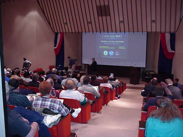 One
big revision to this years program was a special segment on the
contribution local Amateur Radio Operators play in relaying vital
weather information to the Cleveland Weather Service. Slides
depicted our local & district structure as well as our strong
repeater system used to relay reports.
One
big revision to this years program was a special segment on the
contribution local Amateur Radio Operators play in relaying vital
weather information to the Cleveland Weather Service. Slides
depicted our local & district structure as well as our strong
repeater system used to relay reports. 