
|
| |
| MAIN TEAM QRGs NEWS ISLANDS MEMORIES SPONSORS GUESTBOOK | www.qsl.net |
| SM7PKK SM6CAS SM0AGD SM6WYN G4EDG LA7MFA |
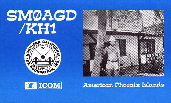
You could see on a picture above or my T31AE QSL card, there is a sign on the wall, I turned it around every day at 00Z. One day T31AE, next day another DXCC country - KH1, from the same shack.
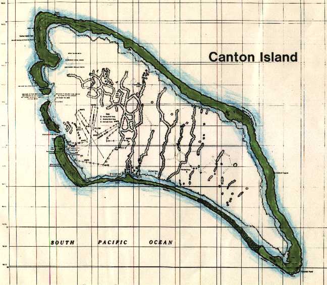
Please take a look at the map of Kanton above. In the south west side of the lagoon I hope you can see some staight lines, that used to be landing areas for flying-boats blasted by Pan American Airlines when they in 1939 where preparing Transpacific flights using their Flying Clippers. The first landing took place on Aug 24th 1939. Then came World War 2. During the war US Air Force had a base on the island. They built landing strips (on land) in the north west corner of the island. Later in the 1960´ies NASA used Canton when they picked up astronauts after the Mercury and Gimini space flights.
We will stay in that north west part of the island. In 1982 there was a lot of installations left, buildings, high antenna towers etc. I hope something is left today. On the middle west side is an opening into the lagoon, there is a dock where our boat can stay. Last time I was operating from a building some 50 meters from the boat.
On the original picture there is also info printed with small text. We will try to enlarge and print copies of it. It will be interesting to compare when we get there!

QSL card of T31AE.
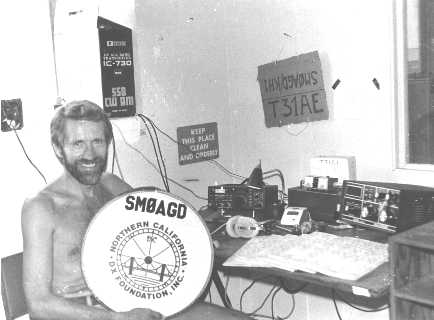
SM0AGD infront of his radio shack on Kanton Island AD 1982.
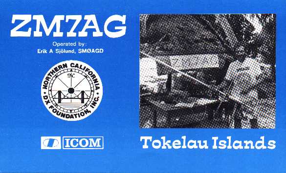
This was Atafu Atoll so unfortunately I can't see my old friends this time.
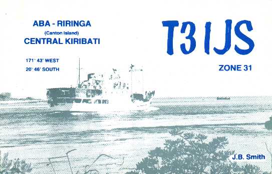
Was this the last major operation from Kanton Island? In 1988 Jim Smith VK9NS made some 12,000 QSO's on 6 bands during his 17 day stay on the island. At that time there was 17 "islanders" on the island.
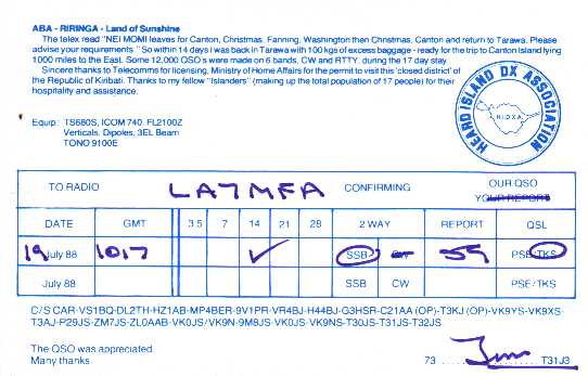
This is my only QSL from T31, so I will still need Central Kiribati on CW!