Links
A lot of information and links concerning GPS can be found in
Hardware
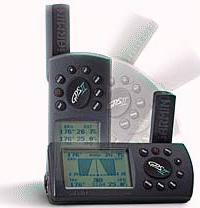
I use the Garmin GPS-II Plus, which
has a switchable display so it can be operated vertically and horizontally.
If you want to make your own cable for the external power and the data communication with a computer you can find a suitable connector at Purple connector .
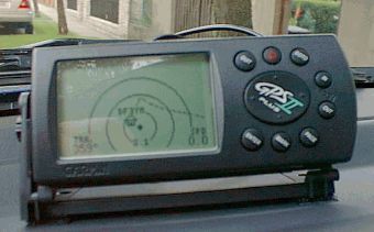
With its 12 channel parallel receiver the GPS-II Plus works very well on the dash of my car with the built-in antenna. Nevertheless I bought the tiny Lowe Electronics magnetic mount active antenna and placed it on top of the car. With the better reception the GPS works good even in difficult conditions like in the forest and the accuracy of the displayed and stored positions will be improved.
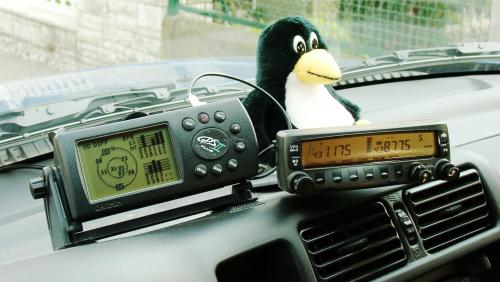
GPS-II+ and a 2m/70cm transceiver in the car
Software
![]() With
With
![]() G7TO Ron Henderson has created a
very good tool for the data transfer with GPS receivers. In contrary to
Waypoint+
(Win-95) it runs in a DOS window an can be incorporated in
Batch files for automation purposes without
problems. With G7TO you can store waypoints, routes and tracks as text files
on the computer and the data can be managed easyly with a text editor.
Under Linux I'm using gpspoint.
G7TO Ron Henderson has created a
very good tool for the data transfer with GPS receivers. In contrary to
Waypoint+
(Win-95) it runs in a DOS window an can be incorporated in
Batch files for automation purposes without
problems. With G7TO you can store waypoints, routes and tracks as text files
on the computer and the data can be managed easyly with a text editor.
Under Linux I'm using gpspoint.
For displaying stored tracks and planing routes at this time I use Navigate GPS . Using it online it often hangs but for displaying trackslogs and creating routes it can be used if you have managed to overcome some pitfalls. For me it has the advantage that it is a 16 bit Windows program and runs under OS/2. For Windows-95 you can use Fugawi , but I had some problems with their demo version. I have now registered OziExplorer , and I'm happy with it, besides the fact that I have to boot my notebook under Windows-95. Creating routes is not as easy as in Navigate but this should change in a future version.
Scanning and adjusting topographic maps is some work but afterwards you
have maps in the desired quality and resolution. In the meantime there are
75MB of maps on my notebook . . .
A new route will be assembled by clicking on the map on the screen and
later transferred to the GPS receiver using a Batch file. This now can show
the desired course with an arrow pointing in the correct direction.
The track data that was collected during the driving (or flight,
hiking . . .) could be displayed on the map after downloading
to the computer. So you can see, where you really have been.
For use in the States have a look on Street Atlas 5,
it is a CD based software with a GPS interface and knows nearly every street.
I used Street Atlas 4 during a visit to Boston.
GPS on my Bike
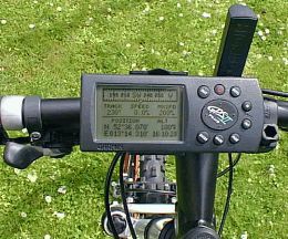
Besides the car mount I also bought the bicycle mount for my GPS receiver.
And in the meantime I bought a suitable Mountain Bike for the GPS ...
And that's the GPS receiver on the handle bar: