|
Back |
BorderLand |
Home |
|
German
border in De Dollard (DE/NL).
One
Bordermarker in the Dollard estuary on the border Germany/Netherlands.
|
Bordervisit on 14 december
2002 12:05. |
|
|
The story: Bordermarker
in De Dollard (German=Dollart) visited.
|
|
|
The map:
|
|
|
|
|
|
|
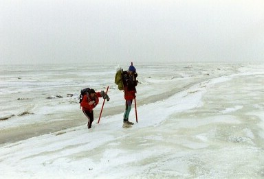
André
and Johan crossing a small ditch in a polar-like environment.
|
|
|
The
bordermarker from 500 mtrs distance.
|
|
|
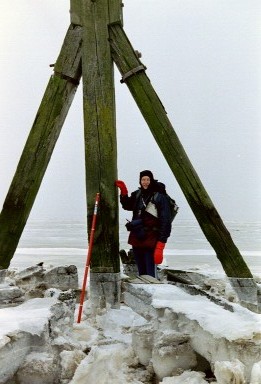
The
marker reached and the border crossed. This is standing in the Netherlands, looking back to Germany.
|
|
|
Yours
truly.
|
|
|
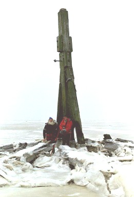
André
and Johan under the lee of the bordermarker.
|
|
|
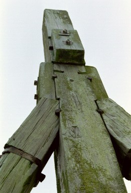
A closer
look at the construction of the wooden bordermarker.
|
|
|
The
protective construction of sloping horizontal poles, reinforced with rail.
|


This was not my only
visit. Here are links to my other visits:
More photo’s
of the above trip:
http://tiny.cc/GP-Dollard
Visit by boat on Saturday
2009-06-27:
https://photos.app.goo.gl/F1KWueFTtuyDFCyk6
Film:
https://www.youtube.com/watch?v=nBLN9Uj-OZs
Wadlooptocht Dutch Border freaks and guide Lammert Kwant on Saturday
2012-07-14:
https://photos.app.goo.gl/1nZs8ArHQFWViTih9
Solo wadlooptocht on Wednesday 2016-09-14:
https://1drv.ms/f/s!Aj6yU3nu4hO1gR_wV9hUY0v5rmFa
Extra infolink
Wadgidsenweb in Dutch:
https://wadgidsenweb.nl/helden/541-grenspaal.html
|
Top |
2023-06-16