|
ZS1AU QSL Card |
|
|---|---|
|
|
|
|
Cape Town harbour lies in Table Bay and the residential areas flank the city on all sides. The Atlantic Ocean surounds most of the peninsula from the front, right and top of this image. Cape Point is in the top, left hand corner and the sea on the left of the point is the Indian Ocean. Cape Point is one tip of a crescent sweeping to the left, thus forming False Bay, which is about 40 km across. The rest of False Bay would be lying where the top paragraph of this text is. The rest of Table Bay lies at the bottom of this computer screen and the village of Durbanville, where ZS1AU lives, is across Table Bay. |
|
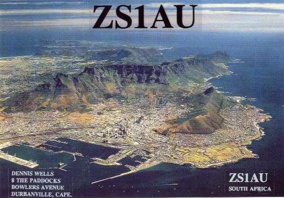 This
photograph is is an aerial view of the port city of Cape Town.
The general view is towards South West with the city lying in
the crescent of Table Mountain, which is the central, flat
topped mountain.
This
photograph is is an aerial view of the port city of Cape Town.
The general view is towards South West with the city lying in
the crescent of Table Mountain, which is the central, flat
topped mountain.