VK2KFJ's JMFD 2018 Field Portable Contest page
John Moyle Memorial Field Day Contest 01:00 UTC 17th March to 00:59 UTC 18th March 2018
I went portable for John Moyle Field Day this year, held across Saturday 17th March and Sunday 18th March 2018,
I operated just for the 6 hour Single Op Phone session on the Saturday afternoon.
I had just over half a dozen contacts, not that I was not really trying hard, as I was also testing equipment,
checking for beacons and trying out a couple sites, helping a few people get some contacts, plus get some fresh mountain air.
I was thinking of some places like Mt.Tomah, Mt.Banks and Mt.Wilson, I did quick tests of accessing the VK2RCW repeater to
get an idea of what the path is like to QF46 and really didnt get an acceptable signal back from the repeater until I got
to Clarence (on the Bell's Line of Road).
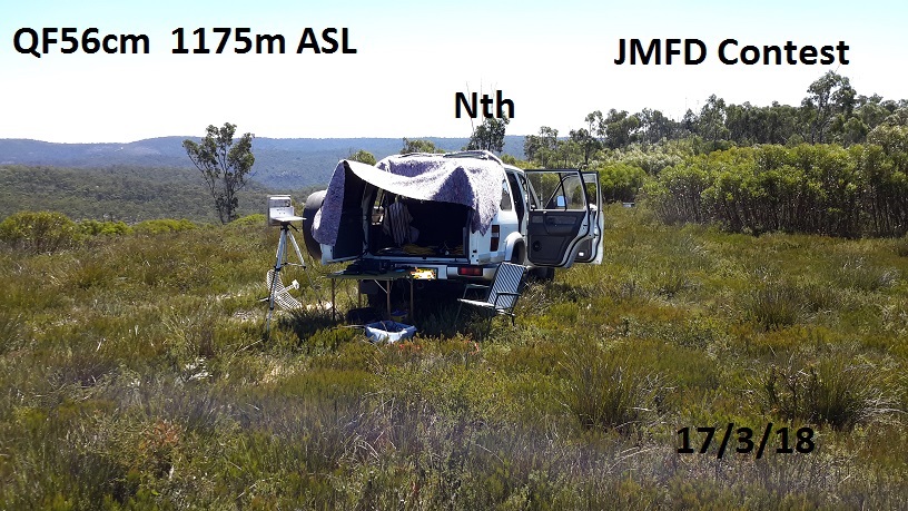
I ended up operating contest from two spots, one site at QF56cm, near Zig Zag Railway at Clarence, I did have a look at a few spots around that area,
before settling on one site at approx 1150m ASL, nice clear mountain top, low level scrub, it was actually
discovered by some friends Geoff VK2AVR and Dom VK2JNA, who had stopped by to visit me when I was operating portable at a nearby
location for a 23 on 23 Microwave Day last year.
After a couple hours, I was not having much luck with making some contacts to some specific people,
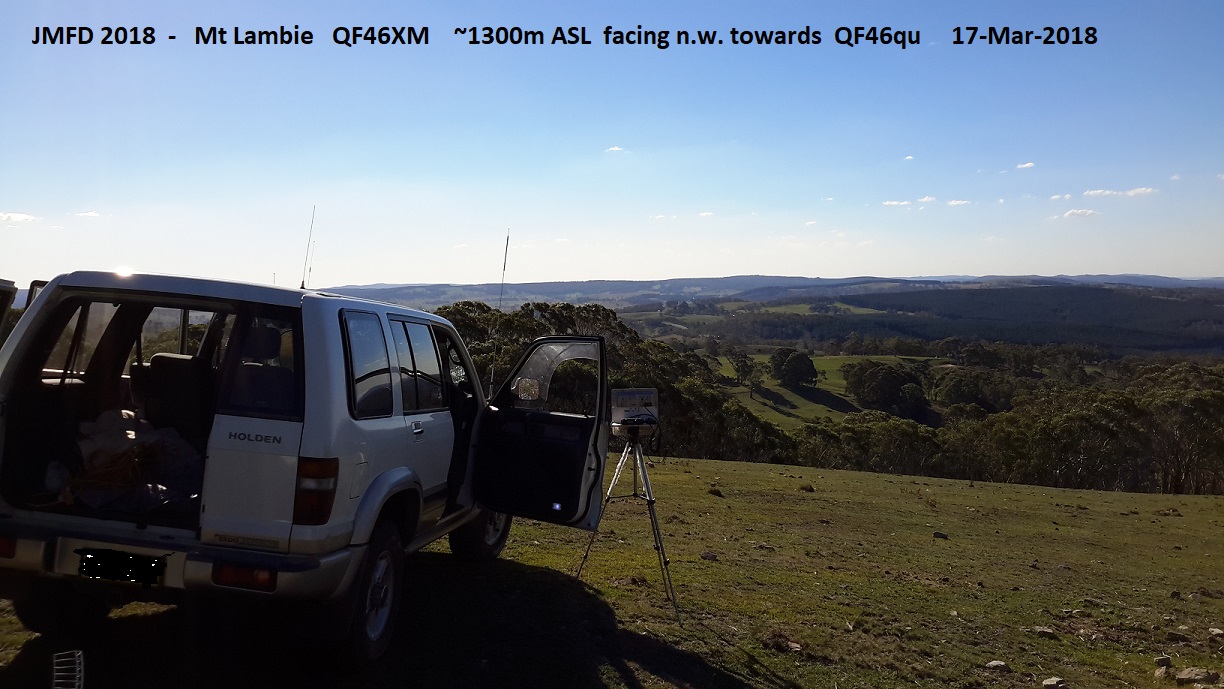
so I packed up and moved to Mt Lambie QF46xm, it is about 1350m ASL, from here I could actually make some successful contacts,
with two club stations, VK2MB/p QF46pu and VK2ACW/p QF46qu, both clubs operating all bands HF through to 76 GHz.
At end of day, I met up with members from Manly Warringah Radio Society and Amateur Radio Central West Group,
at Dave VK2JDS's farm for BBQ dinner, which was great, the two clubs got together to de-brief on their contesting
achievements and discuss future contests as well as other radio related discussions.
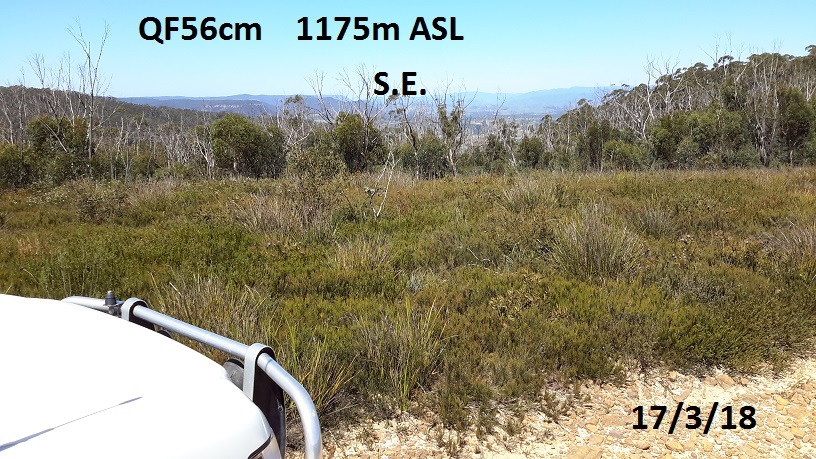
Looking S.E. towards Hartley, Mt Victoria, Kanangra Walls

Looking n.w. to Sunny Corner, Gowan, Hill End
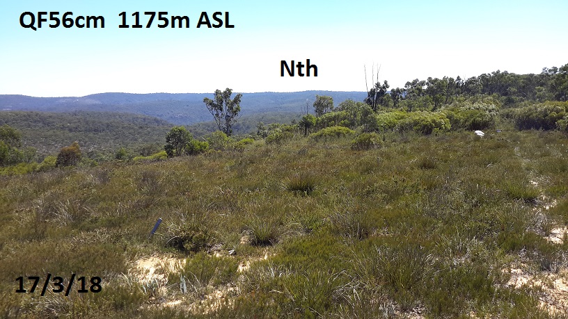
looking north towards Mudgee
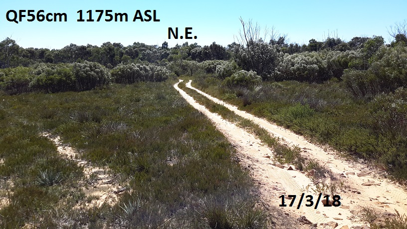
Looking n.e. towards Central Coast, Newcastle
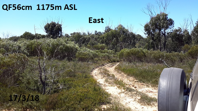
Looking east back towards Sydney, hearing Dural beacons ok, could be better. This is the highest point at the track intersection
set up in best postion to reach QF46pu & QF46qu for 3.4 GHZ and 1296 MHz, put the 23cm Gridpack on the roof
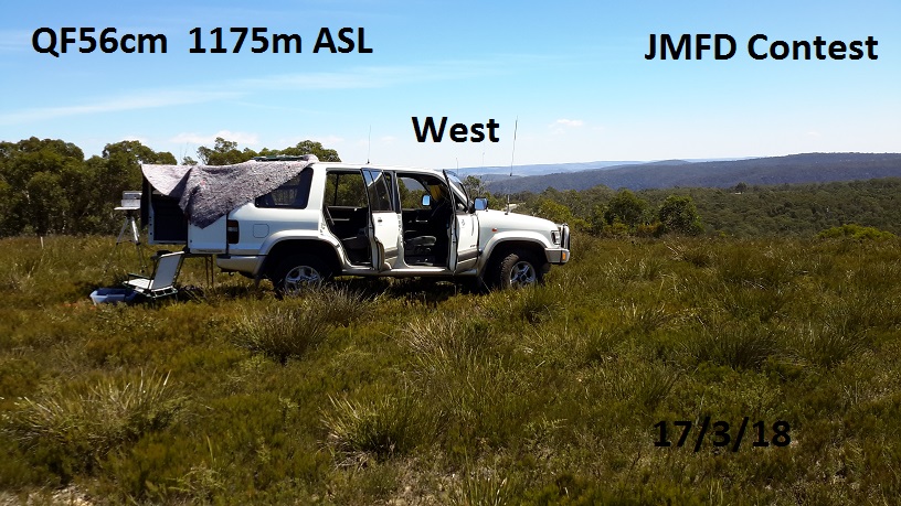
setup showing view to west, to work stations at Orange and Mt Canobolis

map showing some other sites I was sussing out. 'E' was an old comms site from 1960's, found concrete slab, all overgrown
'F' is alternate entry point to 'D', 'C' is good clear hill, but need to cross railway line from western side near 'B'
'A' was a site I have used before, but now barricaded off (new owners) with security cameras.
site 'B' is quite clear, but not as high as site 'D'
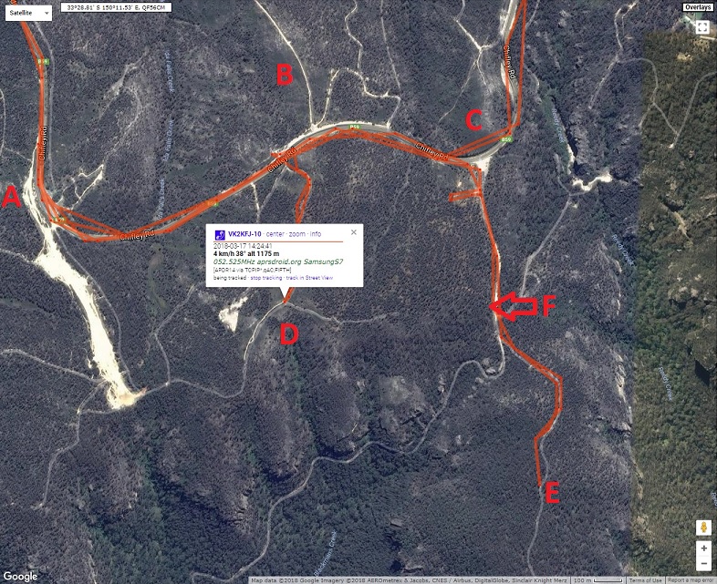
track leading from highway to 'D' is VERY difficult even for 4WD, east of this track is public land, west of this track is private land.
to get to 'D' come in from entrance point 'F' much easier. highest point at 'D' is southern side of intersection.
'D' is great spot, but take a lawn mower or whipper snipper to mow down the low scrub and plant some lawn seeds.

map to Mt. Lambie. QF46xm 1300m ASL at the Trig point, great site for VHF and above.
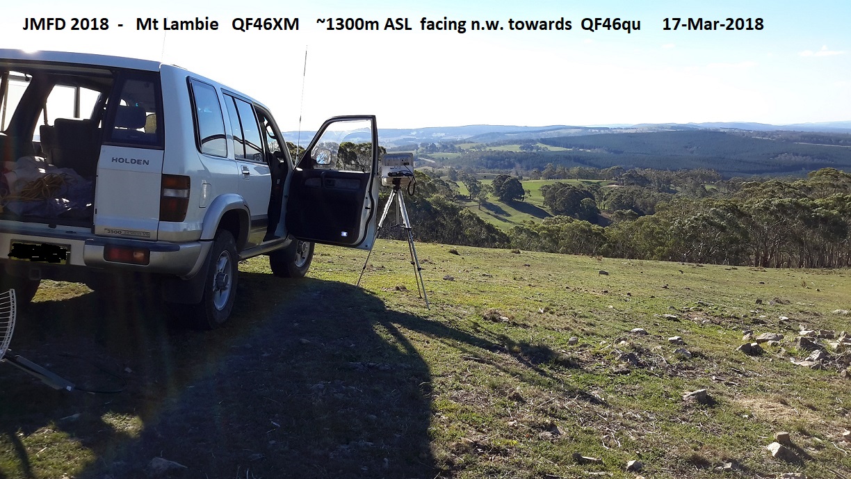
setup on the northern side of Mt. Lambie, to give me clean line of sight view towards QF46qu & QF46pu
used the 3.4GHz panel and 1296MHz gridpack for contacts to contest stations at QF46qu and QF46pu
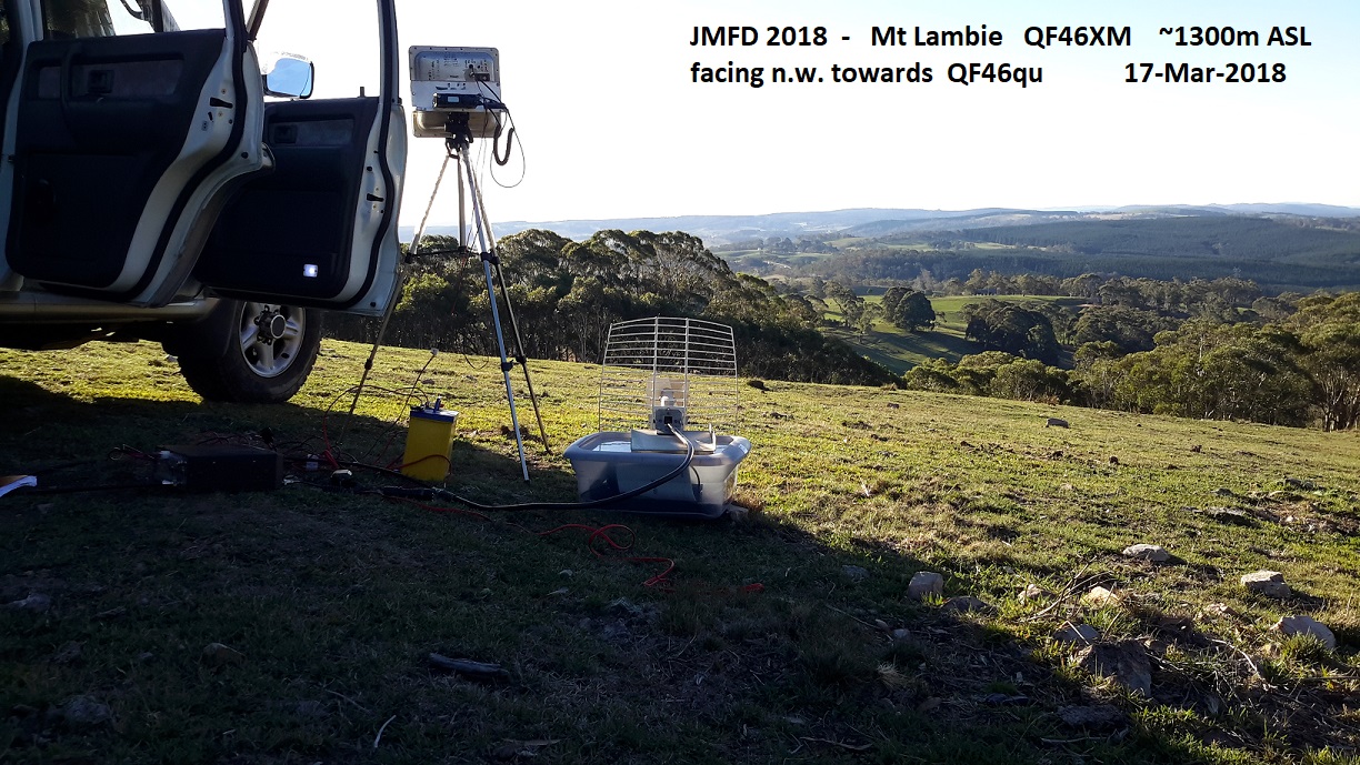
I forgot my tripod for the 23cm gridpack, a plastic box sufficed to make 23cm contacts
back to VK2KFJ main page