|
G3VGR
|
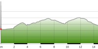
SAAR-HUNSRÜCK-STEIG Stausee Losheim - Weiskirchen
|
 The Gästehaus Blasius provides "breakfast items in a fridge in your room".
Fresh rolls are hung outside the door around 0630.
The kind owner had given me extra rolls for my lunch as she knew I was hiking the trail.
This DIY routine allowed me to catch an early bus back to Losheim.
I walked back from Losheim to the lakeside information centre and rejoined the trail.
It was another dull day, but fortunately dry. The walk towards Scheiden started quietly, following through small copses which were boundaries between meadows.
I then alternated between more copses and open fields.
It had rained heavily during the night, which left the woods looking a splendid fresh green.
The trail then entered a large beech wood and provided some rough walking, mainly upwards.
When I reached the end of the wood, I followed an uphill path between farm fields.
It was very open and windy here and I soon reached Scheiden, the highest village in the Saarland.
From the Sinnenbank just before the village, I had a superb panoramic view over the Saarland.
Scheiden is a very small hamlet, so there was nothing to see there and now I was hardly surprised I had been unable to find any accommodation there.
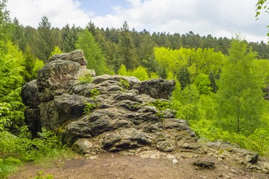
Instead, I soon reached the first highlight of the day.
After passing an impressive rock formation, I descended steeply into the beautiful Lannenbachtal.
The Gästehaus Blasius provides "breakfast items in a fridge in your room".
Fresh rolls are hung outside the door around 0630.
The kind owner had given me extra rolls for my lunch as she knew I was hiking the trail.
This DIY routine allowed me to catch an early bus back to Losheim.
I walked back from Losheim to the lakeside information centre and rejoined the trail.
It was another dull day, but fortunately dry. The walk towards Scheiden started quietly, following through small copses which were boundaries between meadows.
I then alternated between more copses and open fields.
It had rained heavily during the night, which left the woods looking a splendid fresh green.
The trail then entered a large beech wood and provided some rough walking, mainly upwards.
When I reached the end of the wood, I followed an uphill path between farm fields.
It was very open and windy here and I soon reached Scheiden, the highest village in the Saarland.
From the Sinnenbank just before the village, I had a superb panoramic view over the Saarland.
Scheiden is a very small hamlet, so there was nothing to see there and now I was hardly surprised I had been unable to find any accommodation there.
Instead, I soon reached the first highlight of the day.
After passing an impressive rock formation, I descended steeply into the beautiful Lannenbachtal.
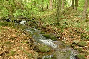
It was very damp and cool in the valley. Everything was covered in iridescent green moss and young ferns were everywhere.
The walk along the brook was all too short and I exited the Lannenbachtal as the trail wound upwards, passing several rock formations until crossing a main road to a pond and Kneippanlage.
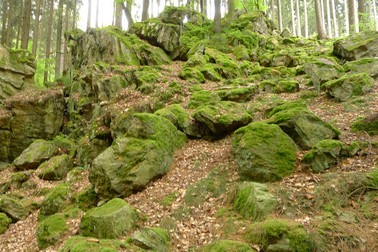
From here, the path became extremely rough as it climbed up into a beech forest.
On reaching the Bärenfelsen, I had to scramble up, over and down a huge jumble of boulders.
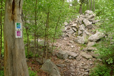
I carried on along rough paths through the forest over a ridge then followed a section named the Grenzweg, which was the border between the Saarland and Rheinland-Pfalz.
A few marker stones erected in 1797 defined the border.
The trail continued down the Holzbachtal all the way to Waldhölzbach.
After a picnic lunch at the Teufelsfelsen, just outside the village, I was confronted with a steep climb up the Engelsfelsen and carried on through the forest.
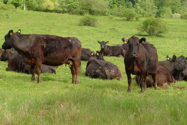
A few minutes later, I reached some fenced clearings which belonged to the Rappweiler Wild Game Park.
There were many deer behind the fences, but the last compound housed some European Bison which was an impressive sight.
After negotiating a particularly wet area of forest, I crossed a main road and started the long descent to Weiskirchen.
This was an impressive walk along a narrow path following the stream down the Hoelzbachtal.
It took me through beautiful forest and past some impressive rock formations, terminating at the outdoor swimming pool at Weiskirchen.
From here, it was another mile to the centre of town and my hotel.
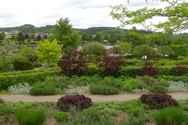
Weiskirchen has many neat houses, a pretty Kurpark and terraced gardens with many herbacious perennials. It rained heavily all evening, so I wasn't looking forward to tomorrow's hiking through mud.
I stayed overnight at the Hotel Schinderhannes in Weiskirchen. Their restaurant appeared to have no atmosphere, so I went out in the rain and found Die Zwo, which was just down the street and full of locals.
It was easy to see why it was so popular. This had been another great day's hiking, although I felt a little tired due to the many steep ups and downs on rough paths.
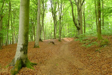
Through the forest towards Scheiden
|
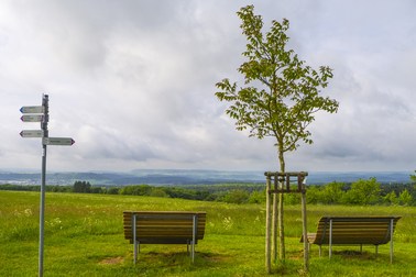
Sinnenbanken at Scheiden
|
Nothing much happens in Scheiden...
|
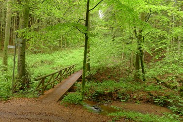
Entering the Lannenbachtal
|
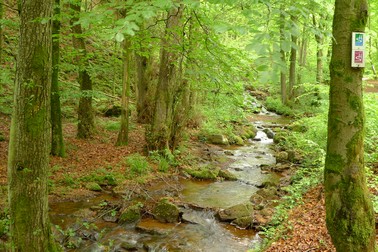
Following the Lannenbach
|
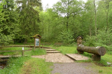
Kneippanlage
|
The Bärenfelsen
|
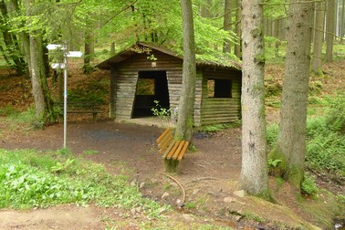
Hut in the Holzbachtal
|
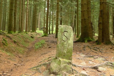
Border Marker along the Grenzweg
|
Teufelsfelsen near Waldhölzbach
|
Engelsfelsen
|
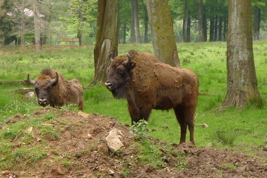
Inmates of Stalag Rappweiler
|
Following the Holzbach
|
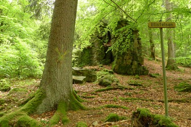
Itisfelsen
|
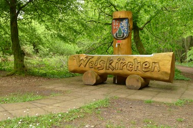
End of the day's stage
|
Herbaceous gardens in Weiskirchen Kurpark
|