|
G3VGR
|
QUERWEG Titisee - Schattenmühle
|
 I woke up with eager anticipation of today's stage, having fond memories of the Wutachschlucht from my 2012 Schluchtensteig hike.
Yesterday's sunshine had disappeared and the morning was dull and cloudy, although fairly warm.
After checking out of the Hotel Imbery, I caught the train back to Titisee and made the pleasant walk from the station to the lake.
The many souvenir shops were just opening for the day as I passed through the town and walked along the promenade to the eastern end of the lake.
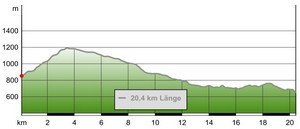
The trail went under the busy B500 road and railway track to start the steep ascent through forest to Hochfirst.
This was hard work as the trail climbed 370m in about 4km.
I was relieved to reach the summit of the Hochfirst and was now at the highest point of the Querweg.
The view from here was fantastic. I was overlooking Titisee and its lake. Despite it being a dull and cloudy morning, I could also see the Feldberg and many other wooded peaks of the Hochschwarzwald.
A 25m high tower, the Hochfirstturm sits on the summit, but it was locked.
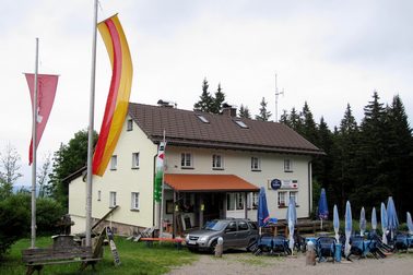
The Berggasthof Hochfirst, was closed too, so I didn't linger at the summit.
I followed the trail eastwards along an easy level path through a forest along the ridge crest.
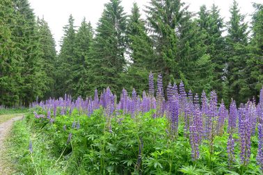
The forest floor was covered in ferns and in many clearings, clumps of wild lupins bloomed.
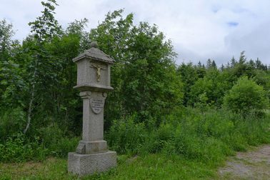
A slight drizzle started, but soon ended. I reached the end of the forest at the Franzosenkreuz, a monument commemorating the turning back of French troops by the Austrians in 1799 during the Napoleonic Wars.
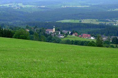
It was a shock exiting the forest to the Kappeler Höhe, a point high, open and windswept, which provided the second spectacular view of the day.
The magnificent vista stretched far from east to west along the Schwarzwald and also south across the Haslachtal.
I could see the pretty village of Kappel nestling in the valley below me.
The Querweg steeply descended through farmland to reach Kappel, where I had hoped to stop for refreshments, but the village seemed completely dead.
I woke up with eager anticipation of today's stage, having fond memories of the Wutachschlucht from my 2012 Schluchtensteig hike.
Yesterday's sunshine had disappeared and the morning was dull and cloudy, although fairly warm.
After checking out of the Hotel Imbery, I caught the train back to Titisee and made the pleasant walk from the station to the lake.
The many souvenir shops were just opening for the day as I passed through the town and walked along the promenade to the eastern end of the lake.
The trail went under the busy B500 road and railway track to start the steep ascent through forest to Hochfirst.
This was hard work as the trail climbed 370m in about 4km.
I was relieved to reach the summit of the Hochfirst and was now at the highest point of the Querweg.
The view from here was fantastic. I was overlooking Titisee and its lake. Despite it being a dull and cloudy morning, I could also see the Feldberg and many other wooded peaks of the Hochschwarzwald.
A 25m high tower, the Hochfirstturm sits on the summit, but it was locked.
The Berggasthof Hochfirst, was closed too, so I didn't linger at the summit.
I followed the trail eastwards along an easy level path through a forest along the ridge crest.
The forest floor was covered in ferns and in many clearings, clumps of wild lupins bloomed.
A slight drizzle started, but soon ended. I reached the end of the forest at the Franzosenkreuz, a monument commemorating the turning back of French troops by the Austrians in 1799 during the Napoleonic Wars.
It was a shock exiting the forest to the Kappeler Höhe, a point high, open and windswept, which provided the second spectacular view of the day.
The magnificent vista stretched far from east to west along the Schwarzwald and also south across the Haslachtal.
I could see the pretty village of Kappel nestling in the valley below me.
The Querweg steeply descended through farmland to reach Kappel, where I had hoped to stop for refreshments, but the village seemed completely dead.
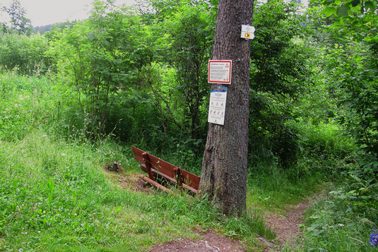
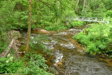
Past Kappel, I headed down towards the Haslachschlucht.
On reaching the Haslach river, the Querweg was now joined by the Schluchtensteig.
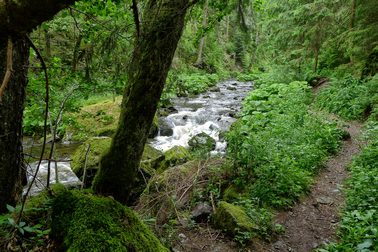
The Querweg followed a wide path until a sudden turn to the right brought me immediately into the wildest part of the Haslachtal.
As the trail entered the Haslachschlucht.
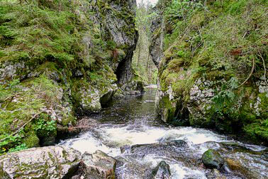
the trail was rocky, narrow and tortuous and led me through the narrow limestone gorge towards the Haslach rocks, Hölllochfelsen and Rechenfelsen.
After exiting this impressive section, it was a pleasant downhill walk through the lush greenery to Haslachmunden, where the confluence of the Haslach and Gutach rivers become the Wutach.
I stopped here for lunch, just as in 2012
Haslachmunden is the start of the Wutachschlucht.
Known as the Grand Canyon of the Schwarzwald, the gorge continues for 28Km with 200m high limestone cliffs in places and is home to over 1200 plant and 80 bird species.
The undulating trail followed the Wutach, alternating with walking alongside the greenery by the river bank or high above the river on narrow rough paths.
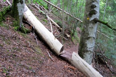
It was slow progress due to the many rocks and tree roots.
I had to clamber over or under a few fallen trees too.
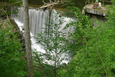
After crossing a bridge at the entrance to the Rotenbachklamm, I headed uphill, passing the Flusskraftwerk Stallegg, a turbine plant built in 1894 and provided electricity to both the village of Donaueschingen and the Fürstenberger brewery.
Shortly after the dam, I reached the Stallegger Tanne, a 300 year old White Fir which was 52m high but had unfortunately lost the top 20m during a storm in 2014.
It now started to rain and I hurried downhill to take shelter in the Stallegger Brücke, a covered bridge who's history dates back to the 13th century and put on my waterproofs.
The trail now went uphill steeply and away from the river. I could hear the roar of the river below and had occasional glimpses through the trees of the river passing angrily through some narrows.
The rain had made the path a little slippery so I had to take care over the wet rocks and tree roots as it was a long drop from the narrow path.
The few remains of the Räuberschlössle stand on a 80 meter high cliff directly above one of the wildest gorge sections of the Wutach.
It had stopped raining when I reached the ruins and was now warm and humid, so I dispensed with my raingear.
From the ruins of Räuberschlössle, the trail skirted some farm fields growing cereal crops then descended on a forest road.
It started raining again but I couldn't be bothered to put my raingear back on as I was close to my destination.
From the road a narrow muddy track took me down steeply to the Schattenmühle, a former water mill, which is the centre of the canyon.
This is the only overnight facility directly on the Wutachschlucht and I'd made a reservation in October 2014 to ensure I would be accommodated.
The waitresses here wear the traditional Schwarzwald costume including a Bollenhut, which originates from this local area.
I was the only restaurant guest, but dinner was nice especially the Kirschstrudel. It rained heavily during the early evening and into the night.
This had been another excellent day's hiking. The unexpected bonus had been the views over Kappel.
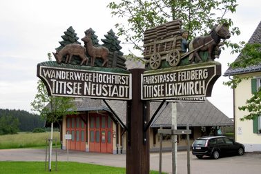
Amusing sign in Saig
|
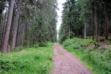
The trail up towards the Hochfirst
|
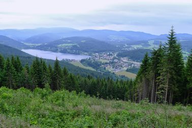
Titisee and Schwarzwald from Hochfirst summit
|
Berggasthof Hochfirst
|

Along the forest trail from Hochfirst
|
Wild Lupins
|
Franzözische Kreutz
|
View down to Kappel
|
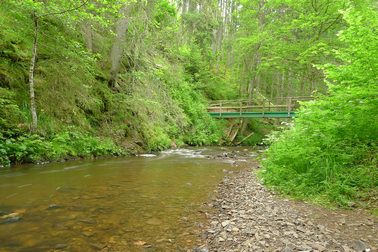
Entrance to the Haslachschlucht
|
Along the Haslachschlucht
|
One fallen tree that I didn't have to climb over
|
River narrows near Rechenfelsen
|
Confluence of the Haslach and Gutach at Haslachmunden
|
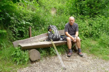
Lunch break at Haslachmunden
|
Bridge over the Rotenbachklamm
|
Flusskraftwerk Stallegg
|
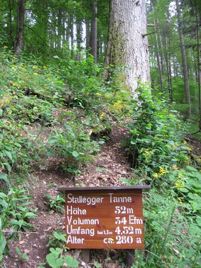
Stallegger Tanne
|
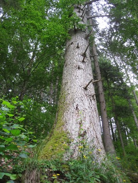
Stallegger Tanne
|
Raingear drying at Räuberschlössle
|
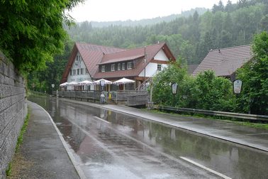
Hotel Schattenmühle
|