|
G3VGR
|
QUERWEG Buchenbach - Titisee
|
 The Hotel Imbery gave me the KONUS VHB Gästekarte which allows free travel on all buses and trains in the Schwarzwald.
Thus I started the day with a free train ride back down the Höllental to Himmelreich, then walked back to the pretty church at Buchenbach to continue on the second stage of the Querweg.
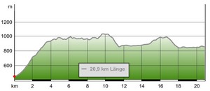
Today's stage leads back up the Höllental to Hinterzarten and onward to Titisee, totalling around 18Km.
The Höllental is six miles long, one of the most impressive valleys in the Black Forest, deeply incised and partly enclosed by high rock slopes.
This stage started uphill on a tarmac road from the village, until reaching the parking place at Pfaffendobel. It was warm work in the hot morning sun.
Shortly after passing the parkplatz, I turned onto a rough, narrow path.
It was a relief to get off the tarmac and get some shade as I made my way up the steep and tiring 500m climb through the trees towards Nessellachen.
At Pfaffeneck (748m), I continued on upwards on a forestry road until reaching a farm at Nesselach (950m).
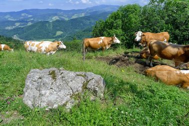
It was open here and I had very good views both back towards Freiburg and northwards towards Breitnau and the hills of the Schwarzwald.
This had been a tough climb, especially in the heat, and I was relieved to find the trail now levelled out somewhat as I started along the ridge walk.
I was on a narrow rough trail through the forest with little to view due to the trees.
The path was rocky with many exposed tree roots, so was tough going at times.
In south facing clearings were wild foxgloves.
The gorge narrows with steep slopes up to 600 metres high and towering cliffs.
This section is known as the Höllenpass ("Hell Narrows").
The narrowest part of the gorge is called the Hirschsprung ("Deer's Jump"), so named because a stag allegedly jumped the 9 metre gap to escape its hunters.
The gap is nowadays much wider, due to blasting when the B31 Bundesstraße was constructed.
However, the legend remains and is marked by a bronze statue of a stag, which is unfortunately not visible from the trail.
The Hotel Imbery gave me the KONUS VHB Gästekarte which allows free travel on all buses and trains in the Schwarzwald.
Thus I started the day with a free train ride back down the Höllental to Himmelreich, then walked back to the pretty church at Buchenbach to continue on the second stage of the Querweg.
Today's stage leads back up the Höllental to Hinterzarten and onward to Titisee, totalling around 18Km.
The Höllental is six miles long, one of the most impressive valleys in the Black Forest, deeply incised and partly enclosed by high rock slopes.
This stage started uphill on a tarmac road from the village, until reaching the parking place at Pfaffendobel. It was warm work in the hot morning sun.
Shortly after passing the parkplatz, I turned onto a rough, narrow path.
It was a relief to get off the tarmac and get some shade as I made my way up the steep and tiring 500m climb through the trees towards Nessellachen.
At Pfaffeneck (748m), I continued on upwards on a forestry road until reaching a farm at Nesselach (950m).
It was open here and I had very good views both back towards Freiburg and northwards towards Breitnau and the hills of the Schwarzwald.
This had been a tough climb, especially in the heat, and I was relieved to find the trail now levelled out somewhat as I started along the ridge walk.
I was on a narrow rough trail through the forest with little to view due to the trees.
The path was rocky with many exposed tree roots, so was tough going at times.
In south facing clearings were wild foxgloves.
The gorge narrows with steep slopes up to 600 metres high and towering cliffs.
This section is known as the Höllenpass ("Hell Narrows").
The narrowest part of the gorge is called the Hirschsprung ("Deer's Jump"), so named because a stag allegedly jumped the 9 metre gap to escape its hunters.
The gap is nowadays much wider, due to blasting when the B31 Bundesstraße was constructed.
However, the legend remains and is marked by a bronze statue of a stag, which is unfortunately not visible from the trail.
I stopped for a lunch break at Pfaffendobel Hütte before carrying on another 6Km along the ridge walk through the trees to the rocky outcrop of Piketfelsen, which offers occasional impressive views down into the Höllental and across to Feldberg, the highest mountain in the Schwarzwald.
Unfortunately, the view is not as extensive as last time I was here, due to the trees having grown more to mask some of the view.
The path continued a little further along the ridge, then began to lose altitude as it went steeply downhill until reaching the Mittlere Ravenna.
I stopped for a snack at the Gästehaus Ketterer at the head of the Ravennaschlucht and decided to make my first detour of the trail.
It seems criminal to take the shorter, direct route to Hinterzarten instead of going via the beautiful Ravennaschlucht, one of the highlights of the Hochschwarzwald.
Although I had already walked the Ravennaschlucht in 2012, it deserved revisiting, so I headed down the ravine from the Gästehaus Ketterer with great enthusiasm.
It is still as wild and beautiful as I remembered.
Along a rough path, I followed the Ravennabach as it made its way noisily downwards. It was slow progress as I stopped many times to try and capture its beauty with my camera.
The path crossed the Ravennabach a few times over wooden bridges and passed some impressive waterfalls on the way until reaching
the Großjockenmühle, a preserved water-driven mill.
From the mill, the trail continued downhill with more views of more small waterfalls until eventually reaching the valley floor. I walked under the Ravenna Viaduct to Hollsteig.
The route from Hollsteig to Hinterzarten is to cross under the busy B31 road and follow the road up the Löffeltal , passing more old water-driven saw mills on the way.
After stopping at the Kurhaus-Café in Hinterzarten for coffee and Schwarzwälder Kirschtorte, I left my backpack at the Hotel Imbery and continued my walk past the Adlerschanze ski stadium, through the forest and over the Kesslerhöhe (where the Querweg was joined by the Westweg). From the summit, the trail descended through some farm meadows to the western end of the Titisee at Bruderhalde.
The Querweg continued along a path that passed through a campsite and followed the lakeshore to its eastern end where today's stage finished at the Hotel Seehof.
Relieved to have finished a tough stage, I enjoyed an ice cream as I strolled along the promenade to the town centre.
Titisee is a real tourist trap with many souvenir shops full of cuckoo clocks (mostly made in China) and is the destination of many tourist coaches.
Despite the heavy commercialization, it still possesses some charm due to being in a beautiful setting.
It was amusing to see the Chinese tourists buying souvenirs to take home, not realising the tat was made locally in their own country.
From previous visits, I did know a good restaurant, well away from the ones frequented by the many tour bus day-trippers.
I was able to eat outdoors as it was a warm sunny evening.
After dinner there, I watched the sunset over the lake before catching the last train back to Hinterzarten.
Today's stage had been a most enjoyable and satisfying walk and I was glad I made the detour through the Ravennaschlucht. However, it had been a very tiring day.
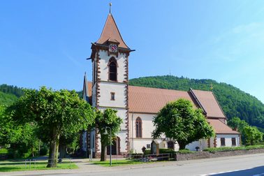
Church at Buchenbach
|

View eastwards from Pfaffeneck
|
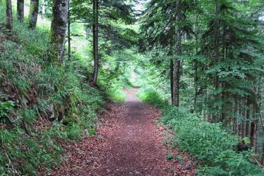
Trail from Pfaffeneck towards Nesselach
|
The farm at Nesselach
|
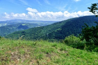
View towards Dreisamtal from Nesselach
|
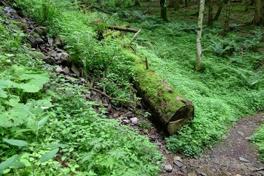
Lush foliage in the shady forest
|
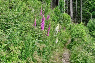
Wild foxgloves in clearings along the trail
|
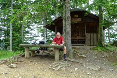
Lunch at the Pfaffendobel Hütte
|

View from Picketfelsen
|
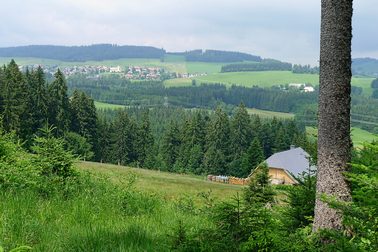
View north to Breitnau
|
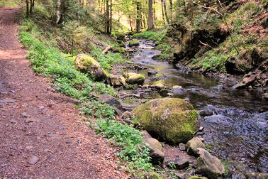
Ravennaschlucht
|
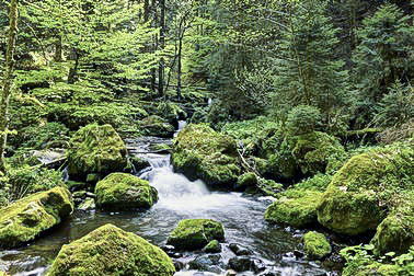
Ravennaschlucht
|
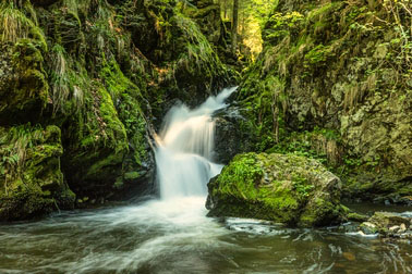
Ravennaschlucht
|
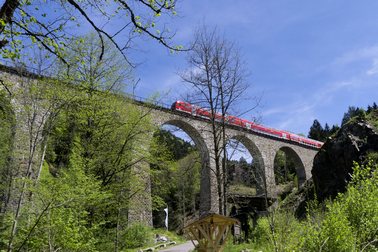
Höllentalbahn crossing the Ravenna viaduct
|

Tourist shop at Hollsteig
|
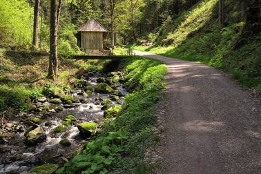
Along the Löffental
|
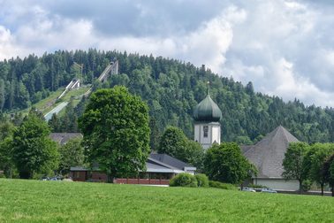
Hinterzarten Church and Adlerschanze
|
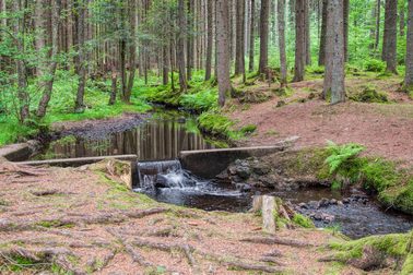
In the forest near Kesslerhöhe
|
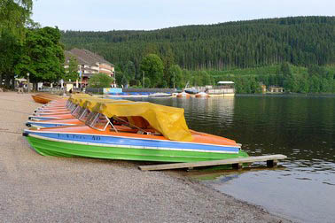
Rental boats at Titisee
|
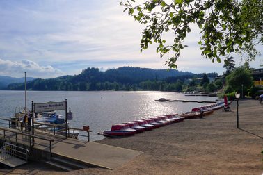
Late evening at Titisee
|