|
G3VGR
|
Hochschwarzwald - Teichschlucht & Zweribach Wasserfall
|
The Teichschlucht lies in the northern Hochschwarzwald and is part of one of the steepest valley landscapes of the German low mountain ranges.
With an average gradient of almost 13%, the Teichschlucht descends to the Wildgutachtal with a 250 meters height difference.
My plan was to walk from Gütenbach through the Teichschlucht then on to Sankt Märgen including a visit to the Zwerichbach Wasserfall.
Much of the area is designated as Bannwald (protected forest).
Due to the recent hot weather, today I brought an extra 2 litres of water. My backpack was now quite heavy with 3 kilos of water along with camera, lenses and tripod.
Getting to Gütenbach required two trains then a bus ride from Bachheim. The bus ride was very scenic as we passed through the Simonswaldertal, then up steep serpentines to Gütenbach.
The bus stop was at the edge of town and I followed the signs down a very steep metalled road until reaching the entrance of the Teichschlucht.
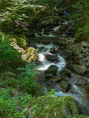
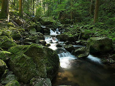
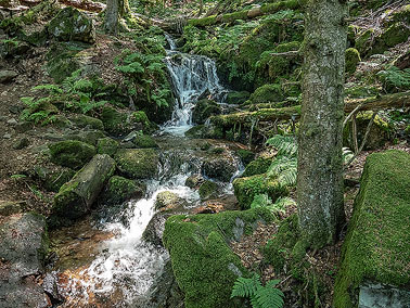
The scene changed abruptly as I started on a narrow path. I was in a world of green.
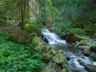
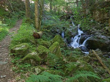
Around me were trees of every shape and size, mainly spruces, firs, beeches and sycamores, as well as ferns and shrubs.
Due to the constant high humidity, tree trunks, branches and rocks were covered with thick cushions of moss which seemed to glow at times as some rays of sunlight penetrated the leafy canopy.
The whiteness of the water which ran quickly and noisily down the centre of the gorge contrasted well with the surrounding greenery.
In places, the path closely hugged the sides of large cliffs and I was surprised that I saw nobody else walking in the Teichschlucht, especially as it is on the Zweitälersteig trail, so hardly unknown.
The whole scene was enchanting and I made very slow progress, stopping frequently to try capturing the beauty on camera.
After two hours, I reached the end of the Teichschlucht at Pfaffenmühle.
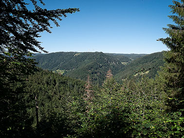
The late morning weather was hot and sunny and looking across to the heights on the opposite steep side of the valley, I realized I had a hard day's climb ahead of me.
I walked down to the valley floor, crossed a bridge over the Wilde Gutach then started a steep walk up an unmade road towards a hill farm.
This was hot work and I was pleased to reach the shade of some trees just after the farm.
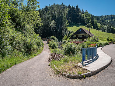
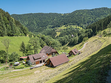
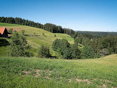
The trail levelled out and continued along the Zwerichbachweg, a metalled road passing some more farms which
perch on the steep slopes of the Simonswäldertal. The views of the Wildgutach and upper Simonswäld valleys with their lush, green meadows framed by the tree-topped peaks of the Schwarzwald heights were delightful.
The road ended at Brunnen where a car park was situated. Next to the car park, a sign pronounced that I was entering the Zweribach Bannwald.
The way ahead was both steep and rocky as I walked another 2Km until reaching the former farmstead of Brunnenhof, which burnt down in 1984. Only a derelict chapel remains. The farm is now a rest area for hikers with a refuge hut and some picnic tables.
This was a good place to stop for lunch and I sat inside the refuge out of the hot, direct sun.
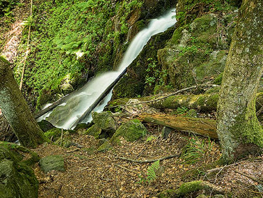
Just above the Brunnenhof, I joined another trail and took the right fork which leads to the Zweribach waterfalls along a short track strewn with boulders.
I could already hear the roar of the falls and clambered over rocks until reaching the main 40m drop of the waterfall.
Being rather tired now, I spent little time exploring around the waterfall and just contented myself with the views upwards before making my way back to the junction at Brunnenhof.
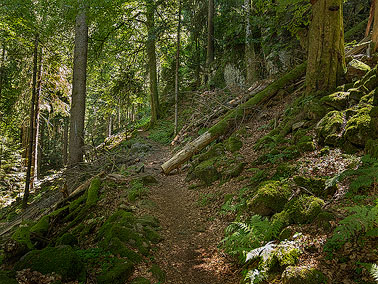
Then began a steep, long, rough walk up through the Bannwald to the Hirschbach waterfall.
It was very like an alpine walk with many rocks and roots to trip over as the trail gained elevation through a series of serpentines.
The forest here was quite lush and the trees were mainly a mix of fir, ash and sycamore, which provided diversity of view and is far more appealing than just coniferous trees.
I had done much uphill walking since crossing the Wilde Gutach at Pfaffenmühle and was feeling exhausted, despite my lunch break at Brunnenhof.
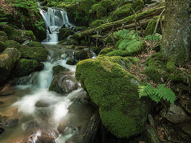
As I walked upwards, I could see and hear the Hirschbach as the stream made its way down the mountainside to the left of me.
Near the top of the climb, I eventually reached the Hirschbach Waterfall which impressed me more than the Zweribach Waterfall.
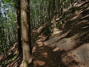
A little further on from the waterfall, the narrow forest trail ended at the Hauptweg, a gravel road in the forest.
It was depressing to find I was still walking upwards, although it was a small incline.
To my left were impressive views down into the Wildgutachtal and across to the Gütenbach area where I started the day's walk.
An even better view was at the Hohwartsfelsen. I plodded on, very tired in the extreme heat and now wondering would this road never end.
The gravel road eventually turned into a metalled road but still on an incline. Rounding a bend at a farm, it levelled out at last.
I now had wide expansive views over farm fields, forests and meadows. All very beautiful in the afternoon hot sun.
After spending the whole day in the confines of forests, it was quite pleasant to be out in the open with a wonderful panorama to enjoy.
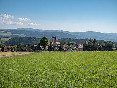
When I reached Rankmühle, I could now see the twin spires of Mari� Himmelfahrt, St Märgen's pilgrimage church, in the distance and another kilometer brought me to the village.
The bus to Kirchzarten wasn't due for almost another hour so I sat in a biergarten, took off my boots and demolished a few Hefeweizens whilst waiting.
Sankt Märgen is a pretty village but I was disappointed to see an almost constant procession of heavy trucks driving through the village which spoilt things somewhat.
This had been a hard day's hiking in extreme heat and I was totally exhausted at the end.
Too much uphill walking in great heat and the weight of carrying extra water did for me.
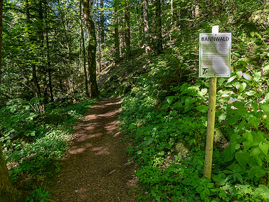
Entering the Teichschlucht
|
Sheer beauty of the gorge
|
The path closely follows the Teichbach
|

White water, green moss
|
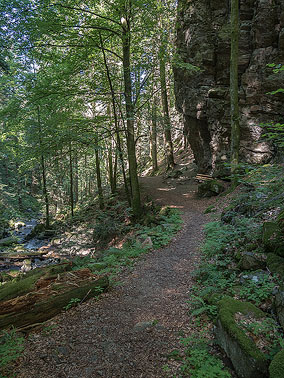
Along the Teichschlucht
|
Along the Teichschlucht
|
More cascades and greenery
|

Another waterfall
|
The Teichschlucht ends at Pfaffenmühle
|

Along the Zweribachweg towards Brunnen
|
View back to Wildgutachtal from Zweribachweg
|
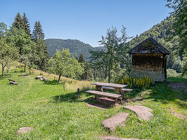
Rest area at Brunnenhof
|
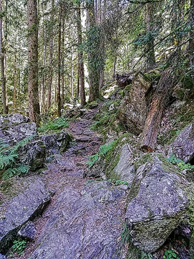
Rocky path to Zweribach Waterfall
|
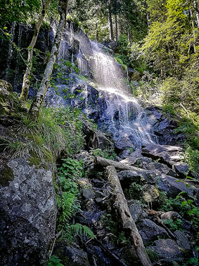
Zweribach Waterfall
|
steep path towards Hirschbach Waterfall
|
Hirschbach flowing down the mountainside
|
Hirschbach Waterfall
|
Hirschbach Waterfall
|
Ever onward, ever upward from the Hirschbach Waterfall
|
View across Wildgutachtal from Hauptweg
|
Out in the open spaces
|
Sankt Märgen and St. Maria Church
|
[Home]