|
G3VGR
|
ALTMÜHLTAL PANORAMAWEG Gungolding – Enkering
|
 The forecast was for another hot (29C) sunny day. After checking out of the Zum Alten Wirt, I followed the E8 European Long distance hiking trail along the left bank of the Altmühl back to Arnsberg.
Although I had already walked quite a few miles along Wacholderheide since Pappenheim, I had yet to see a single sheep grazing on the slopes.
On the outskirts of Gungolding, I saw my first sheep, but they were fenced into a small meadow instead of roaming the heaths. I was still pondering this anomaly all the way to Arnsberg.
Walking through the village, I passed a few Altmühljurahäuser.
At the northern end of Arnsberg, the first steep climb of the day took me to the next nature reserve, the Arnsberger Leite, which has one of the most beautiful dolomite rock formations in the Altmühltal.
I met some day hikers on the way up, only the second I'd seen since my first day on the trail.
Once at the top, I passed through a gate to an area which was fenced off to protect the (non-existent) sheep from falling off the cliifs and was confronted with the splendid panoramic view shown in many of the tourism brochures.
To the left is Arnsberg with its castle towering high in the rock and to the right a superb view of the rugged rocks of the Arnsberger Leite on the steep slope.
Below and snaking into the distance is the Altmühl. It was very peaceful sitting here and enjoying the view.
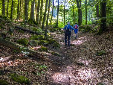
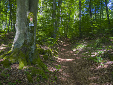
The trail continued along the ridge and through the forest where the ground was covered in leaves, so it was just like walking on a soft carpet. Despite my nose running like a tap, I was thoroughly enjoying the walk.
Eventually, I reached the end of the ridge and the trail went slowly downhill to the village of Böhming.
The forecast was for another hot (29C) sunny day. After checking out of the Zum Alten Wirt, I followed the E8 European Long distance hiking trail along the left bank of the Altmühl back to Arnsberg.
Although I had already walked quite a few miles along Wacholderheide since Pappenheim, I had yet to see a single sheep grazing on the slopes.
On the outskirts of Gungolding, I saw my first sheep, but they were fenced into a small meadow instead of roaming the heaths. I was still pondering this anomaly all the way to Arnsberg.
Walking through the village, I passed a few Altmühljurahäuser.
At the northern end of Arnsberg, the first steep climb of the day took me to the next nature reserve, the Arnsberger Leite, which has one of the most beautiful dolomite rock formations in the Altmühltal.
I met some day hikers on the way up, only the second I'd seen since my first day on the trail.
Once at the top, I passed through a gate to an area which was fenced off to protect the (non-existent) sheep from falling off the cliifs and was confronted with the splendid panoramic view shown in many of the tourism brochures.
To the left is Arnsberg with its castle towering high in the rock and to the right a superb view of the rugged rocks of the Arnsberger Leite on the steep slope.
Below and snaking into the distance is the Altmühl. It was very peaceful sitting here and enjoying the view.
The trail continued along the ridge and through the forest where the ground was covered in leaves, so it was just like walking on a soft carpet. Despite my nose running like a tap, I was thoroughly enjoying the walk.
Eventually, I reached the end of the ridge and the trail went slowly downhill to the village of Böhming.
The church of St. John the Baptist stands outside Böhming in the site of a former Roman fort.
My impression of Böhming was that it was depressingly awful, consisting of an estate of new-build houses and little else.
It is probably just a characterless dormitory for commuters. I hurried down the main street then crossed the Altmühl to walk uphill into more forest towards Kipfenberg.
The forest was quite beautiful, being mainly comprised of tall beech trees and I made my way upwards via a series of zigzags until reaching the Limes Radweg.
Following the Radweg, I was mindful of the fact that I was walking along the border of the Roman Empire.
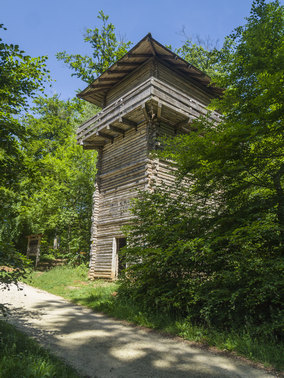
On the high ground before Kipfenberg the path passed the remains of a Roman watchtower, one of over 900 that were built along the Rhaetian Limes.
Nearby is a reconstructed Roman watchtower.
The Limes, today a UNESCO World Heritage Site, was the Roman imperial border, built mostly in the 2nd century BC and existed until about 260 AD, the end of Roman rule in Raetia north of the Danube.
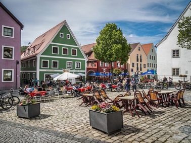
Leaving the fort and also the Panoramaweg, I continued downhill and across the river again to arrive in Kipfenberg, which is the geographical centre of Bavaria.
First mentioned in 1266, Kipfenberg impressed me with its picturesque market square, framed by mostly gabled houses and is overlooked by a hillside castle built on a high cliff behind the town.
I was now getting the impression that it seems a prerequisite for towns and villages along the Altmühl to be located next to a high cliff on which an obligatory castle has been built.
The town centre is quite pretty and I had lunch sitting outside a bakery café in the Marktplatz.
The Altmühltal seems very popular with cyclists, as there were quite a few in Kipfenberg enjoying the hot weather and superb scenery.
From Kipfenburg, I rejoined the Panoramaweg and walked about 5 miles along shady paths through more beech forest up the Kohlplatte, a hill between the Anlauter and Altmühl valleys.
I was quite thankful for the shade of the trees protecting me from the hot sun.
When originally planning my trip, I had problems finding suitable accommodation in Kinding, but was able to make a reservation at Pension Hackner in nearby Enkering.
The Panoramaweg passes below the peak of Schellenberg, a mountain spur, and heads towards Kinding, 2Km away.
I left the trail here and walked downhill to the Pfarrkirche St. Ottmar and into Enkering.
My overnight stay was at Pension Hackner.
Despite being a small village, I had noticed two restaurants when passing by the church.
In the evening, I walked back to the Hotel zum Brau (with excellent Doppelbock from Kloster Scheyen) for dinner.
I had enjoyed today's walk through the shady forests of tall beech trees which are so different to my local Epping Forest, where the beeches assume strange shapes due to many years of coppicing.
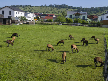
Sheep at Gungolding
|
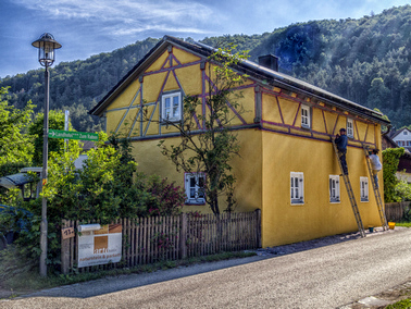
Jurahaus in Arnsberg
|
Climb to the Arnsberger Leite
|
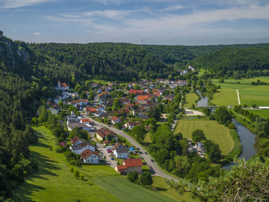
View upstream back to Arnsberg
|
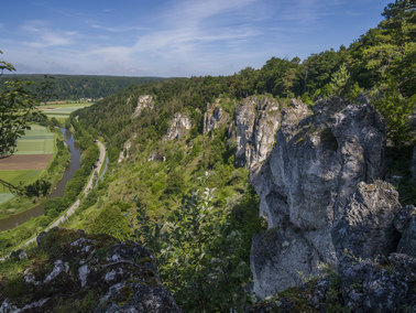
View downstream from Arnsberger Leite
|
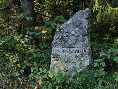
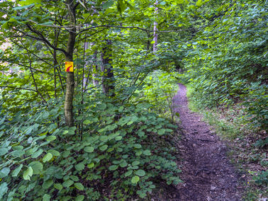
The only trail marker seen on the Panoramaweg
|
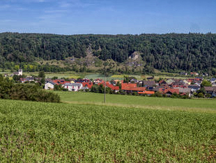
View across to Böhming
|
Through the forest from Böhming
|
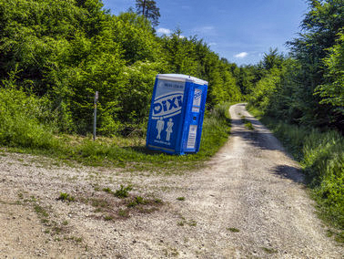
On the Limes, but I don't think this was left by the Romans
|
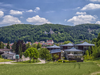
View to Kipfenburg
|
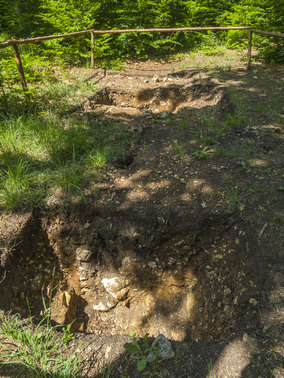
Foundations of original Roman watchtower
|
Replica watchtower
|
Kipfenburg Marktplatz
|
Back in the forest
|
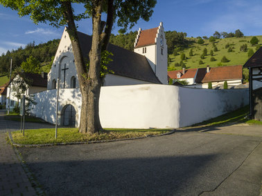
Pfarrkirche St. Ottmar, Enkering
|
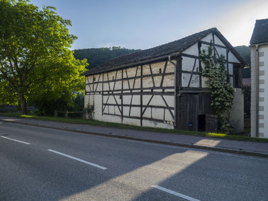
Old barn in Enkering
|
[Home]