|
G3VGR
|
ALTMÜHLTAL PANORAMAWEG Eichstätt – Gungolding
|
 Many of the "Wandern ohne Gepäck" tours skip the section of trail between Eichstätt and Walting.
This is mainly to shorten the usual 29Km stage from Eichstätt to Kipfenberg.
As I had already planned today's trek to end at Gungolding to avoid such long stages, starting the day's walk at Walting was unnecessary.
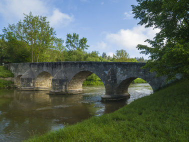
However, I did want to spend some time visiting Pfünz to see the reconstructed Roman fort Castra Vetoniana and also the Altmühlbrücke, a 15th century old stone bridge.
Fortunately, the Braugasthof Trompete starts serving breakfast at 07:00, so I was able to catch the 9232 bus at 07:53 to Pfünz.
The bus ride allowed me to miss out the suburbs of Eichstätt, saving 7Km of fairly uninteresting walking and allowing sufficient time for my visit.
The early morning was foggy, so I wouldn't have seen much anyway.
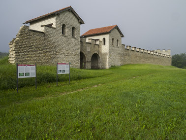
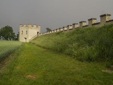
From the centre of Pfünz, I followed the steep Römersteig trail which led me up the Kirchberg, a mountain spur, to the site of Castra Vetoniana.
The Kirchberg is ringed by three valleys, resulting in a strategically optimal location for a fort.
The original fort was built around 90AD and destroyed by the Alemanni in 233AD.
Despite being an inaccurate reproduction, the rebuilt north gate, corner tower and part of the defensive wall are still very impressive.
Whilst exploring the fort, the fog cleared and gave way to a hot, sunny day.
Many of the "Wandern ohne Gepäck" tours skip the section of trail between Eichstätt and Walting.
This is mainly to shorten the usual 29Km stage from Eichstätt to Kipfenberg.
As I had already planned today's trek to end at Gungolding to avoid such long stages, starting the day's walk at Walting was unnecessary.
However, I did want to spend some time visiting Pfünz to see the reconstructed Roman fort Castra Vetoniana and also the Altmühlbrücke, a 15th century old stone bridge.
Fortunately, the Braugasthof Trompete starts serving breakfast at 07:00, so I was able to catch the 9232 bus at 07:53 to Pfünz.
The bus ride allowed me to miss out the suburbs of Eichstätt, saving 7Km of fairly uninteresting walking and allowing sufficient time for my visit.
The early morning was foggy, so I wouldn't have seen much anyway.
From the centre of Pfünz, I followed the steep Römersteig trail which led me up the Kirchberg, a mountain spur, to the site of Castra Vetoniana.
The Kirchberg is ringed by three valleys, resulting in a strategically optimal location for a fort.
The original fort was built around 90AD and destroyed by the Alemanni in 233AD.
Despite being an inaccurate reproduction, the rebuilt north gate, corner tower and part of the defensive wall are still very impressive.
Whilst exploring the fort, the fog cleared and gave way to a hot, sunny day.
After leaving Castra Vetoniana, I headed out of Pfünz following the signs for Schlaufenweg 15, one of the 16 Altmühltal hiking loops, which led me to the Altmühlbrücke.
I crossed over the bridge and the Schlaufenweg rejoined the Panoramaweg 300 metres further on.
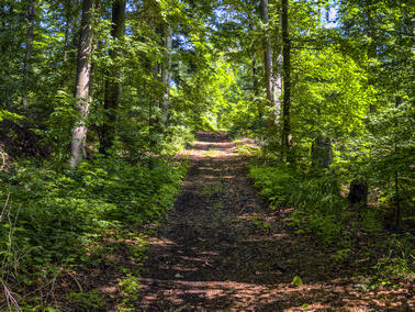
The uphill walk through another forest brought me to Buchenhüller Mammuthöhle,
a large cave where the well-preserved skeleton of a mammoth and remains of other prehistoric specimens were found in 1911, although there was nothing to see due to the entrance being barred.
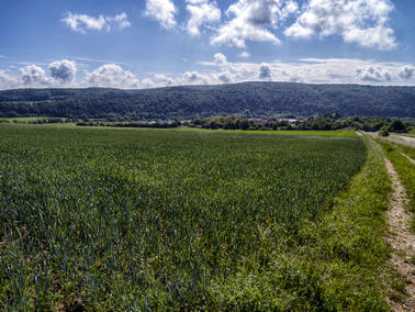
The forest walk was starting to get a little monotonous, but relief came when I reached a clearing with an impressive panorama stretching down to the village of Rieshofen.
I made my way down some farm roads to Rieshofen and stopped for lunch, a substantial Bauernschmauss, in the Biergarten of Gasthof Bauer, a venue renowned for it's home cooking.
Rejoining the Panoramaweg, there followed a walk across another juniper heath to a climb through a forest above Isenbrunn.
I arrived at the road into Gungolding around 1500 which seemed too early to go to my lodging for the night.
Instead, I decided to carry on and end the day's walk at Arnsberg.
The trail took me across the Gungoldinger Wacholderheide, another of the highlights of the Altmühltal nature park.
This is not only considered the most beautiful juniper heath of the southern Frankenalb, but is also the largest and is designated as a nature reserve.
Nearing the end of the Wacholderheide, the view across to Arnsberg was remarkable.
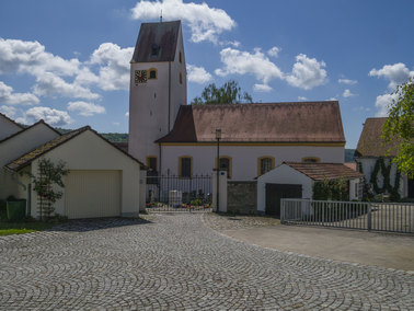
The little village is built by a flood plain with terraces of houses leading up to its highest point at St. Sebastian Church.
Perched on a 120 metre high dolomite massif immediately behind the village are the ruins of Burg Arnsberg.
I caught the 9232 bus from Arnsberg back to Gungolding and booked in at the Gasthof Zum Alten Wirt.
The Alten Wirt serves good food and Herrnbräu Weisse.
Although my cold had been especially bad today, the heat had been quite debilitating and I was quite tired due to lack of sleep from a disrupted sleep pattern, it had been another great day of hiking with much scenic beauty to savour as well as the interesting legacies of the Roman empire.
Castra Vetoniana
|
Castra Vetoniana
|
Altmühlbrücke, Pfünz
|
Through the forest
|

Buchenhüller Mammuthöhle
|
View to Walting
|
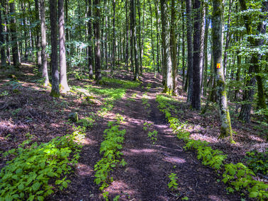
More forest
|
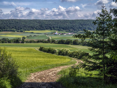
View down to Rieshofen
|
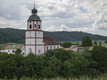
Rieshofen Church
|
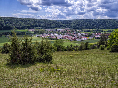
View to Gungolding
|
Gungolding Church
|
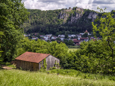
View to Arnsberg from Gungoldinger Wacholderheide
|
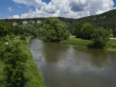
Altmühl at Arnsberg
|

Arrival at Arnsberg
|
[Home]