
|
DX0K |
|
Map of Kalayaan Island Group Pagasa I is at 11o03’N 114o17’ E |
|
There were two operations for DX0K, the first was from February 1 to 23 and sole operator was 4F2KWT, Gil and the second was from March 30 to April 12. Operators for the second trip were DU1EV, Eddie; 4F1OZ, Ed; and 4F2KWT, Gil. The project is an astounding success for the team. There were many plans to activate our side of the Spratly Islands by many of our elders but those did not bear fruit. We found out that focusing on the job actually helped us accomplish it, twice. We handed out contacts from Topband to Magic Band and in modes CW, SSB, RTTY, PSK31, and SSTV. The thrill of being on the DX side of the pile up really is an experience of a lifetime. There must be another one of these trips. Where do we go from here? |

|
Pictures of the March 30 to April 12 operation |
|
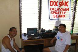
On the air |
|
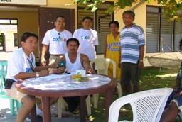
Medical mission in full swing |
|
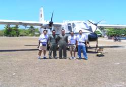
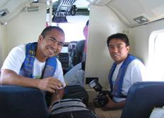
On board the plane to 1S |
|
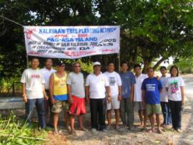
Posing with Mayor Mantes and Island Commander Secreto |

|
R & R on DX0K |


|
Cold beer and roasted pig on a nice island, any takers? |
|
Making it official |

|
Mayor Mantes starts a really nice program to protect the ground water |
|
I get to plant my own tree! |

|
The markers of proof |

|
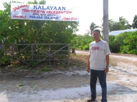
Fiesta! |
|
Team DX0K arrives on Pagasa Island |

|
Singing with the band |
|
Once more with feeling |

|
Time to go home |

