|
G3VGR
|
ALBSTEIG Albsee - Niedermühle
|
 The last stages of the Albsteig required very early starts.
I caught the 6AM train from Hinterzarten to Seebrugg then the bus to St. Blasien, where I caught the 7323 bus back towards the Albsee.
School holidays were now finished and both buses had been very crowded with schoolchildren who start quite early in Germany.
The bus dropped me off close to the dam wall where I would start today's stage.
It was another warm sunny morning and the weather forecast predicted the temperature to reach 27C later.
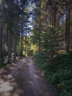
After crossing the wall, I located the first Albsteig sign and made my way along the Albtal on a wide forest path passing Urhalde, then climbed steeply up through the forest to the
Bildsteinfelsen, a rocky outlook point high above the Albtal, which offered intermittent views of the Schwarzwald and the southern Alb valley.
The Bildsteinfelsen is historically significant. In the early Middle Ages, a castle of the Knights of Tiefenstein is said to have been enthroned here.
Below the Bildsteinfelsen is an entrance of a former mine called "Grube Gottesehre".
The entrance is now concreted and the old mine is a refuge for bats.
Leaving the Bildsteinfelsen, a completely different vegetation awaited me in the Hotzenwald as I started on the Schmugglerpfad, a quite challenging stretch of narrow, rough and rocky trail along rock faces and across a small boulder field and scree.
This was excellent walking and I pondered over the thought that the smugglers of earlier times would need to have been well rewarded to subject themselves to using such a difficult route to secretly transport their contraband.
The Schmugglerpfad ended shortly before the hamlet of Arnoldsloch and the Albsteig led me into a beautiful forest area crossed by small streams.
A small detour took me to a clearing where a marker on a large rock informed me that I was at the summit of the Dachsberg.
The last stages of the Albsteig required very early starts.
I caught the 6AM train from Hinterzarten to Seebrugg then the bus to St. Blasien, where I caught the 7323 bus back towards the Albsee.
School holidays were now finished and both buses had been very crowded with schoolchildren who start quite early in Germany.
The bus dropped me off close to the dam wall where I would start today's stage.
It was another warm sunny morning and the weather forecast predicted the temperature to reach 27C later.
After crossing the wall, I located the first Albsteig sign and made my way along the Albtal on a wide forest path passing Urhalde, then climbed steeply up through the forest to the
Bildsteinfelsen, a rocky outlook point high above the Albtal, which offered intermittent views of the Schwarzwald and the southern Alb valley.
The Bildsteinfelsen is historically significant. In the early Middle Ages, a castle of the Knights of Tiefenstein is said to have been enthroned here.
Below the Bildsteinfelsen is an entrance of a former mine called "Grube Gottesehre".
The entrance is now concreted and the old mine is a refuge for bats.
Leaving the Bildsteinfelsen, a completely different vegetation awaited me in the Hotzenwald as I started on the Schmugglerpfad, a quite challenging stretch of narrow, rough and rocky trail along rock faces and across a small boulder field and scree.
This was excellent walking and I pondered over the thought that the smugglers of earlier times would need to have been well rewarded to subject themselves to using such a difficult route to secretly transport their contraband.
The Schmugglerpfad ended shortly before the hamlet of Arnoldsloch and the Albsteig led me into a beautiful forest area crossed by small streams.
A small detour took me to a clearing where a marker on a large rock informed me that I was at the summit of the Dachsberg.
At the end of the forest was the Dachsberghalle and a Kindergarten where I was astounded when the Albsteig signs guided me into a children's playground.
I was relieved to see another sign at the other end of the playground, which implied I hadn't just lost my mind.
Through the playground gate was a small forest walk with many information boards.
My trail descended through another forest on a narrow trail until reaching a tarmac road.
From there, I walked up through a large open meadow until reaching the Bühl viewpoint above the village of Wolpadingen.
There were superb views from here all the way to the Alps. Individual mountains could be identified via a bronze plaque which showed the named peaks.
A picnic bench was also here, so it was an ideal place for lunch. As I sat there in the hot sun adnmiring the scenery, I felt relaxed and contented.
After lunch, I continued down into the small village of Wilfingen and past a farm with some rather shy Highland Cattle to the edge of a forest.
Here, I saw my first hikers of the walk They had obviously walked up from Immeneich and looked completely exhausted.
I was soon to find out why. For the third consecutive day I started another steep rough descent. This one was tougher than the ones of the two previous days.
At times the descent appeared almost vertical and my feet suffered greatly again as I rued the decision to leave my boots at home.
Near the bottom of the descent and partially hidden amongst the trees is an idyllic church on the small hill directly above the Albtalhalle.
The Bernhardskapelle was built in 1895 and was dedicated to St. Bernard of Baden.
As much of the descent had been in the open with the hot sun beating down on me, I now felt as exhausted as the two hikers I saw at the forest edge.
Inside the church, some kind soul had left a large, cool bottle of water. I greedily drank this to rehydrate myself then left a donation in the alms box.
From Immeneich it was just a 2Km walk on relatively flat paths through meadows along the edge of the forest following the Alb to Niedermühle where I caught the 7323 bus back to Sankt Blasien.
During the Würm ice age, the Alb glacier ended at the point where is now the village of Niedermühle. With a length of 27Km, it was the longest glacier in the Black Forest.
Downstream of Niedermühle, the Albtal is very narrow, leaving no room for settlements.
Today had been the the best day's hiking so far, especially the section between the Bildsteinfelsen and Dachsberg. I finished the stage quite early and managed to catch the 14:14 bus back to Sankt Blasien.

Albstausee Dam Wall
|
Through the forest near Urhalde
|

Bildsteinfelsen
|

View from Bildsteinfelsen
|

Start of Schmugglerpfad
|

Slight obstruction
|

Along the Schmugglerpfad
|

Along the Schmugglerpfad
|

Abtal view from Schmugglerpfad
|

Nature Trail at Dachsberghalle
|

Dachsberg Summit Marker
|

Out of the forest
|

Viewpoint at Wolpadingen
|

Farm at Wolpadingen
|

View down to Immeneich
|

Start of descent to Immeneich
|

Bernhardskapelle
|

Alb between Immeneich and Niedermühle
|