BOB'S CENTRAL CAROLINA WEATHER PAGE
WX4MMM
and I monitor most Raleigh area 2 meter repeaters. My weather
observing station location is in Northwestern Wake County near
Highway 98 and Highway 50. I have been continuously
recording climatic data since September 1985, including
daily maximun/minimun temperatures, precipitation, barometric
pressure, dew point, wind direction and wind speed (Weatherflow
Tempest). Weather data from this station is uploaded to several web
sites including the Citzens Weather Obervation Program ( station
WX4MMM, AP098) and Weather
Underground .(stations KNCRALEI11 and KNCHOLLY148).NC State and have a BS and MS in Meteorology and a member
of the American Meteorological Society ( AMS ), Atlantic Coast Observer Network ( ACON ), Raleigh Amateur Radio Society ( RARS ), American Radio Relay League ( ARRL ), Smith Chart
Amateur Radio Society ( K4OO ), and Weather Matrix. I am also an assistant
emergency coordinator for Central Carolina Skywarn
CLICK HERE FOR: CURRENT
WEATHER CONDITIONS ( NW Wake County)
CURRENT
WEATHER
CONDITIONS (CWOP Data)
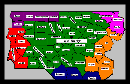
RALEIGH
CWA WX STATIONS WILMINGTON
CWA WX STATIONS
Rain returned
with 4.11 inches which is 0.22 inch above normal. June
was also hot including 103 degrees on June 12th. The average
daily temperature was 1.4 degrees above normal . No severe
weather was observed during June.
Max. Temp: 103 degrees , Min. Temp: 46 degrees
, Avg. Daily Temp: 78.1 degrees.
Precipitation :4.11" Peak
Wind: 17
mph, Max Snow Depth: 0.00 inch Days Max. Temp= > 90: 15
Days Min Temp <32 degrees 0 2026 EXTREMES: Max. Temp: 103 degrees (June
12th) 10 degrees ( February 2nd) Year To Date
90+ degree days: 23 Year to Date 32 degree days or lower:24
Max. Peak Wind: 22 MPH Max 24 Precipitation: 1.50 inches ; Min Sea Level Pressure: 29.70 inches Year to Date Precipitation: 13.44 inches (-7.97 inches below normal). STATION RECORDS ( Since September 1986
Wake County): Max. Temp: 105 F 7/31/99 Min. Temp: -1
F 2/5/96 Max. Monthly
Precipitation: 23.2" 9/99 Min. Monthly Precipitation: Trace 10/2000 Max. 24 hour snowfall: 18" 1/24/- 1/25/2000 Peak Wnd: 51 MPH 3/26/2002 Links CURRENT WEATHER IDSS Forecast
Points IDSS
Forecast Point TB WPC Local
Precipitation Range KRDU Metar Zoom
National SFC Map Local
WX Obervations Map College of Dupage SFC
and Upper Air Analysis GFS Thickness Maps HRRR
Radar and SLP Map NCAR
HRRR Neutral Network Probabilies HWO Display North Carolina Active Warnings Ma pSPC
Sfc Analysis RAX
Radar- VAD VWP
Hodographs Precipitable
Water Climatology USA Precipitable
Water Climatology-GSO Current
PW Map-Choose Heavy Rain Upper Level Analysis Upper Level Maps and
1000-500 mb Thickness Skew-T Log
P GSO Sounding SPC Soundings GOES
LIGHTNING Mapper Atantic Ocean
SFC map Daily Weather
Maps Archive Coastal Mesonet Obervation sCurrent
Lightning Activity P-Type
Trends
Nomogram SPC
Mesoanalysis Ocean
Upwelling Ocean
Temp Johnny Mercer Pier Satellite
Estimated Ocean temps GOES
16 Images GOES
16 Geocolor Composite Image GOES
Water Vapor Image Nearby Weather Stations APRS/CWOP Stations CoCoRaHS CoCoRaHS
Rainfall Reports CoCoRahS
Observation Comments CoCoRaHS Water Year Report Mesowest
Sfc
Obervations Surf
City CWOP FW 2794 Hampstead
Govt Annex Weather Station Pender
Co EOC WX-Burgaw Surf
City Elementary Weather Station WeatherUnderground-Topsail
Beach Weather
Undergound Clark at Ocean Blvd TB Tempest Wx
Data-Topsail Beach ## Tempest WX
Data -Raleigh APRS
Location WX4MMM Weatherflow
Rain Report Data#27439 Holly Ridge-
Weatherflow Tempest
Weather-Wrightsville Beach Weatherflow
Support Troubleshooting Weatherflow Community Cooperative
WX Station Photos Cooperative
Weather Stations User manual ASOS User
Guide Bald Head
Island Current Weather Weatherunderground-NC
stations Econet NC Mountain
Observations WeatherStem Stations Wake
Co NC
Coop Daily Weather Data Frying
Pan Tower Weather Mount Mitchell
Weather Beech
Mtm Weather Grandfather
Mountain Weather Virginia
Tech Mountain Observations NWS Difax
Charts SKYWARN/VOIP CENTRAL CAROLINA
SKYWARN Central
Carolina Skywarn Facebook NWS Chat Slack Tuesday
Night script 2021 STORM PREDICTION CENTER SPC Severe WX
Outlooks SPC
Intensity ratings (Cat 1,2,3) SPC Partners
Outlooks SPC
Severe Weather Local Timing ### CIPS
Experimental Severe Probability Guidance GEFS Iowa State Warning Data Plot History Broadcastify
146.88 repeater Multi-Radar
Viewer GR
Placefiles SPC
Mesonalysis Mesobriefer Spotter Network RAH
Warnings and Watch Criteria NC
Warnings Display National Warnings
Display iNWS warnngs I EMBOT
Warnings NWS WX Chat Central Carolina Skywarn Faceboo k NWS Raleigh
Facebook RAH Twitter NWS Raleigh
Skywarn Triad Skywarn VOIP Skywarn ILM Skywarn EF scale DOD
Storm Chaser
Tracker NWS Interactive Alert Signup IRLP Link Spotter
Field
Guide SPC Lectures National Skywarn
Training Sessions NWA
Advance Spotter Training NWS Boston
Radar Course Abridged
Spotter Field Guide NWS
Norman
Spotter videos PSU
Advanced Spotter Webinar 2023 PSU
Advanced Radar 2023 Handout Gibson
Ridge for Dummies Radarscope
User Guide NWS Louisvlle
Training Documents Severe
Weather Cheat Sheet NWS Raleigh Case
Studies 2002
Severe Ice Storm Case Study Comet MetEd
Courses Dual
Pol Radar Training for NWS Partners How Do Tornadoes Form Charles
Doswell Publications April
16 2011 Tornado Outbreak Case Study Spectrum
One TV Skywarn 2023 HURRICANE LINKS National Hurricane Center NHC Facebook 2026
NHC Graphic Changes Hurricane Models Experimental Tropical Atlantic Hurricane Models University
Okahoma Hurrricane Models FSU Genesis Guidance Week
2 Tropical Weather Outlook Weather Underground
Models Wisconsin Models Tropical
Tidbits Models Weathernerds
Ensembles Hurrevac 2023 Hurrevac
Youtube Training videos Storm
Surge Forecast Maps NOAA
Probablistic TS Surge Guidance Realtime
Coastal Flooding Update Vortex
Data Message RAH Tropical WX Page Storm Pulse 2022 National
Hurricane Conference Hurricane Watch Net Coastal
Emergency Risks Assessment Hurricane
FAQ North Atlantic Hurricane
Watch-NASA NHC Blog TOPSAIL TIDE AND SURF FORECAST ETC. Bush
Marina Current Tide Level ETC New
Topsail Inlet Tides Surf
Zone Forecast Wrightsville
Beach Ocean Temperature Climatology Wrightsville
Beach Ocean Temperature SST
Anomalies Marine
Traiffic Map Water
Prediction Service National Upwelling
Article NWS Text Message sWPC
Medium Range Discussion NC Watches/ WX Discussions River
Levels WRAL-TV Radar State
Record Climate Extremes Committee NWS Storm
Publication Assessments RAH
Prior Weather Events Summaries Atlantic Coast
Observer Network Broadcastify Radio Scanner including
Pender Co.
Vienna
WX NWS Offices N WS RA H
NWS
Raleigh Facebook NWS Rah- X (twitter) IDSS Forecast
Points Dynamic
IDSS Maps Hourly Forecast
Points NDFD
Max/Min Temp Forecasts Probabilty of
Snow/Rain Forecasts WPC NWS Snow
Report Map NWS Heat Risk RAH
Winter Storm Severity Index (WSSI) Snow
Accumlation Forecasts NWS ILM NWS ILM
Facebook Topsail
NWS Weather Forecast Topsail Beach 3 day
detailed forecast Topsail Surf
Forecast National
Water Prediction Service Aviation Weather NWS
Eastern Region Technical Attachments NWS/NOAA News Foothills Action Network Weekly
Weather and Crop Bulletin Captial City
Weather Gang National Weather Association NWS RDU
Radar Winter
WX Forecasts Davis Weather Instruments
Weatherflow
Tempest Manual WeatherBrains StormTrack Home Page
RedTeam WX and GR
Level Products Place File Nation GR2
Analyst User Guide Wet
Bulb Temp Chart Warning Archieves NWS
Normals 1991-2020 Weather Prediction
Education Comet
MetED Jet Streaks QG
Equation Sutcliffe-Petterson
Developmental Equation Sunrise
and Sunsets for Raleigh NC BAMS AMATEUR RADIO LINKSAlinco
DR 735 Progranning QRZ Allstar
Bridge Smith
Chart Amateur Radio Society Raleigh Amateur Radio Society Amateur Radio Reference Guide Radiogram
Numbered Messages QSL Net On The Air
Magazine NC ARRL ARRL Carolina440 UHF Raleigh
Area Repeaters W4BAD
repeaters RATPAC
Presentations UTUBE Ham Radio
Information More
UTUBE Videos ARRL UTUBE WINLINK UTUBE WINLINK
USER INFO N1FOG
Field Operations Guide TERMS AUXCOM
Task Book Wake
Co Emergency Management SHARES
(HF) NC
Emergency Operations Plan 2020 DPS
Emergency-Communications ARRL
Emergency Communications Convention HF Remote Stations to Listen Winlink app
for Iphone IC2100H
programming via UTUBE VHF
Antenna Videos WEATHER SAFETY INFORMATIONHeat Risk Index Safety
Tips NOAA Weather Radio Live
NWR Broadcasts NOAA WX Radio
NC Status NWR
Progation Range for NC Weather
Vanes Storm
Recovery Plans and Roof Preparation WEB
CAMS Breezeway Web Cam Surfchex
Topsail Beach Web Cam Figure
Eight Island Bridge Web Cam Surf City-Downtown St
Regis Web Cam Wrightsville
Beach Traffic Cams Carolina Yacht
Club Web Cam Topsail
Beach Gazette WeatherBug Web Cams NC
Weather Cams Lees McRae
College Web Cam Banner
Elk Web Cam Boone King Street Web Cam NC Mountain Web Cams Beech
Mountain Web Cam Beech
Mountain Parkway Web Cam Beech
Mountain Sledding Hill Web Cam Sugar Mountain Web
Cam Other Sugar Mountain Web
Cams Blowing
Rock Web Cam Laurel
Springs Web Cam Deadwood
SD Web Cam Mt Mitchell Web
Cam Alpine Lodge
Web Cam West Coast Frying
Pan Tower Web Cam Ocean
Isle Beach NC Ocean
Isle Beach Inn Movable Cam Ocean
Isle Web Cams Atlantis Motel Web Cam Bogue Pier Web Cam Bald
Head Island Web Cam Holden
Beach Web cam Nags Head Web Cam Hatteras
Webcam Deadog
Saloon SC Sea Captain's
House Web Cam Myrtle Beach Myrtle Beach Web Cam Myrtle
Beach
2 Web Cam Myrtle
Beach
Earthcam Murrels
Inlet Webcam Fort
Lauderdale New River Web Cam Biscayne Bay FL
Webcam Port of Miami
Utube Web Cam Fort
Lauderdale Marina Webcam Destin
FL Webcams Wilmington
Cape Fear River Web Cam WNCT
Web cams Other
Beach Cams Skyview Webcams Beaufort
Webcams Port Nassau Web Cam NWP and SPC MODELS Operational
Models Encyclopedia SFC
Prog Medium Range
3-7 days QPF 72 hour Rainfall and
Snow Statewide forecast 7
day Total QPF Excessive
Rainfall
Outlook ### National
Water Prediction Center 8-14 Day
Extended Temp Outlook ### WPC
500 MB 5 day outlook 5
Day Temperature Outlook NMME
Monthly Forecast NAM
and GFS MOS Models by City Arctic
Oscillation Forecast NAO
Index Forecast 4-
7 Day Winter Wx Outlook Models/Upper Air Soundings
ECMWF from
weather .us FSU Models SPC
500 MB Vorticity SREF Ensemble
Forecast Ensemble Situational
Awareness Table ECMWF Situational
Awareness Table GEFS
Plumes RDU GFS MOS
evaluation thru April 2022 GFS 500 MB Vorticty maps
out to 144 hours ETA/GFS/NGM
Graphics BufKit
Generator -Iowa State University Bufkit
Warehouse Snow to Rain ratio and totals HREF NAM
MOS KRDU NCAR
NAM and GFS Models SPC
HREF Ensemble Precipitation Type National Blend of
Models(NBM) NBM Model Images HREF
24HR updraft Ensemble HREF
COMPOSITE RADAR FORECAST NSSL
Radar Cam Model Roger
Edwards Models List Pivotal WX Models
Polar
WX models (HRRR, GFS, NAM,ECMWF, etc) NAM Maps WeatherWorld at PSU Tim
Vasquez's' youtube Forecast Lab WPC
Probabilistic of Winter Precip Probability of
Snow RDU RDU
Hour to Hour Forecast TAFB
Gridded Wind and Wave Forecast Weatherbell Analytics Model
Discussion Texas A&M Model TREND Preview Weather NOAA WRF
NoGaps Environmental
Modeling Center
[email protected]
Topsail
Beach Fire Dept Weather