Project Definition
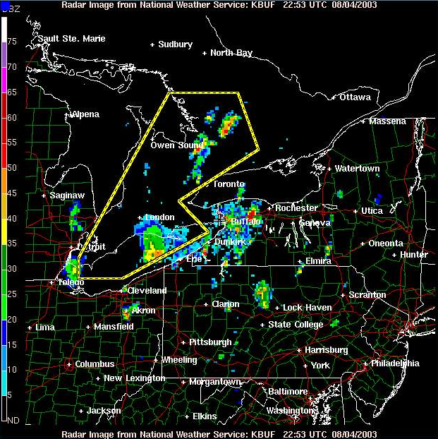
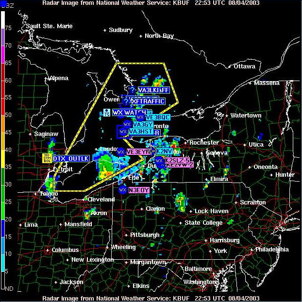
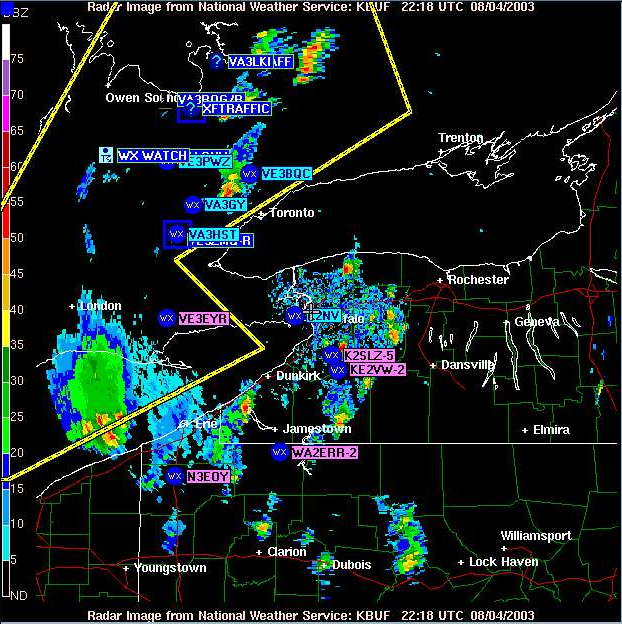
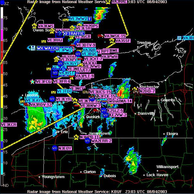
This project will provide Radio Amateurs with official Environment Canada notification of severe weather. APRS Stations will then "relay" the data to the APRS Network. In doing so, they can provide an additional service to the general public, the communities they serve (ARES) and it can also be used by Canwarn, as a secondary method of communications. During network conditions yellow and red, it would be very useful to the Canwarn Network Controller to know exactly where Canwarn stations (identified by an eyeball icon) are located in relationship to a storm's radar image. Specific weather information could then be acquired / exchanged, using either the voice network, APRS messaging, or APRS weather observations may be read direct from the station weather instruments. While radio amateurs are already sharing weather reports and notifications on APRS, this project would be such that only official E.C. information would be released.
The first phase of this project is to manually send the information to APRS. The second phase would be to connect with E.C. via the Internet, and automate the process. That would allow E.C. complete control of the notification. Graphic data indicating affected weather areas would be relayed from E.C. to the APRS Network across Canada, or to specific locations served by APRS Stations.
Any APRS equipped station can receive these broadcasts. Currently, in southern Ontario, about 200 radio amateur stations are using APRS at any time of the day.
For more information or to inquire as to how you might contribute your skills and talents to the project, email [email protected]
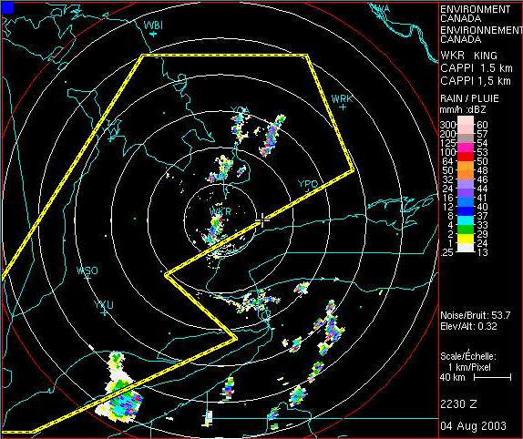
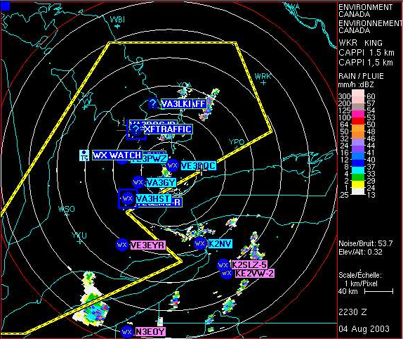
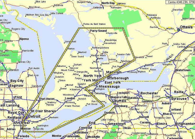
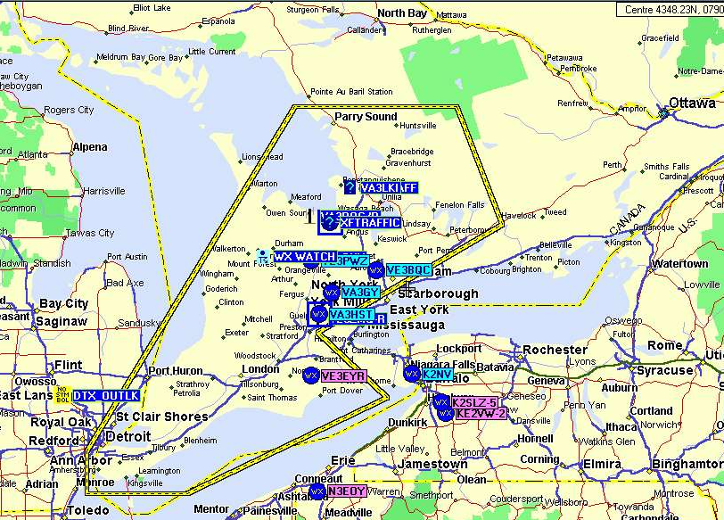
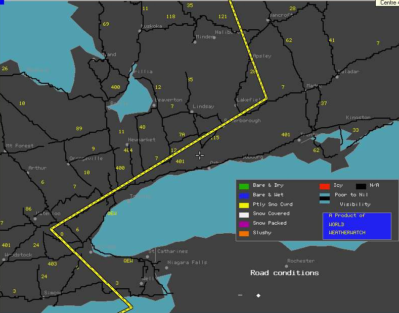
The following images are intended to demonstrate the adage "A picture is worth a thousand words." If you don't have a high speed connection, it would be ok to slip out and open an 807, soft drink, or brew a coffee. Sorry, but I wanted you to see APRS quality images.
This project will provide Radio Amateurs with official Environment Canada notification of severe weather. APRS Stations will then "relay" the data to the APRS Network. In doing so, they can provide an additional service to the general public, the communities they serve (ARES) and it can also be used by Canwarn, as a secondary method of communications. During network conditions yellow and red, it would be very useful to the Canwarn Network Controller to know exactly where Canwarn stations (identified by an eyeball icon) are located in relationship to a storm's radar image. Specific weather information could then be acquired / exchanged, using either the voice network, APRS messaging, or APRS weather observations may be read direct from the station weather instruments. While radio amateurs are already sharing weather reports and notifications on APRS, this project would be such that only official E.C. information would be released.
The first phase of this project is to manually send the information to APRS. The second phase would be to connect with E.C. via the Internet, and automate the process. That would allow E.C. complete control of the notification. Graphic data indicating affected weather areas would be relayed from E.C. to the APRS Network across Canada, or to specific locations served by APRS Stations.
Any APRS equipped station can receive these broadcasts. Currently, in southern Ontario, about 200 radio amateur stations are using APRS at any time of the day.
For more information or to inquire as to how you might contribute your skills and talents to the project, email [email protected]
The following images are intended to demonstrate the adage "A picture is worth a thousand words." If you don't have a high speed connection, it would be ok to slip out and open an 807, soft drink, or brew a coffee. Sorry, but I wanted you to see APRS quality images.