Coordinates 51d 21' N 77d 25' W
GRID Square FO11gi
Camp Rupert 257 Km North of Matagami - JAMES BAY
Check site Topo Map
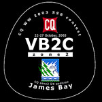
CQ WW 2003 VB2C - Zone 2 - Grid FO11gi Oct 25 - Oct 26 2003
|
|
|
|
|
|
|
|
|
|
Bob, VA3RD
Don, VA3ZV Ted, VA3TSG |
Carl, VE3BY
Kim , VE3DXE Kevin, VE3KJS Ray, VE3HAE Brad,VE3SLI Wendy,VA3WCF |
Bob, VE3AGC
Bob, VE3SRE Rick,VA3VO Paul, G3SXE Art, Swl |
Karel,
VA3KO
John, VE3TV Manfred VA3RMF Jose,VE3DFM Gilligan,VE2LBN Michel,VE2MKJ |
Dennis,
NB1B
Chet, N8RA |
Hank, K8DD
Stan, AC8W James, VE3TPZ |
|
|
inverted L, 90' vert. 100' horiz. (190') | 2 phased 1/4 wave verticals | 4 SQ phased vert. + 2L wire beam | Hy-Gain 203BAS | 4L monobander | 5L Monobander |
|
|
|
|
|
2788/33/126 | 3198/35/135 | 1397/28/112 |
Final Score = 14,905,408


![]()

Simple map of the Matagami/Radisson area . The road from Matagami to Radisson is the Route de la Baie James.
Detailed map of the Matagami/Radisson area . Site located Kilometer 257 EnRoute de la Baie James.
CQ Zone map showing our approximate location . James Bay (Baie James) is the southern "finger" of the Hudson Bay.
Map of Canada showing our approximate location (for the truly lost )
@Copyright 2002-03 Team Zone2 HOME Revised : 06 Dec 2003