Why APRS? Here's why!!
There are four examples on this page
Here is a simulated storm chase. I have chose a very simple map just for the size of file. With Precision Mapping (a cd available) you can have a very detailed map showing the county roads. It is a very detailed CD perfect for spotters who are going somewhere they have never been before and can make sure they get out of the way. The red lines coming from the vehicles and the Tornado show direction of travel and the longer the line, the faster they are going. I used skywarn for the calls of the truck and van but you would actually use your call. The tornado could be added by the NWS (assuming they would have aprs) or any of the field stations. In the next couple of samples, you'll see how the NWS or any trained operator can add actualy placement via radar.
I put the NWS icon and the NTS icon and the EOC icon (I just put them on the map randomly not knowing where they realy are located). The NTS will be showed at the bottom.
Here is the use of radar with APRS, i'm sure this will hook a few of you, it convinced me that APRS should be used with SKYWARN and several chase teams and NWS's across the US agree.
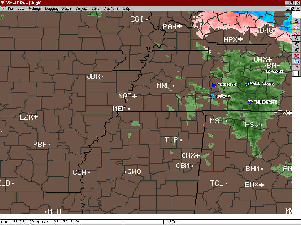
Here is the radar map that many of us use right now (Intellicast). When you want the current map, you open Intellicast in the web browser and save the map. Winaprs then opens the map and all the stations will automatcily be placed on the map. Now I now this isn't our area (we didn't have a Tornado today) so I just prettend that this was a severe storm (acutally wasn't on this day, see the snow up North). This is actually the Tennessee area, but will work for demo purposes. The thing that is realy nice with this option is the ability for a trained operator to be abale to SEE the storm at his/her home QTH or at the NWS and place the weather objects (Wall Cloud, Thunderstorm, Tornado, and many more) on the exact location that radar sees it. That way, if the spotter on the ground can't see to good (like at night), he would be able to make sure he don't get in to close to the Tornado on the ground. This would also help them get a better idea where the "HOT" spot is in the cell. Many more uses here too.
Here another nice feature of the APRS system. Being able to place warnings, watches, weather advisories, and some others on the map so usuers at home and the gournd spotters can see if there is any active warnings or watches or advisories for there county. There is a station on the TCP/IP side of APRS that automatcially transmits all the weather statements put out by any NWS office acorss the US onto the APRS Network and anystation that acts as an IGATE (Internet Gateway for VHF) can automaticaly retransmitt those statements to the VHF side. I have used this a couple of times. There is also the option to be able to add manually which is perfect for the local NWS office or a TRAINED person at there home QTH. If i'm out spotting and I notice the county I'm in his highlighted, I can see the active statement. The nice thing about this is that you put the expiration time on the statement and it will expire at that time and go off the map, you can also manualy cancel the alarm. Here is what this looks like (I don't have the radio transmitting this stuff by the way). I used a simple map so the picture would be that large of a file. Three different colors, one was a watch, warning, and an advisory. I put my home station on the map.

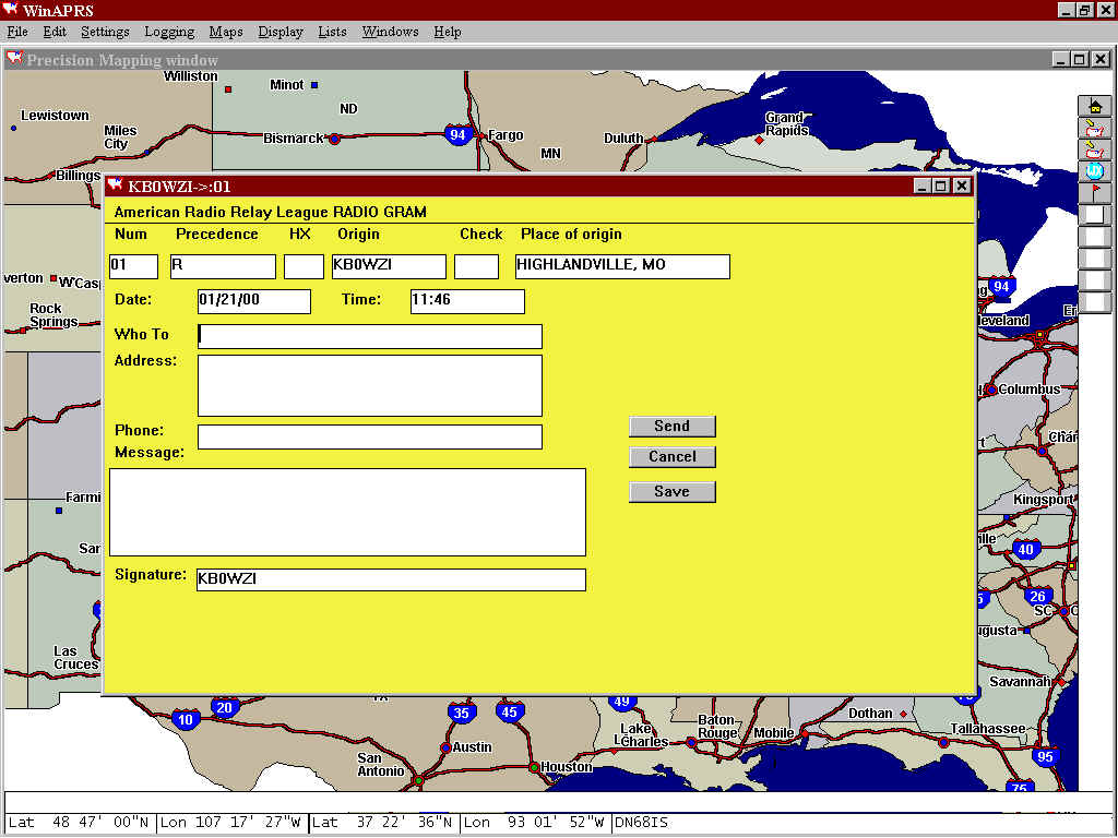
Now for the NTS'ers. This is a pretty nice and easy method for NTS messageing. This gets transmitted throughout the network (will go through Internet if there is a local IGATE (I have the capabilites of this at my QTH) and is a very quick method. Here is what the message input form looks like (you'll notice I used the PM base map for the map on this one, didn't want you thinking that all the maps where ugly)