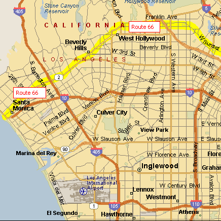
Route 66 On The Air
W6A - Santa Monica and W6B - Los Angeles
9 - 17 September 2023
The 24th Anniversary of this Amateur Radio Special Event
Celebrating the 97th Anniversary of Route 66


Home
Route Map
Memorabilia
QSL Information
Award Certificates
Archive QSLs
QSL Collection

Route 66 Map - West LA through Santa Monica

From downtown Los Angeles Route 66 turns west to follow Sunset Blvd. onto Santa Monica Blvd. to Hollywood. Although Route 66 follows Santa Monica Blvd., in Hollywood, most of tourist attractions such as Chinese Theater are located on Hollywood Blvd. north of Santa Monica Blvd. The route travels on the south of Beverly Hills, and continues west past Westwood.

In 1935 Route 66 was extended from Los Angels to Santa Monica. It follows Santa 
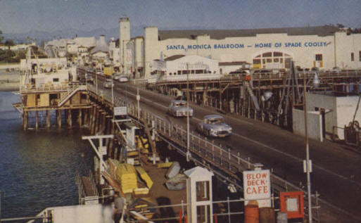
Monica Blvd. and comes to an end at Ocean Ave. by Palisades Park, a palm-lined bluff, two blocks north of the city's landmark pier.

Old Standard Oil Map Showing Route 66 through California


Driving towards the end of the Santa Monica Pier

Shown in this picture is the Santa Monica Ballroom - Home of Spade Cooley, the "King of Western Swing".  Cooley's 18 month engagement at the pier ballroom was record breaking for the early half of the 1940s. His "Shame on You", was recorded in December of 1944, and was No.1 on the country charts for two months. On August 5, 1948 television station KTLA broadcast his show live - the first ever live broadcast of a variety show.


Home | Route Map | Memorabilia | QSL Information | Award Certificates | Archive QSLs | QSL Collection

Copyright © 2020 All rights reserved
The Westside Amateur Radio Club of Los Angeles
Post Office Box 3471
Santa Monica, CA 90408-3471

For information regarding W6A or W6B only, send e-mail to: [email protected]

.