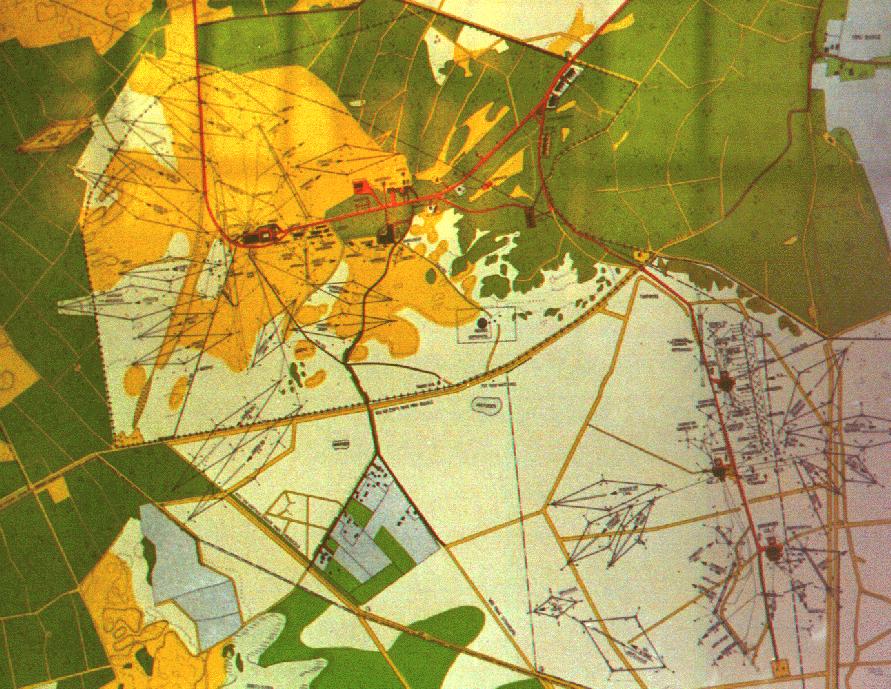
This map shows the situation in 1965. Sorry, there
are no details and text readable. The 25 large rhombus shaped wire antenna's
are large highly directional Rhombic antenna's. The transmitting direction
is in the direction of the sharp corner where you can see a line in the
middle which in fact is a 700 Ohm terminating open line made of chrome-nickel
resistance wire which dissipates HALF of the transmitter output power which
then is not send to the unwanted direction. On the lower right side of
the map there are several curtain antenna's and verticals. The main transmitter
building is the black spot near the red structure on the left where
the (red) road makes a 90 degrees turn. The white spot in the middle of
the red structure is a water basin for cooling water.
Click this to load a world map (143 kb)
with Kootwijk in the center to compare it to the antenna directions to
find out where the antenna is pointing to.
(tip: with browser back and forward buttons you can fast and easy switch
between the two maps to see the directions)
Important transmitter targets at the time this chart was made were
with Surinam, the Netherlands Antilles, the USA and Indonesia.