Click here for more detailed
information on Chenango County fire/ems communications.
LifeNet 7-8 helicopter Sidney, NY and LifeNet 7-12 Seneca Falls, NY
33.900 MHz (91.5 PL) .......Broome County fire/ems dispatch
460.075 MHz PL 94.8 Chenango County fire/ems dispatch (46.380 MHz permanently shut down on 22-MAR-2012)
119.025 MHz Lieutenant Warren Eaton Airport AWOS (Automated Weather Observation Station)
453.150 MHz PL 123.0 Chenango County Highway Dept.
460.300 MHz PL 107.2 Chenango County State DOT
147.550 MHz TASIS Communications Group repeater KC2NYS
446.550 MHz TASIS Communications Group repeater KC2NYS
Guthrie 1 helicopter
Mercy Flight helicopter
Albany Med Flight helicopter
Norwich City Emergency Management Office
33.940 MHz (91.5 PL) .......Broome County fire/ems channel 2
33.980 MHz (91.5 PL) .......Broome County fire/ems channel 3
33.820 MHz (91.5 PL) .......Broome County fire/ems channel 4
33.860 MHz (91.5 PL) .......Broome County fire/ems channel 5
33.520 MHz (91.5 PL) .......Broome County fire/ems channel 6
151.025 MHz ......................Broome County Highway Dept.
155.160 MHz (103.5 PL)....Broome Ambulance
460.625 MHz (67.0 PL)......Johnson City Fire Department
155.235 MHz (103.5 PL)....Vestal Volunteer Emergency Services
453.7375 MHz ....................Cortland County fire/ems dispatch
46.280 MHz (82.5 PL) .......Cortland County fire/ems channel 3
46.300 MHz (82.5 PL) .......Cortland County fire/ems channel 4
151.115 MHz (97.4 PL) .....Cortland County Highway Dept.
153.905 MHz.......................Cortland County School Buses
158.925 MHz.......................input for above
46.060 MHz (110.9 PL) .....Delaware County fire/ems dispatch
46.160 MHz.........................Madison County fire/ems dispatch
46.440 MHz.........................Otsego County fire/ems dispatch
47.020 MHz (162.2 PL) .....Otsego County Highway Dept.
46.200 MHz.........................Tioga County fire/ems dispatch
46.120 MHz.........................Tompkins County fire/ems dispatch
159.435 MHz ......................NYS DEC Pharsalia and Georgetown repeaters on different output PL tones
151.145 MHz ......................Bowman Lake State Park
151.340 MHz ......................NYS Park Police
47.040 MHz (151.4 PL) .....NYSDOT - Oxford
| FREQUENCY | NY LOCATION | POWER |
|---|---|---|
| 162.400 | Elmira | 1000W |
| " | Rochester | 500W |
| " | Stamford | 300W |
| 162.425 | Cattaraugus | 80W |
| " | Hornell (Call Hill) | 300W |
| " | Middleville | 300W |
| " | Walton | 100W |
| 162.450 | Bath (Mt. Washington, NY) | 300W |
| " | Cooperstown | 100W |
| " | Gore Mountain | 300W |
| 162.475 | Binghamton | 1000W |
| " | Highland | 1000W |
| " | Riverhead | 500W |
| " | Watertown | 100W |
| 162.500 | Ithaca | 1000W |
| 162.525 | Norwich | 300W |
| " | Frewsburg | 175W |
| " | Whites Hill | 300W |
| " | Spencerport | 175W |
| 162.550 | Albany | 1000W |
| " | Buffalo | 330W |
| " | New York City | 500W |
| " | Syracuse | 1000W |
Many have complained about the voice quality of older automated voice systems used by the NWS,
so now an improved system is here: click here
to find out more about the newest system.
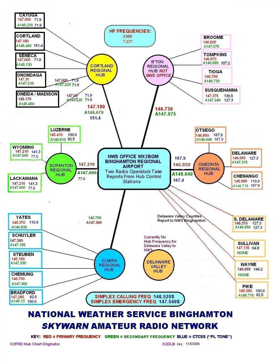
Click here to view the SKYWARN frequency listing for NY counties in the Binghamton CWA (County Warning Area)
236.0 ......USN/USAF Sea Survival Training
miscellaneous other US Navy:
miscellaneous other US Air Force:
Coronet East Refueling: (US military flights between continental US and Europe)
miscellaneous other refueling:
GMRS low power interstitial (5 watts or less)
The Military Aircraft Band (225-400 MHz AM):
237.9 ......USCG SAR Air-to-Surface
241.65 ....USCG Air-to-Surface
242.8 ......USCG SAR Air-to-Air
243.0 ......Military Aero Distress
251.9 ......USAF SAR & Survival Training
252.8 ......USN/USAF SAR
259.0 ......USAF SAR
263.8 ......USCG Air-to-Surface
282.0 ......USCG Air-to-Surface
282.8 ......USCG/USN/USAF SAR
342.2 ......USCG Air-to-Surface
381.0 ......USAF SAR
381.7 ......USCG Air-to-Surface
381.8 ......USCG Air-to-Surface
383.9 ......USCG SAR Air-to-Surface
386.5 ......USN SAR
233.7 ..... 251.6 ..... 307.4 239.2 ..... 255.0 ..... 308.5 244.3 ..... 266.7 ..... 369.9 246.8 ..... 267.8 249.8 ..... 285.0
228.4 ..... 254.6 ...... 270.6 ...... 288.9 ...... 318.3 235.1 ..... 255.8 ...... 273.1 ...... 299.5 ...... 321.0 238.7 ..... 258.3 ...... 276.1 ...... 311.0 ...... 338.5 239.2 ..... 260.4 ...... 278.4 ...... 312.8 ...... 342.2 251.6 ..... 264.6 ...... 283.8 ...... 313.6 ...... 361.4
228.550 ...... 343.100 236.750 ...... 370.400 254.600 ...... 372.300 255.750 ...... 375.700 289.700 ...... 378.200 293.000 ...... 388.400 297.300 ...... 391.000 314.500 ...... 394.600 322.800 ...... 396.200
235.1 ...... 291.9 238.9 ...... 295.8 242.4 ...... 322.6 259.8 ...... 339.2 264.9 ...... 342.1 266.4 ...... 352.6 270.1 ...... 361.0 276.1 ...... 366.3 285.9 ...... 378.2 286.3 ...... 385.6
general freqs:
47.420 +American Red Cross 120.300 pilot-to-metro weather info 121.500 commercial aircraft emergency 122.750 pilot chit-chat 123.100 air search and rescue 123.450 pilot chit-chat 123.475 pilot chit-chat 125.125 pilot chit-chat 151.820 MURS 1 (1 watt) 11.25 KHz bandwidth 151.880 MURS 2 (1 watt) 11.25 KHz bandwidth 151.940 MURS 3 (1 watt) 11.25 KHz bandwidth 154.570 MURS 4 / "Blue Dot" (2 watts) 20.00 KHz bandwidth 154.600 MURS 5 / "Green Dot" (2 watts) 20.00 KHz bandwidth 156.800 Marine Distress & Calling 157.100 US Coast Guard weather transmissions to mariners 161.650 Canadian weather broadcasts in some areas 162.400 All Hazards Radio 162.425 " 162.450 " 162.475 " 162.500 " 162.525 " 162.550 "
FRS radios (Family Radio Service):
462.5625 ...... 467.5625 462.5875 ...... 467.5875 462.6125 ...... 467.6125 462.6375 ...... 467.6375 462.6625 ...... 467.6625 462.6875 ...... 467.6875 462.7125 ...... 467.7125
GMRS frequencies (General Mobile Radio Service):
repeater
outputs... frequency name
462.550 ... 462.575 ... "white dot" 462.600 ... 462.625 ... "black dot" 462.650 ... 462.675 ... "orange dot"...emergency frequency 462.700 ... 462.725 ...
...shared with 1/2 watt FRS users:
462.5625 462.5875 462.6125 462.6375 462.6625 462.6875 462.7125
US FORESTRY SERVICE emergency frequencies for eastern states
168.050 ...... 168.200 168.075 ...... 168.600 168.100 ...... 168.700
USFS forest fire interagency coordination (eastern states)
170.475 171.425 171.575
USFS non-fire interagency coordination
171.475 172.275
USFS aircraft frequencies
118.825 ...... 122.750 ........ 123.075 ........ 168.650 118.950 ...... 122.800 ........ 166.675 ........ 169.150 118.975 ...... 122.900 ........ 167.950 ........ 169.200 119.950 ...... 122.925 ........ 168.550 ........ 170.000 119.975 ...... 123.050 ........ 168.625
BUREAU OF LAND MANAGEMENT special activities
166.775 ....... 168.475 167.100 ....... 169.350 167.250 ....... 169.400 168.400 ....... 171.725 168.450
Cleanup of oil/toxic spills in waterways
36.250 ....... 154.585 ........ 158.445 ........ 165.3125 41.710 ....... 156.750 ........ 159.480 ........ 168.500 122.925 ....... 157.075 ........ 163.175 ........ 454.000 150.980 ....... 157.125 ........ 164.450 ........ 459.000
NATIONAL TRANSPORTATION SAFETY BOARD (NTSB)
Channel 1 ....... 165.750 Channel 2 ....... 165.7625 Channel 3 ....... 166.175
FEDERAL EMERGENCY MANAGEMENT AGENCY (FEMA)
138.2250 141.7250 163.1000 164.8625 165.6625
cruise ship and maritime frequencies
NY Metro
September tropospheric ducting enables 100-mile FRS radio contact and rescue
Oneida County Sheriff's Office 24-hr police blotter
California wildfires of 2003: radio communications problems
New dispatch center for Tompkins County, NY: news article
News article about Cortland County, NY public safety radio system
Saratoga County, NY seeks to establish new countywide emergency services radio system
Cattaraugus County, NY news article: Mayor proposes giving up control of city dispatch
Broome radio system, mobile unit streamline law enforcement communication. How it works.
Wireless Growth Hinders Rescuers: news article
Click here for a worldwide listing of repeater stations in the 10 meter amateur radio band only
Click here for another
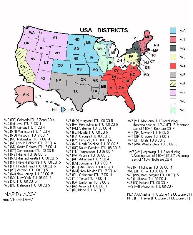
US amateur radio callsign district map
international amateur radio callsign prefixes
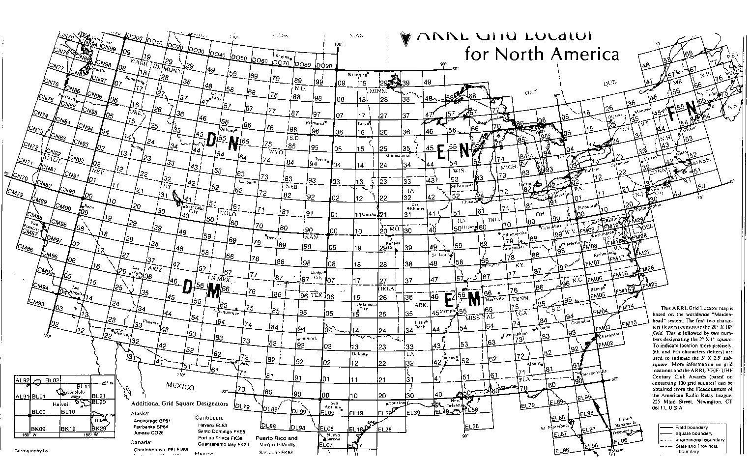
grid square map of North America
grid square map of most of the western hemisphere
list of 2 meter ham radio beacons
large US map of APRS digipeaters
trunking channel number/frequency conversion chart
Motorola PL tone chart
racing frequencies
North American railroad frequencies
FCC rules for GMRS
FRS & GMRS bulletin board
frequencies for retransmitted Space Shuttle audio: listing by state
NASA frequencies for scanner and shortwave
help track wildlife with your ham radio or scanner: click here
Fire/EMS pager notification services for alphanumeric pagers:
northeast US states
Carolinas Fire Page
Citywide Communications (Hartford, CT)
Fire Page Northwest
Firenet Chicago
Incident Command Page (Arizona)
Maryland Fire Network
Mass Info (Massachusetts)
Ohio Fire News
Incident Page Network
Equipment Authorization: FCC ID Search Page
FCC frequency databases