|
|
|
|
current conditions at Norwich Emergency Operations Center (alternate)
Hazardous Weather Outlook
long range forecasts
Air Quality Forecast
Climate Prediction Center releases outlook for winter 2024/25
current trend of the North Atlantic Oscillation
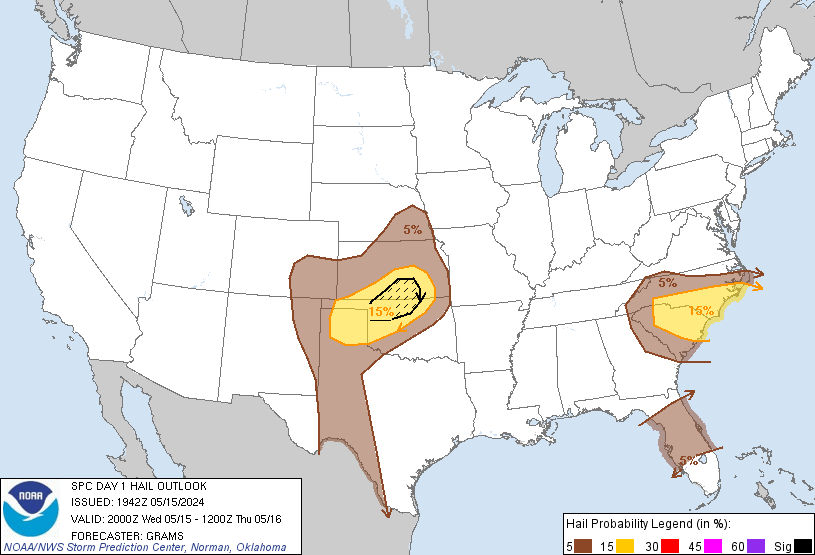
day-1 hail outlook
latest NWS Public Information Statements: Binghamton | alternate
Local Storm Reports: current | archives for past 24 hrs
latest GOES east satellite image
mobile device page warnings
Recent Marine Buoy Data for the northeastern US
heavy rain & global flooding information & imagery
traffic, travel, and transit info: 5-1-1 NY 5-1-1 PA
nysroads.com
EastCoastRoads.com
CLOSINGS / CANCELLATIONS / DELAYS
DMV
local school closings: 1 | 2 | 3 | The Evening Sun | syracuse.com | CBS-6 Albany
USA wind chill temperature map
the revised wind chill chart
24-hour snowfall totals
NY ski reports
"powder alert" for skiers: click here
daily climate report
Palmer Drought Severity Index: USA map
weather information for pilots
NOAA aviation weather
additional airport info for Binghamton Regional Airport
FEMA media page: breaking disaster news, photos & links
archived radar imagery 1 | 2 | 3 | 4 | 5
some historical weather data for Norwich, NY: 1 | 2
weather info for select cities in Canada

