
.jpg)

|
|
|
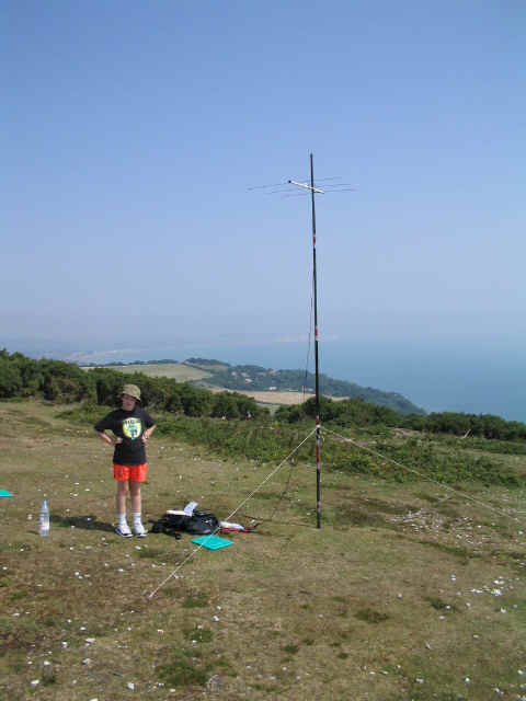
From Fishbourne, we headed to the island's capital town Newport, then followed the signs for Shanklin and ultimately Ventnor. Just before Ventnor, we followed the minor road to the summit, which I think was signposted as "Ventnor Down". The trig point is on this road, lying in a most undistinguished position by the high boundary fence to the radar station. The trig is not the true summit, which lies 5m higher within the radar station compound. There is however another peak of 240m ASL by the visitor car park and viewpoint at SZ 573 787. It is not listed in the "Twin Peaks" section in the update sheet to The Relative Hills of Britain (Alan Dawson), so perhaps more accurate measurements to centimetres are known here. Nonetheless, at less than 1m lower than the true summit, this easily accessible and beautiful spot, looking out over the English Channel, would make a qualifying SOTA activation.
My first contact was very pleasing, as it was my first ever into France, and in fact my fourth contact, plus two more later in the day on Brighstone Down SE-012 were also to be French stations. After packing up and retracing the very short walk to the car, we headed into the island town of Shanklin for lunch in one of the many cafes on the high street, and then down to the beach for an hour's swimming, cooling off from the scorching sun above. Callsign today was MX1SWL/P, the club call of the International Short Wave League (ISWL). See my radio page or click on the link for further details. Thanks to the following stations, all worked on 2m SSB with 2.5 watts:
|
|
|