
.jpg)

|
|
|
Mickle Fell, G/NP-002
- 788m ASL - NY 804 243 - OS Explorer OL31 - 6 SOTA points
I had chosen to activate Mickle Fell G/NP-002, because it was one of only two remaining summer weekends with open access, because the MOD were definitely not firing. Also, with the unique SPs for M3EYP due to be completed on the Pennine Way, it was time to start working down another region. Cross Fell G/NP-001 would also be encountered on the Pennine Way, so another reason to visit G/NP-002.
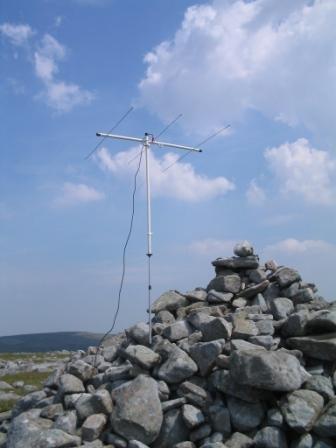
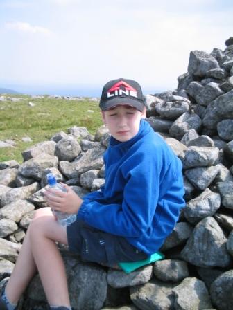
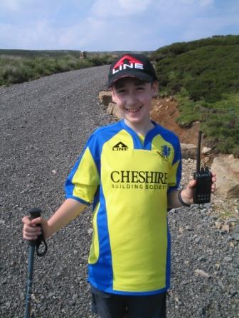
We considered four routes. The (allegedly) shortest route from the Pennine Way to the North East would have involved driving a few more miles, and I wanted to keep the mileage to a more environmental 250 mile round trip. The route from the West (Dufton) would have meant being more vigilant than I care for in checking each footstep for unexploded shells. The route from the South along the fence was worthy of consideration, but Jimmy hates trudging across pathless moorland. So it had to be the route from East of Grains o'th' Beck, as described by James M0ZZO. There was a wide entrance to the track, and room for at least half a dozen cars to park. Two already were when we arrived at 11.00am (it's a long long drive from Macclesfield this one), so we assumed that we weren't the only ones taking advantage of the open access day on the MOD land. Jimmy's rucksack turned out to be wet, the reason being a tiny hole in his bladder pack, rendering it useless. The advantage of rucksack liners then proved to be twofold, as it had not only kept all his spare clothes and equipment dry, but enable me to quickly transfer the whole liner bag to Liam's rucksack, which fortunately was in the car. Also fortunate was that after breakfast at Lymm Truck Stop earlier, I had decided to stock up on liquid, and bought several bottles of Buxton spring water and Lucozade Sport. It was a scorching hot day, and if I hadn't got the extra drinks, we would have been unable to attempt this summit with only two litres of water between us, what with one bladder out of action. We set off along the very good track, setting a cracking pace. This was the first time since we "upgraded" to two walking poles each that we had been able to use them in anger. When Liam is with us, it is actually counter productive, as I lose the opportunity to hold Liam's hand and encourage him to walk at something approaching mine and Jimmy's pace. As the good surfaced flat track stretched a few kilometres into the moor, I couldn't help but wonder about driving the car along it to cut down on the distance of the walk-in. Even though the initial sign said "Private Road", there was not a soul about, all the gates were openable, and there were plenty of parking/turning places. However, that was not the objective today anyway, as we were particularly keen to test how we would cope with this length of walk ahead of our Pennine Way expedition just three weeks away. Eventually, after about 5km, the track began to wind up to the summit plateau of High Crag, and from this vantage point, the long broad ridge of Mickle Fell began to take shape. The OS Map indicates that the track terminates at the lip of High Crag, but it in fact continues up most of the Eastern ascent of the Mickle Fell ridge. Just before the 758m trig point, it stopped, but continued as a grassy land rover track for another 2.5km around to the true summit 788m ASL. This ridge afforded us sneak previews of Cow Green Reservoir and the dam, Cauldron Snout and Cronkley Scar, features to greet us on the Pennine Way. On the flattish summit plateau, we had a good wander around, and decided that the large cairn in the middle was higher than any other point, even though the map indicated the true summit to be a few metres to the South West. Our minds may have been influenced by an urge to shelter from the increasingly strong southerly wind. Our fleeces were added for the first time of the day (it was all shorts, t-shirts and suncream before this) and we set up for 2m SSB on the cairn. I worked six stations on 2m SSB, including three in the contest, and Jimmy worked four of these. I then tried 2m FM, but only made contact with one station. We relaxed a little enjoying our drinks, Baxter's Scotch Broth, more drinks, fruit flapjack and more drinks, before deciding to pack up and descend.
With a 2.5 hour descent in baking late afternoon sun ahead of us, I was pleased when Jimmy set the same blistering pace as he had on the ascent. We reached the car bang on schedule at 6.00pm, just as some cracks of thunder were heard. We later found out that Manchester had been battered by torrential rain during the afternoon. At the parking place were the same two cars as seen in the morning, plus another. We were quite surprised, as we had not seen a single other person out all day. After a slight delay caused by the masses joining the M6 from the M55 after a sunny Sunday day out at Blackpool, we arrived home just after 9.00pm, greeted by a welcome serving of Marianne's improvised "Spam-in-the- Many thanks to the following stations, all worked on 2m SSB, except the last one on 2m FM:
|
|
|