 |
Our helicopter arriving at the Valdez airport |
Valdez
Valdez was the last port of call before debarkation. The town is not at all touristy. There weren't the several blocks of trinket & jewelry shops that we had found in the other ports. The town is really there only because of the Trans-Alaskan pipeline. Valdez is the southern ending point for the pipeline. There is a large tank farm, which hold the oil until it is loaded onto ocean going tankers. Not much to see here really. It's quite sterile, very business like. The oil tanks are huge, but nothing more than a big cylinder with a conical top. If you've seen one storage tank, then you've seen them all.
At Valdez, Margot and I had scheduled to take a Helicopter Glacier tour. This, to me, had to be the highpoint of our trip. We were originally schedule for a 9:30 trip, but this was delayed by the helicopter company because of mechanical problems with one of the helicopters. So, our helicopter trip got rescheduled to start at 11:30. This presented a bit of urgency, as the cruise ship was to leave port at 12:45 and the helicopter trip was 90 minutes. So, in Celebrity fashion, they held the boat until we returned, as this excursion was booked through Celebrity. Otherwise, we would have had to cancel the trip, or figure out our own way back to the cruise ship.
|
Our helicopter arriving at the Valdez airport |
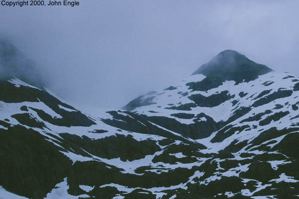
We were taken by motor coach to the airport, and given an excellent briefing on helicopter safety, and the flight itself. We flew in an AS390 helicopter - 4 passengers in the rear, and two in the front, plus the pilot in the right front. We saw seals, sea otters, and a couple of black bears during our flight. The sea life didn't pay any attention to the whirlybird, but the bears didn't want anything to do with the noisy monster, and they skittered off to hide. The helicopter offered exceptional views - better than the seaplane that we took in Ketchikan. The pilot flew us amazingly close to the mountains - what seemed like 20-30 feet off the surface. I'm sure it was more than that, but that was my estimation of our height above the surface in many areas.
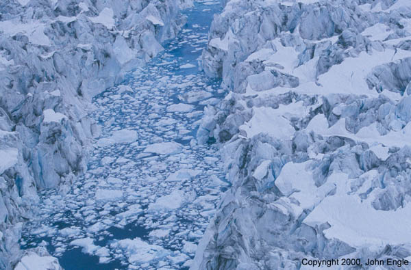
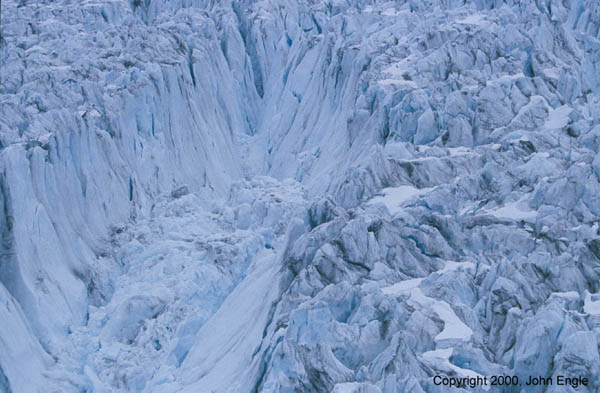
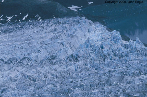
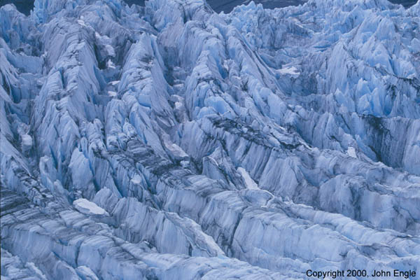
He flew us out the bay of Prince William Sound and then into the mountains and out to the Columbia Glacier. The Columbia is huge - it's 90 miles long and several miles wide. Not as big as Hubbard, but of the same caliber. The "surface" is jagged. Jagged beyond belief. Not a smooth flat space to be seen. Certainly no place to land a helicopter safely. Much of the jagged surface is covered in volcanic ash, which give the otherwise white/blue ice a dingy gray/black coating. There are crevices in the surface that must have been hundreds of feet deep - you couldn't see the bottom. And the deep blue of the ice was just intense. Think of an electric spark or a pure blue natural gas flame and you can sort of image the color blue that the glacier ice is. And scattered about the surface of the glacier of pools of melted ice - again with this intense blue color. It almost looks fake, much like swimming pool water is fake blue.
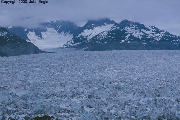 |
The vast expanse of the Columbia Glacier |
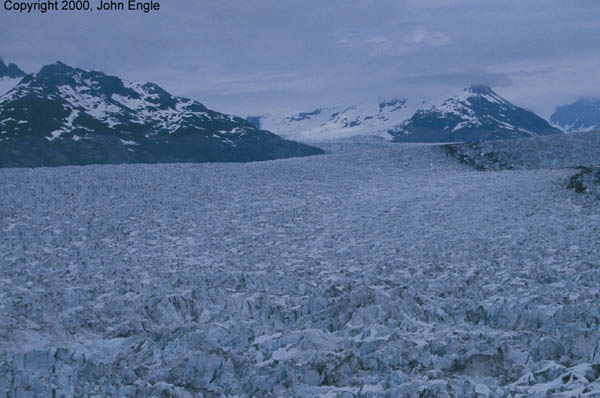 |
Another shot of the Columbia Glacier. It seems as though we are very close to the surface of the Columbia Glacier, but we were hundreds of feet above the surface. |
 |
A "small" pool of glacial water in the middle of Columbia. Notice the brilliant electric blue color |
 |
A massive crevace in the surface of the Columbia Glacier. There was no way for us to know how deep it is, but it must be hundreds of feet deep. |
 |
Here, you can see the winding river of ice that is the Columbia glacier. The black stripe is volcanic ash. |
 |
Here it's evident that the Columbia is flowing down hill. |
After flying over the Columbia, the pilot took us to the Shoupe glacier, a "small" glacier in comparison. We are able to land on the beach just across a small glacial pool from the glacier itself. We couldn't have been 100 yards away from the face of the Shoupe glacier. The beach was not sandy, but comprised of large deep gray/black gravel. It was not jagged but quite smooth - like river stone.
 |
The end of the Shoupe Glacier |
 |
A close up of the curved jagged surface of the Shoupe Glacier |
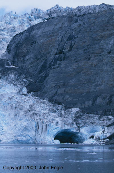 |
Here, you can see the Shoupe Glacier "spilling" down the side of the mountain and into the lake. |
 |
To give some perspective, the man standing at the edge of the lake is about 100 yards away from the glacier. |
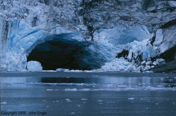 |
A close up of the glacial cave at the base of the Shoupe glacer. |
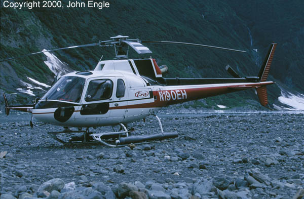 |
A shot of our helicopter on the rocky beach. |
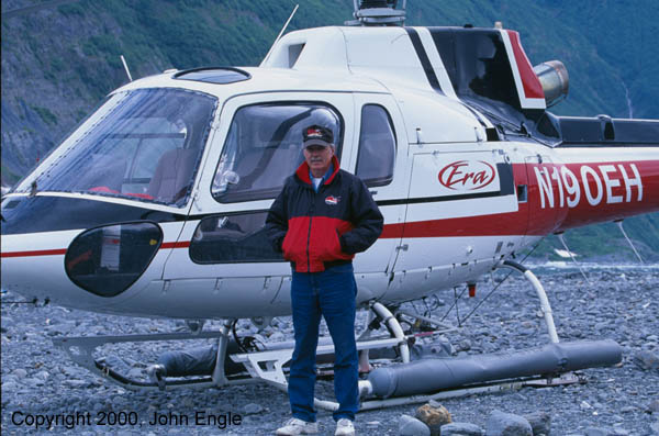 |
Our most friendly and knowledgeable pilot in front of this AS-390 Helicopter. |
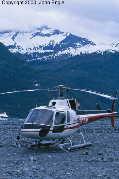 |
A view of the ERA AS-390 at Shoupe glacier. |
A sister helicopter landed shortly after we landed. Beautiful machines these helicopters. Such grace, and agility. I think I would become a helicopter pilot if I had to choose another vocation.
 |
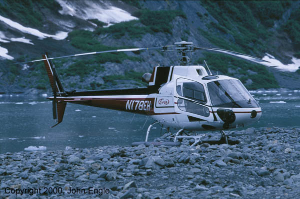
Our sister helicopter on the Shoupe Glacier beach |
After spending a brief period of time at the base of the Shoupe, we piled back into the helicopter and back to the Airport. So we thought. Turns out we were running late, and the pilot was instructed to land on the dock near the cruise ship. So, again fortune smiled upon us, and our pilot buzzed the cruise ship and landed just a couple of hundred yards away from the cruise ship. We then boarded a motor coach for a 30-second ride to the gangway of the cruise ship. Just enough time to return our life vests and express our sheer joy of the experience. I'd highly recommend taking a helicopter tour if at all possible!
 |
Our Sister helicopter perched ever so close to the waters edge |
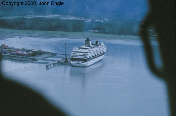 |
A view of the Mercury as we return from our helicopter tour. We landed on the dock to the left of the Mercury. |
We had mostly cloudy weather, about 50 degrees, and little to no wind. I shot everything on the 100-400 and exclusively on Velvia, save maybe one roll of Provia-F. No monopod here - it never would have made it on the Helicopter. It was a cozy flight.
 |
A view of the Mercury at the dock in Valdez |
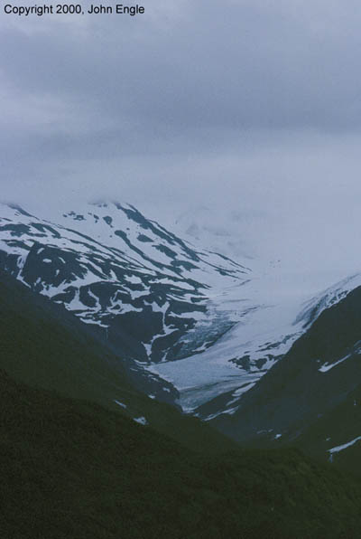 |
A view from the Valdez airport |
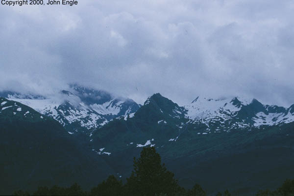 |
Another view from the Valdez airport |
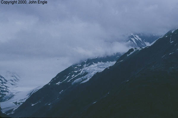 |
Another view from theValdez airport. |
 |
Another view from the Valdez airport |
 |
A view from the dock at Valdez |
 |
This boat was preparing to do oil spill containment exercises |
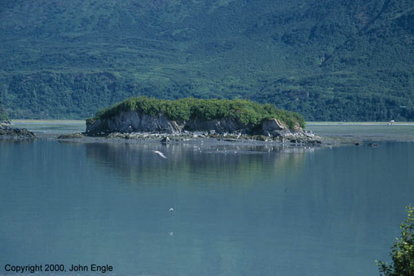 |
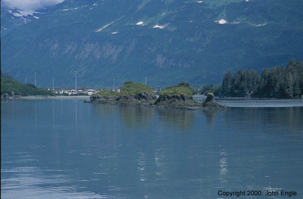
An island in the bay as Valdez |
 |
Another island in the bay at Valdez |
[email protected]
Unless otherwise indicated, all text and photos copyright1995-2000 John Engle


