
|
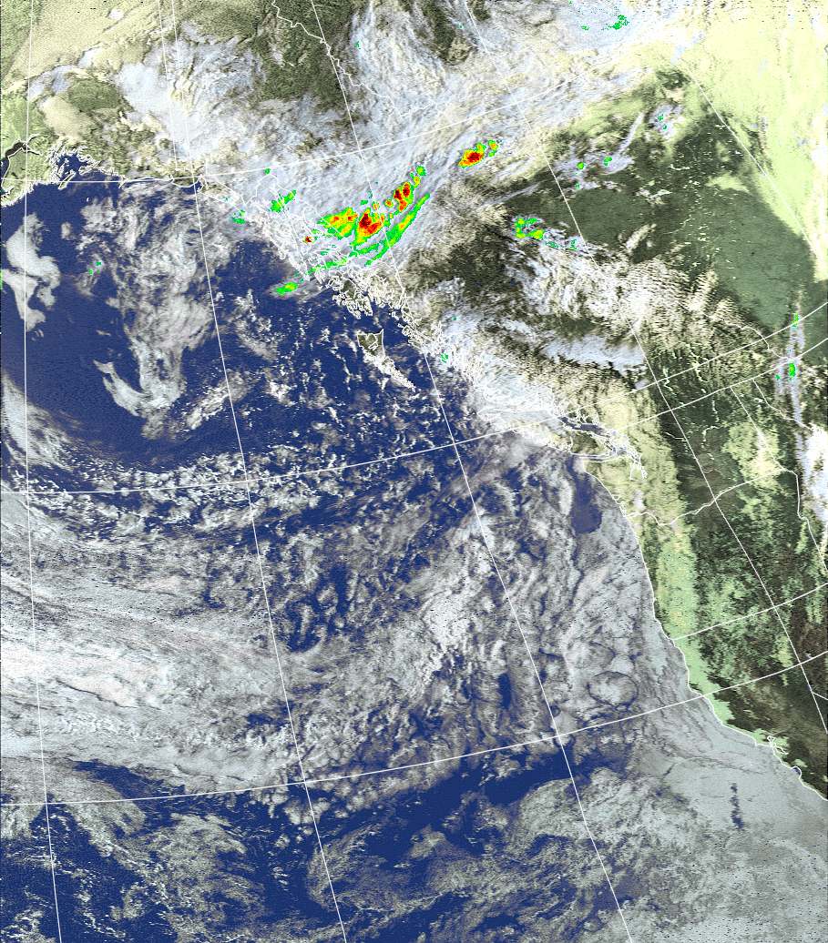
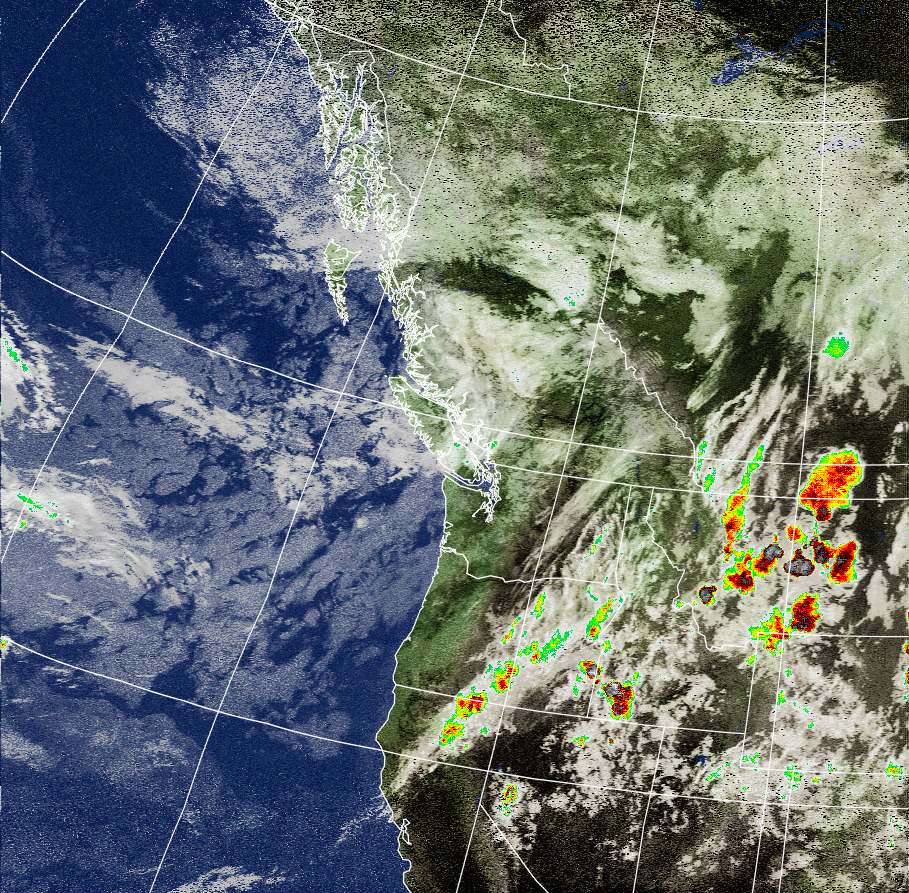
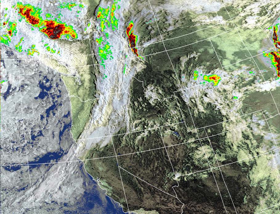
Weather Satellite
Images
With
color
precipitation enhancement, map color and 10° grid.
Produced by Thomas Williams, K9AC at Sequim,, Washington, USA 48° N 123° W |
||
| Next up: NOAA 15-82 E 19:31 PDST | Forecast NWS Discussion | Satellite Receiver: Hamtronics R139 |
| Add 7 hours for UTC |
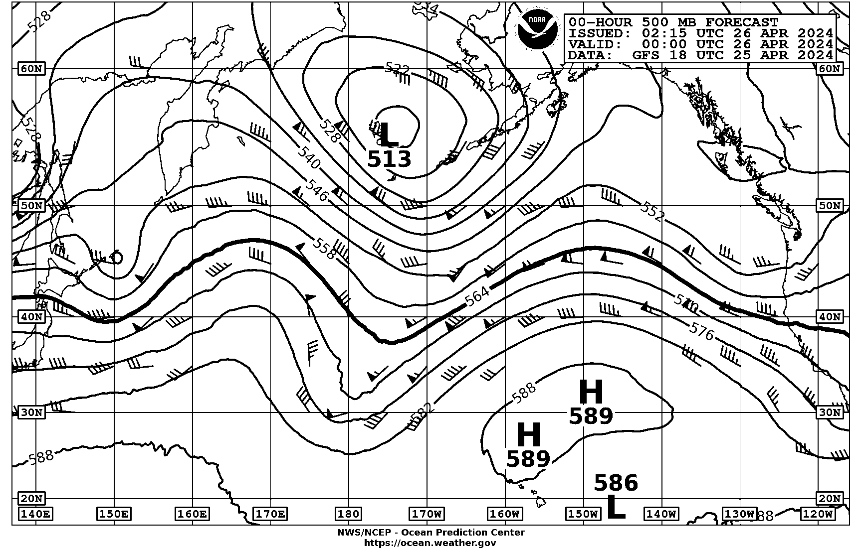
00Z (~7PM) NWS 500 MB 12Z (~7AM) | Software: Puppy Linux and WXtoImg |
|
|
|
Updated Satellite Predictions for Port Williams, Washington, U. S. A.
| Start of Pass | Image Available | Maximum Elevation | Frequency | |||
| Satellite | UTC | local time | UTC | local time | (east or west) | MHz |
| NOAA 15 | 25 Aug 02:31 | 24 Aug 19:31 | 25 Aug 02:44 | 24 Aug 19:44 | 82° E | 137.62 |
| NOAA 19 | 25 Aug 05:32 | 24 Aug 22:32 | 25 Aug 05:45 | 24 Aug 22:45 | 75° W | 137.10 |
| NOAA 18 | 25 Aug 06:46 | 24 Aug 23:46 | 25 Aug 07:00 | 25 Aug 00:00 | 52° W | 137.9125 |
| NOAA 15 | 25 Aug 16:21 | 25 Aug 09:21 | 25 Aug 16:34 | 25 Aug 09:34 | 53° W | 137.62 |
| NOAA 19 | 25 Aug 17:49 | 25 Aug 10:49 | 25 Aug 18:02 | 25 Aug 11:02 | 35° E | 137.10 |
| NOAA 18 | 25 Aug 19:03 | 25 Aug 12:03 | 25 Aug 19:17 | 25 Aug 12:17 | 52° E | 137.9125 |
| NOAA 19 | 25 Aug 19:30 | 25 Aug 12:30 | 25 Aug 19:42 | 25 Aug 12:42 | 39° W | 137.10 |
| NOAA 15 | 26 Aug 02:05 | 25 Aug 19:05 | 26 Aug 02:18 | 25 Aug 19:18 | 51° E | 137.62 |


