|
G3VGR
|
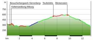
SOONWALDSTEIG Bundenbach - Simmerbachtal
|
 Yesterday, I noticed there were no shops whatsoever in Bundenbach, so I was unable to buy anything for lunch.
However, Frau Kingels had laid on an impressive breakfast spread, so missing lunch would be no great hardship.
I left Bundenbach at 08:30 and made my way back up to the Wanderparkplatz and on to the Herrenberg slate mine with its small fossil museum.
It was deserted here as both attractions do not open until 10AM.
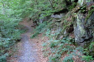
Next to the mine is the Altburg, where Celts settled almost 2500 years ago.
A village has been reconstructed on the castle ruins giving an impression of the Celtic settlement. This was also closed.
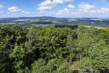
It was a bright, sunny day, so perfect for viewing far and wide.
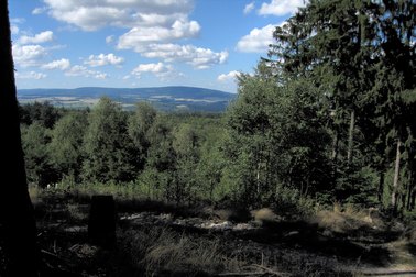
From my vantage point at the Altburg, I had a great view across the river to the castle ruins of the Schmidtburg, one of the largest medieval castle complexes in Germany, which is located on a craggy mountain spur high above the narrowest part of the Hahnenbach valley.
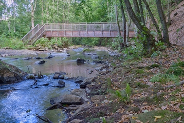
Behind the settlement, the trail headed steeply down into the valley and crossed over the Hahnenbach.
The Soonwaldsteig here runs along the Wasserelebnispfad Hahnenebachtal, an educational water trail along the riverbank, passing some boggy places where many plants were still in bloom.
The valley is narrower here and it was completely silent excepting the sound of the river and a noisy take-off from a heron I'd disturbed near a pretty pond.
When the trail turned away from the Hahnenbachtal, I started a long climb through the forest up to some large farm fields near Schneppenbach, where there was a great view to the north.
I had originally planned to visit Schneppenbach to shop, but after yesterday's disappointment of finding no shops in Bundenbach, I decided against making a possibly fruitless detour and carried on the trail instead, soon entering a beautiful forest.
Yesterday, I noticed there were no shops whatsoever in Bundenbach, so I was unable to buy anything for lunch.
However, Frau Kingels had laid on an impressive breakfast spread, so missing lunch would be no great hardship.
I left Bundenbach at 08:30 and made my way back up to the Wanderparkplatz and on to the Herrenberg slate mine with its small fossil museum.
It was deserted here as both attractions do not open until 10AM.
Next to the mine is the Altburg, where Celts settled almost 2500 years ago.
A village has been reconstructed on the castle ruins giving an impression of the Celtic settlement. This was also closed.
It was a bright, sunny day, so perfect for viewing far and wide.
From my vantage point at the Altburg, I had a great view across the river to the castle ruins of the Schmidtburg, one of the largest medieval castle complexes in Germany, which is located on a craggy mountain spur high above the narrowest part of the Hahnenbach valley.
Behind the settlement, the trail headed steeply down into the valley and crossed over the Hahnenbach.
The Soonwaldsteig here runs along the Wasserelebnispfad Hahnenebachtal, an educational water trail along the riverbank, passing some boggy places where many plants were still in bloom.
The valley is narrower here and it was completely silent excepting the sound of the river and a noisy take-off from a heron I'd disturbed near a pretty pond.
When the trail turned away from the Hahnenbachtal, I started a long climb through the forest up to some large farm fields near Schneppenbach, where there was a great view to the north.
I had originally planned to visit Schneppenbach to shop, but after yesterday's disappointment of finding no shops in Bundenbach, I decided against making a possibly fruitless detour and carried on the trail instead, soon entering a beautiful forest.
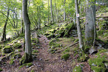
I had reached the start of the Lützelsoon forest, where many trails intersected.
My trail took me up to a clearing on the rocky ridge of the Lützelsoon.
This is the Teufelsfels, located on a rocky scree slope, with a stone-built lookout tower, picnic table and rest bench.
I climbed to the observation platform at the top of the tower and was rewarded by fine panoramic views.
To the north, I could see over Bundenbach into the Hunsrück heights. To the west lay the Hochwald and to the south, the Donnersberg.
Eastwards I could see little as I was level with the treetops of the dense forest, where the trail would next lead me.
From the Teufelfels, the trail followed the ridge.
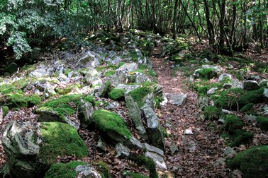
I was in dense (mainly beech) forest where the floor was just quarzite rock boulders and it was not possible to identify any discernable path through the jumble of rocks.
It was tough and slow progress through the forest as I tripped over quartzite rocks and tree roots whilst making my way along the ridge.
I had to concentrate all the way, memorizing where the last marker was, to ensure I didn't get lost.
As well as the Soonwaldsteig signs, the way ahead was occasionally marked by some frontier marker stones and cairns.
In some places, I navigated by guesswork, just remembering to stay on the prominent ridge and not deviate downwards to the left or right.
Eventually, I reached the end of the rocks and continued along a normal forest path.
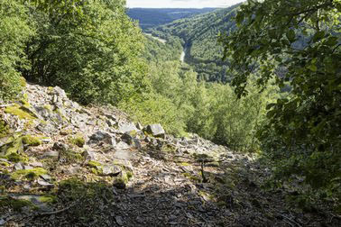
This took me to Blickenstein, a collection of rock formations at the edge of the ridge with intermittent views to the south through the gaps in the vegetation.
After the Blickenstein, the going was much easier as the trail slowly descended through some woods until reaching the B241 main road in the Simmerbachtal valley.
This is the normal endpoint of this stage. It is in a remote area, requiring a 2.2Km walk to Gehlweiler to catch an infrequent bus to Gemünden where I had an overnight reservation.
As it was only early afternoon, I decided to carry on and finish the day closer to Gemünden, so crossed the Landstrasse to the Simmerbach.
A footbridge, specially constructed for the Soonwaldsteig, took me over to the other bank of the Simmerbach.
The Soonwaldsteig continued along the east bank of the stream for a short distance until I was confronted by a 275 metres climb up over scree slopes and past quartzite rocks.
This was a brutally steep climb and my calf muscles were burning when I completed the first part of the climb at the edge of the old quarry of Gehlweiler.
The remaining section was equally tough and I was relieved to reach the top. Someone had thoughtfuly installed a bench at the summit and I gratefully flopped out on it, quite exhausted.
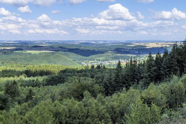
From the summit, the trail became much easier as I walked along a broad level path and had occasional views northwards over Gemünden and its castle.
I was now in the Großer Soon.
After quite a way, I noticed the Soonwaldsteig signs had now disappeared, so realized I had missed the turnoff for the ruins of Burg Koppenstein.
As I had almost reached the tarmac road, I decided both the ruins and mystery of the missing sign could wait until tomorrow.
From the tarmac road junction, I followed the yellow "Soonwaldsteig Zuweg" signs which brought me down through the woods to Gemünden, where I had a reservation at the Hotel-Restaurant Gemündener Hof.
It was a warm sunny evening and I was able to eat dinner outdoors after another great day's walking.
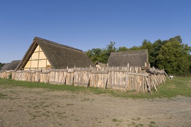
Celtic settlement at Altburg
|
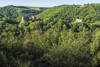
View across Hahnenbachtal from Altburg
|
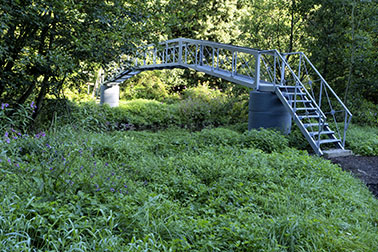
Bridge over the Hahnenbachtal
|
Along the Wasserelebnispfad
|
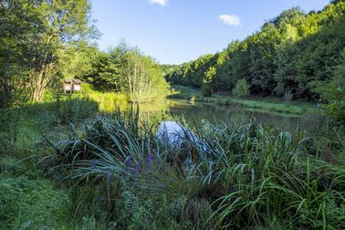
Pretty pond along Wasserelebnispfad
|
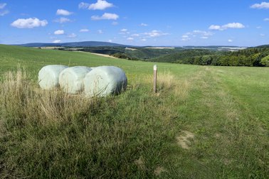
Open countryside near Schneppenbach
|
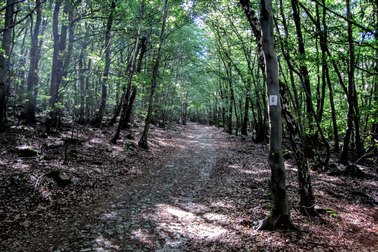
In the Lützelsoon
|

Lookout Tower at Teufelsfels
|
View north from Teufelsfels tower
|
Along the ridge from Teufelsfels
|
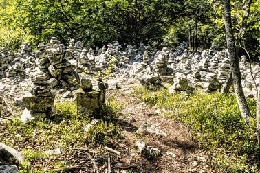
A gathering of Steinmännchen
|

Blickenstein
|
View north over Gehlweiler
|
Hiker's bridge over Simmerbach
|
Starting the steep climb to Koppenstein
|
View along the Simmerbachtal
|
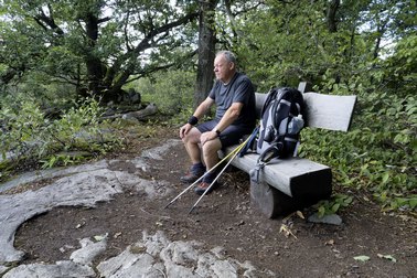
Taking a rest after the big climb
|
View north near endpoint of stage
|