|
G3VGR
|
Hochschwarzwald - Wasserfallsteig & Todtnauer Wasserfall
|
Certified as a Premiumweg in 2010, the Wasserfallsteig runs along the Wiesental between the two villages Feldberg and Todtnauberg, following the Wiese stream and leads past two large waterfalls.
The trail starts at the Feldberg Pass (elevation 1231m), a high mountain pass in the Schwarzwald and the second highest in Germany.
I took the 8AM bus 7300 from Titisee to Feldbergerhof. The morning was cloudless and sunny and already very warm.
As the bus climbed the pass through the Bärental, I has very clear views across to the peaks of the Hochschwarzwald.
Seeing this panorama was a great start to the day.
Unfortunately, after I left the bus at the Feldberger Hof, I realized it was the wrong bus stop and I should have continued to the Hebelhof stop.
A pleasant 20 minute downhill walk brought me to the correct bus stop where I was confronted with the next problem - where is the start of the Wasserfallsteig?
There were no obvious signs, but with the help of the Outdooractive offline map on my iPhone, I crossed the main road and walked 10 yards along a gravel road to find the start.
The trail got off to a promising start as I walked steeply downhill through a rocky forest of alpine character until reaching the top of a ski slope.
After continuing along a path to the side of the ski slope for a while, I realized I was on the wrong path and needed to cross the slope to a forest on the other side.
Walking through the long grass to get to the trees, I was mindful of the possibility of ticks which apparently abound in the Schwarzwald and carry TBE and Limes Disease.
Although my clothes had been previously doused with Permethrin, I wasn't sure it was a good idea to be wearing shorts.
However, during my inspections that evening, I found no ticks on my person, so carried on hiking in shorts for the duration of my holiday.
I could see the trail through the trees on the opposite side of a stream and looked for a place to access the path.
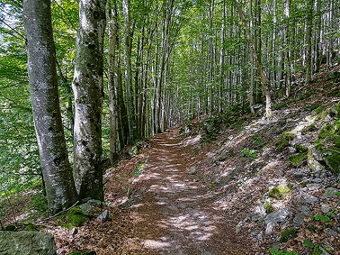
After making a hairy crossing over some big rocks in the stream, I was now on the Hebelwegle and enjoyed a pleasant descending walk next to the Wiese as it flowed noisily downhill.
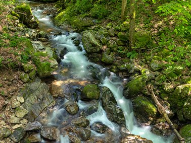
I made occasional stops to take some photos of cascades whilst precariously balanced on wet rocks in the stream.
The forest ended at a hairpin bend on the main B317 road.
After crossing the road, a short walk along another forest path brought me to the 50 metre high Fahler waterfall.
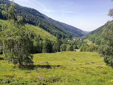
After exploring the area of the waterfall, the trail carried on further downhill through the forest until reaching open meadows.
There were very pretty views but I was now exposed directy to the hot sun. The temperature was in the low forties and quite debilitating.
Forest and meadow landscapes alternated with each other again and again as I made my way down towards Todtnau.
Unfortunately, the trail is close to and parallel with the well-travelled B317 mountain road, so I could both see and hear the incessant traffic which detracted somewhat from the outdoors experience.
A small beech forest near Brandenberg provided some respite from the long walk in the sun, but I was soon back in the sunshine.
I managed to find a bench in an almost shady area for lunch and a midday rest before continuing my descent through fields and meadows.
Just before Todtnau, I was relieved to get back in the shade again as the trail led me into the Wolfschlucht, a small deep gorge.
This was the last highlight of the downhill section as I soon arrived in Todtnau which, apart from its nice church, seemed a fairly nondescript town.
After buying and drinking a very large bottle of mineral water from the town's only supermarket, I decided it was far too hot to hike up to Todtnauberg, so caught a bus to the Hangloch stop instead.
A short walk from the bus stop brought me to the entrance of the path which leads to the top of the impressive 97 metre high Todtnauer Wasserfall.
I followed a path and steps down to the base of the waterfall, where it was quite busy with many visitors.
After admiring the waterfall for a while, feeling really tired, dehydrated and suffering fron the intense heat, I took a slow walk down to a bus stop and caught a bus to Kirchzarten.
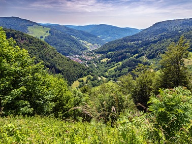
The bus ride was most enjoyable and the scenery gave me an appreciation of how mountainous the Hochschwarzwald is.
I had time for a beer at Kirchzarten Bahnhof before catching a train to Hinterzarten.
The walk had been quite worthwhile, despite the high temperature and the traffic on the B317. However, I would rather visit the waterfalls at a different time of year when there is a larger flow of water.
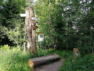
Hidden entrance to the Wasserfallsteig
|
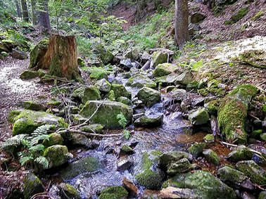
Along the Hebelwegle
|
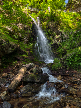
Fahler Wasserfall
|
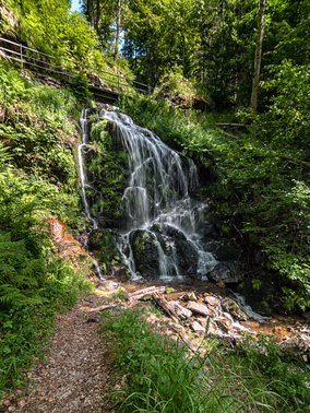
Fahler Wasserfall
|
Into the first meadow
|
Some welcome shade from the hot sun
|
Through the Wolfschlucht
|
Stúbenbachtal from Todtnauberg
|
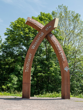
Entrance to Todtnauer Wasserfall trail
|
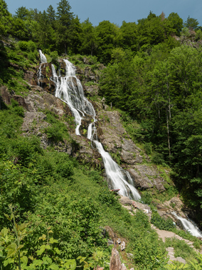
Todtnauer Wasserfall
|
[Home]