|
G3VGR
|
ALTMÜHLTAL PANORAMAWEG Beilngries – Deising
|
 I didn't feel so well when I awoke. My cold had now settled in the chest, causing some breathing difficulties. I was also quite tired due to the lack of good sleep and the excessive afternoon heat of the last few days.
Today was going to be another very hot day, so no respite was on offer.
I had a few errands to run in Beilngries and mindful of Piet Smulder's blog which dismisses the walk across the Arzberg as uninteresting, I decided to have an easy day by starting the walk at Töging.
Prior to leaving Beilngries, I stopped off at the Metzgerei-Gasthof Der Millipp for a late morning snack.
As I was south of the Weißwurstäquator and it was before midday, I deemed it was safe to order the traditional Bavarian mid-morning schmankerl of Weißwurst, without upsetting any of the locals.
Served with a Brezen and Senf and washed down with a Hefeweizen, this was a very tasty snack.
I seem to be slowly turning native, despite an inability to communicate in Bairisch.
I didn't feel so well when I awoke. My cold had now settled in the chest, causing some breathing difficulties. I was also quite tired due to the lack of good sleep and the excessive afternoon heat of the last few days.
Today was going to be another very hot day, so no respite was on offer.
I had a few errands to run in Beilngries and mindful of Piet Smulder's blog which dismisses the walk across the Arzberg as uninteresting, I decided to have an easy day by starting the walk at Töging.
Prior to leaving Beilngries, I stopped off at the Metzgerei-Gasthof Der Millipp for a late morning snack.
As I was south of the Weißwurstäquator and it was before midday, I deemed it was safe to order the traditional Bavarian mid-morning schmankerl of Weißwurst, without upsetting any of the locals.
Served with a Brezen and Senf and washed down with a Hefeweizen, this was a very tasty snack.
I seem to be slowly turning native, despite an inability to communicate in Bairisch.
After the bus dropped me off at Töging, I followed the Panoramaweg signs to a bridge and crossed the original Altmühl for the last time.
The trail took me into the shade of some woods and generally followed the river to its confluence with the Main-Donau Kanal at Griesstetten.
Unfortunately I was unable to see the meeting of the rivers due to the trees. Perhaps it would have been better to walk along the Radweg to Griesstetten instead.
The trail left the forest for a short strech through some farm fields where I was opposite Dietfurt, but I didn't really have time to visit the town.
I was sad at leaving the original Altmühl and would miss the river's slow meandering progress along the valley.
From Dietfurt to Kelheim, it has been considerably widened to accommodate the modern 1800 ton capacity barges.
Although the 171Km Main-Donau Kanal is quite an engineering feat with its Sparschleusen in the Franconian Jura area, where it is the highest canal in Europe, it does lack the charm of the original Altmühl.
The trail from Griesstetten continued through woods and passed some Jurassic rock formations until reaching a farm at Einsiedel, where the trail has been rerouted to follow the canal bank instead of continuing along the border of the forest.
This permanent detour along a flat gravel farm path was worse than yesterday's walk. Again, my feet hurt on the sharp stones. The sun was very hot and heat was also reflected up from the road.
The uncomfortable walk continued for 3.5Km and was quite boring. In fact the whole day's walk so far had been quite boring.
I've always being fascinated at watching the enormous barges plying their trade along the rivers and canals of Germany, but only saw 2 barges during my walk, one of which was registered in Romania.
Shortly before Deising, I passed by the ruins of Burg Flügelsberg which overlooks the village of Meihern on the opposite bank.
I arrived at Gasthaus Zum Himmelreich, located in the centre of Deising.
After checking in and taking a short rest and rehydrating, I left my backpack in the hotel and hiked up the steep "Eselsteig" to the Rosskopf.
From the viewpoint on the Rosskopf is a superb panorama of the Altmühltal with the rocky outcrop of Obereggersberg and its castle ruins downstream.
A path led along the plateau through the forest until arriving at a second viewpoint, which provided sweeping views over Altmühlmünster.
I walked back to Deising in time for dinner. The Himmelreich doesn't serve hot meals, but their Brotzeit was rather good.
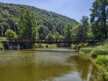
Bridge over Altmühl at Töging
|
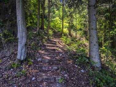
Trail climbs into forest near Griesstetten
|
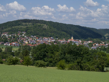
View across to Dietfurt
|
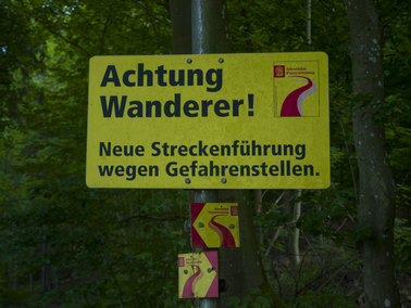
Diversion sign at Einsiedel
|
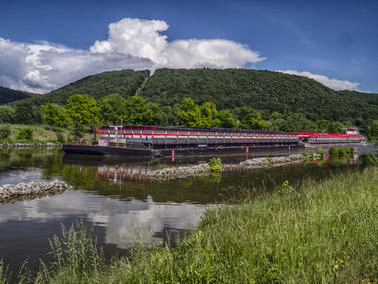
Barge on Main-Donau-Kanal
|
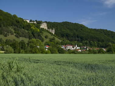
Burg Flügelsberg and Meihern
|
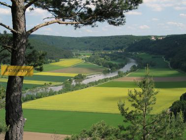
View downstream from Rosskopf
|
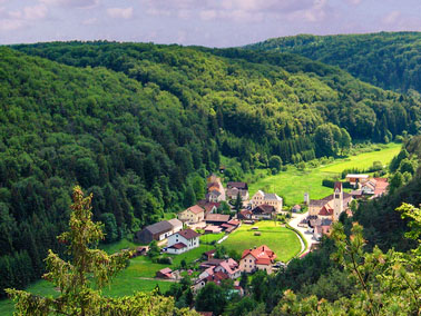
Altmühlmünster
|
[Home]