|
G3VGR
|
ALTMÜHLTAL PANORAMAWEG Solnhofen – Dollnstein
|
 I woke up to a warm but overcast day. After another good breakfast from Frau Tschernach, I caught the train from Treuchtlingen Bahnhof to start the second stage of my walk and I arrived in Solnhofen at 0845, where it was now raining steadily.
Rejoining the trail at the Römertal car park after a steep climb up through the town, I started along a ridge above another Wacholderheide.
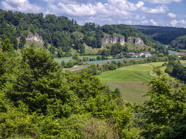
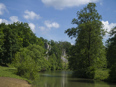
In front of me and following a curve in the river was the impressive sight of the "Twelve Apostles", massive formations of limestone and one of the highlights of the Naturpark.
These imposing white rock towers are the remnants of a reef belt from the tropical sea during the Jurassic period of 150 million years ago.
It is possible to climb on top of some of the "Apostles" to get a better view of the outstanding scenery.
However, there are no safety barriers, so standing too close to the edge is not for the timid hiker. As well as the rain, which reduced visibility of the Apostles, it was quite windy on the exposed ridge.
The trail continued along the ridge above the immense rocks then down to Eßlingen, where the 13th Apostel awaits - a small inn with a beer garden right next to the Altmühl.
The inn serves Wurm beer, brewed 2Km away in the tiny village of Bieswang.
I woke up to a warm but overcast day. After another good breakfast from Frau Tschernach, I caught the train from Treuchtlingen Bahnhof to start the second stage of my walk and I arrived in Solnhofen at 0845, where it was now raining steadily.
Rejoining the trail at the Römertal car park after a steep climb up through the town, I started along a ridge above another Wacholderheide.
In front of me and following a curve in the river was the impressive sight of the "Twelve Apostles", massive formations of limestone and one of the highlights of the Naturpark.
These imposing white rock towers are the remnants of a reef belt from the tropical sea during the Jurassic period of 150 million years ago.
It is possible to climb on top of some of the "Apostles" to get a better view of the outstanding scenery.
However, there are no safety barriers, so standing too close to the edge is not for the timid hiker. As well as the rain, which reduced visibility of the Apostles, it was quite windy on the exposed ridge.
The trail continued along the ridge above the immense rocks then down to Eßlingen, where the 13th Apostel awaits - a small inn with a beer garden right next to the Altmühl.
The inn serves Wurm beer, brewed 2Km away in the tiny village of Bieswang.
Unfortunately, the inn was closed, so I left Eßlingen, crossed the Altmühl and started a steep ascent up a forest road to the Maxberg.
The climb reached a plateau and continued through the site of "Jurakalkschieferwerke Solnhofener Aktien-Verein", a working limestone factory where the famous Jurakalkschiefer (Solnhofner limestone plates) are processed.
The surrounding area has active open-pit quarries where limestone is extracted by the Solnhofen Stone Group.
In the quarries, the breaking of limestone plates for commercial use occasionally results in the finding of more fossils.
Located in the factory area is the Gaststätte Schnorgackl which was also closed.
Leaving the factory site, I followed a dirt road along the plateau of the Maxberg, passing old limestone waste dumps until reaching a small chapel where there was a superb view over the Gailachtal.
It had now stopped raining and the sky was clearing.
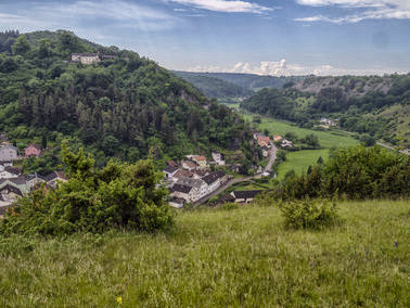
As I made my way down from the chapel over another Wacholderheide, I had good views of the pretty town of Mörnsheim nestled in the Gailachtal.
Remains of the fortification wall and the castle ruins of Burg Mörnsheim on Schlossberg bear witness to Mörnsheim's almost 1100-year history.
Unfortunately, I had just missed by 2 days the "Altmühltaler Lammauftrieb", an annual event whereby over a thousand sheep and lambs are paraded through the village from their winter quarters to the summer pastures on the juniper heaths of the Altmühltal.
As I walked through the village, I noticed a few Altmühljurahäuser.
These traditional style houses, with a limestone roof and small windows, are unique to the Altmühl area and were built from the 12th century to mid 20th century.
I was hoping to have lunch at Metzgerei Heinle in the Marktstrasse. They too were closed.
From Mörnsheim, the trail goes steeply upwards over a wooded hill and back down to the valley at Altendorf.
This seems just a PUD, so I carried along the main street to Altendorf instead, which was less than a kilometre's walk.
A sculpture by Karl Hemmeter by the bridge over the Altmühl at Altendorf commemorates the finding of Archaeopterix fossils nearby.
The weather was now extremely hot and sunny again and I was quite hungry, due to all previous lunch options being closed.
Directly off the trail, about 2 Km outside Altendorf is Zeltplatz Hammermühle, a campsite with a boat slip, popular with the canoeists.
Of greater interest to me was their Biergarten, which included Wettelsheimer Märzen amongst their beers. A couple of these went down well with a Brotzeit.
Whilst sat in the Biergarten, I noticed the symptoms of having caught a cold.
After leaving the Biergarten, the trail continued along the Altmühltal between the forest and cornfields with little of interest until reaching another Wacholderheide, where there was an impressive view over the small village of Hagenacker.
I checked the map and decided to leave the trail and make my way down to the village, which was quite pretty and idyllically located. From Hagenacker, I followed mainly the E8 until reaching what looked like a dead end.
I crossed over the railway track and found the Altmühl Radweg which took me to the small town of Dollnstein, the end of today's stage.
Dollnstein is situated in a wide basin created by the Urdonau and Altmühl rivers at their confluence.
The old town centre is still completely surrounded by the medieval defensive wall.
Built on a rock in the town centre, the 14th century parish church is a landmark. Inside the church is an impressive collection of frescoes.
The old town completely impressed me.
I had coffee and cake at the Tourist Information Office then explored the Altstadt some more before seeking the railway station, located outside the town to catch the train back to Treuchtlingen.
Back in Treuchtlingen, I had dinner at the Restaurant Delphi.
This greek restaurant had been recommended by a local and the food was good, so was the Retzina.
Was für eine tolle Strecke! - this had been an excellent scenic day's walking.
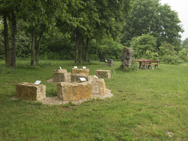
Römertal - Limestone exhibits
|

Zwölf Aposteln - Solnhofen
|

Thirteenth Apostle
|
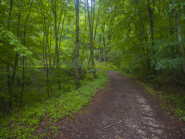
Trail up to Maxberg
|
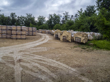
Limestone plates at SSG Factory
|
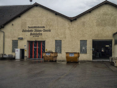
SSG Factory
|
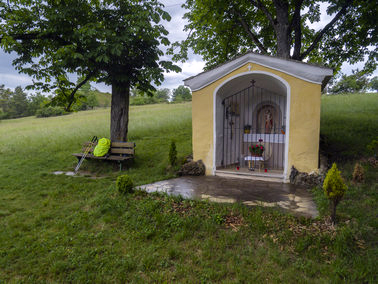
Chapel at Maxberg
|
View over Gailachtal
|
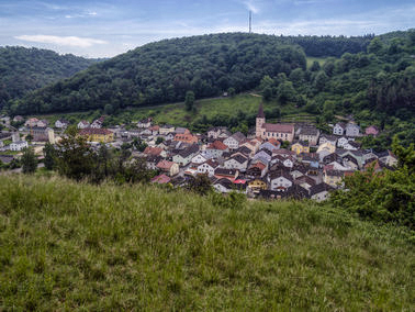
View over Mörnsheim
|

tower at Mörnsheim
|

Archaeopterix & Ammonite sculpture at Altendorf
|
View over Hagenacker
|
Along the E8 from Hagenacker to Dollnstein
|

Dollnstein and medieval wall
|

Dollnstein Marktplatz
|
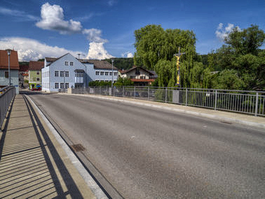
Dollnstein - Papst-Viktor-Brücke
|
[Home]