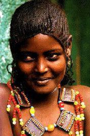
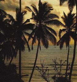
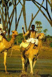
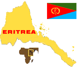
Eritrea is located in the Horn of Africa, between latitudes 12 degrees and 18 degrees north covering some 125,000 sq kms. It has 800 miles of Red Sea coastline and more than 355 islands. Its neighbors are Ethiopia, Sudan and Djibouti, with a coastline on the Red Sea. Eritrea became Africa's newest democracy in 1993 after an internationally supervised referendum where the population almost unanimously (99.8%) voted in favor of independence. The public plebiscite came after the Eritreans won a 30 year war of indepenence defeating Ethiopia's, black Africa's largest at the time, army in 1991. For more detail here is an excerpt from Eritrea: General Facts, EPLF, 1989.
|
|
|
 Major Attractions
- List of major attractions (under construction)
Major Attractions
- List of major attractions (under construction) Embassies
- Embassies, Ministries, and International Organizations
Visa
- Visa requirements and how to obtain a visa in the U.S.
Health
- Shots required, vaccinations, immunization, medical Facilities
Embassies
- Embassies, Ministries, and International Organizations
Visa
- Visa requirements and how to obtain a visa in the U.S.
Health
- Shots required, vaccinations, immunization, medical Facilities Packing
- What to wear, what to take
Food
- Where to get the best Traditional Eritrean food, Italian, Chinese
Hotel
- Main hotels in Eritrea
Packing
- What to wear, what to take
Food
- Where to get the best Traditional Eritrean food, Italian, Chinese
Hotel
- Main hotels in Eritrea Currency
- Banking, where and how to pay
Climate
- Three main geographical zones
Transportation
- By Air, By Land, By Sea - customs, airport tax, taxi
Currency
- Banking, where and how to pay
Climate
- Three main geographical zones
Transportation
- By Air, By Land, By Sea - customs, airport tax, taxi
 Brief History - Breif history,from Eritrea Embassy
History II - A broader view of the past
Languages
- Languages, Major Holidays, Culture
Miscellaneous
- Time, electricity, phone, postal service, measurements
Suggested Reading
- Books available on Eritrea
Brief History - Breif history,from Eritrea Embassy
History II - A broader view of the past
Languages
- Languages, Major Holidays, Culture
Miscellaneous
- Time, electricity, phone, postal service, measurements
Suggested Reading
- Books available on Eritrea