Some screenshots of NAOMI in action. Note that the quality of the .jpg images are not as good as the standard NAOMI screen, due to format-coding limitations of the .jpg standard.

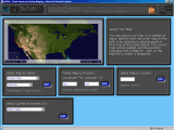
Full sized image: JPG PNG | A view of the Map Navigation page. As you move your cursor around the photo-relief map, the red frame follows to indicate the area of the map selected if you click that spot. 47 maps are available in this way; the 2 Overview maps are selected with the text-links below. |

Full sized image: JPG PNG | The 'Select Map by Name' box opened up to show some of the choices available. Each entry will open a new list in the select box below (covered up). A choice from the list will select the relevant map, and mark the entry's position with a Map-Pin. Alternative ways of loading a map and marking the position are by entering the exact position or Grid Locator in the other boxes below. |
Full sized image: JPG PNG | When selecting a map from the lists of 'Smaller Cities' or 'Counties', a new box will open below containing a list of the entries for the state or province selected above. Over 28,000 cities are listed, plus all US counties and Canadian municipal regions. |

Full sized image: JPG PNG | A map has been selected, without an individual position marked. The toolbar above has changed to one that controls the 9 background and 16 foreground overlays available. The current back ground overlay is 'ARRL Sections'. In the foreground, Roads and Cities are showing, with 'Major City' presently on top. |
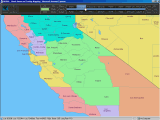
Full sized image: JPG PNG | This example shows the advantage of separate back and foreground overlays. The overlay 'ARRL Sections' is on in the background, and the overlay 'County', which shows county borders and text, is on in the foreground. It is thus easy to see which counties fall within which ARRL Section areas. |

Full sized image: JPG PNG | In this view, the 'State' background layer is over-laid with the 'Water and Water-Feature Names' overlay. Also showing is the Scale-Bar; useful as a rough guide to distances. The Scale-Bar can be dragged around the screen, and remembers its last position when turned off. |
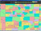
Full sized image: JPG PNG | The 'County' background has no text on it, so can be used to illustrate county-areas without cluttering up the map for other data. Here, the Cities have been added in the foreground. |
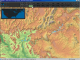
Full sized image: JPG PNG | This view shows one of the colored relief maps. Relief shading has been added, to give a 3-dimensional view, and a clearer understanding of topographical features. Also showing is the Location-Map, one of which is provided for each main map. It can be configured to automatically turn on for 1-3 seconds when a new map is loaded. |
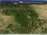
Full sized image: JPG PNG | The 'Photo' background layer shows an actual satellite photograph, with added relief-shading, sourced from NASA's 'Terra' satellite. The 'State/Province' foreground is also turned on, and clearly shows the state, province, and country borders. |
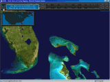
Full sized image: JPG PNG | Another view of the 'Photo' background layer, showing the fascinating algal bloom around Florida and the Bahamas. The Locator-Map is also on, with one of the tool-tips provided for some buttons. |

Full sized image: JPG PNG | Once some Map-Pins have been added to a map, they can be used for a variety of purposes, including on-screen graphics. Here, three of the pins have been connected with the 'Pin-Distance' tool, and two other lines drawn with the 'Pin-Bearing' tool. Colors and line-widths are fully selectable. |
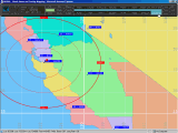
Full sized image: JPG PNG | In this view, the positions of all ARRL section-managers on this map have been plotted. By adding range-rings for a supposed range of WA6PWW's transceiver, its possible to see which other section managers he could maintain a QSO with. |
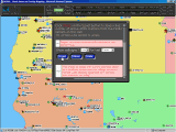
Full sized image: JPG PNG | Here, the APRS interface has been used to plot the current positions of all APRS stations transmitting during the last hour. This data comes direct from the FindU servers, so an Internet connection is required. Various other APRS tools are provided, allowing tracklines, bread- crumbs, and a range of other filtered positions to be displayed. |
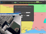
Full sized image: JPG PNG | In this view, the TerraServer interface is in use, providing an easy way to get a color photo of the 'Astros' baseball ground. The interface will load an image for any currently selected Map-Pin, and provides an easy way to set image size, content, and resolution. |
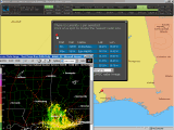
Full sized image: JPG PNG | The 'Doppler Radar' tool is in use here. With one or more Map-Pins selected, the Doppler-Radar tool will display a list of the 5 nearest sites to the Pin's position, and provide a simple way to access the latest NEXRAD or MSC radar image. Various image-options are available. |

Full sized image: JPG PNG | Another useful tool is the Repeater-Database interface. This tool again uses a Map-Pin for positional reference, and queries the K1IW online-database for a list of the nearest repeaters. Various filters and sort-options are provided. |

Full sized image: JPG PNG | This image shows the 'Table Viewer', an interface that accesses 130 tables of useful information. The Table Viewer provides facilities for searching the tables, and allows full sorting of each table, referenced to any column title. |