HERE THEY CAN SEE ALL THE ACTIVATIONS
IN PORTABLE THAT WE HAVE CARRIED OUT DURING YEAR 2012 BY
TEAM "L' ESMORZAR ABANS DE TOT"
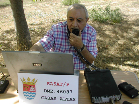
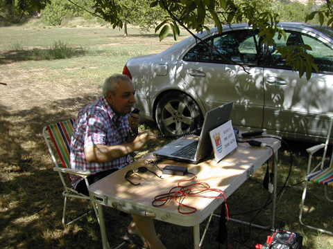
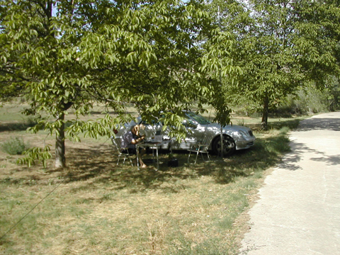
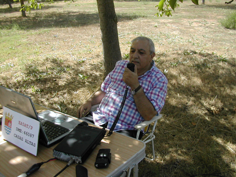
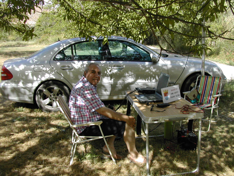
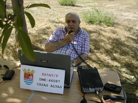
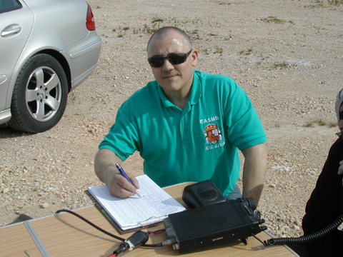
23 AUGUST 2012 ACTIVITY FROM MUNICIPALITY OF CASAS ALTAS
DME: 46087
The municipality of Casas Altas is located in the southern sector of el Rincón de Ademuz. The term surface is mountainous. The main heights are Loma Lorente (1.047 m.), Puntal del Sorde (1.001 m), El Resillo (1.022 m), El Peñasco (1.206 m), Puntal del Peloto (1.264 m), Corella (1.136 m). he Turia River, which flows the ravine of the Umbria crosses the end of North to South.
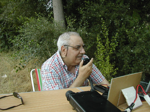
In this my last activity from El Rincón de Ademuz was located next to the Turia River in the shade of a walnut that I facilitated a temperature more pleasant, because the day was very warm, this time I started activity soon already I had for front about 160 Kms until you reach home, here you can see some photos as well as view the activity log.

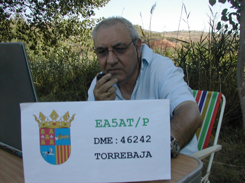
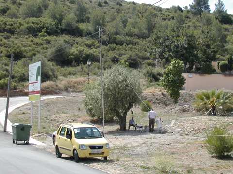
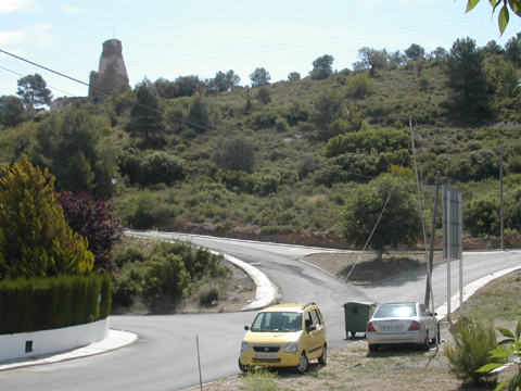
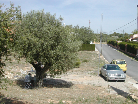
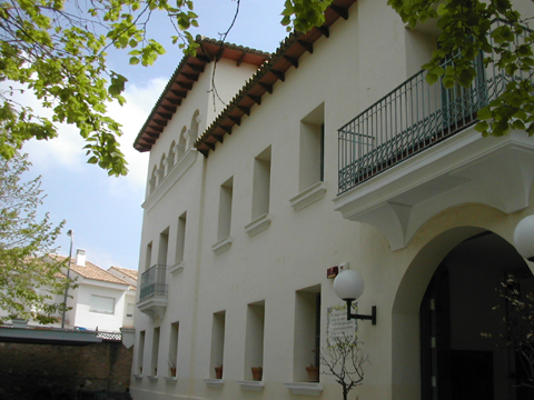
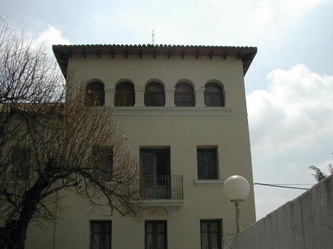
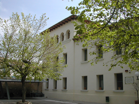
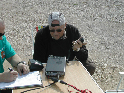
DAY 22 AUGUST 2012 ACTIVITY FROM MUNICIPALITY OF TORREBAJA
DME: 46242
Municipality Torrebaja is located on the right bank of the River Turia, in the point of greater breadth of this River Valley. Its location corresponds to the end of a hill which enters on the bottom of the Valley, between the Turia and its tributary the Ebrón. Its orography is relatively little hilly, due to his brief term and lies in the Valley of the River Turia; Although it is surrounded by high mountains, especially in the East, limiting him their high horizon the Javalambre y la Sierra de Tortajada, con los Algezares y los Molares (1.077 m.) although already summits outside of his term.
I was located very close to the Hermitage of San Jose in this town next to a few poplars I relief suffered stifling heat in my second activity carried out from El Rincón de Ademuz, this time finish a little before already he had been to see me with my friends Aurelio EA5MR and Fernando EA5AHN residents Arroyo Cerezo (Castielfabid) close to the population I to spend a few moments with them.
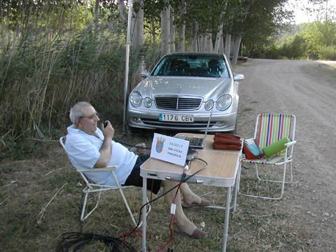
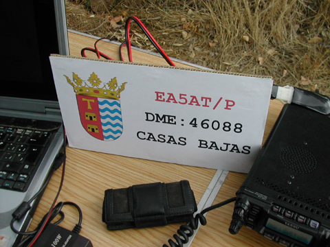
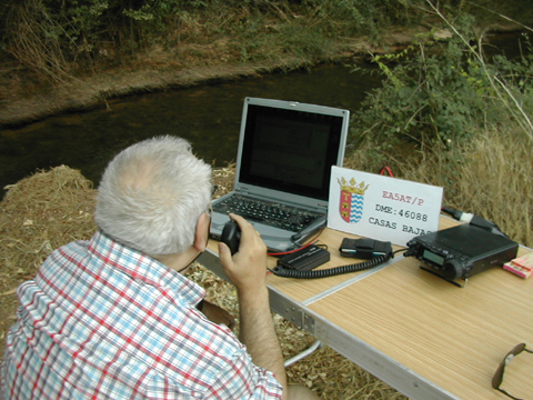
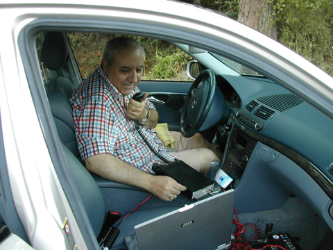
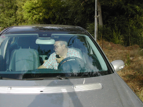
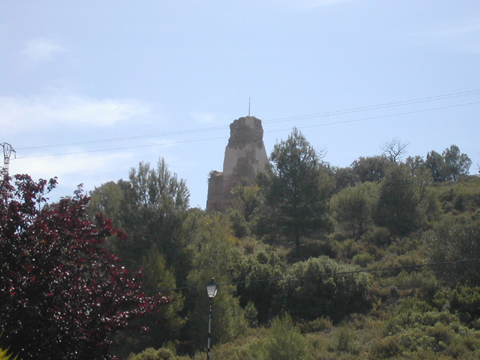
DAY 21 AUGUST 2012 ACTIVITY FROM MUNICIPIPALITY CASAS BAJAS
DME: 46088
The municipality of Casas Bajas
is located in the South of the comarca of Rincón de Ademuz.
The term surface is mountainous and broken. The main heights are: La Somera
(981 m.), Peña Alta (1.057 m) y La Molatilla (1.045 m)
The Turia river crosses the from North to South, circulating a long way through
a fertile valley, boxing later in a deep gorgel. The flocking espider ravin
of Malas Noches and Rambla of ravin.
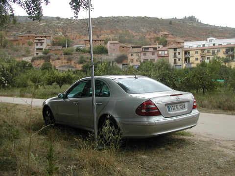
First activity of those scheduled during my vacation in El Rincón de Ademuz from this picturesque town of low houses being located next to the Turia River very close to the old mill site in this municipality after re-installation and begin transmitting when you only had a few 50 qsos I surprised a storm downloading a quantity of water is impressive having to leave momentarily activity returning after 30 minutes but from inside the carSince then we need fans to confront these situations and follow the divide, as you can see from the photos that I put below, you can also consult the activity log.
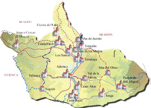
ACTIVIDADES DESDE EL RINCON DE ADEMUZ
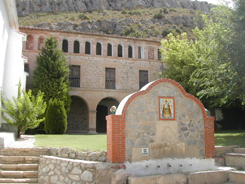
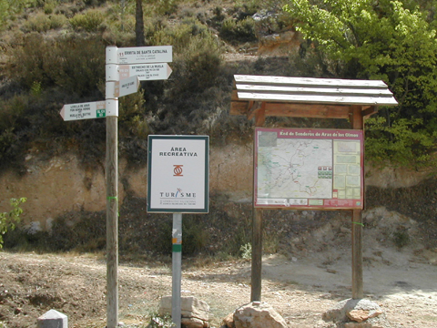
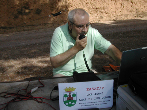
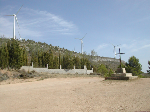
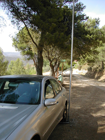
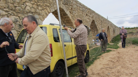
DAY 20 AUGUST 2012 ACTIVITY FROM MUNICIPALITY ARAS DE LOS OLMOS
MVV-0219 SANCTUARY OF SANTA CATALINA + DME: 46041
This municipality is located to the Northwest of the province, between the rivers Turia and bows, its surface is very irregular. It has some syringodium in the central part; but predominantly mountainous areas, with some very deep ravines. The main heights are: Muela de Santa Catalina (1.315 m), Fuente del Lirio (1.398 m), Tejerías (1.181 m) y Mampedroso (1.207 m) he Turia river crosses from North to South by the western sector. Flocking to this river, The spider ravines of Hoz, Carril, Regajo y Araña.
I was located in the recreational area of the sanctuary of Santa Catalina, referenced to diploma monuments and vestiges of Spain as MVV-0219 belonging to the municipality of Aras de los Olmos with DME 46041, the place chosen for the activity was special having a very good temperature to blow a nice wind and therefore be in shadow in the Sun were at 32 ° CelsiusHere you can see some photos of the activity as well as consult the log.

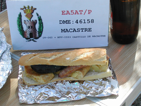
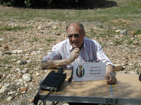
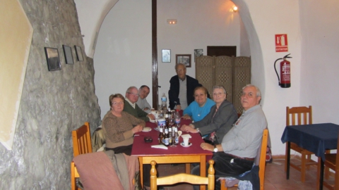
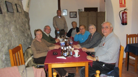
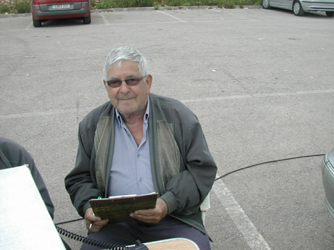
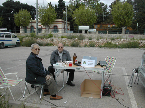
DAY 26 MAY 2012 ACTIVITY FROM MUNICIPALITY OF MACASTRE
CV-060 + MVV-0553 CASTLE OF MACASTRE + DME: 46158
The municipality of Macastre this located to 45.4 km of the city of Valencia, in the region of the Hoya of Buñol. Located between the river basins of the Buñol river and the Magro river. The relief is quite broken and they constitute small elevations and hills of integrated cretáceos materials in the Iberian system. In north half it emphasizes the hill of the Castle (430 M.s), whose foot extends the population.
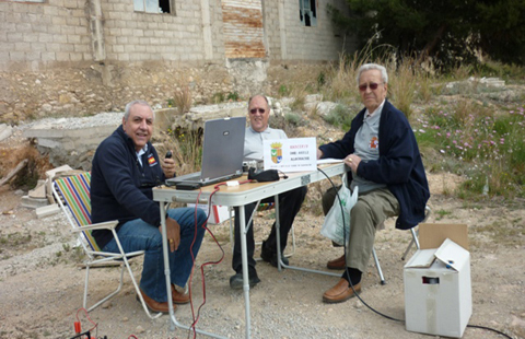
We were located in the skirt of the Castle of Macastre that is raised on the top of a small hill that dominates the locality of the same name. It had a strategic importance of first order by its border situation between the Kingdoms of Castilla and Valencia. It was constructed by the muslims, towards century XI, on previous rest that can go back until the Age of the Bronze. The main body is clearly arab, although the christian conquerors formed the definitive image of the elements that have arrived to the present time, referenced for the diploma Castles of Spain DCE 1,0 as CV-060 and for the diploma Monuments and Vestiges of Spain as MVV-0553 being reference DME 46158 for the diploma Municipalities of Spain, in this occasion we used indicative EA5AT/P next can see some photos of the activity as well as consult log.
Panoramic of the Castle of Macastre and a location of our station.
Here they can see the antenna the skirt of the castle of Macastre.
Today it deserves to be in a photo in great, as it were…. fabric goes ......
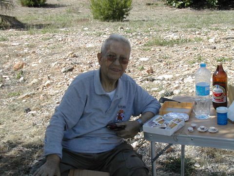
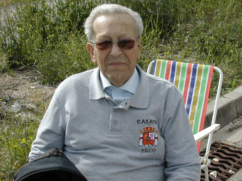
To right Paco EA5AEN preparing the coffee as always.
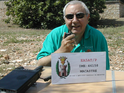
To the left Fernando EA5AT, the right JoseVicente EA5CIF
This has been all my friendly we were listened to from the next one, 73.
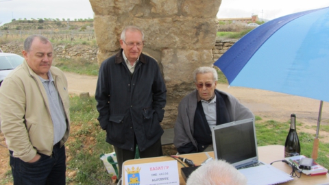
DAY 5 MAY 2012 ACTIVITY FROM MUNICIPALITY OF ALPUENTE
AQUEDUCT OF THE ARCS PV-061 + MVV-0883
DRE: 1238 REGUERO RIVER + DME: 46036
We continue with our activities putting in the air in this occasion the municipality of Alpuente located to the northwest of the province of Valencia pertaining to the region of "Los Serranos" distant of capital Valencia 87 km., in the limit with the province of Teruel, to the south of the mountain range of Javalambre. The term is steep, by the existence of numerous precipices, especially to the south. The mounts are very eroded; the main ones are: the Tooth with its peak the Erilla (1,511 ms), Black Hill (1,407 ms), Hontanar (1,238 M.s), the Cabezo (1,289 M.s) and Barajuelo (1,114 M.s). The precipices of Reguero and Arquela are the main waterways, and gather waters of other subsidiary, giving origin to the river of Chelva. The climate is continental. There are numerous sources in his I finish.
The town of Alpuente this to an altitude of 1,000 meters on the level of the sea, and rises in the col that unites mounts of San Cristóbal and the Castle, in rocky lands.
We were located next to the Aqueduct of the Arcs in the municipality of Alpuente. One is a hydraulic infrastructure of constructed medieval style between centuries XVI and XVII, is to 2.50 kilometers the north of the town, in the highway of Alpuente to the Yesa.
It lead the water coming from Fuentes Nueva and Marimacho, being used to supply to the needs of the town and irrigation of its kitchen garden, saving the unevenness that causes the river basin of the Reguero river, has a length of 265 meters of drawing up straight, except a about fourteen meters of the beginning where it presents/displays a small curvature. Rest of the drain are still appraised that from the sources lead the water to the aqueduct.
The aqueduct consists of thirteen arcs pointed of drawing up to regulate, of them ten arcs are similar and located to the right of the river (South direction), they are reduced arcs. The arc that covered the river is missing person, was the main one of the arches with about 11 meters of light and about 6.50 meters of shoot with an arrow, was dragged by a water avenue in 1880 that also caused flaws in the next arcs.
In a rehabilitation conducted in years 1986-1988 two concrete arcs have been constructed here in both fronts of the wall, with directive similar to the previous one.
The aqueduct of the Arcs this referenced one as MVV-0883 for the award Monuments and Vestiges of Spain and as PV-061 for the award Bridges and Aqueducts of Spain, the Reguero river with reference DRE-1238 for the award Rivers of Spain.
After several postponements we decided to go to Alpuente being the occasion of Paco EA5AEN, José Vicente EA5CIF with his XYL, José Luis EA5FKP with his XYL, José María EA5MB and Fernando EA5AT with his XYL, but we were not too well, after fixing a prick of a wheel when we were missing only 5 Kms. to reach Alpuente, assemble the same antenna as always and he gave us a few stationary highchange of location and more of the same, total that we decided to have lunch and then remove the fault was arranged on our arrival in Valencia, a false contact that was cut had guilt, we saw not be taped and secure, we took the opportunity for sightseeing in the town of Alpuente visiting the interesting Museum of paleontology of the same, here I put the link http://www.museopaleontologicoalpuente.net/index.php?page=museo being very well attended by Maite Suñer biologist and paleontologist, daughter of José Luis EA5FKP, showing us the recovery paleontological classroom showed us where the findings that are in preparation and laboratory study where the fossils of the dinosaurs found at the end of the Villa here I put the link if you are interested in this exciting topic. http://www.museopaleontologicoalpuente.NET/index.php?page=Aula-de-recuperacion and eating, giving complete activity, here you can see some photos of the lunch and dinner later, as you can see there is no log because we didn't do any qso.
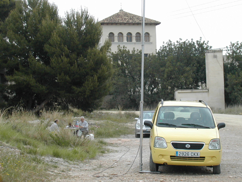
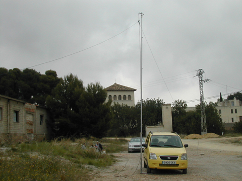
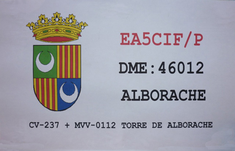
DAY 28 APRIL 2012 ACTIVITY FROM MUNICIPALITY OF ALBORACHE
CV-237 + MVV-0112 TORRE DE ALBORACHE + DME: 46012
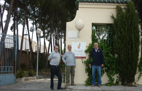
The municipality of Alborache this located to 44 km of the city of Valencia, in the region of the Hoya of Buñol. The municipality of Alborache is nailed at the top of a hill located in the right margin of the Chico river, to which they spill numerous precipices, cárcavas and streams that mark their simultaneously steep and colorful character.
We were located next to the Tower of referenced Alborache for the diploma Castles of Spain DCE 1,0 as CV-237 and for the diploma Monuments and Vestiges of Spain like MVV-0112, at the moment the building is dedicated to dependent youthful shelter of the Institut Valencià of the Joventut, in this occasion we used call-sign EA5CIF/P next can see some photos of the activity as well as consult log.

In this photo of the left they can see Jose Vicente EA5CIF after having lunch, you already see the satisfaction face that took and in the photo of the right to Paco EA5AEN preparing hot coffees to culminate the lunch strictly speaking, making honor to our TEAM " L' ESMORZAR ABANS OF TOT "
In these photos they can to see the three components of this activity in the one of the left Fernando EA5AT, Jose Vicente EA5CIF and Paco EA5AEN, in the one of right EA5CIF Jose Vicente, Paco EA5AEN and Fernando EA5AT.
This has been all my friendly, until the next one that did not take much, to be good we were listened to, 73.
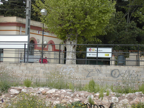
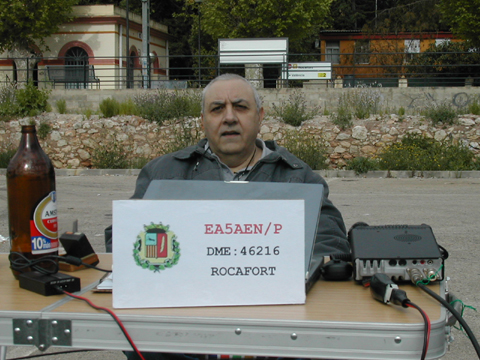
DAY 14 APRIL 2012 ACTIVITY FROM MUNICIPALITY OF ROCAFORT
DME: 46216

The municipality of Rocafort is placed to 7.7 km to the northwest of the city of Valencia, in the region of the Huerta Norte, with an average altitude of 35 meters on the level of the sea. The municipal term presents/displays a form extended in direction NO-SE that extends by calcareous lands. The urban helmet divides to the term in two parts of relief and use of the ground very differentiated. The part that follows the northwest occupies a series of smooth hills whose height never gets to surpass the 90 meters on the level of the sea and where the dry land cultures (carob trees, olive trees and grapevine) have been replaced by urbanizations of type of rest and summering. From the primitive urban nucleus towards south-east the ground he is completely level and of sedimentary origin and is occupied by cultures of irrigated land with water coming from Real Acequia of Moncada.
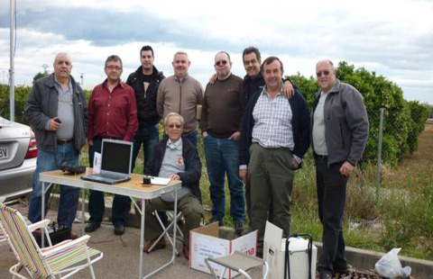
We decide to activate this municipality when being very near ours qths in Valencia and to be a municipality that only has an extension of 2.3 km2s,we were located against the station of the subway of Rocafort, in this occasion we used callsign EA5AEN/P, we had a cloudy time and by far wind that us towards very inconveniences the stay, during the activity we had the pleasing visit of some radio hams, as they were enough I hope not to leave me to anybody when mentioning them, EA5AHN Fernando, EA5EF Paco, EA5HE Jean Marie, EA5HRB Jose Manuel, EA5KO Jose Vicente, EC5BQQ Santiago and EC5CR Francisco, can here see some photos of the activity
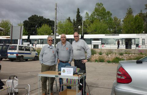
Here they can see snapshots of the colleagues visited who us in the activity, of course was a little while very pleasant, like notices the satisfaction face that they have…. he is that they venian of to have had lunch in the near district of Massarrojos, we we did also it as " is constumbre in our TEAM "L' ESMORZAR ABANS DE TOT".
To it completes hour I get our friend EA5HE Jean Marie to visit to us and I help us taking note from the last qsos.
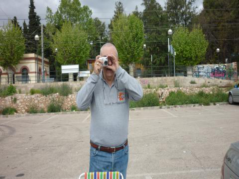
In these photos they can see photographers EA5AT J.Fernando and EA5CIF Jose Vicente photographed the one on the other, thus is pleasant ..........
This has been all my friendly, we will be listened to in the next one that did not take much, if it desires podeis to you to consult log of today activity.
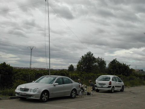
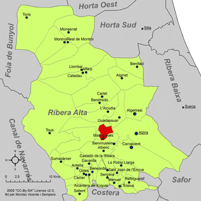
DAY 31 MARCH 2012 ACTIVITY FROM MUNICIPALITY OF MASSALAVES
DME: 46162 + DRE 1222 RIO VERDE
We begin this year 2012 putting in the east air municipality pertaining to the region of the High Shore, nowadays all the term of Massalavés is of irrigated land, thanks to waters of the communities of Real Acequia of the Júcar and the Community of irrigations of “Els Ullals” (old Reva). With regards the hydrography, we have the Verde River or “dels Ullals” that is reserve of the Samaruc and home of an endemic species of snail, is born in the great raft of the game from “Resalany”, terms of Benimodo and Massalavés, crosses average term of Massalavés, that serves as natural border with Alberic and Alzira, ending at the Júcar river, already in term of Alzira.
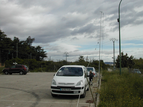
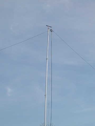
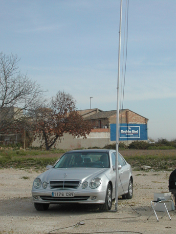
Next they can see photographs of the location of our antenna in today.
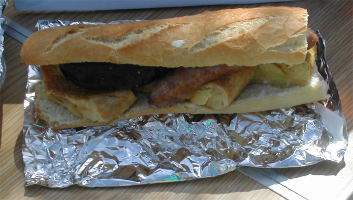
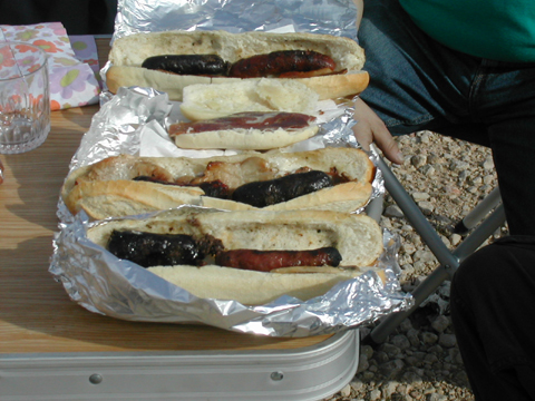
As constumbre is ours and making honor to the name of our group " L' Esmorzar abans of tot" we strictly speaking made the lunch to 10 of morning as they send to the canons here they can see sandwiches that we went between chest and back, but small so that there are not doubts he is the one of Paco EA5AEN.
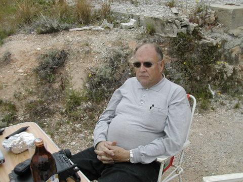
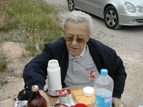
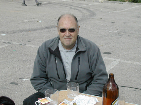
In this photo they can see a water bottle, is the one that uses Paco EA5AEN, now I have included/understood, since it has gotten to turn 82 years and one has not oxidized still, goes fabric .....
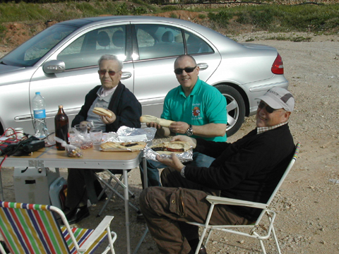
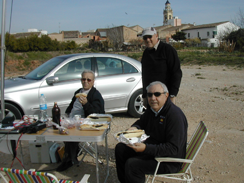

In the photo of left EA5AT J. Fernando to right EA5MB Jose Maria
In the photo of the Jose left Vicente EA5CIF to right Paco EA5AEN
If they want to consult log of the activity they can do puncturing it down in the logo but. This has been all friendly, we were listened to in the next one, that did not take much.

EA5AT 2012