| Temotu | |
|
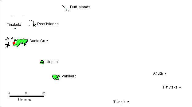
Temotu Province is the far east of the country. It comprises some large islands such as the Santa Cruz Islands, which host the Provincial centre Lata, serviced by Solomon Airlines, and some other island groups including the Reef Islands, Duff Islands and the remote Polynesian islands of Tikopea and Anuta.
The small 3.5-km-wide island of Tinakula is the exposed summit of a massive stratovolcano that rises 3-4 km from the sea floor at the NW end of the Santa Cruz islands. Tinakula resembles Stromboli volcano in containing a breached summit crater that extends from the 851-m-high summit to below sea level. Landslides enlarged this scarp in 1965, creating an embayment on the NW coast.
The satellitic cone of Mendana is located on the SE side. Tinakula has frequently been observed in eruption since the era of Spanish exploration began in 1595. In about 1840, an explosive eruption apparently produced pyroclastic flows that swept all sides of the island, killing its inhabitants. Frequent historical eruptions have originated from a cone constructed within the large breached crater. These have left the upper flanks of the volcano and the steep apron of lava flows and volcaniclastic debris within the breach unvegetated. ( Tikopea, Polynesian island in the far east of the Province.
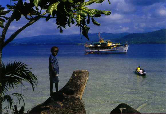
M.V. Southern Cross, the inter-island ferry arriving in Temotu Province. (1)
The Temotu Province is the easternmost group of islands in the Solom Island State. It is the collective name for the Vanikoro Group, the Tikopia Island and the most outlaying Mitre (Anuta) Group. This group of Islands, which includes in some maps also the Santa Crux Group, (other informations wrote that Sant Cruz will be an own country?!) became independence in 1978, and will become a new autonomous state on the 01-Apr-1998.
Vanikolo Islands (11S40, 166E52) is a group of vulcanous islands, about 1000 meters in high and densyly wooded. It became well known outside the Solomons in 1828, when the Frence D'Urville found the remainds of the 'Astrolab' and the 'Boussole', the two ships of LaPerouse's Expedition, who run on ground here in1788. Most of the two wreks could be found in the last 30 years when several expeditions went to there.
Mitre Island (11S55, 170E12), also known as Fataka or Fatutaka, is a steep, 122 meter high islet with two seperate hills on it. The islet is bare except for some vegetation on its north side. The island is uninhabited, but frequently visited by the islanders from Anuta. Mitra was discovered in 1791 by the British captain Edwards with the HMS 'Pandora' and named.
Anuta Island (11S34, 169E52) also known as Chery Island, is the widest outlier of the permanent inhabited islands in the Solomon's. The volcanic island has an area of about 0.2 square miles, and is inhabited by about 200 people. In its centre is a volcanic hill, 65 meters in hight. Anuta was discovered in 1791 by the British captain Edwards with the HMS 'Pandora' and named as Chery Island.
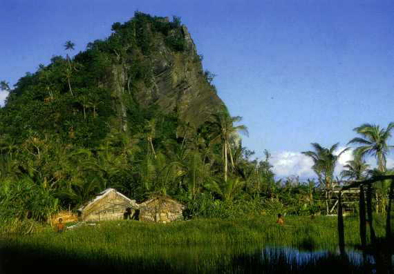
Tikopia Island (12S18, 168E50) is a densely wooded island, cultivated by plantations and inhabited by about 1300 people. It is an ancident volcanou of which on of the sides had broken into the sea. The interiour of the crater is a fresh water lake. The island rises to abou 397 meters. The island was inhabited when the Spain Quirios and Torres discovered it in 1606. Both stood several weeks on the island.
The Temotu Province includes about 10 islands, and are inhabited by about 2500 or 3000 permanente inhabitans. The group is located close north and north east of Vanatu State, which want to become some of the islands since the 1980's. In former time this islands were a part of the British Solomon Islands, which became independence in the 1960's.
IOTA Numbers for the Temotu Group
OC-163 (Vanikolo Group) and OC-178 (Tikopia Group, including Anuta and Mitre)