Next activity....
2010 International Lighthouse and Lightship weekend.
..... Diane and I are off to East Cape
We plan to arrive on the Friday and set uop the station. I plan to work from the sumit of the hill alongside the East Cape lighthouse.
Hope to work you during the weekend.
Most recent activity....
Curvier Island Lighthouse Adventure.
�Take only photos and leave only footprints�
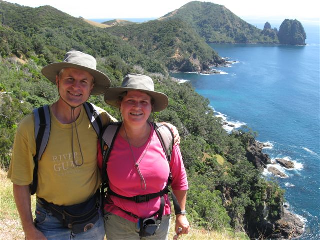
How do you find words to describe something more fun than �fantastic�? I may have to put it this way� Cape Brett has ALMOST met its match for first place in the Lighthouse Adventure stakes!

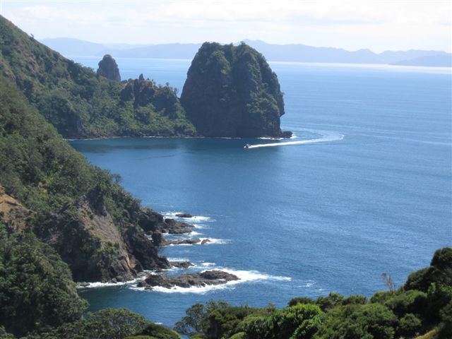
This adventure entailed many dusty kilometres on Pohutukawa lined, narrow winding dirt roads, fantastic scenery that rivalled the Bay of islands for beauty, sheer drops into rocky surf, a gold mine tour, five days camping, another of New Zealand�s Great (long) Walks, rock climbing, penguins, dolphins, 3 hours at sea, hornets, paper wasps, wetas, geckos, Saddlebacks, Bellbirds, ducks and� the lighthouse.
Our visit to Curvier Island had an early start on a Tuesday. The roads at the top of the Coromandel Peninsular aren�t designed for quick get-aways or speedy arrivals. With Nigel being on holidays and time not pressing us, we planned to go several days early to the Coromandel Peninsular and camp the weekend at the DOC camp site at Port Jackson and relocate on Monday to the DOC camp site at Stony Bay. The boat to Curvier left from Port Charles at 0700 and Stony Bay was a hair rising 10 to 15 minute drive away. That suited us fine.
What Nigel didn�t tell me was that we would also be doing the Coromandel Walk� both directions!
The weather forecast on the Thursday we planed to leave had the tail end of a storm from Tonga arriving with 50 knot winds at the Peninsular. We delayed our departure till Friday morning and left with the car and trailer packed with everything including the fridge! Only thing missing was the cat, and that not her fault for the lack of trying!
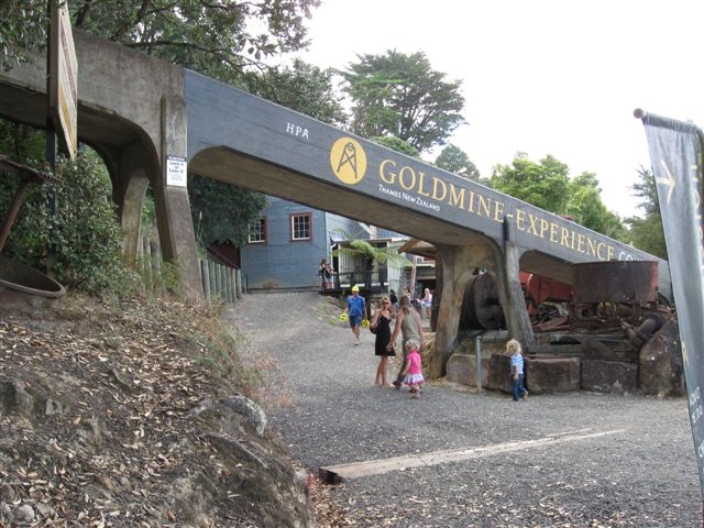
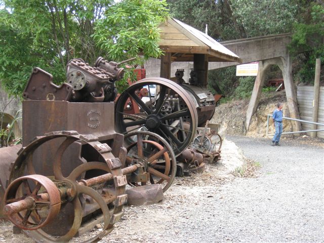
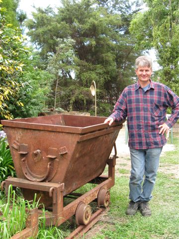
Thames Gold Mine.
Our first stop was at Thames Gold mine where we went for a guided tour of the remains of the mine and got to see the �stampers� in action and how the gold was processed in the gold rush days. It was very interesting and worth a visit.
Our guide had been telling us about the conditions the miners worked under in the mine shafts and how there would have been rats and mice attracted to the less than sanitary conditions in the tunnels. Our guide led us along the tunnel to a flight of stairs that climbed to the next level up. On the first step he narrowly missed stepping on a small mouse desperately trying to clean its paws.
I bent down and picked up the mouse by the scruff of the neck. He was mostly wet and very muddy and his little paws were freezing cold. The mouse didn�t look too lively and didn�t resist being handled. I carried him by the scruff through the rest of the mine, out into open air. (My hands were muddy from his paws, so no photo.) I lay the mouse on some shady dry leaf litter to either recuperate or RIP.
The little critter really needed to be in warm sunshine, but there was a fox terror running around who would have demolished the mouse with one bite. Ok, so I�m a softie� why else would I feed a Rascally stray cat and rescue a small mouse?
The history of the gold mine and how they processed the quartz rock to extract the gold is fascinating. This mine had one extremely rich vein of gold bearing rock that succeeded in caking the stampers so thickly it required the gold ore to be shovelled off the stampers to free them.
The stampers on display were powered up and made a huge racket. There were only 5 pounding away, but we were told that there were multiple stamper batteries throughout the Thames mining area at the height of the gold rush. The noise of a thousand stampers working in Thames could be heard in Auckland on a windy day! No one slept on Saturday nights when the stampers shut down as the silence was so deafening it kept them awake!
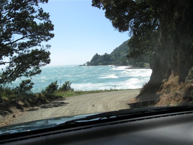
On the road again, we headed north to Coromandel township where we had lunch, then continued on with the road becoming dirt, increasingly narrow and winding. I found it a little nerve wracking at times with the roadside cliff faces unfenced, sometimes dropping considerable distances to sea and surf. The drive otherwise, was rather pleasant with nearly the entire road length bordered by Pohutukawa trees of all shapes and sizes. They hugged the roadside or clung to the sheer cliffs.
Later I saw a sign stating �Pohutukawa Coast�. Very aptly named! It would have been rather spectacular at Christmas time with the Pohutukawa trees loaded with crimson blooms and displayed against the background of aqua and deep blues of the sea.
Port Jackson.
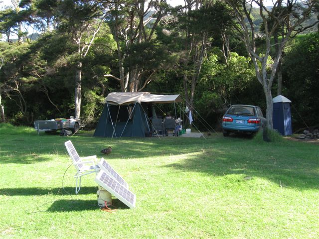
Port Jackson eventually came into view at the top of a ridge and the road meandered down to the gate of the DOC campsite where we were met by several young wild rabbits. Nigel recognised the Caretakers as the same ones he had met years before when camping there. We have found the DOC camp sites neat and the fees very affordable at $9 a night for the camp site. Toilets and fresh water provided.
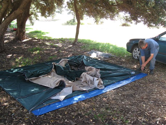
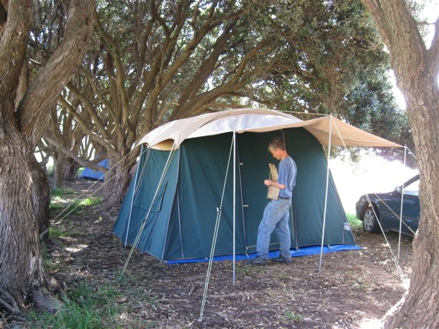
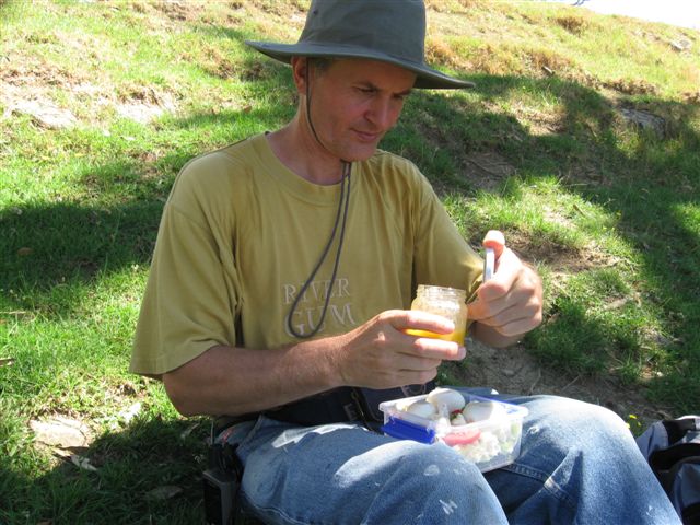
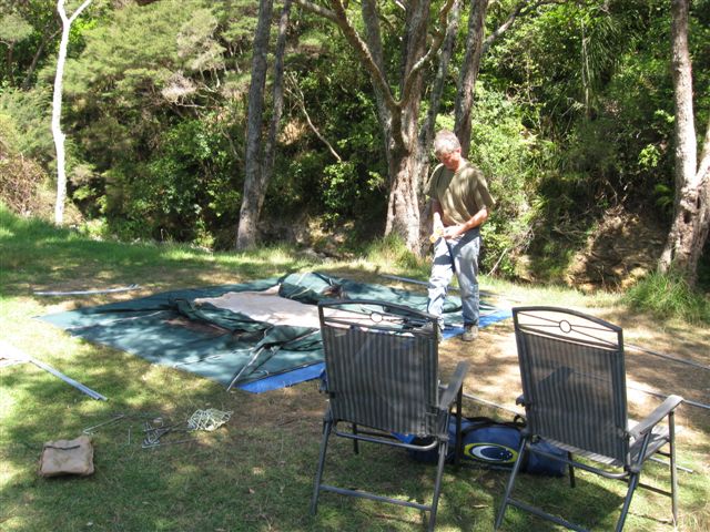
We are set up for showers and anything extra that makes the tent homely. The tent went up quickly. Nigel soon discovered we had a problem as he set up the �kitchen� for me� the gas fitting that would have allowed us to use our large cylinder, gas light and stove� was back in Auckland!
I mentally ran through what foods we had with us and changing this camp�s food to all raw. It would have been manageable, as there were enough cans of beans, fruit, etc to combine with the raw fruit and vegetables, but raw eggs�?? Eeewww!
Nigel later returned to the tent carrying two small gas cylinders the caretakers had given him for keeps. One bottle was empty, but the other had sufficient gas to see us through our camping trip. Saved!
Saturday morning after breakfast we walked to the end of the beach and up the hill crest, down to the fence, over the fence and continued up to the top of the headland and out as far as we could safely go. I had fun hunting cicadas and shooting them on camera. They were so plentiful and easy to find!
We went as far as we could on the headland facing into the bay entrance then back down the hill to the water�s edge and rock hopped as far as we could before the rocks changed to sheer cliff with water depth that would have been waist deep or deeper.
Neither of us wanted to get our hiking boots wet and we had to scramble up the rock face to make it across several places, the last one being most difficult. Fully expecting to slip off the precarious rock face and fall into waist deep water, I handed Nigel my camera, pack and glasses before attempting the crossing. Thankfully I made it over dry! With impassable sheer rock ahead we left the water�s edge and headed inland up the embankment to the track and down to the beach.
On the beach I found the remains of three unfortunate Little Blue Penguins in various states of decay. A lot of Little Blues have recently been found around NZ beaches dead or dying from starvation supposedly due to over fishing. Poor little guys. A sad introduction to my first �Little Blues�.
I am particularly fond of the Fairy Penguins. They were a highlight of my sailing in Pittwater, NSW. Lion Island, in the mouth of the Hawkesbury River/ Pittwater entrance, is their main nesting site around Sydney. Locating the Fairy Penguins from their call was always a great thrill when out sailing. Their yapping calls always signified I had arrived home after being offshore.
After lunch and siesta, we drove to Fletcher Bay and hiked up the Sugarloaf Rock and back. The area and paddocks on the walk were beautifully clear of gorse bush but I managed to walk into the only gorse bush on the Sugarloaf! Ouch!
We had a lovely view of the coastline and the off lying islands in both directions from the top of Sugarloaf Rock. Nigel and I walked to the far end of the Sugarloaf and came to an old Pohutukawa tree clinging to the edge of a sheer drop of a hundred odd metres down to the Pinnacle rocks� surf washed base. It was an intriguing sight: The Pinnacles rose from the sea like several rugged black needles reaching for the sky. Framed by the Pohutukawa tree and blue of the ocean, the scenery before us was worth the hike up the rock.
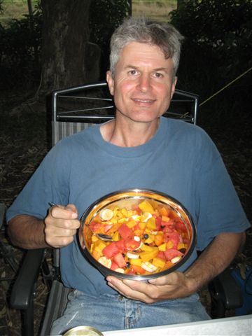
Heading back to Fletchers Bay, the reflections of Square Top Island and the reef near the shoreline added to the general beauty of a small bay as the sun was sinking lower in the western sky. Back at the tent we enjoyed fresh fruit salad and coconut cream.
Coromandel Walk.
Sunday early, we returned to Fletchers Bay for the second time and the morning light gave a new perspective on the coastline we had seen by late afternoon sun.
The Coromandel Walk started at the same crossing we had used for the Sugarloaf Rock walk the day before. We followed the same track for a distance before heading higher up the sheep paddocks, crossed the fence and continued climbing around the side of the hill to a lonely gate.
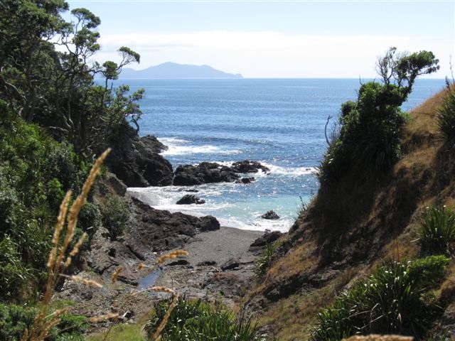
Beyond the gate was a new adventure: a 3 to 4 hour walk around to Stony Bay. The track passed through open grassland into tea tree and descended through native forest, steeply dropping down to sea level in Poley Bay and climbing steeply out into tea tree scrub before levelling out again.
Nigel told me there were Kiwi birds in the native forest. But being a nocturnal bird, we wouldn�t be seeing or hearing them during the day. Pity! But it was great just knowing that Kiwi were in the area. In the deeper shaded bush areas we kept a watch for the little Ruru owl, hoping to see them again in daylight.
I noticed an abundant presence of traps and bait stations for the length of the walk. One track junction was marked with a hand written board �Possum Trackers Only� with the Coromandel Walk direction signed with an arrow.
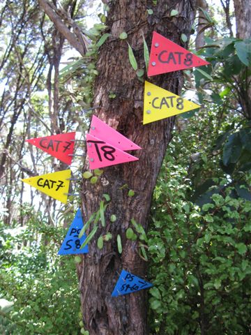
We came across a couple trees which were so heavily tagged with trap and bait information tags that I had to photograph them. They almost resembled colourful Christmas trees!
Later while on Curvier Island, I was to learn that the traps and bait stations were forming a successful almost continuous chain across the Coromandel Peninsular and predator number were falling noticeably. Kiwi, reintroduced Robins and several other endangered species were slowly increasing in numbers. One Kiwi, tagged with a tracking device, and released near Port Charles made his way over the high rugged ranges and a couple weeks later was located near Coromandel township! Amazing where the Kiwi�s little legs take him! It is not a tramp I�d wish to tackle!!
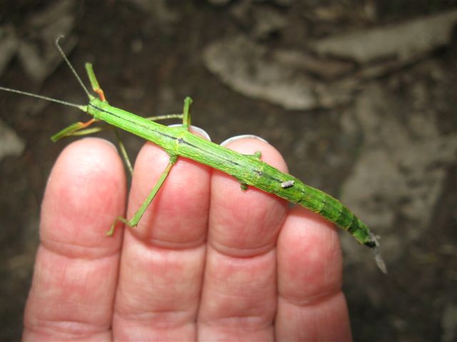
The air was alive with Cicada calls and twice I was hit in the face by errant cicada navigation. A bit later I found cicadas upside down on the track, expired. I also noticed an unusual amount of dead stick insects on the track and wondered� �why?�
Nigel found a Weta Hotel and waited for me to catch up and showed me the Wetas (huge crickets) inside; a large male and female. It was exciting seeing them. A few small cockroaches got squashed when the lid was put back in place.
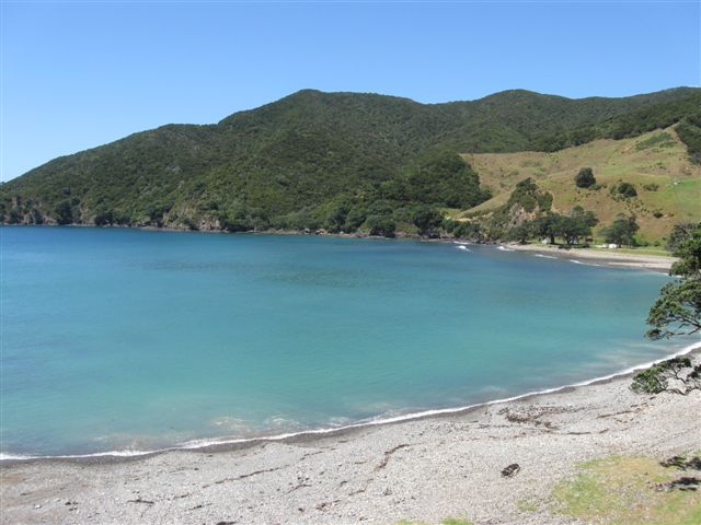
Between abundant bugs and beautiful scenery, it took 4 hours to walk the track as I kept stopping to take photos of what I found so it could be shared on DVD. We reached Stony Bay around 2pm and had lunch in the shade of a large old Pohutukawa overlooking the rocky beach of Stony Bay. The water was a clear inviting aqua colour, but I had no desire for swimming in it� too cold for my likings!
The return tramp back to Fletchers Bay only took us 3 � hours as I didn�t stop for so many photos. The track scenery was just as beautiful on the way back, but I was feeling the distance. The track was best part of 10km one direction and we were on the return, so I was glad of the tramping pole�s assistance but wished I had the second. They do make a surprising difference. Nigel made it back to the car well before I did. I was glad we were having a less active day the next day!
Stony Bay.
Monday we moved camp from Port Jackson to Stony Bay. The drive was a scenic long way round the Peninsular with the road mostly only 1.5 cars wide, corrugated, dusty, steep drops and tight corners. Not much room for error. We found the road to Port Charles wharf and timed how long it took to Stony Bay. It was a rugged 10 minutes of intense concentration with vegetation overhanging the road and gorse bush being more abundant. Stony Bay campsite was a welcome end to the road.
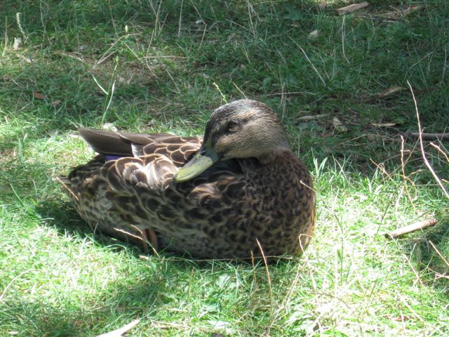
In looking around for somewhere to set up, we were beckoned over to a picnicking group. They told us they were in the best spot in the camp, and would be leaving shortly. The lady told me a duck had been trying to catch the eels in the dammed up creek all morning. Her husband told us we could have duck and eel on the menu and laughed when told the livestock were safe with us�
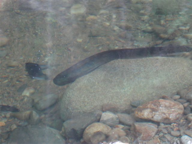
Some of the eels were impressive sizes and the duck looked to be playing a game of tag with the eels. Later in the stay I noticed the same duck move rather fast, leaving a couple feathers with a large eel. TAG! I never saw the duck catch any of the 20 odd eels in the creek.
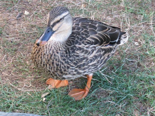
Ducks and eels� we had a lovely camping spot above the creek and 24 friendly, well mannered ducks checking everything we did. The ducks carefully inspected a clean bucket of water, and then cheerfully wandered off, leaving me with a bucket of muddy water to wash my vegetables in. Cheeky little beggars!
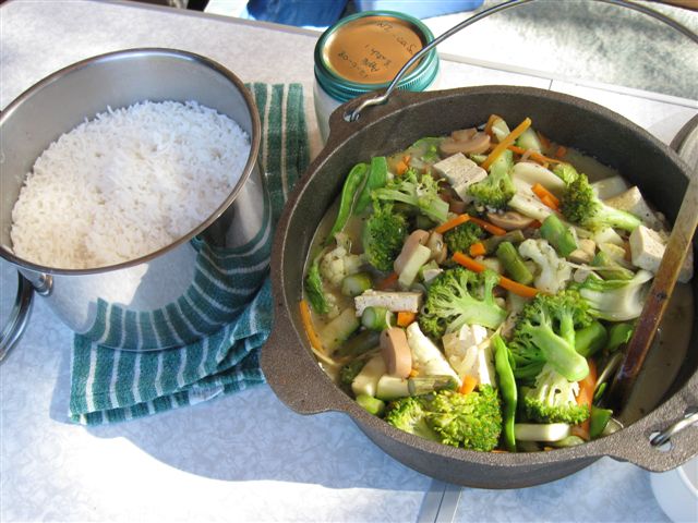
We had a green Thai curry and rice for dinner that night and the ducks were quite relieved it was tofu that ended up in the cooking pot.
Monday evening�s entertainment was scrubbing hiking boots and the fibreglass flexi pole till spotless, ready for Curvier Island, checking over camera and radio gear and packing what we were taking. No bugs, no seeds, no dirt, no mice, no ducks� the packs etc were stored on the camp table overnight.
Curvier Island.
The alarm went off at 0500. I was still weary and sore from the 20km walk and groaned. Staggering around in the dark, trying to cook breakfast and having the only half decent light constantly going walk-about when needed most, wasn�t a good way to start the day. It had to improve!
We were on the road to Port Charles at 0615, giving us plenty of time to get there on the crazy narrow road. Going down to the wharf we found there was no real space for parking, and what initially looked like an available parking spot on grass, soon revealed it would have been parking on thin air. Going further up the road we found some roadside space to park and were soon met by an eager cloud of hungry mosquitoes!
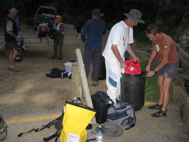
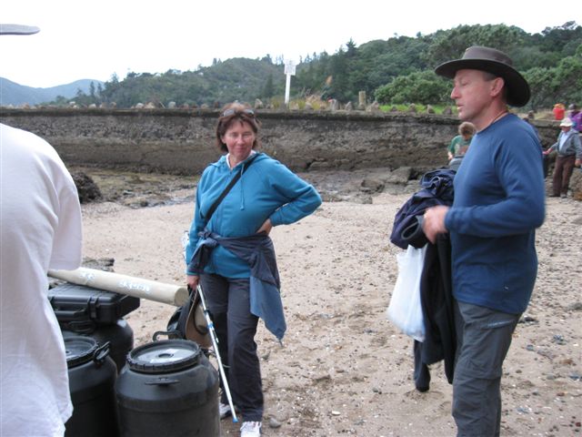
We carried our packs down to the wharf and met up with Paul and Judy who were also busy swatting mozzies. Closer to 0700 the MEG van arrived along with DOC Ranger Rob, the inflatable dinghy and the empty barrels. Other members of our tour group were arriving as well.
The Moehau Environmental Group�s volunteer leader Leticia started organising the barrels and the inspection of belongings being taken out to the island. The strict quarantine measures are similar to and if not stricter than those of travelling internationally. The filled barrels then went down to the beach to join the inflatable.
A short wait later Leticia gave her briefing and the first group to the boat were zipping up life jackets and climbing aboard the dinghy. We were told to keep fingers and hands away from the landing duckboard and were directed when to leave the dinghy. A load of barrels was shuttled out next followed by more barrels and passengers.
As soon as the last persons and dinghy were onboard, Craig our skipper gave us a safety at sea brief before setting off. In a very short time the boat was ploughing into swell larger than was expected. It was so wonderful feeling the deck heaving beneath my feet again! The motion of the ocean� marvellous!
Several of the group weren�t as thrilled� their colour slowly changed to varying shades of green. All thoughts of green were forgotten when the first call of �Dolphins!� went up. It was wonderful seeing the dolphins dancing through the waves. Seabirds were also in abundance as we continued to Curvier Island.
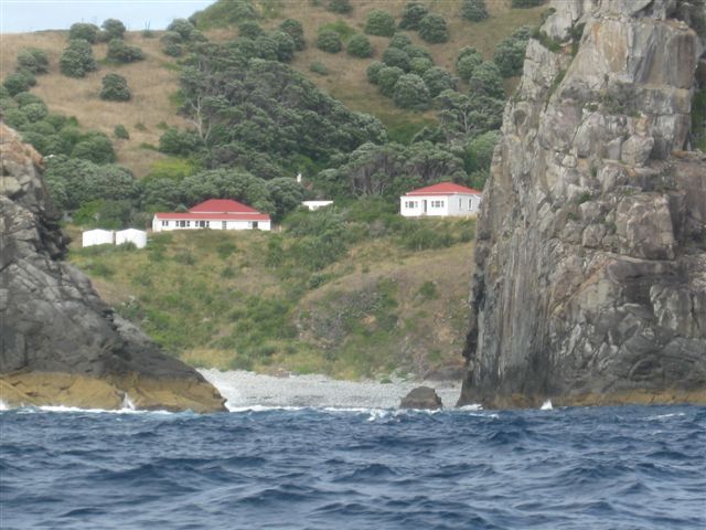
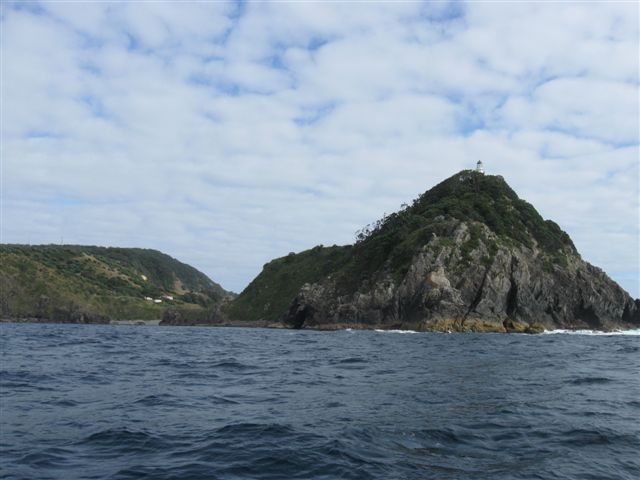
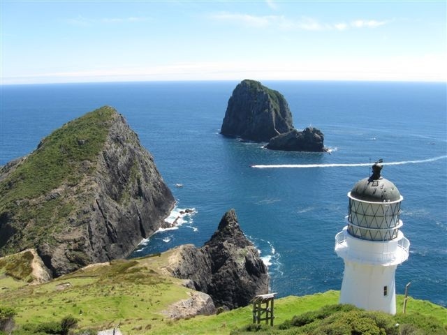
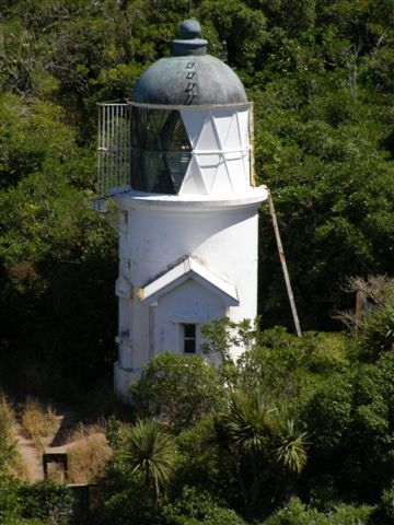
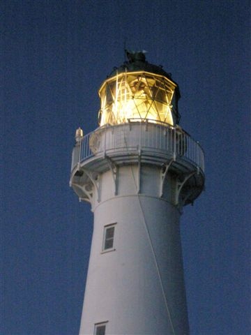
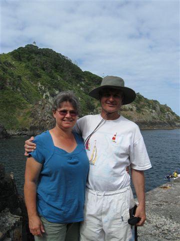
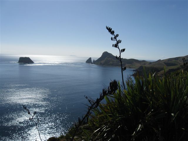
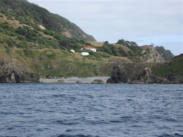
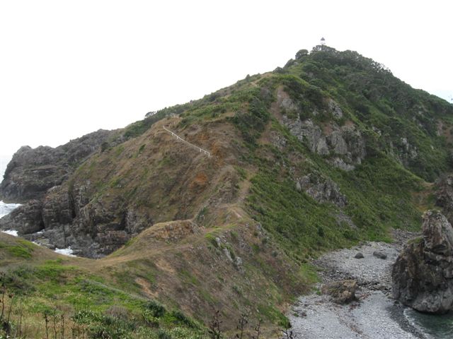
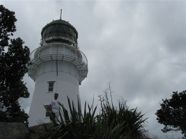
The boat was making a straight line for Curvier Island and excitement grew the closer the island became. We had a reasonably close look at its rugged steep cliff faces from the western end and as we travelled along the northern side around to the southern side bay we would attempt to go ashore, all being well. The wind and sea swell were not too promising on the windward (northern) side of the island. Slowly the lighthouse perched high on the rocky outcrop grew more distinct as we reached the eastern end of the island and ducked around under the light into the bay on the southern side.
The water was flat when the boat dropped anchor in 14m of water to unload. The wind was blowing directly across the rocky foreshore, all swell breaking on the northern side.
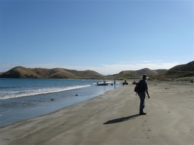
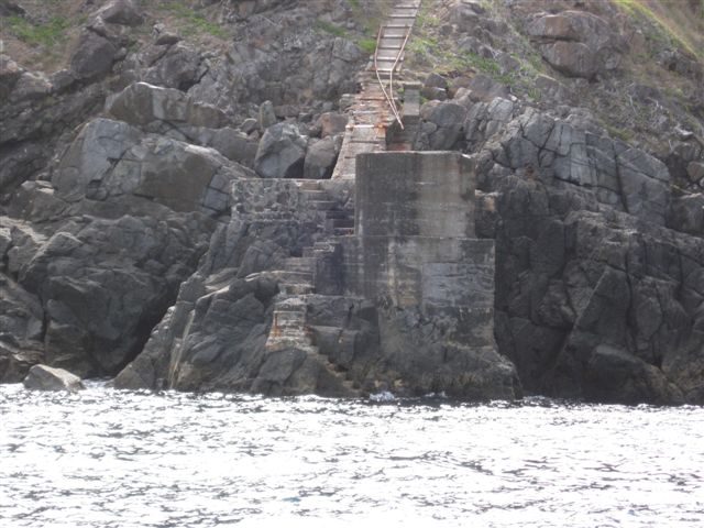
The greenest of the group were in the first load ashore, Nigel going with them as the �anchor man� on the landing stairs to assist the groups from the dinghy. The first group landed without problem and formed the beginnings of a human chain up the steps to receive the barrels. My camera went ashore in a barrel for safety sake.
After handling the dinghy ropes and assisting with loading the barrels, it was my turn to go ashore. Well, I did my best to make the leap when told to, but between slipping as I went to leave the dinghy and it falling away with the swell, I was left hanging mid air doing the splits� one foot touching the step, the weight bearing foot still on the dinghy. The only thing that prevented me going swimming was Nigel�s grip of my hand. The return swell enabled me to transfer my weight and gain the step. Close! One really needs to be quick and agile going on these island boat trips!!
We each picked up a barrel, any barrel and joined the slow climb to the remaining Assistant Keeper�s house where morning tea was served. Nigel and I ate our lunch instead. Ranger Rob then gave his introductory talk and shortly after, Nigel went to the lighthouse to play radios. Paul and Judy had gone straight to the lighthouse.
Since it would be a long time before we would be able to return to Curvier, I decided to go with DOC Ranger Rob and tour the island. I had been told he was a walking encyclopaedia when it came to the islands, their birds and the Coromandel wildlife. I wasn�t disappointed!
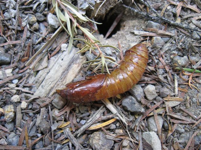
Rob answered my question on why so many stick insects were found dead on the Coromandel Track� it would be due to either the extremely dry weather recently or it could be from breeding. Like the Preying Mantis, the Stick Insect males are killed by the female after mating. As to why Penguins would have died� the answer wasn�t as easy to define or remember. Even in good years a number of penguins die with no pin-point-able reason.
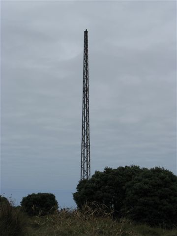
We were led up a narrow trail through grass towards the remains of the radar towers. The towers were part of the early development of radar and Curvier Island was Radar Station 4, one of the active testing sites. Aircraft were able to pick up signals and head straight for Auckland airport regardless of weather.
The grass growing off the trail was a thick cushion which was over knee deep. There were some young Pohutukawa trees transplanted from Tiri Tiri�s nursery on the grass slope near the radar towers. Saddleback birds and Bell birds flittered between the trees and for some reason they stopped singing whenever I tried to catch their delightful songs on movie.
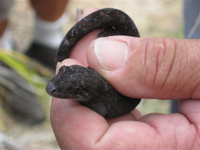
Rob led us to the fence line that previously separated the light station�s grazing land from the back of the island where restoration had begun. The change was very obvious. To the east of the fence it was grassy, to the west of the fence it was thick native scrub. Rob told us of the removal of the goats, cats, rats and mice from the island and how the undergrowth had recovered and how the bird life was recovering. Some birds had been removed, bred up and returned to the island. The endangered Tuatara has also returned to Curvier after being removed for an intensive breeding program at Auckland zoo. Nocturnal, we didn�t see the Tuatara.
We got to meet one species of the two Geckos that live on the island. The gecko had a sweet, dark velvety face with bright eyes. Rob had opened one of the 600 artificial sea bird burrows to show us the geckos. His main task while on the island was to inspect the burrows and band any chicks he found. He knew of about 18 chicks in the artificial burrows. Each burrow was tagged with a numbered red triangle.
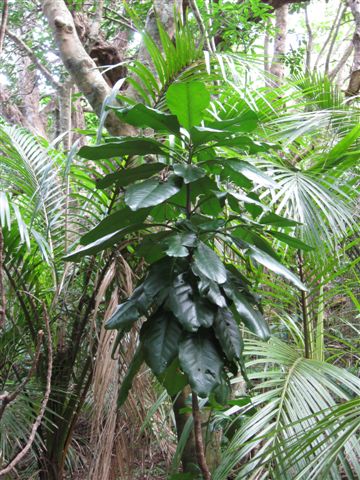
Rob pointed out a native dark broad leafed tree that was on the endangered list. I was surprised to hear a plant was on the endangered list! The Para Para tree, otherwise known as the �bird catcher� tree, on the mainland was actively destroyed because it caught the poor little birdies. Bird rescue groups hate the tree. Its seeds are very sticky and get stuck on bird�s feathers. The seeds are spread by bird flight, but on occasions, the seeds by sheer number immobilize the bird when the bird pursues insects attracted to the tree. The immobilized bird eventually falls to the ground and fertilizes the tree. Fascinating. Rob told us the Saddleback was big enough to break loose, but the smaller birds like the Robin or Wax Eye or Fantail were more likely to remain stuck.
By now I was at the front of the pack, camera recording as much as could be recorded. Rob, leading, walked into a paper wasp nest and got stung for his troubles, the folk right after him were also hit. I rolled my slacks legs right down and darted past the nest hanging from a flax leaf, avoiding any sting. The people behind me also got hits. Major excitement for the day!
The track led us up to the back of the island where old buildings were still standing from WW2 Radar watch. Their history was interesting.
From the buildings, Rob led us down the side of the island to a shady secluded spot by a pool of water that the naval guys had used as their water source while on the island. This was our lunch spot. Nikau Palms were the dominant plant there and we were told that 30 rare and highly endangered Middle Mercury Island Tusked Wetas had been released in that area but hadn�t been sighted since release. Rob laid several tracking tunnels before we left the Nikau Palm pool.
We hiked back up to the top of the ridge and Rob directed us to the track we were to take back to the station. He was staying at the back of the island to check on the seabird chicks.
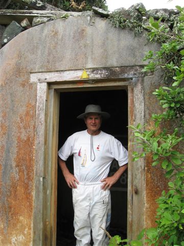
I led the way down to the keeper�s house and paid a visit to the island�s only toilet. Outside the loo on a fence post was a mailbox flag arm to indicate occupied or not. The hand basin was opposite the fence post and standing free. Painted forest green, shaped like a round tube standing upright, the loo was like a sauna it was so hot inside! Pleasantly clean and odour free for a dry long drop loo, it amusingly has to be flown off the island by helicopter for emptying! What a load!!
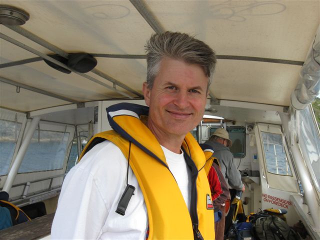
I met Nigel on the narrow walkway crossing between the station and the lighthouse. He had finished for the day! I was like �Huh? Already??�
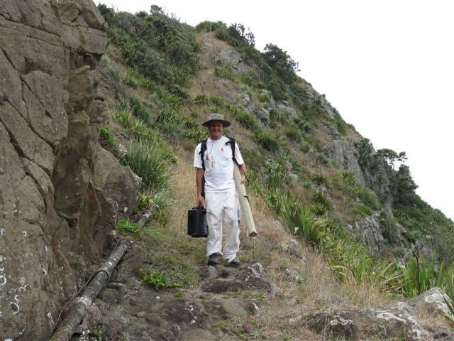
Nigel tucked his radio and pole behind a rock out of the wind and kindly went back up the steep climb to the lighthouse with me so I could get some photos of the lighthouse.


I had heard there were angry wasps near the big rock near the top of the track leading to the lighthouse but thought they would have settled by the time I got there. The track leading to the lighthouse was alive with skinks which was fantastic! There are three species of skink on Curvier, one darker from Mokohinau and the lighter Curvier ones. I had to watch where I trod to avoid stepping on the little guys.
I was still watching for skinks when Wham! Wham! I was hit on the back of the arm and right through my shirt on the ribs. I squealed and stumbled forward trying to run up the steep path away from what had hit me. The pain!! Nigel turned back to help me, spraying a lavender and essential oils mix I had with me onto the stings, which brought immediate relief.
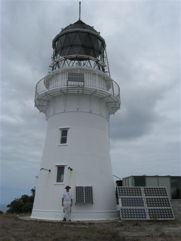
Nigel showed me around the lighthouse and where he had set up his radio and how many calls he�d received. The space at the lighthouse is very tight with steep cliffs dropping down to the surf well below. It was difficult getting a good full shot of the lighthouse with such limited space. I took several good shots by carefully rock hopping down the side of the rocky slope. Curvier lighthouse would unfortunately, be the least photographed lighthouse so far! This in itself was disappointing, but if I didn�t go on the tour I wouldn�t have seen the island and probably not get the opportunity to again. The Olympus could have gone with Nigel and been working the lighthouse and radio� but�
Under time pressures, I half noticed an absence of the stamp in the ironwork near the door that was so noticeable on most of the other lighthouses we had visited, barring Mokohinau, Baring Head and Cape Reinga lighthouses.
Curvier lighthouse is a first in New Zealand�s maritime history. It is not New Zealand�s first cast iron tower. Tiri Tiri Matangi is NZ�s oldest cast iron tower shipped in from England 1865; Cape Egmont also cast iron from England 1881; Palliser 1897 also English cast iron; Mokohinau a first in locally made brick in 1883. Baring Head a first in concrete construction, 1935.
Curvier has pride of place being New Zealand�s first lighthouse tower constructed from locally cast iron. It was first lit in 1889 and demanned in 1982. The cast iron plates had to be taken straight from the landing boats and hauled 100m straight up the cliff to where the 15m tower stands today at an elevation of 119m above sea level. The scars remain on the cliff face from where the plates were hauled up on a tramline system. Each plate was a hefty weight on its own.
Curvier remained New Zealand�s most isolated offshore lighthouse, her keepers hating the loneliness and isolation. The island was frequently enveloped in fog and the steep track to the lighthouse was frequently made hazardous by stormy weather.
Nigel and I had stopped at the foghorn bunker on the way up, not realizing what the bunker was used for. The bunker stored the gunpowder for the slaughter gun cotton picking fog horn.
Curvier lighthouse was extinguished for the duration of WW2, but Curvier Island was an important coast watch outpost and radar station. It generally does not seem to have an event of any great significance recorded; unless you classify the development of radar and its testing and eventual use in the Battle of Britain important� it only saved England!
Nigel left me to the last couple photos I wanted to take. He wanted to go and see the radar towers. Reluctantly leaving the lighthouse I started down the track looking for the skinks underfoot and the hornet nest I had to avoid. No luck! Wham! Straight through the shirt again... Skinks or not, I had to get out of there! I passed another two of our group making their way up and told them to beware the hornets above. They got done both ways too. Later, meeting the lady at the bottom of the track I sprayed her hands to ease the multiple stings she had received. Nasty little critters! Rob later identified the nasty insect as an Australian Hornet.
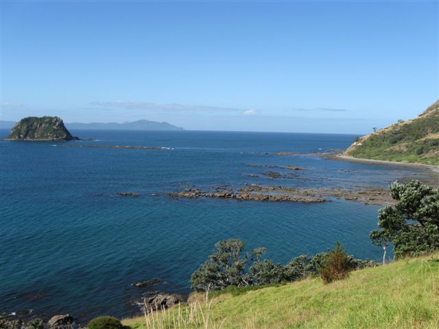
I spent some time down on the rocky northern �beach�. The rocks were amazing! Some perfectly round, the size of basketballs, others cracked as neatly as an egg for breakfast. I didn�t see any skinks on the beach, but found an old bleached bone I later learned may have been from a mainland cow that died and had washed up on Curvier years back.
Nigel was a long time coming back from the radar towers. He looked exhausted when he did arrive back. He�d missed the track and had gone �bush bashing� uphill, through thick knee high grass, eventually reaching the track and the towers. It was tough going. He found the track on the way down, which was much easier!
It was somewhat reluctantly that we bundled our things back into the barrels and made our way down to the landing. Craig was there to meet us with the boat and dinghy and everyone and everything was reloaded in reverse order� the ones liable to go green being in the last load.
We waved Rob goodbye as he turned the dinghy back to shore. He was staying the week on the island. We turned our attention to what our boat was doing. Anchor raised, we headed along the southern shore and out into the swell again. This time the motion of the ocean was more kindly as the seas were behind us. I love the feel of running with the seas.
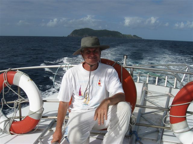

Dolphins again came to entertain us on the way home and Port Charles had a special surprise in store for me. As the boat entered the calm outer waters of Port Charles, Little Blue Penguins were spotted. Their yapping sounded so much like the Fairy Penguin. We passed fairly close to 6 and it was delightful seeing their sweet little faces turned to watch us pass, bright eyed and unafraid. Now the day was perfect! Penguins to welcome us home!
Anchor was dropped and the shuttle ashore was assisted by a young gentleman who lived locally with his runabout tinny. Passengers he was expecting, but I was sent ashore with a load of barrels that were swung into every available space till I was left half sitting on barrels. This he wasn�t expecting! We made it to shore safely and he returned for more passengers and barrels till everyone and all the gear was in.
Thanking Leticia and the MEG group for organising such a wonderful day, we departed for Stony Bay camp. The ducks were all tucked into bed for the night and we followed their example shortly after.
Wednesday morning was spent breaking camp and packing the car and trailer before rejoining the crazy road system back to Coromandel. I was glad I wasn�t driving!
Driving Creek Railway.
I had forgotten all about it and wondered where Nigel was going when he turned off the main road. He pulled into the car park of Driving Creek Rail and Pottery. Oh, that�s right� Nigel bought our tickets and after a brief look around the pottery, we went to a lovely Organic caf� 100m down the road for lunch.
The food was excellent. They also do specialty menus for gluten free, dairy free, vegetarian, vegan, organic and have a wide range in their menu. Fantastic! I wish there were more cafes like it around!
Hurrying back to the pottery we found the last available seats were behind the train driver. It turned out our train driver was going out to Curvier the following day. He was so excited hearing about our visit to Curvier Island and I was glad to be able to shoot over his shoulder and get good footage of the railway as we went. The rail tracks led to the top of the property in a series of switch backs, ending under a large lookout building.
The lookout was inspired by and based on Bean Rock lighthouse in Auckland�s harbour. The view from the lookout was fantastic. The rail line couldn�t go any higher as the soil on the upper parts of the ridge was unstable. The little train rattled and bumped its way backwards down to the pottery and we went back to the car and continued home.
We had so much fun and so many adventures this Lighthouse journey.
I had succeeded in filling an 8GB, 4GB and 2x 2GB cards and was on my last 1GB card for the Canon. The Olympus had used nearly 2GB. The computer was groaning when it was all downloaded for editing. It resulted in a set of 3 DVDs to manage the 3 hours of footage! Nigel is still considering a High Definition movie camera for me, with lots of GB memory!! Hi.
Nigel had 21 individuals contact him, including 3 from Australia. Some contacts reached him on various bands to bring his total to 29 recorded contacts. For a work day, that is still pretty good.
+++++++++++++++++++++++++
Earlier adventures
These are a non-hamster's adventures with her hamster husband...
for the full stories on articles shown below, just click on the links.
2009
Mokohinau Islands Lighthouse Adventure. December 27th, 2009.
Wow!! What a fantastic time!!
The Mokohinau Lighthouse adventure was so much fun; I don�t know where to start!! Camping over Christmas, hiking mystery trails, abundant birdlife, beautiful surroundings, great weather, great company. The poor little Canon worked overtime, we had a great time on the dive boat, the lighthouse is simply gorgeous and the cloud formations that came in only added to its beauty. And all that came as a bonus for calling CQ� CQ�
Mokohinau Island - 27th December, 2009
for the full story.. click on this link.
Labour Day weekend 2009. Tiritiri Matangi was on Sunday 25th October
The car has just been unpacked and it�s raining heavily in New Plymouth, but it is good to be home again. Nigel and I have had a wonderful weekend away together and the visit to TiriTiri Matangi Island is the highlight of the trip.
Tiritiri Island - 25th October 2009
for the full story.. click on this link.
Weekend 15-16 August 2009
International Lighthouse Lightship weekend
Nigel and I were so impressed by our Cape Brett experience we had originally planned to return and activate Cape Brett lighthouse for the 09 Lighthouse weekend. But Nigel�s work had progressed slowly and was at a stage he couldn�t leave. Deciding cost, weather and time wise, it was a bit risky to proceed with Cape Brett, we chose to go with ..............
International Lighthouse Lightship weekend 15-16 August 2009
for the full story.. click on this link.
Weekend 6 -9th March.
Taranaki Anniversary
Nigel and I have returned from another great lighthouse weekend away. It was a stressful week for both of us and the time away almost didn�t happen due to Nigel�s work. But everything was paid for so we were not letting the Taranaki Anniversary long weekend pass by without a lighthouse!
That was the easy ..............
Sunday 8th March 2009
Castlepoint Lighthouse
It was closer to 4pm when Nigel met me and we headed off to Palmerston North and Castlepoint.. Following the �short cut� directions on the print out was interesting. We became slightly geographically disorientated getting through Palmerston North then a place name for heading cross country on the back roads totally disappeared off the map when needed! We missed the turn off.
Castlepoint & Cape Paliser Lighthouses
for the full story.. click on this link.
Sunday 8th March 2009
Cape Palliser Lighthouse
We took the Masterton-Castlepoint road and found it good bitumen all the way into Masterton. Nigel had planned we go cross country using the AA GPS directions before getting into Masterton. That was ok, the instructions were out and I had read through them and had alerted Nigel to which road we had to look for and turn off. The GPS was packed in with the radio gear. We took the turn when we saw the road and frustratingly the next set of signs didn�t include
Castlepoint & Cape Paliser Lighthouses
for the full story.. click on this link.
Waitangi Weekend Lighthouse Adventures!
Friday 6th - Sunday 8th February 2009
We have just returned from a great weekend away, chasing lighthouses, having so much fun it�s hard to believe it was all above board, legal and we were sober!
Since arriving back from Cape Brett , Nigel and I have been busy with research and preparations for the Waitangi weekend. Extra equipment has been bought; Nigel made contacts and gained special permission to use the ..........
Friday 6th February 2009
Pencarrow Lighthouses... upper and lower
We had an early start to the day picking up the gate and lighthouse keys from Nigel�s friend at 0730 before heading out to Pencarrow Lighthouse for the morning. Driving through the gate into restricted territory was a strange exciting feeling. The gravel road was well kept and this was a very civilised way to find lighthouses!
Pencarrow Lighthouse Adventure.
for the full story.. click on this link.
Friday 6th February 2009
Baring Head Lighthouse
We drove further down the Pencarrow Coast Road through open gates. We pulled up beside the wreck of the SS Paiaka and took some photos of it, before continuing on. We came to a farm gate that said private. Nigel wanted to go through it, but I wasn�t too keen. We continued along the road we were on till we came to ..........
Baring Head Lighthouse Adventure.
for the full story.. click on this link.
Saturday 7th February 09
Brothers Island Lighthouse
Saturday morning was spent quietly in the shade. I was tired and cherry pink from Friday. After a late lunch we hopped in the Pajero and headed for Makara Beach and the walk we had planned to do up to the .........
Brother�s Island Lighthouse Adventure.
for the full story.. click on this link.
Sunday 8th February 09.
Somes Island Lighthouse
We set off for Somes Island soon after. It was reasonably calm so Nigel and I took the top deck for the better view. Arriving at Somes Island we were met by Rangers who guided us into the �rat house� to check we had no mice, rats, ferrets, possums or weed seeds in our bags. We were given a brief history of the island and an introduction to the special wildlife and ..........
Somes Island Lighthouse Adventure.
for the full story.. click on this link.
Sunday 11th January 2009
Cape Egmont Lighthouse
We went to Cape Egmont Lighthouse on Sunday and set up Nigel's new aluminium pole for the antenna. It has 15m of length in the full pole but we only set up 12m. The pole has sections that fit into each other as another section is added. Each section is about 1.5m and there are guy ropes set at certain heights to support the pole. Nigel wanted something like the plastic of the breadboard so we went looking for a new breadboard... I scored the new large one and gave him the old small one from the kitchen to carve up and drill holes he wanted for securing the ropes to the pole. It seemed to work ok.
Putting the pole up in strong winds is like trying to support a cooked spaghetti from the bottom and getting it to stand straight on its own. I had the job of holding the spaghetti pole while Nigel ran around tightening ropes here, loosening them there, running out more ropes and ..........
Cape Egmont Lighthouse Adventure.
for the full story.. click on this link.
2008
28th December 2008
Cape Reinga Lighthouse
We went up to Cape Reinga on Sunday. For the very Northern tip of NZ, it was so busy!! I counted 9 busses parked in the upper carpark and there were no carspaces available in that carpark! There was a feel of city impatience in that carpark, so Nigel parked the car in the lower carpark further away from the light house. He wanted somewhere quieter to set up his aerial and make a few contacts ..........
Cape Reinga Lighthouse Adventure.
for the full story.. click on this link.
30th December 2008
Cape Brett Lighthouse
My pack was as heavy as I could manage and I couldnt move Nigel's pack! The first section had a flight of stairs going up... the track then went up... and up... and up... and up... and continued going up...!! Two hours later we were still going up!! By then I was in the lead as I am the slower walker, but Nigel's heavy pack made him slower still... We came to a small shelter with rain catchment and a lovely view over the bay. I was carrying 2 litres of water and had already drunk 1litre of water, so topped up...........
Cape Brett Lighthouse Adventure.
for the full story.. click on this link.
|
|