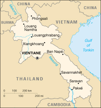
Laos Map


Area:
total: 236,800 sq km
land: 230,800 sq km
water: 6,000 sq km

Capital: Vientiane

Administrative divisions: 16 provinces (khoueng, singular and plural), 1 municipality* (kampheng nakhon, singular and
plural), and 1 special zone** (khetphiset, singular and plural); Attapu, Bokeo, Bolikhamxai, Champasak, Houaphan,
Khammouan, Louangnamtha, Louangphabang, Oudomxai, Phongsali, Salavan, Savannakhet, Viangchan*, Viangchan,
Xaignabouli, Xaisomboun**, Xekong, Xiangkhoang

Climate: tropical monsoon; rainy season (May to November); dry season (December to April)

Terrain: mostly rugged mountains; some plains and plateaus

Elevation extremes:
lowest point: Mekong River 70 m
highest point: Phou Bia 2,817 m

Natural resources: timber, hydropower, gypsum, tin, gold, gemstones

Irrigated land: 1,250 sq km (1993 est.)
note: rainy season irrigation - 2,169 sq km; dry season irrigation - 750 sq km (1998 est.)

Natural hazards: floods, droughts, and blight

Environment - current issues: unexploded ordnance; deforestation; soil erosion; a majority of the population does not have
access to potable water


Population: 5,497,459 (July 2000 est.)

Sex ratio:
at birth: 1.05 male(s)/female
under 15 years: 1.02 male(s)/female
15-64 years: 0.97 male(s)/female
65 years and over: 0.85 male(s)/female
total population: 0.98 male(s)/female (2000 est.)

Infant mortality rate: 94.8 deaths/1,000 live births (2000 est.)

Nationality:
noun: Lao(s) or Laotian(s)
adjective: Lao or Laotian

Ethnic groups: Lao Loum (lowland) 68%, Lao Theung (upland) 22%, Lao Soung (highland) including the Hmong ("Meo")
and the Yao (Mien) 9%, ethnic Vietnamese/Chinese 1%

Religions: Buddhist 60% (in October 1999, the regime proposed a constitutional amendment making Buddhism the state
religion; the National Assembly is expected to vote on the amendment sometime in 2000), animist and other 40%

Languages: Lao (official), French, English, and various ethnic languages

Literacy:
definition: age 15 and over can read and write
total population: 57%
male: 70%
female: 44% (1999 est.)


Economy - overview: The government of Laos - one of the few remaining official communist states - began decentralizing
control and encouraging private enterprise in 1986. The results, starting from an extremely low base, were striking - growth
averaged 7% in 1988-96. Since mid-1996, however, reform efforts have slowed, and the economy has suffered as a result.
Because Laos depends heavily on its trade with Thailand, it was further damaged by the regional financial crisis beginning in
1997. From June 1997 to June 1999 the Lao kip lost 87%, and reached a crisis point in September 1999 when it fluctuated
wildly, falling from 3,500 kip to the dollar to 9,000 kip to the dollar in a matter of weeks. Now that the currency has
stabilized, however, the government seems content to let the current situation persist, despite 140% inflation in 1999 and
limited foreign exchange reserves. A landlocked country with a primitive infrastructure, Laos has no railroads, a rudimentary
road system, and limited external and internal telecommunications. Electricity is available in only a few urban areas.
Subsistence agriculture accounts for half of GDP and provides 80% of total employment. For the foreseeable future the
economy will continue to depend on aid from the IMF and other international sources; Japan is currently the largest bilateral
aid donor; aid from the former USSR/Eastern Europe has been cut sharply. As in many developing countries, deforestation
and soil erosion will hamper efforts to attain a high rate of GDP growth.


Illicit drugs: world's third-largest illicit opium producer (estimated cultivation in 1999 - 21,800 hectares, a 16% decrease
over 1998; estimated potential production in 1999 - 140 metric tons, about the same as in 1998); potential heroin producer;
transshipment point for heroin and methamphetamines produced in Burma; illicit producer of cannabis

MENU