
| The 2002 10 GHz and Up Cumulative Contest | |
|
In the year 2002, I got my first real exposure to operating on the 10 GHz band.
The Northern Lights Radio Society
members had been talking a lot about the fun of
getting on this band, and the first few members to venture into these frequencies
gave lots of generous support to others who had an interest but had not yet taken
the plunge.
For the first few years, wide-band FM was the rage, because the gear was relatively easy to build with available surplus parts (Gunnplexers) and kits (Ramsey Electronics 10 meter IF receiver). These rigs got a lot of people on the air, although the performance was not terrific. There was (and still is) commercial gear for 10 GHz and 24 GHz WBFM operation, but the cost-to-performance level leaves something to be desired. The NLRS folks closer to the leading edge of the curve had graduated to transverter systems from Down East Microwave and from SSB Electronics for all-mode (CW, SSB, NBFM) use. Such systems have far superior performance, albeit at a higher price tag and complexity level. I managed to borrow a WBFM Gunnplexer system from Donn, WA2VOI/Ø for this contest, and had a fair bit of fun running around to some of the 10 GHz sites that the NLRS folks had scouted out over the years. Of course, being WBFM, it didn't take me too long to exceed the working range of the unit, but at least I got the exposure, and gave out a few 100-point multipliers to other club members, plus a few measly distance points to boot. But it was a start. My totals for the 2002 contest were 555 points, (55 distance points and 500 QSO points), with only 6 QSO's made, and a maximum distance of 20 Km. Look for KBØZEV in 16th (last) place in call district Ø in the 10 GHz Only category (95th place of 106 entrants from all call districts in this class).
Although I did not participate in the NLRS North Shore expedition in 2002, a lot
of NLRS folks did, and here is a web link to some words and pictures about that
trip: |
|
| The 2003 10 GHz and Up Cumulative Contest | |
|
In the year 2003, I managed to borrow a narrow-band 10 GHz transverter unit from
Bob, WØAUS. This was his "spare" homebrew unit. It has modest power output,
about 250 to 300 mW, and instead of a 30-ish dB gain parabolic dish antenna, it used
a lower-gain horn (20 dB gain). The horn antenna makes the system simpler and
easier to point, but also imposes a significant (10 dB or so) performance penalty on
both transmit and receive.
Nevertheless, this system was "head and shoulders" superior to the WBFM unit I had borrowed in the previous year. Unfortuntely, work committments prevented me from joining the NLRS on their Lake Superior "expedition" for the contest, so I only worked one weekend of the contest, over modest paths. But my enjoyment level, and my contest score, were exponentially greater than the year before. I had been bitten by the bug. I decided I would put together a system for the next year's contest. My totals for the 2003 contest were 2,856 points, (1,556 distance points and 1,300 QSO points), with 35 QSO's made, and a maximum distance of 138 Km. Look for WØJT in 22nd place (next-to-last place) in call district Ø in the 10 GHz Only category (93rd place of 105 entrants from all call districts in this class).
Although I did not participate in the NLRS North Shore expedition in 2003, here are
some web linksto some words and pictures about that trip: |
|
|
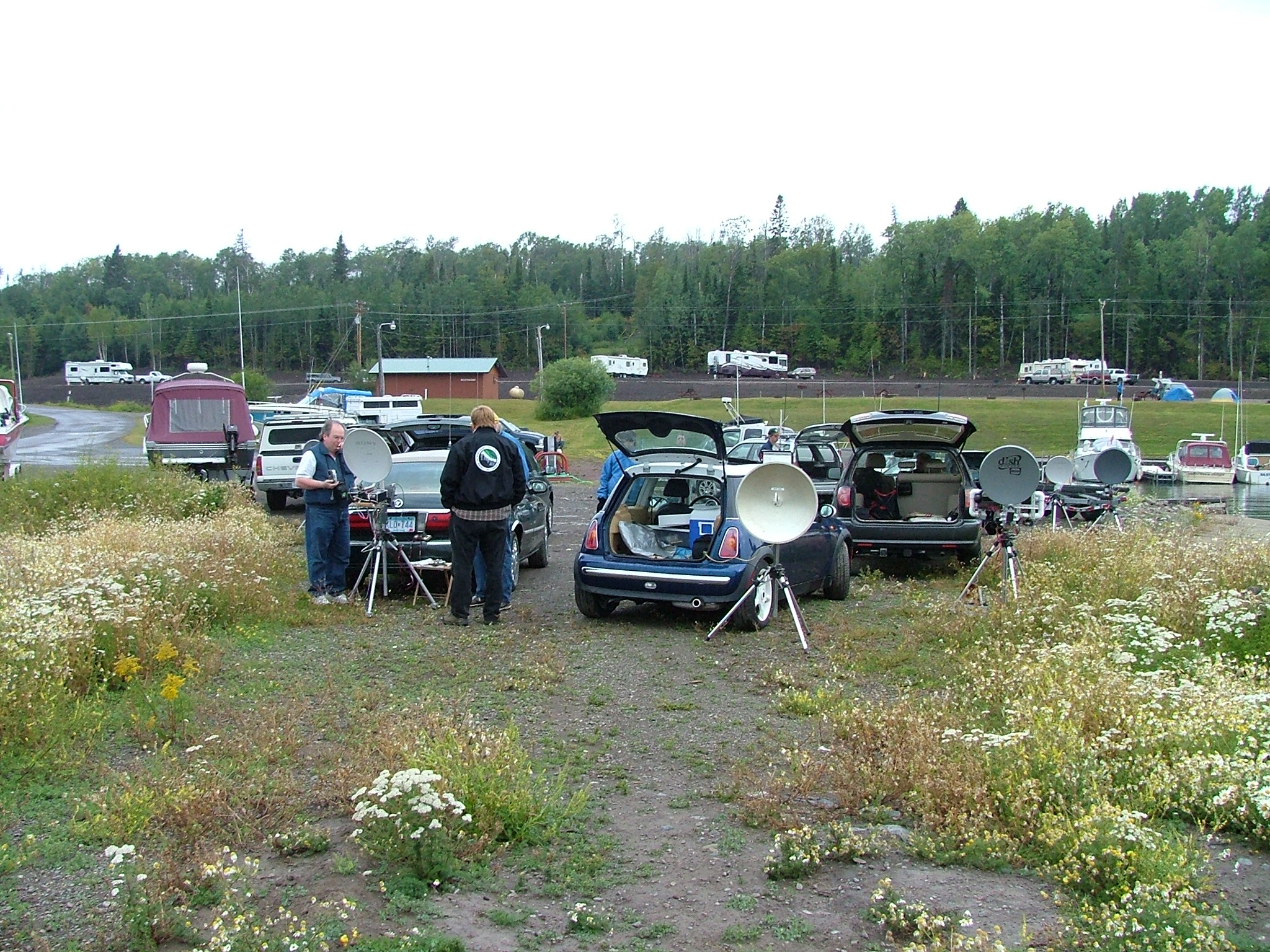
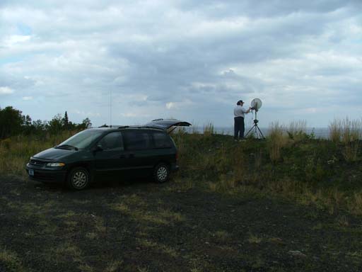
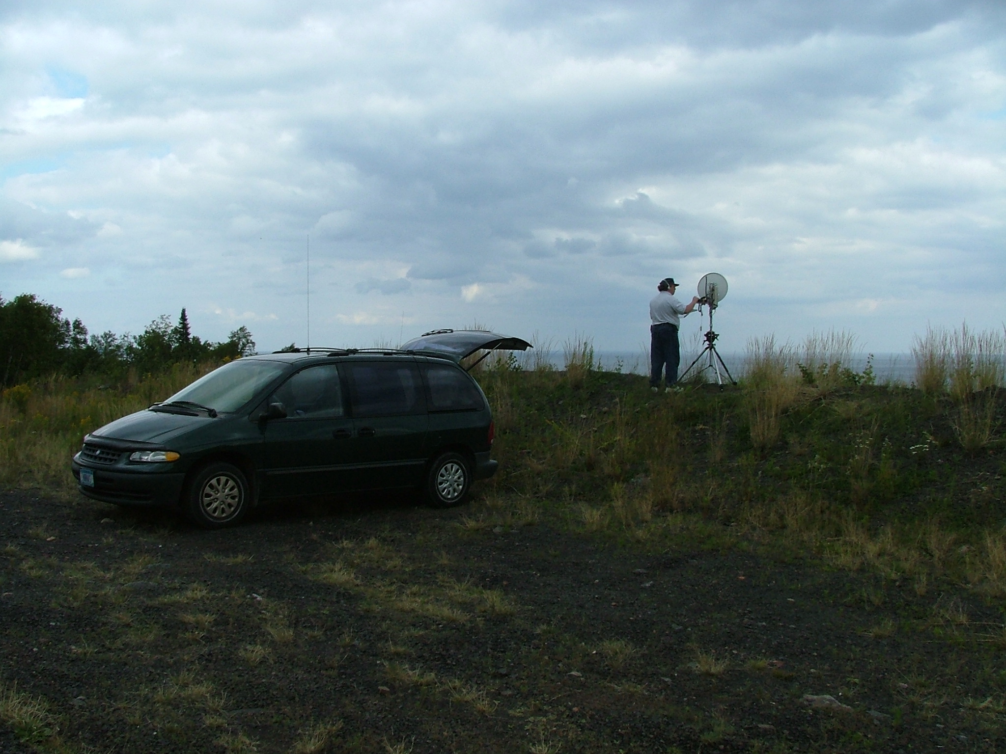
The 2004 10 GHz and Up Cumulative Contest Preparations: Building the System |
|
|
|
|
Photo goes here 512 x 384 1024 x 768 2048 x 1536 |
Descriptive text goes here. |
|
The 2004 10 GHz and Up Cumulative Contest Preparations: Testing the System |
|
|
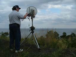
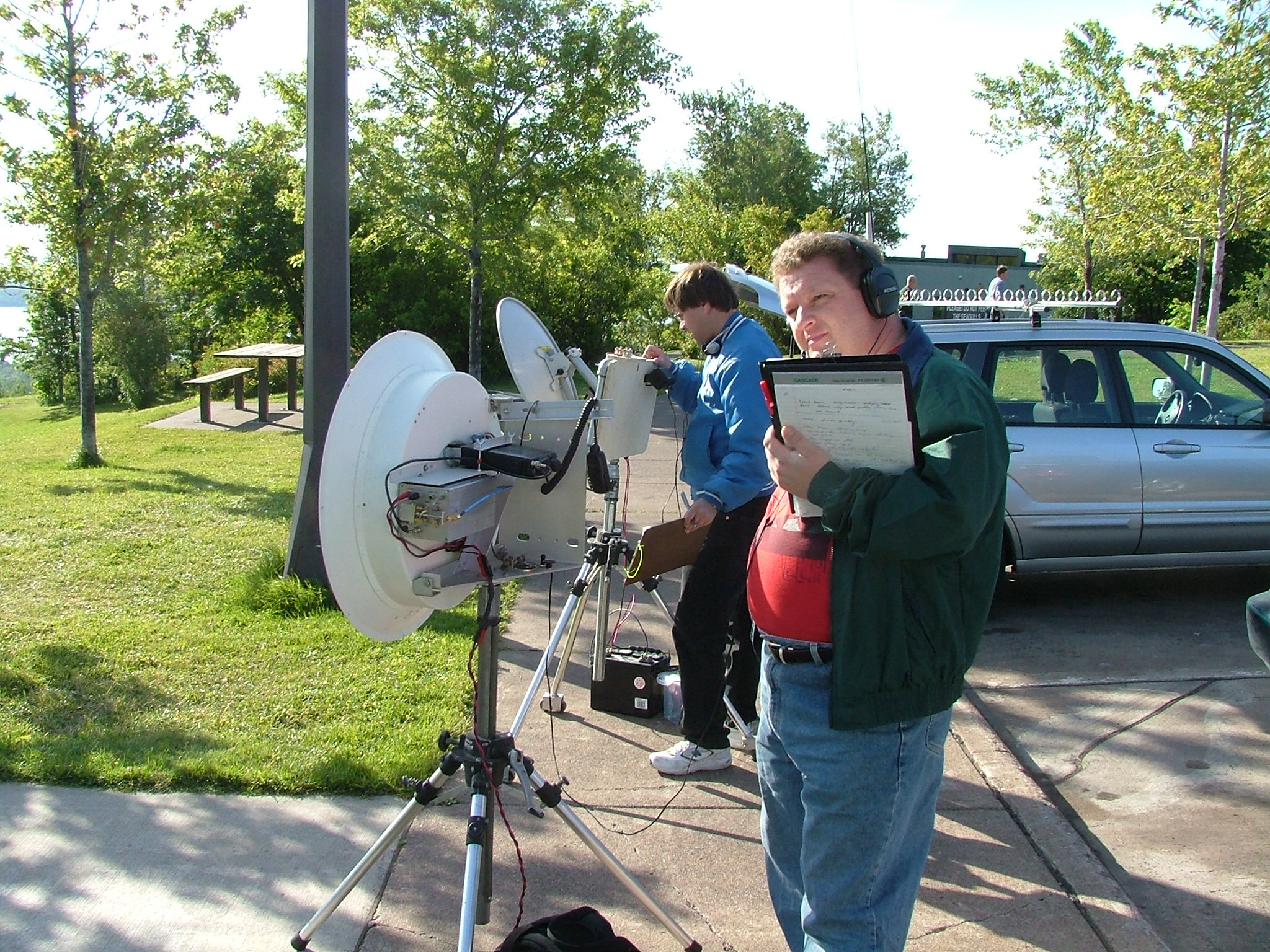
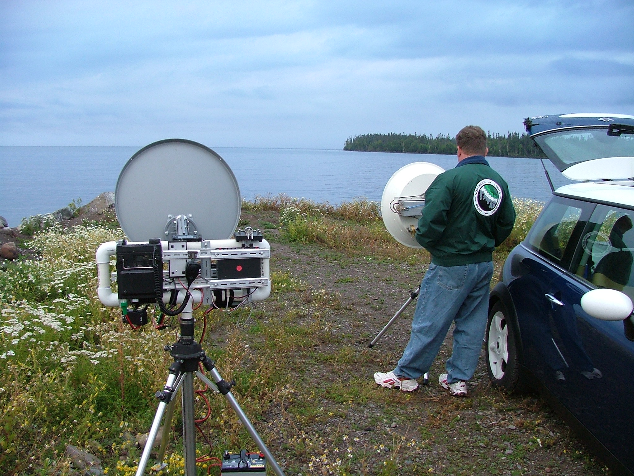
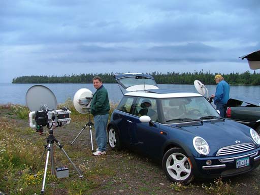
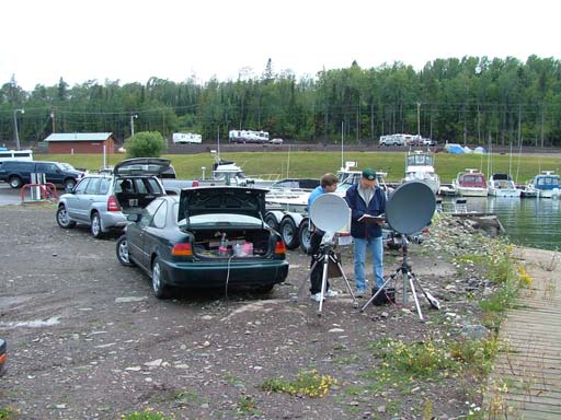
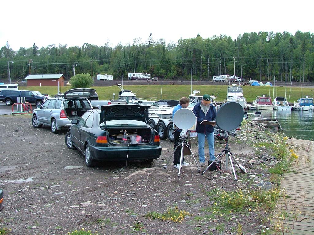
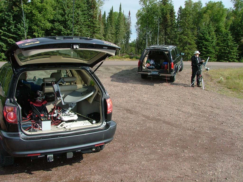
After the equipment was assembled, it was time to give it a real test. I had proved
that the system had basic functionality by bringing it out to the Nokomis Coffee
House and setting it up 20 feet away from a couple of other 10 GHz systems, and I
verified that it did indeed receive and transmit. The next test was to try to check
in to the NLRS 10 GHz Net by bouncing my signal off the downtown Minneapolis skyline.
This net is held most Friday afternoons, at least when the weather is mild enough to
permit it.
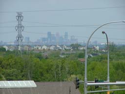
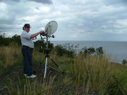
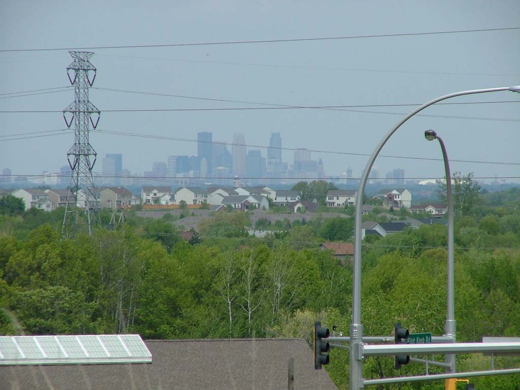
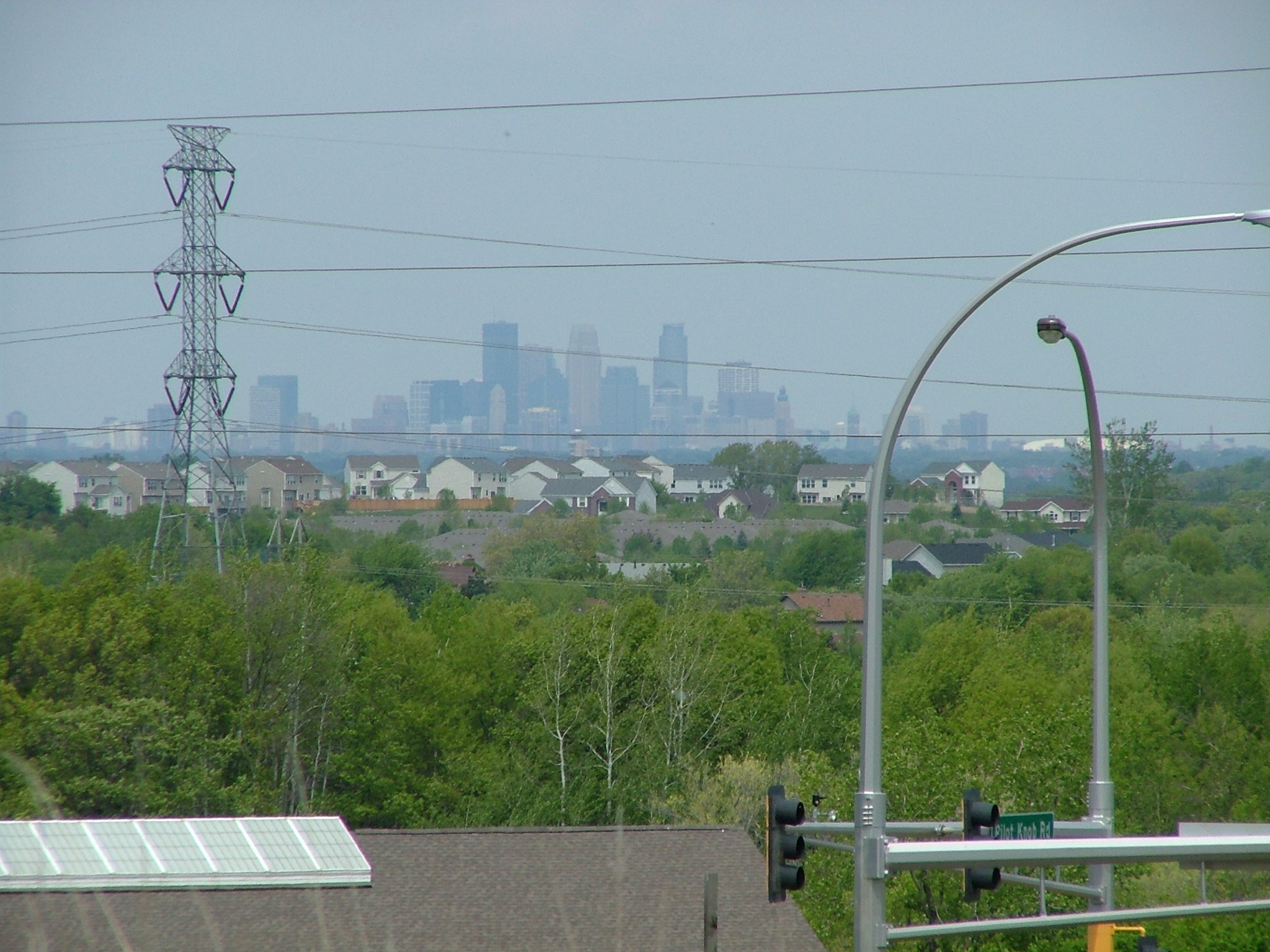
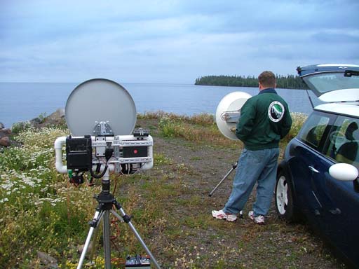
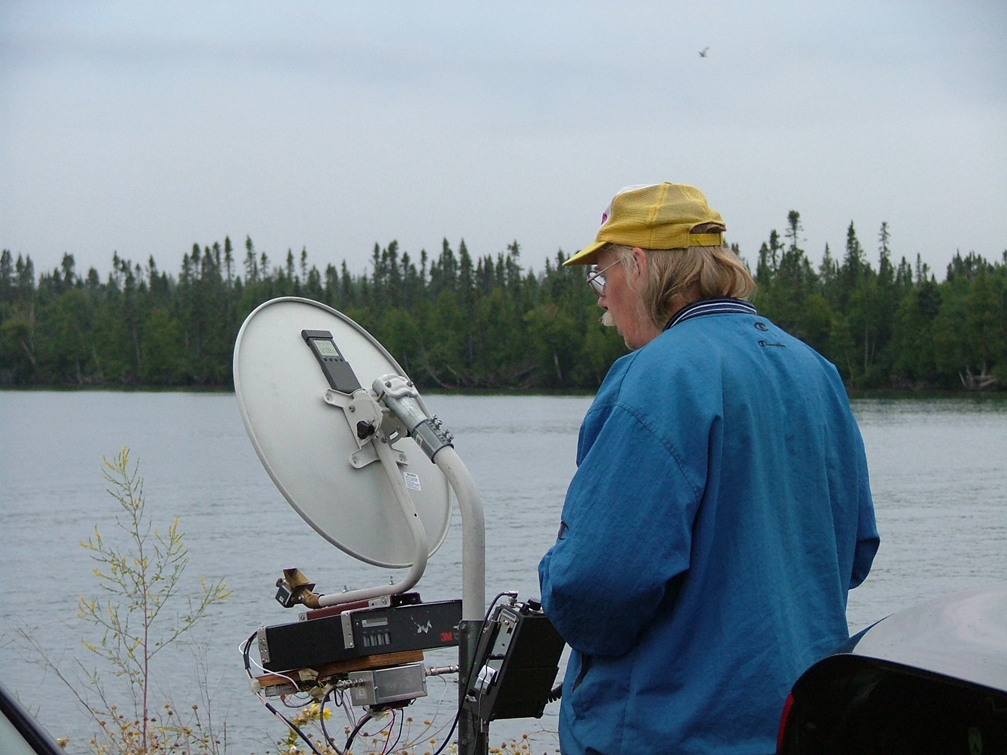
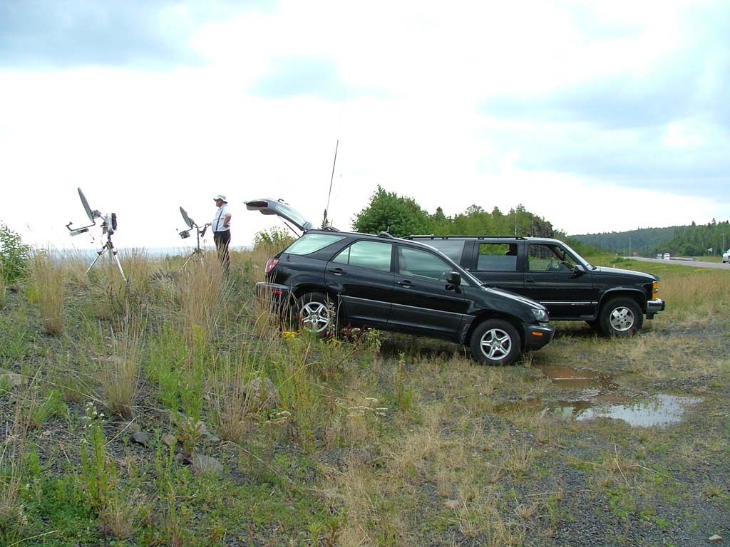
I knew there was no hope of checking in from my home location, but I had seen a very promising spot a few miles from home. Just a short drive north on Pilot Knob Road and over the border from Apple Valley into Eagan, MN, there is a spot with a good view of downtown Minneapolis. There is a side road called Camelback Drive that runs parallel to Pilot Knob Road for a short distance, and has the view of downtown that I needed. I set up, and made my first contact by downtown building bounce over a significant distance, sort of. I heard the other net check-ins easily, but when I tried to check in, my lead-acid gel-cell battery didn't have enough power left in it to transmit for more than a few seconds. I was heard and recognized, but didn't really have a proper check-in. I responded to Donn's call on the 2 meter liason frequency and confirmed that it was indeed me who was trying to check in, and told him of my battery problems. It was at this point that I vowed to add the W4RAY battery booster to my system before the contest, to help with low-voltage situations. As it would turn out, I needed more than a battery re-charge and the W4RAY battery booster. I needed a more robust battery than my puny 8 amp-hour gel cell. Knowing how much Murphy enjoys following me on ham radio expeditions, I also picked up a 31 amp-hour gel cell battery from Batteries Plus. There are bigger units availble, but this old man with creaky joints isn't interested in carrying anything that is heavier than that beast. |
|
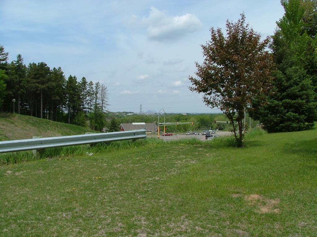
 512 x 384 1024 x 768 2048 x 1536 |
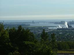
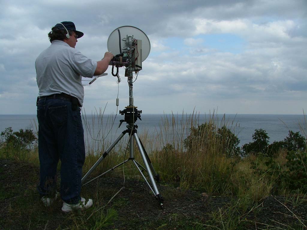
Wide-angle view of downtown Minneapolis from my net check-in site in Eagan. This is pretty much the way it looks to the eye as you stand in position facing the downtown buildings from behind the 10 GHz transverter system. The road intersection visible ahead of you and down the hill is Cliff Road (going left-to-right or west-to-east) with Pilot Knob Road (going north-to-south). |
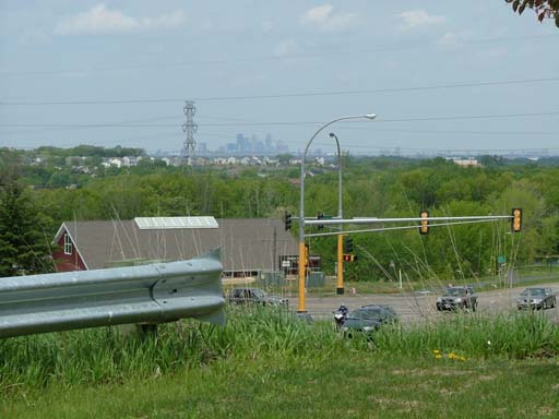
 512 x 384 1024 x 768 2048 x 1536 |
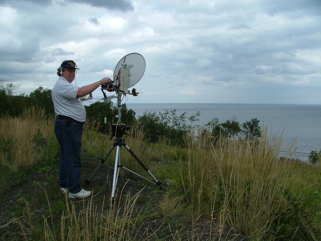
Medium-angle view of downtown Minneapolis from my net check-in site in Eagan. In this view, I have zoomed in about mid-way on the range of my camera system's zoom range, and now it is easier to see the downtown buildings in the distance. |
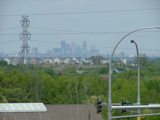
 512 x 384 1024 x 768 2048 x 1536 |
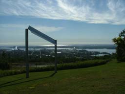
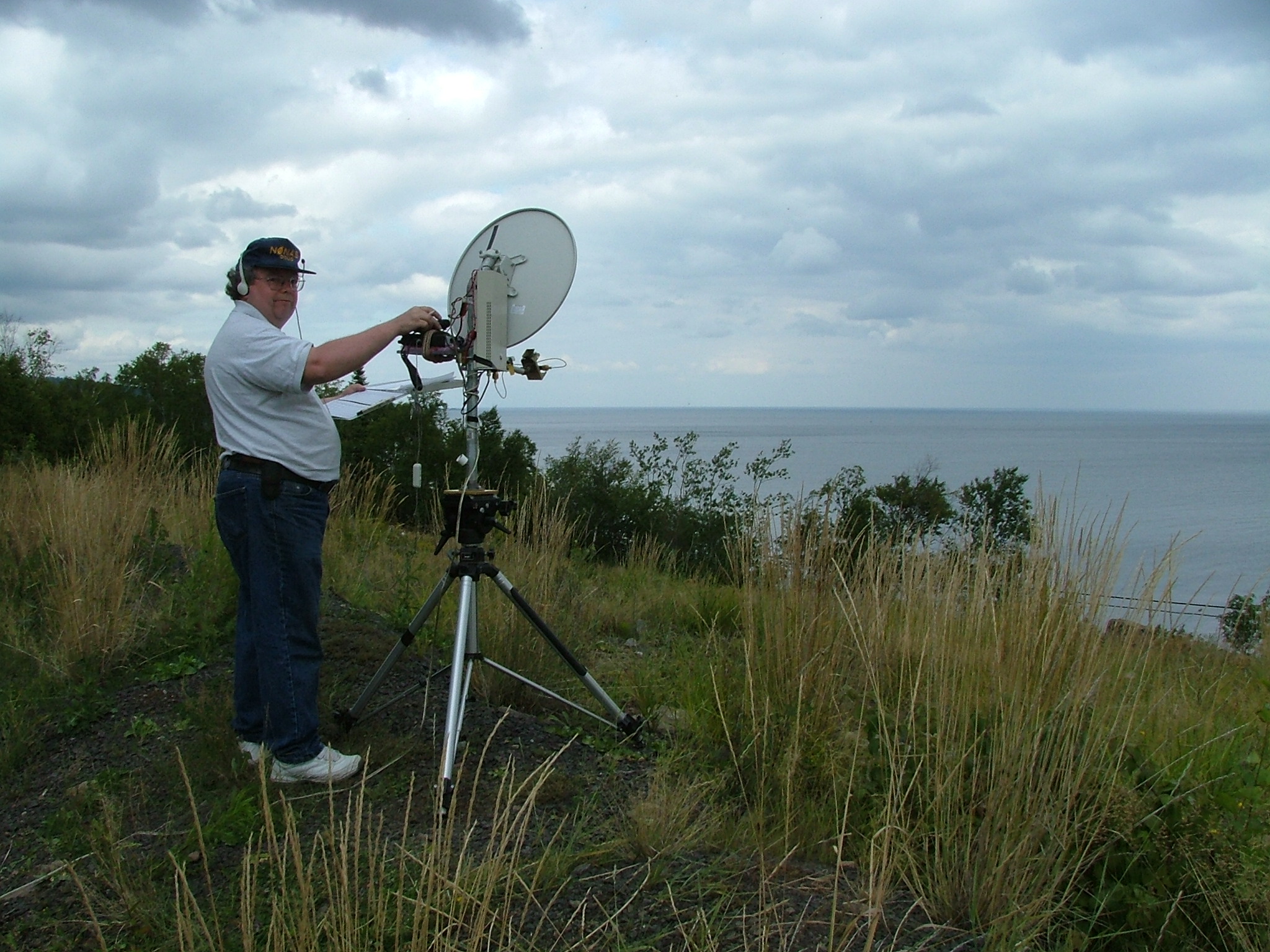
Narrow-angle view of downtown Minneapolis from my net check-in site in Eagan. The camera is at maximum zoom, and the downtown skyline is clearly visible. |
|
The 2004 10 GHz and Up Cumulative Contest Weekend One -- Expedition to the North Shore of Lake Superior |
|
|
Now, it's time for the real test -- operating in the 10 GHz and Up Cumulative
Contest, with my own gear, with the Northern Lights Radio Society, shooting signals
across Lake Superior.
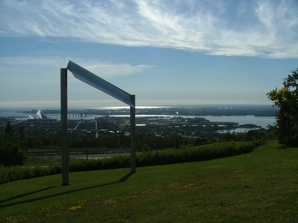
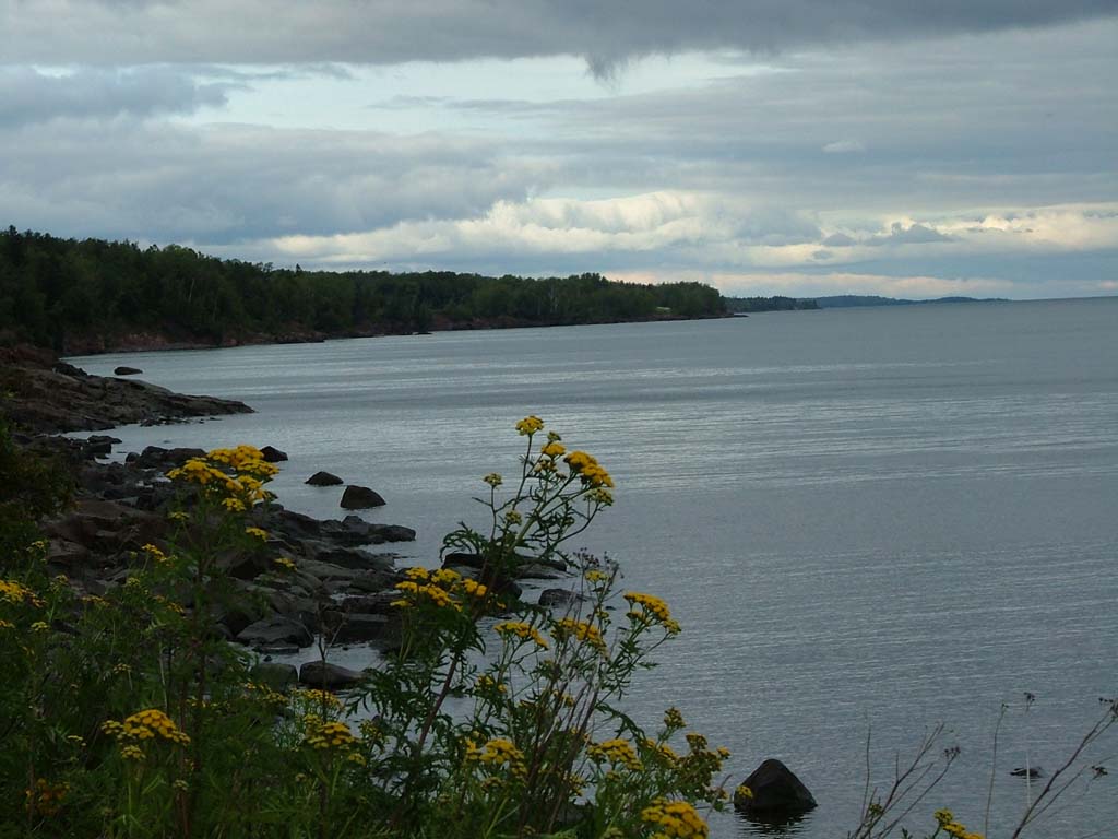
For those of you who are not experienced with 10 GHz operation, you may be asking, "Why shoot across Lake Superior?". The answer is fairly straightforward. In this contest, scores are strongly influenced by the distance in kilometers between each station for each contact made. Longer paths mean more points. At these frequencies, however, an unobstructed path between the two stations is the norm, because these signals are highly attenuated by hills, foliage, etc. Out West, it is typical for teams to set up on the tops of high mountains, so that they have a line-of-sight shot to many distant stations. If you have ever visited Minnesota, you know that our complement of high mountains is in quite limited supply (to say the least). So we figured that the next best thing to getting a long-distance line-of-sight path was to aim over an extremely flat surface, such as Lake Superior. It certainly meets the criterion of flat, subject to the limitation of the Earth's curvature, and it doesn't have trees or hills sticking out of the middle of it to obstruct the radio path. And being the largest body of fresh water in the world, it also would qualify as being big enough for serious scores to be gained. Hence, our plans to go there. One team took the North Shore, and one team took the South Shore. The South Shore team operated from the Upper Peninsula of Michigan.
Here are some links to web pages by other Upper Midwest participants in this year's contest: |
|
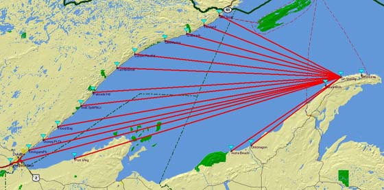
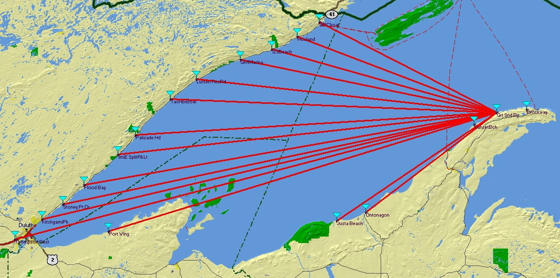
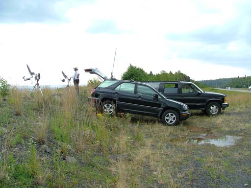
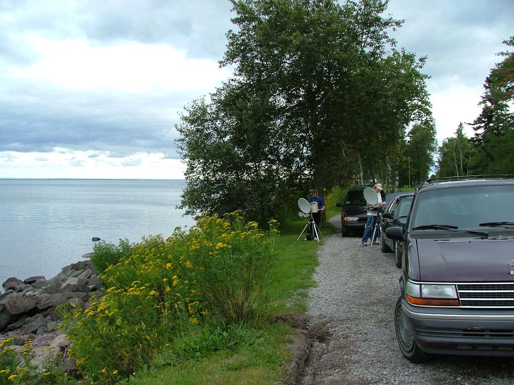
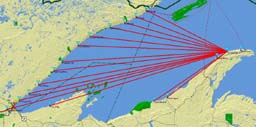 560 x 278 1121 x 557 Map kindly supplied by W9FZ |
Overview
Here is a map of Lake Superior from the 2003 NLRS Expedition. It gives you a good idea of the strategy. The North Shore team makes numerous stops along the North Shore of Lake Superior, while the South Shore team stays in place. Then the North Shore team works back down the North Shore after the South Shore team has had a chance to move to a new location. The whole process can be repeated on the second day of the weekend. In practice, the North Shore team actually ran from the Thompson Rest Area (slightly southwest of Duluth) up as far as Grand Marais on Saturday while the South Shore team worked from Great Sand Bay. While the North Shore team took a dinner break, the South Shore team repositioned to Mount Brockway, and then the North Shore team worked them at their new location and called it a night. On Sunday morning, the North Shore team started at Grand Portage (far NorthEast corner of the Minnesota border, a stone's throw from Canada), while the South Shore team started at Sunset Bay Campground. The North Shore team then worked our way back to the Thompson Rest Area, and when we arrived there late on Sunday, a few members of the South Shore team moved back to Mount Brockway for some final QSO's. |
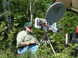
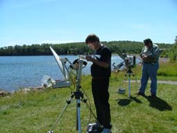
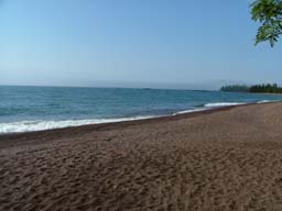
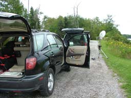
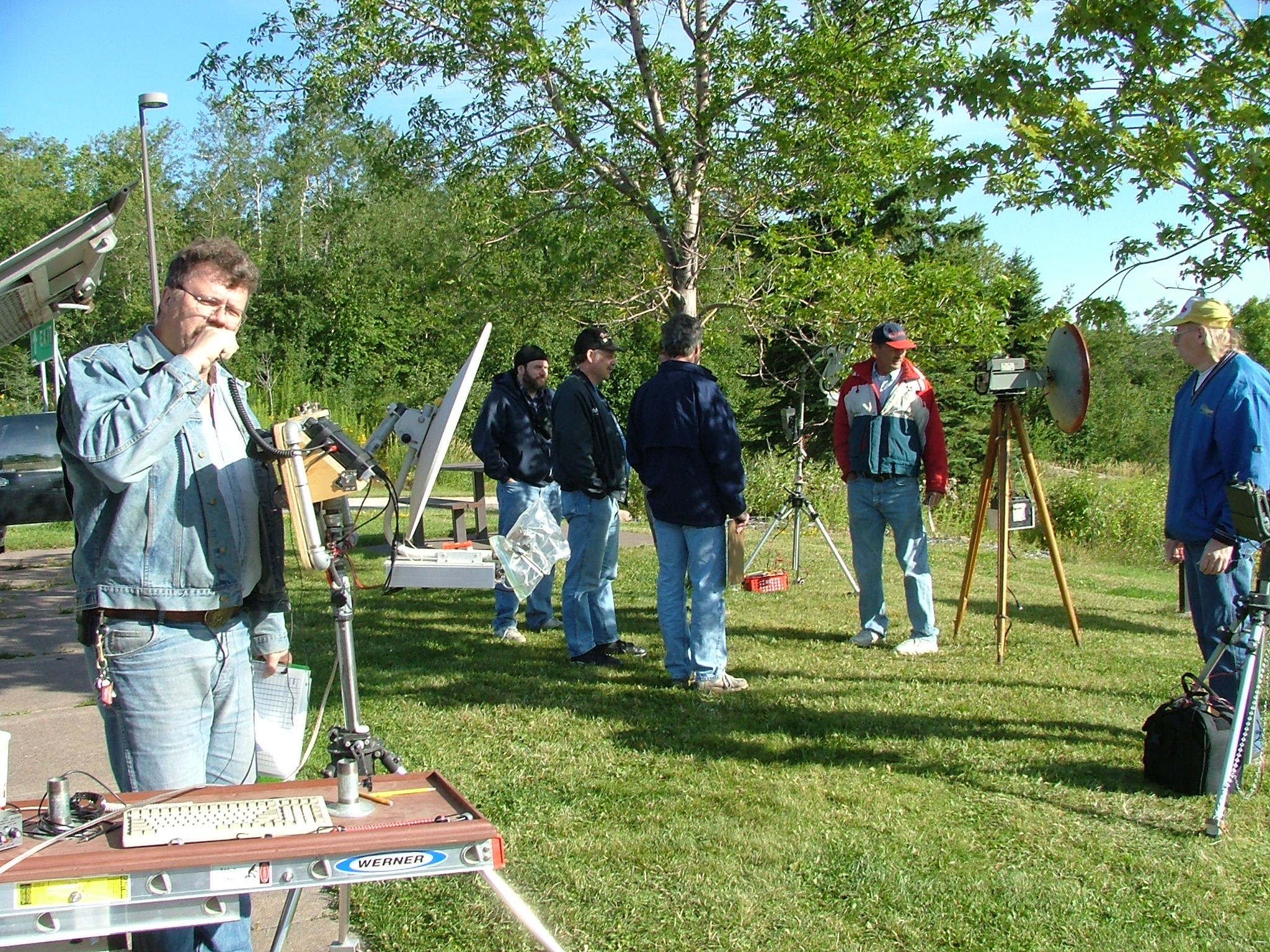
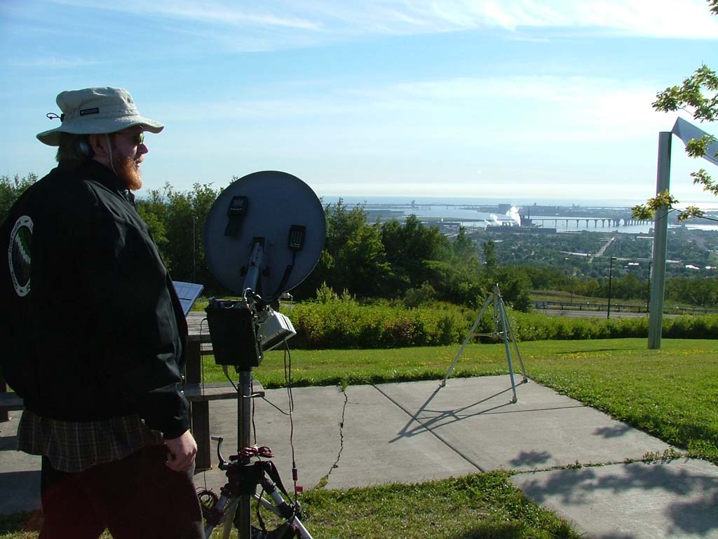
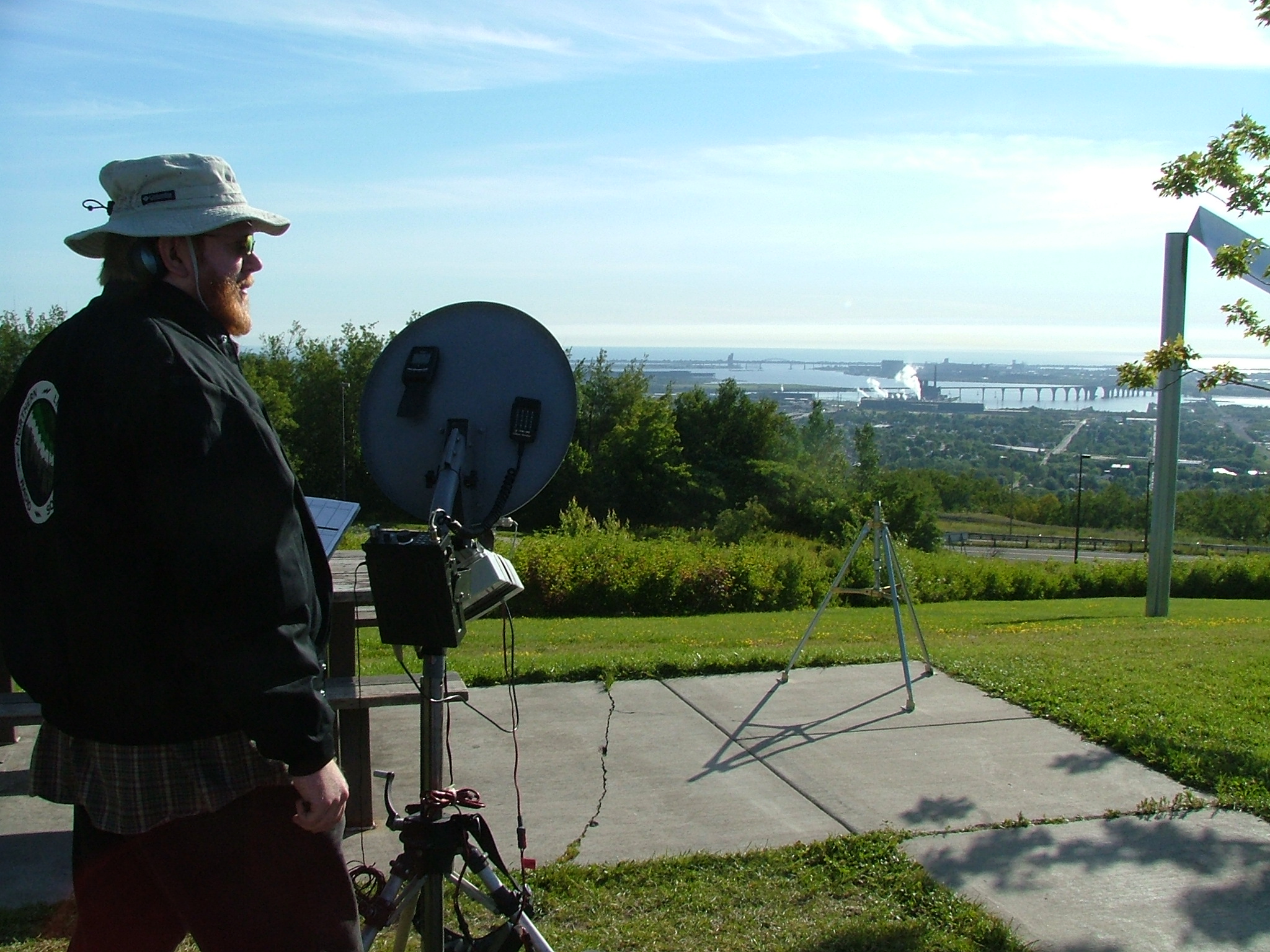
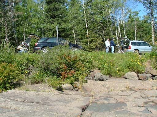
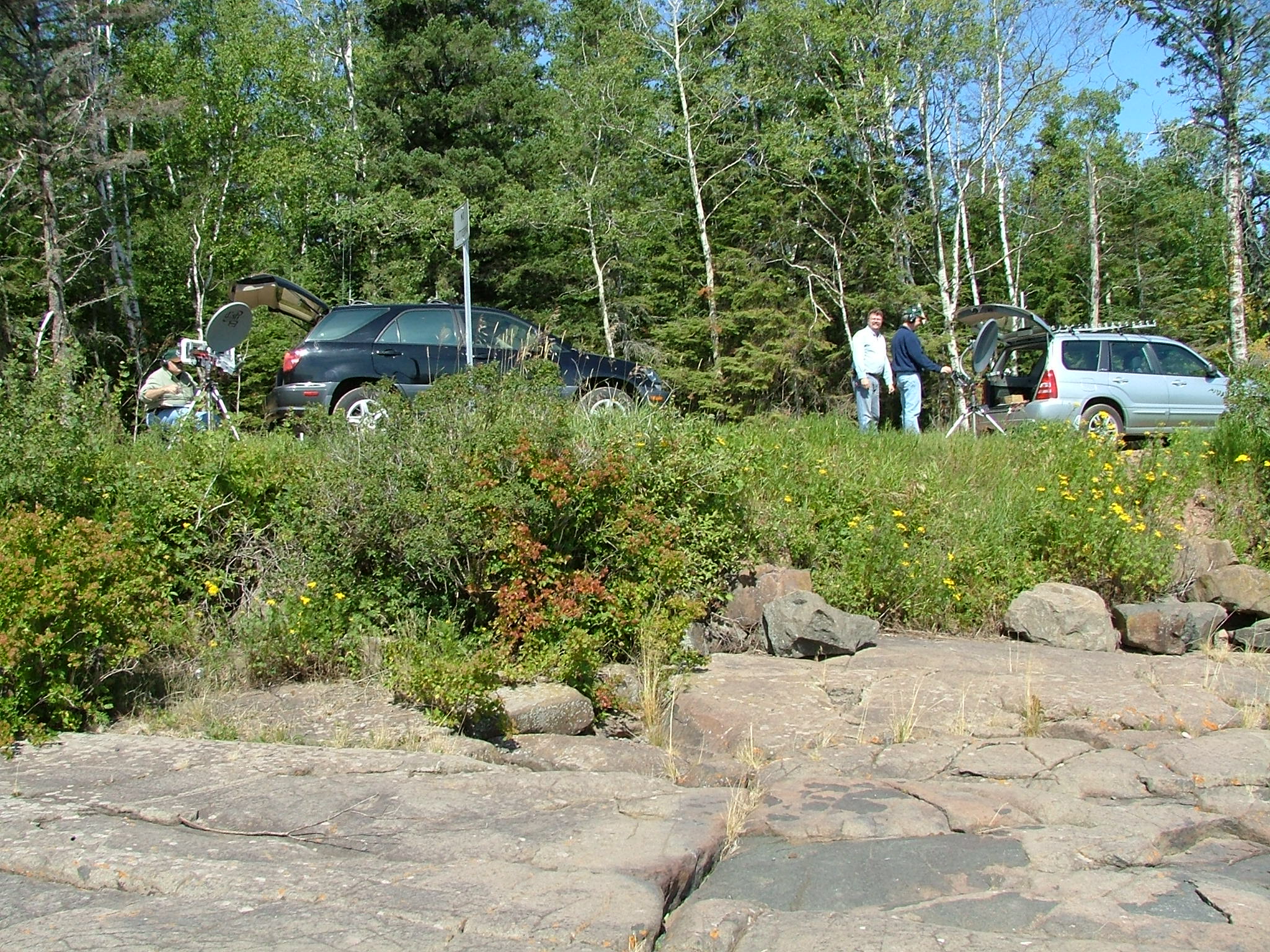
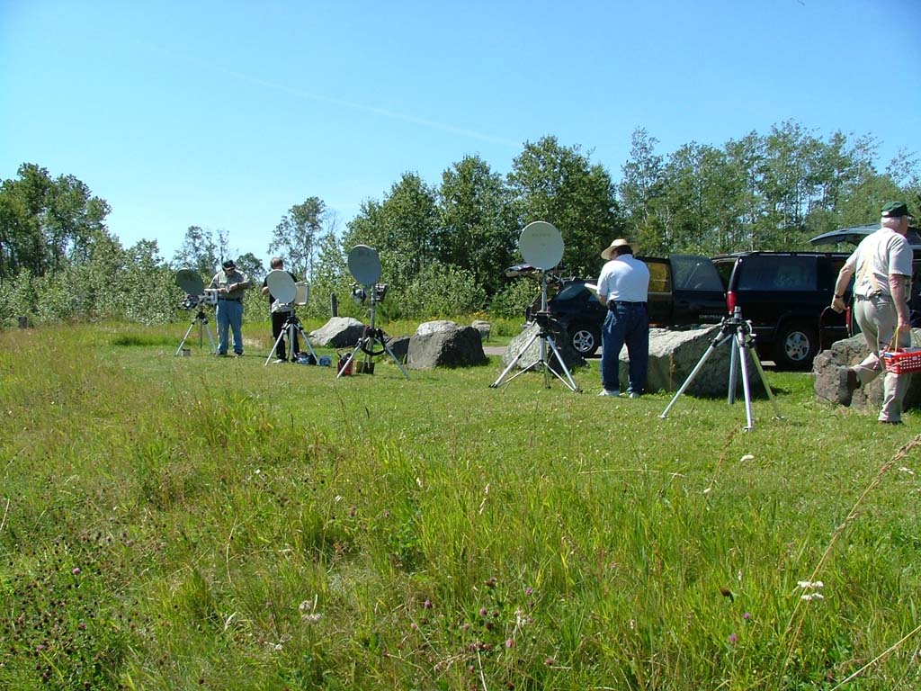
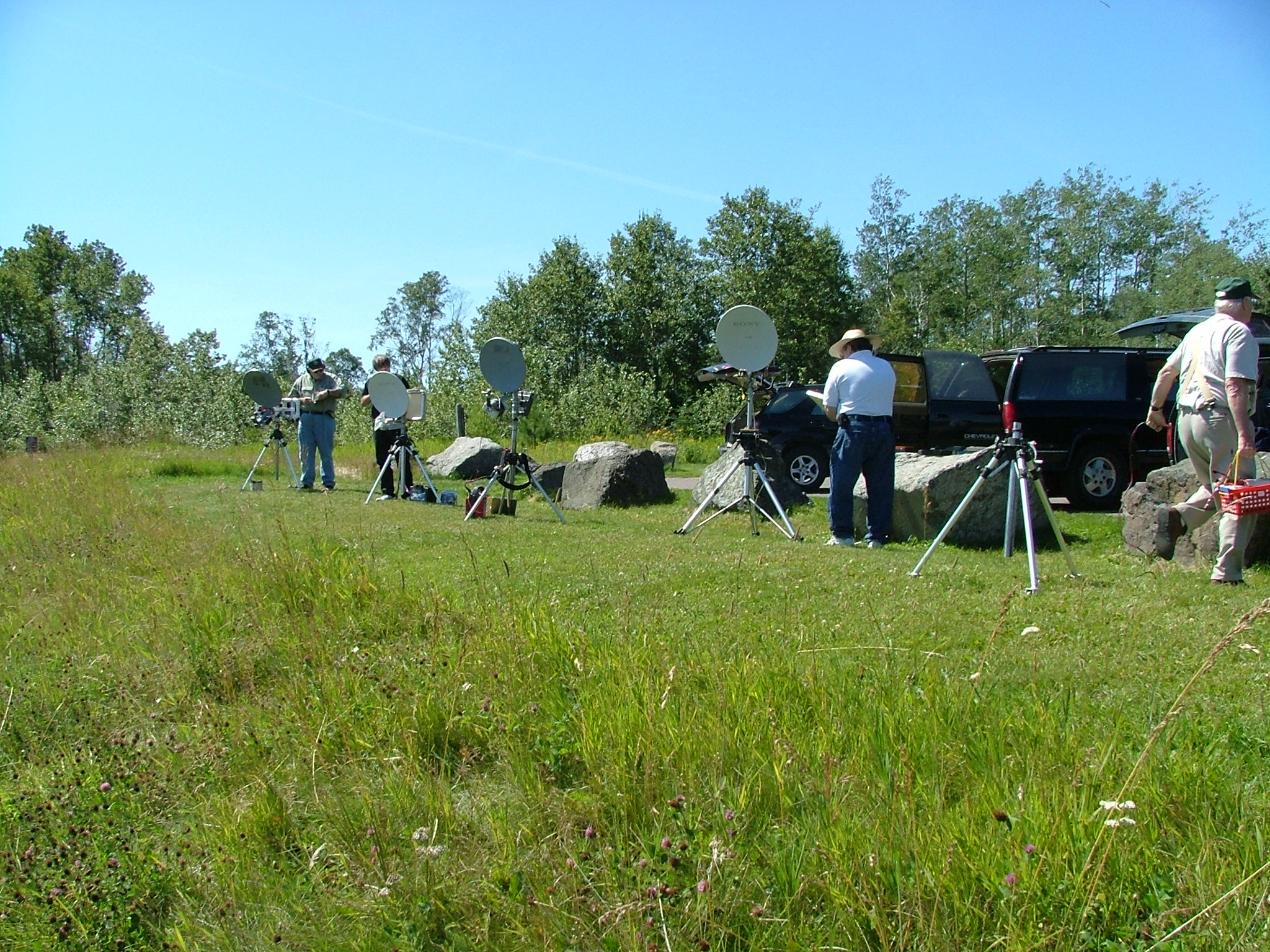
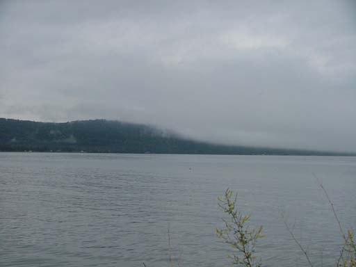
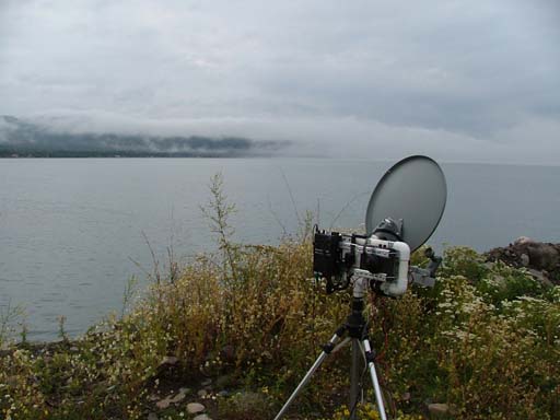
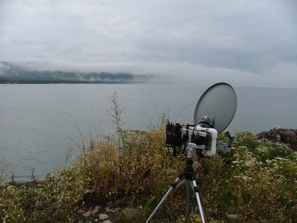
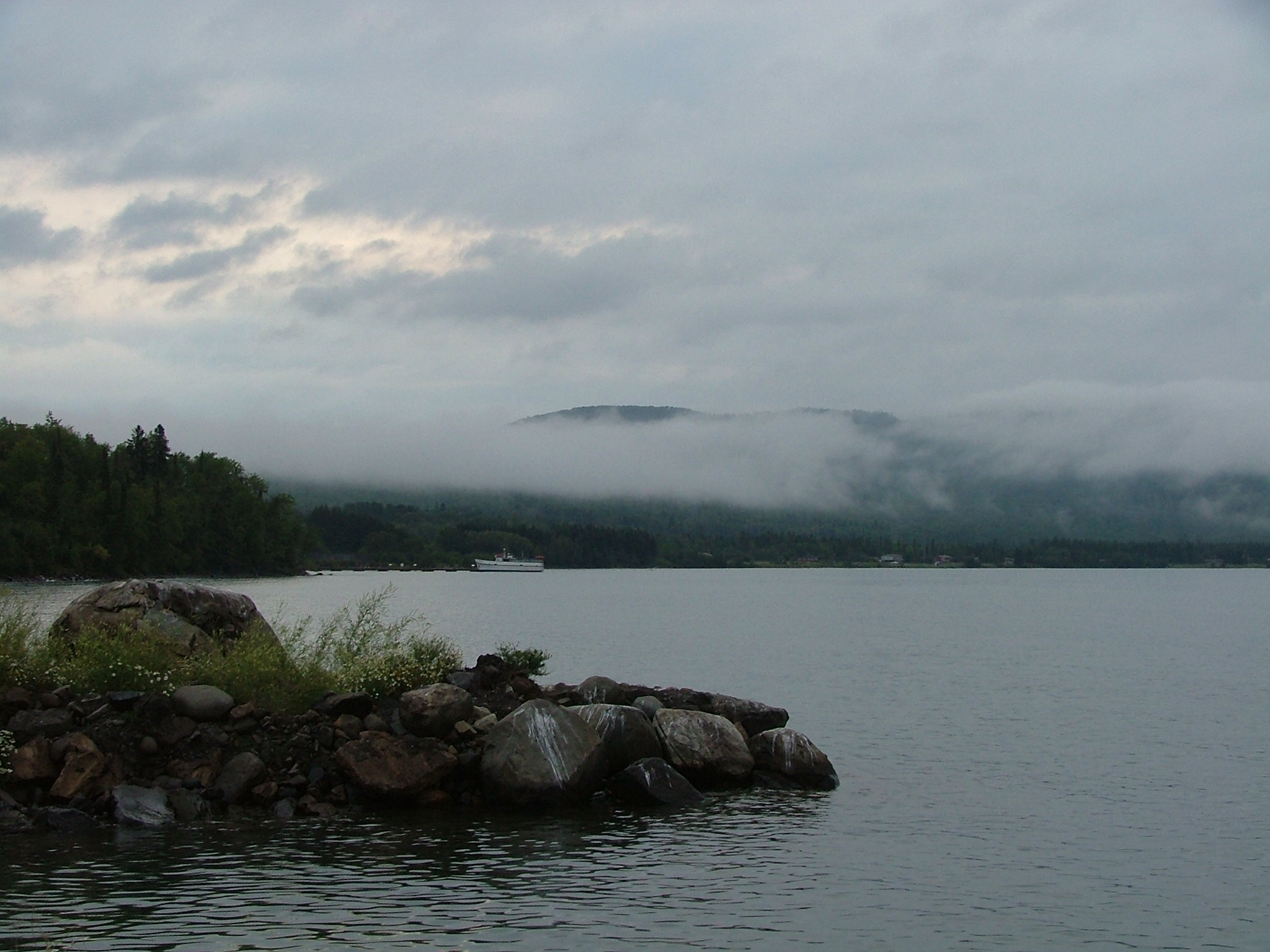
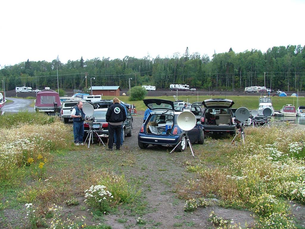
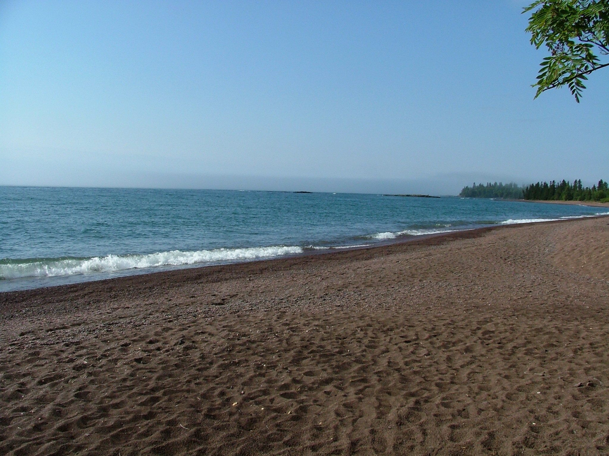
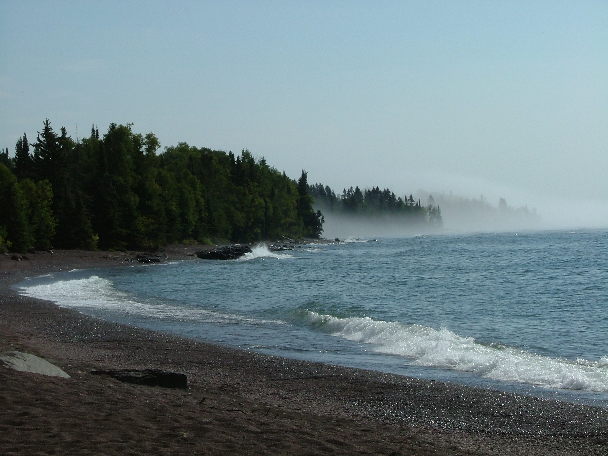
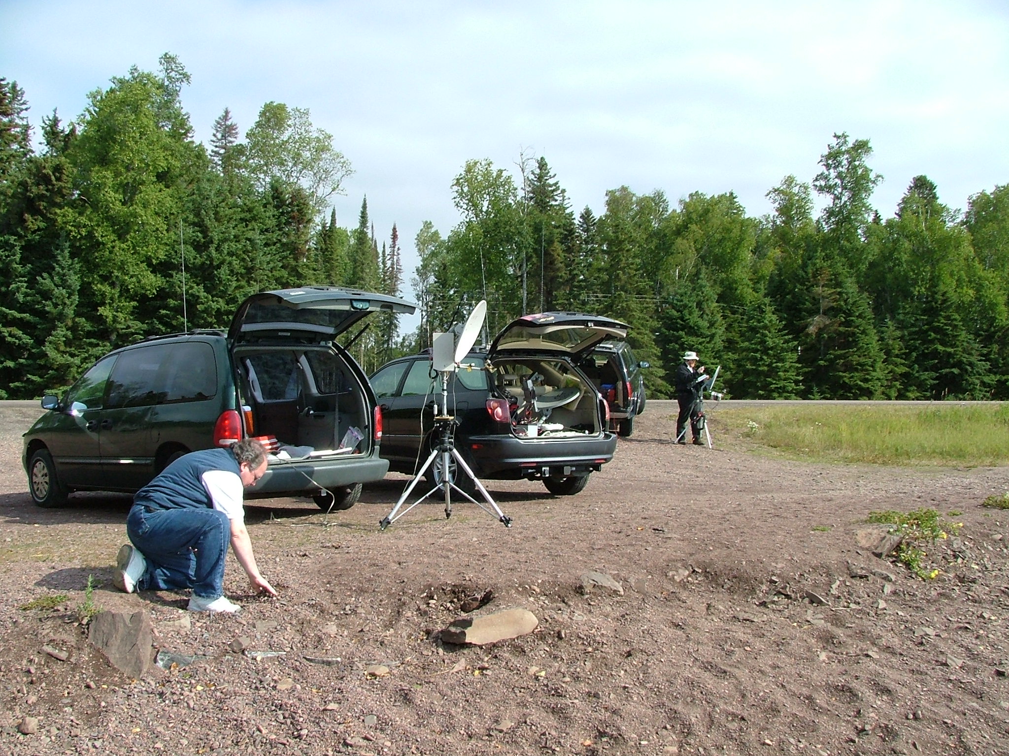
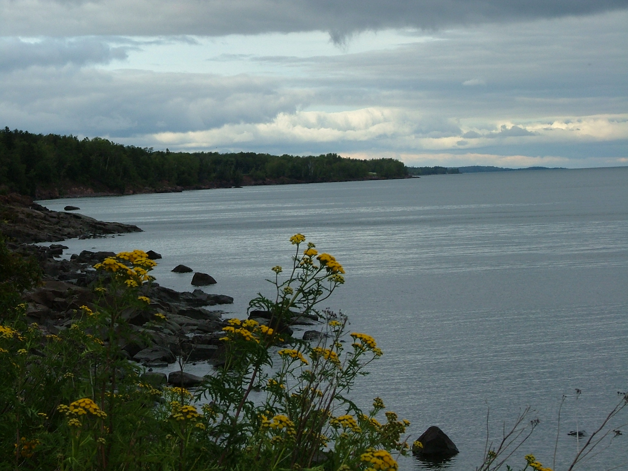
 512 x 384 1024 x 768 2048 x 1536 Photographed on 08/21/2004 at 07:52 AM by WØJT |
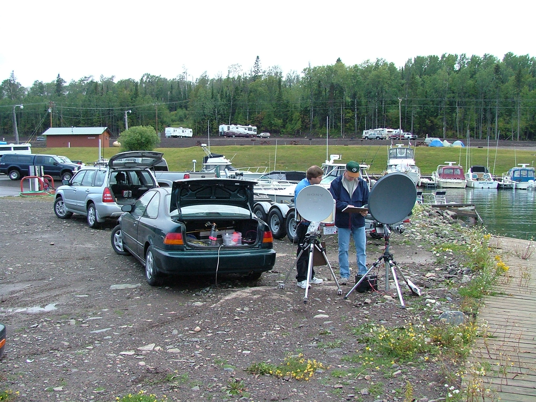
EN36VR: Thompson Rest Stop
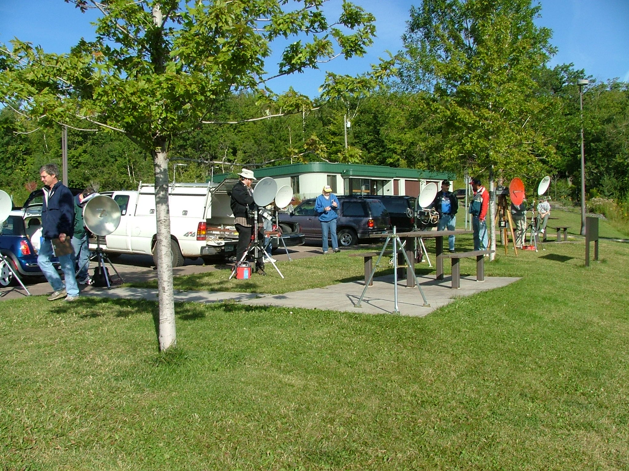
My wife and I arrived at our hotel late Friday night, without actually knowing just where the Thompson Rest Area was located, but trusting that my GPS would get us there, since we had the coordinates saved. As it turned out, our hotel was about a mile away from our first operating spot, so we easily arrived there by the 07:00 AM starting time that had been agreed upon in advance. It was cold, windy, and overcast. It took much longer than expected to make the first QSO, as signals were initially very weak. We also had a lot of problems executing our plan to use two different operating frequencies (10368.1 and 10370.1 MHz) so that we could work twice as fast. We eventually decided it was too chaotic, and moved to a single frequency of operation. As it would turn out, our single frequency was about 40 KHz above the calling frequency of 10368.1 MHz, which would end up preventing us from making any contacts with a couple of other operators in Wawa, Ontario. From Thompson to Wawa (EN77nw) would have been a 570 Km path, and if we had been able to do it, my score would have been boosted by 1340 points! Here you see NØKP calling the South Shore team, while other members of the NLRS North Shore team mill about in the background. Some are also talking with a few hams who were not part of our group, who happened to walk over to ask what we were doing. |
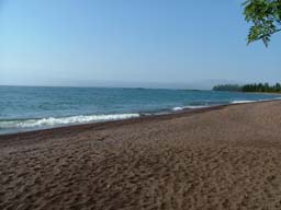
 512 x 384 1024 x 768 2048 x 1536 Photographed on 08/21/2004 at 07:53 AM by WØJT |
EN36VR: Thompson Rest Stop
Here is NØUK making a contact on the South Shore. Behind him is KCØIYT, who is waiting his turn to do the same. |
 512 x 384 1024 x 768 2048 x 1536 Photographed on 08/21/2004 at 07:53 AM by WØJT |
EN36VR: Thompson Rest Stop
Here is KBØOZN waiting for his turn to contact the South Shore team. |
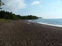
 512 x 384 1024 x 768 2048 x 1536 Photographed on 08/21/2004 at 07:53 AM by WØJT |
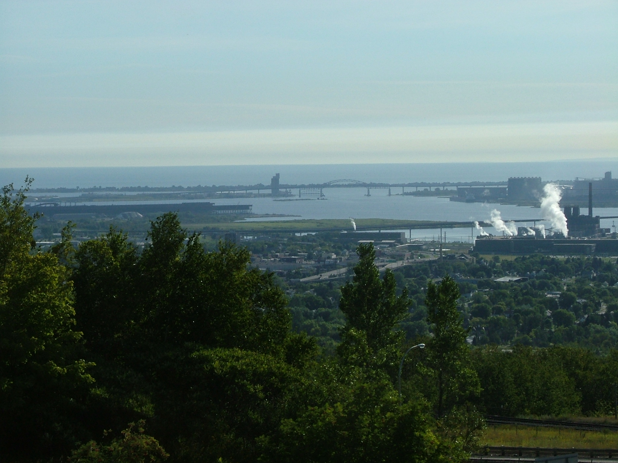
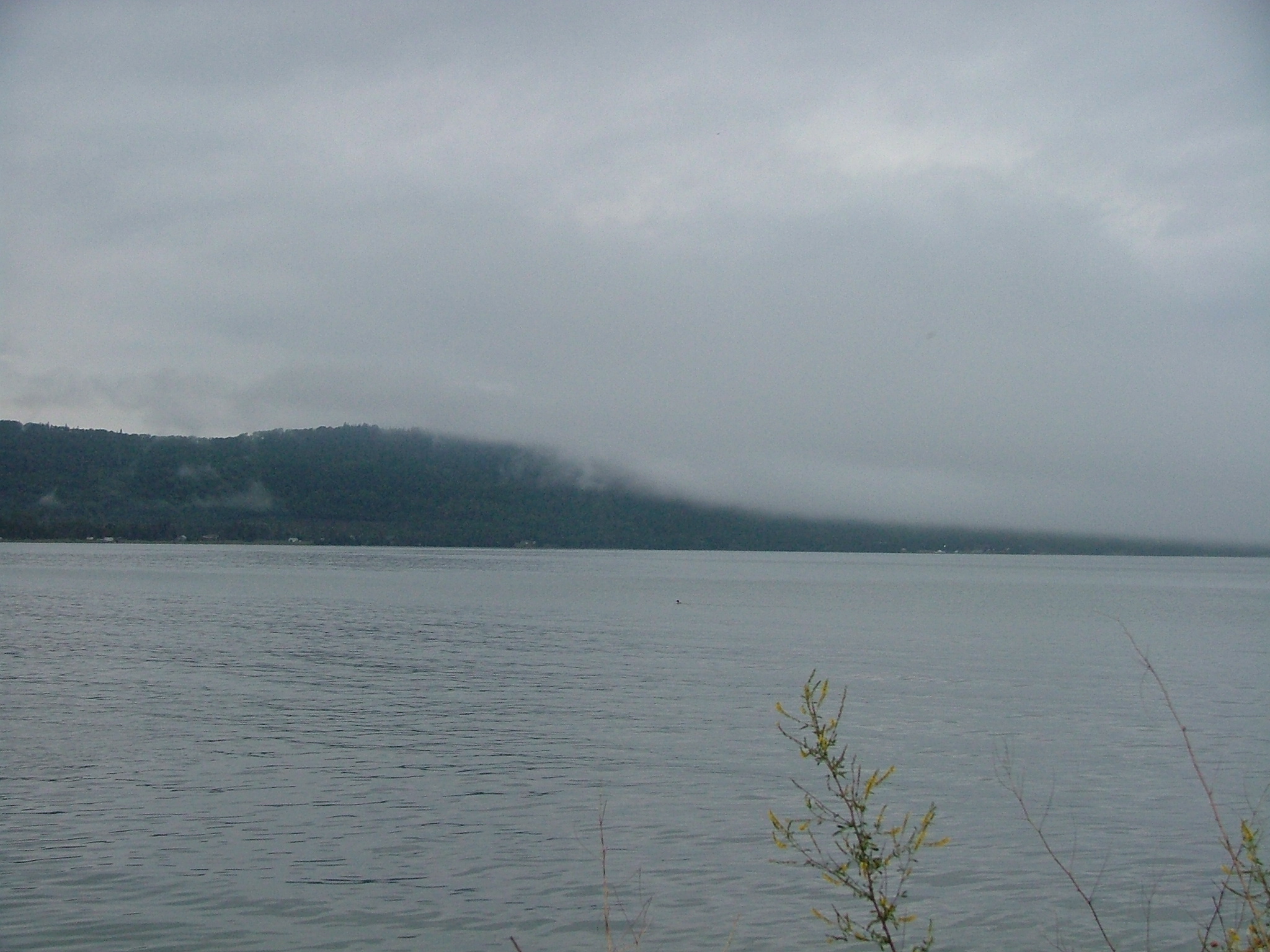
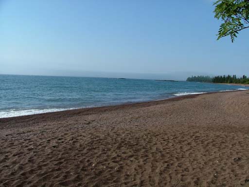
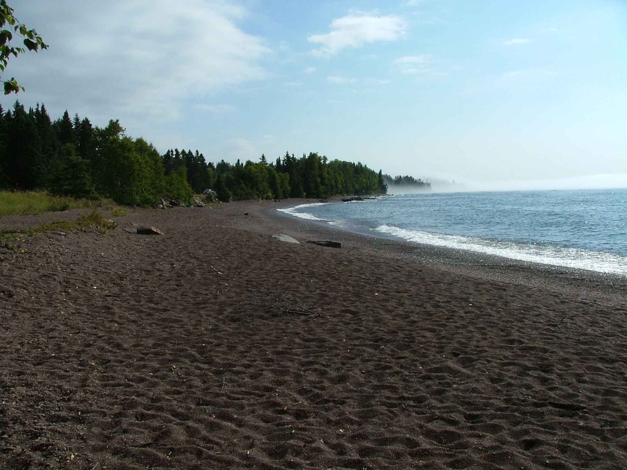
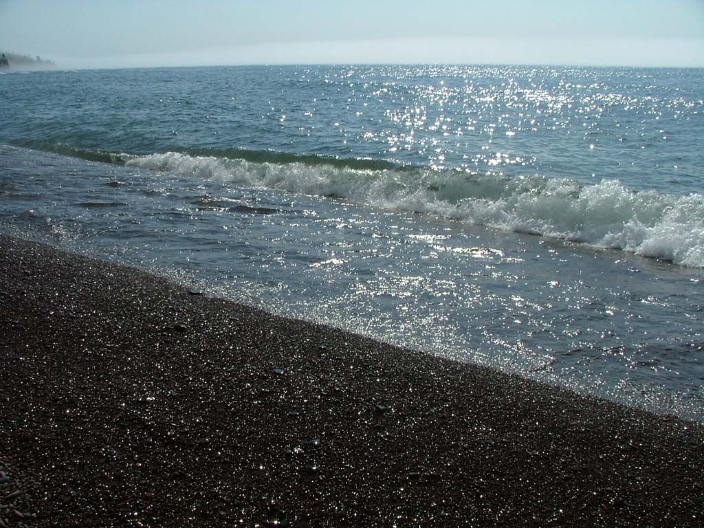
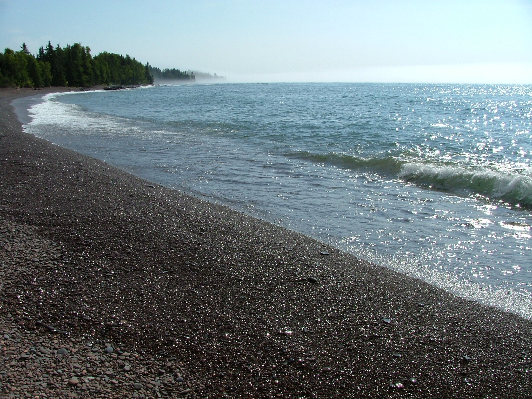
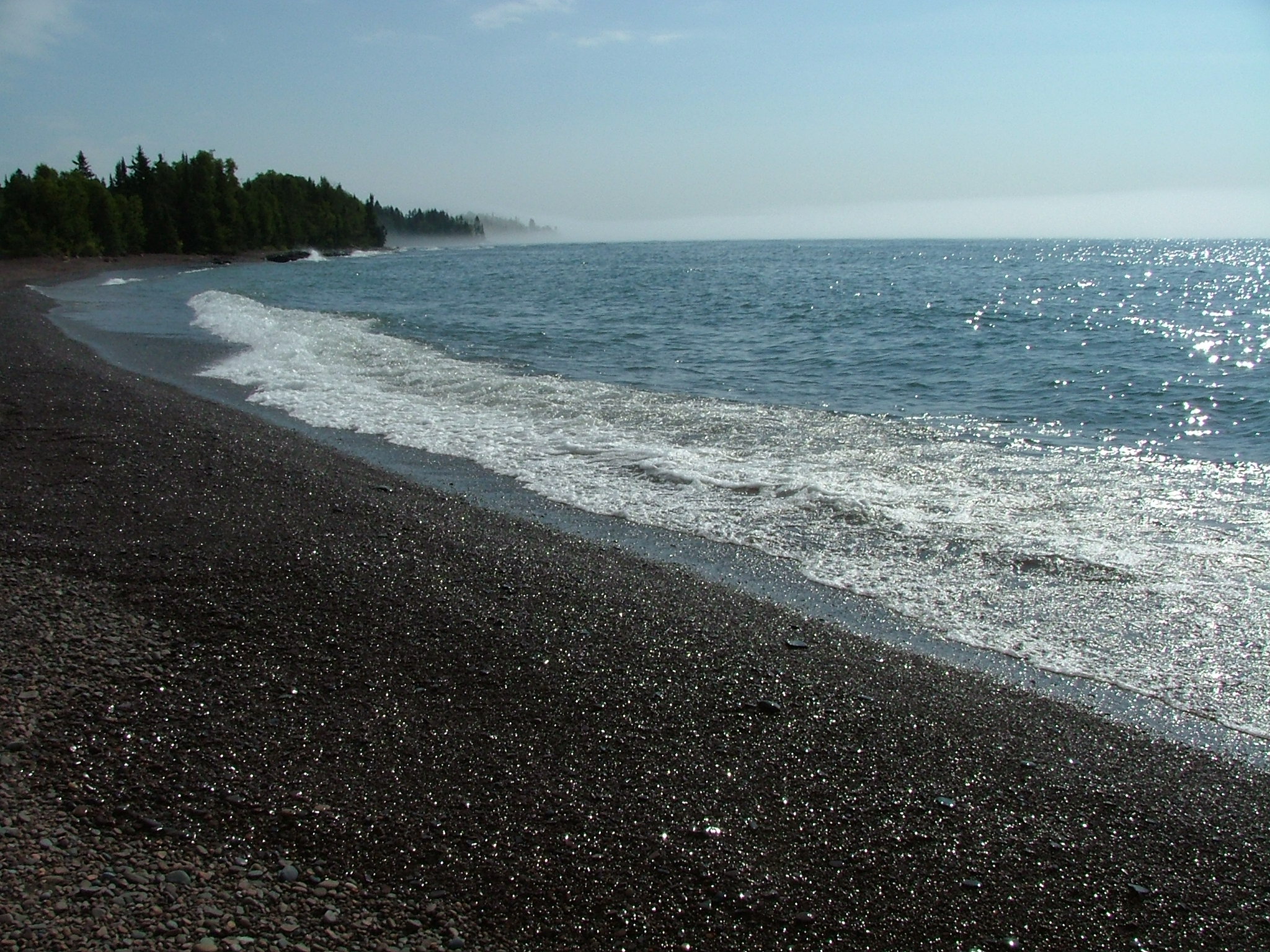
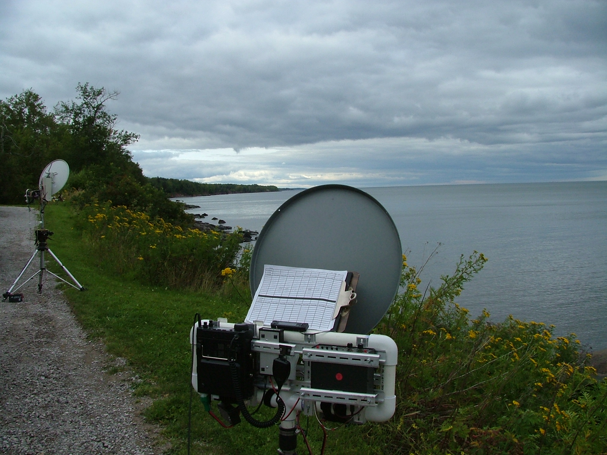
EN36VR: Thompson Rest Stop
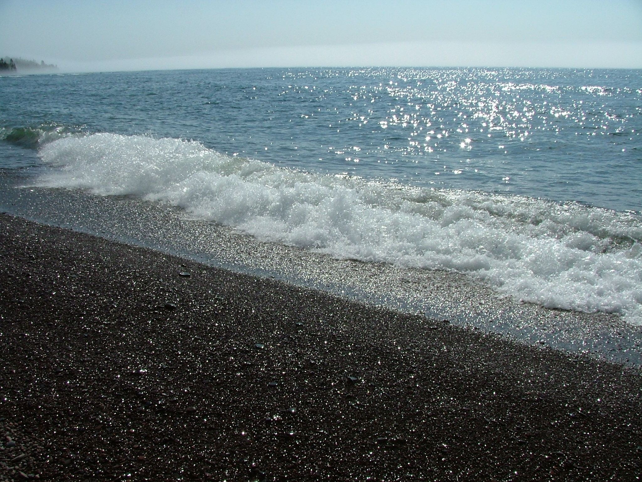
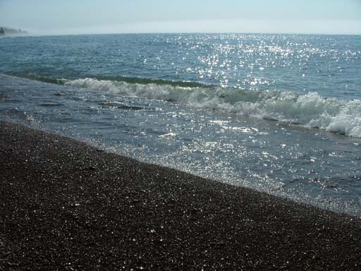
This is the view from the Thompson Rest Area. Point your dish at about the middle of this picture to contact the South Shore team! |
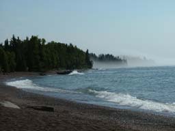
 512 x 384 1024 x 768 2048 x 1536 Photographed on 08/21/2004 at 07:53 AM by WØJT |
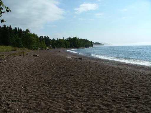
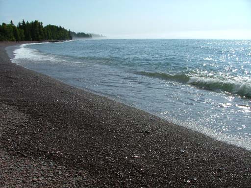
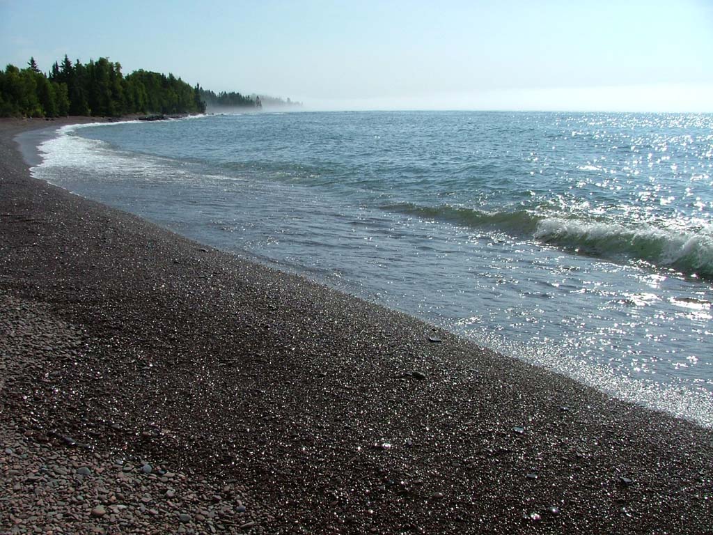
EN36VR: Thompson Rest Stop
Another view of the panorama visible from the Thompson Rest Area. The fog has started to lift, and the sun is starting to warm up the air. Signals are starting to pick up in intensity also. |
 512 x 384 1024 x 768 2048 x 1536 Photographed on 08/21/2004 at 07:54 AM by WØJT |
EN36VR: Thompson Rest Stop
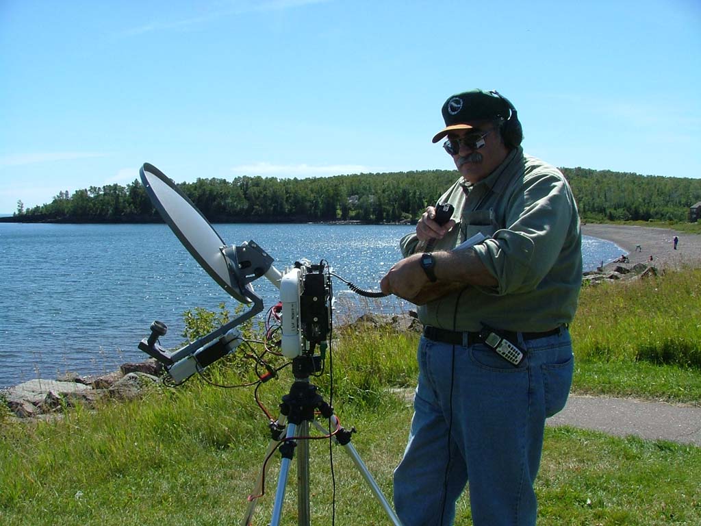
WØZQ (at the left) has finished his QSO's from this spot, and is starting to tear down and move to our next location. Also visible are KBØOZN and WBØLJC, and some others. At the time this photo was snapped, I had only worked WBØVHF and W9FZ on the South Shore. After this photo, I put down the camera, got back into position behind my radio, and worked WA8VPD, KCØP, NØHZO, WA2VOI, N8KWX, WØLMS, and AA9IL.
Thompson Rest Area (EN36VR) to Great Sand Bay (EN57VK), 313 Km, 9 QSO's. Next stop: Kitchigammi Park! |
 512 x 384 1024 x 768 2048 x 1536 Photographed on 08/21/2004 at 10:07 AM by WØJT's XYL, Ann |
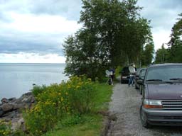
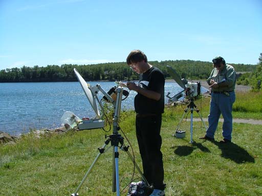
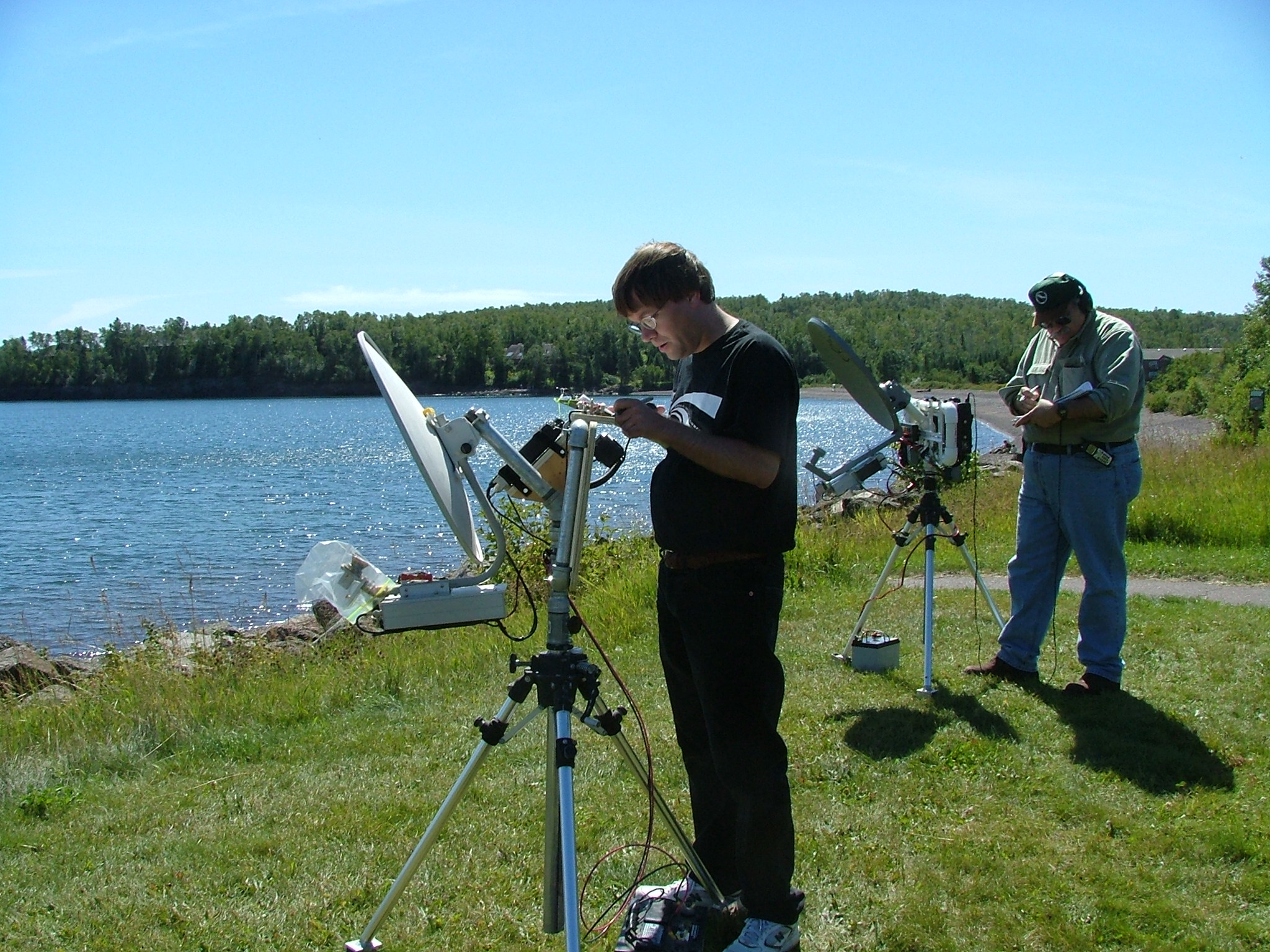
EN46AU: Kitchigammi Park
Here I (WØJT) am, sitting on my folding camp stool behind my 10 GHz rig, at our second North Shore stop of Kitchigammi Park. By this time, the sun was shining nicely, temperatures were much more comfortable, and signals were considerably stronger. |
 512 x 384 1024 x 768 2048 x 1536 Photographed on 08/21/2004 at 10:08 AM by WØJT's XYL, Ann |
EN46AU: Kitchigammi Park
My wife walked down the embankment to the rocky shore, and pointed the camera back towards the 10 GHz operators on the roadway. You can see me at the left, crouched behind my rig, which is set up behind my SUV. Further to the right is NØKP who is standing behind WØZQ, who is standing at his rig operating. By the time my turn to operate came, signals were quite good. I knocked off 11 QSO's between 10:16 and 10:20 local time. There were 9 QSO's with the same 9 operators as at the first stop, plus two more South Shore operators KDØJI and KCØIJB who were missed at the first stop. I also worked 2 QSO's with WØGHZ and KØFQA, who were located at Herbster, Wisconsin.
Kitchigammi Park (EN46AU) to Great Sand Bay (EN57VK), 292 Km, 9 QSO's.
Kitchigammi Park (EN46AU) to Herbster (EN46IU), 51 Km, 2 QSO's. Next stop: Stony Point Drive! |
 512 x 384 1024 x 768 2048 x 1536 Photographed on 08/21/2004 at 11:56 AM by WØJT's XYL, Ann |
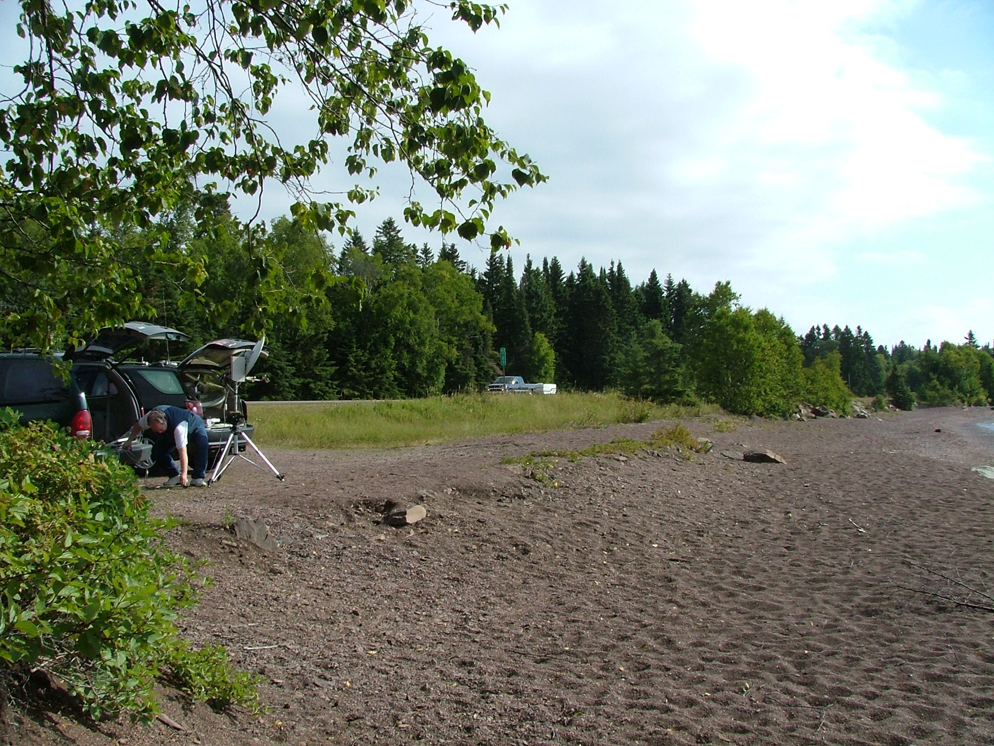
EN46CW: Stony Point Drive
Here I am at Stony Point Drive, listening in to the other QSO's being made by our team. Signals were good at first, but Murphy decided to peek in on me at this operating location. When my turn to transmit came, my battery gave up. Figuring it was no big deal, I passed my turn to the next operator, and went to trade the dead pair of 8 amp-hour gel cells for the (heavy) 31 amp-hour gel cell that was in the back of my SUV being charged whenever the engine was running. Unfortunately, by the time everyone on our side had worked, and I went to take my turn last, signal quality had faded terribly, and I was unable to work any of the operators at Great Sand Bay (a 277 Km path). I lost a couple of thousand points because of this flub. Visible in this shot by my wife, from left to right, are WØJT, KCØIYT, NØNAS (his back to the camera), and WØAUS (walking off with his gear to head to the next location). |
 512 x 384 1024 x 768 2048 x 1536 Photographed on 08/21/2004 at 11:56 AM by WØJT's XYL, Ann |
EN46CW: Stony Point Drive
Here is WØJT getting ready to work the pair of folks in Herbster, over a 51 Km path. |
 512 x 384 1024 x 768 2048 x 1536 Photographed on 08/21/2004 at 11:57 AM by WØJT's XYL, Ann |
EN46CW: Stony Point Drive
In the center of the picture is KCØIYT making a Q. Further back and to the right is me, WØJT, studying my log sheets. Stony Point Drive (EN46CW) to Great Sand Bay (EN57VK), 277 Km, zero QSO's.
Stony Point Drive (EN46CW) to Herbster (EN46IU), 39 Km, 2 QSO's. Next stop: Flood Bay! |
| (Sorry, no photo!) |
EN47EA: Flood Bay
I'm not quite sure why I never pulled out the camera at this stop, but that's the way it goes sometimes.
Flood Bay (EN47EA) to Herbster (EN46IU), 31 Km, 2 QSO's.
Flood Bay (EN47EA) to Great Sand Bay (EN57VK), 263 Km, 10 QSO's. |
| (Sorry, no photo!) |
EN47FC: Castle Danger
The lead team on the North Shore side tried to work the South Shore folks, but had no luck due to an overgrowth of foliage since last year, so most of them decided to "bag it" and head for the next stop. We arrived as they were packing up to go, so we decided to skip calling the folks at Great Sand Bay from this stop also, but we did set up long enough to work the Herbster team over a 34 Km path. We did not stay here long enough for me to take a photo. Castle Danger (EN47FC) to Great Sand Bay (EN57VK), 255 Km, zero QSO's.
Castle Danger (EN47FC) to Herbster (EN46IU), 34 Km, 2 QSO's. |
| (Sorry, no photo!) |
EN47HF: East of Split Rock
Made two quick QSO's with the Herbster team, then after a short delay, made 11 QSO's with the team at Great Sand Bay. The first 10 QSO's with them were with the same 10 operators as before, and the 11th QSO was my first with WB8TGY.
East of Split Rock (EN47HF) to Herbster (EN46IU), 42 Km, 2 QSO's.
East of Split Rock (EN47HF) to Great Sand Bay (EN57VK), 240 Km, 11 QSO's. |
| (Sorry, no photo!) |
EN47JH: Palisade Head
The next planned stop was Palisade Head, but for several reasons, we decided to pass it by and skip to the next stop. These included the fact that we were way behind schedule due to the lateness in making first QSO's from our first stop at Thompson, the fact that we seemed to be having better propagation via ducting at the surface of the lake than from high locations, and the fact that access to Palisade Head is poor, with very limited parking. |
| (Sorry, no photo!) |
EN47MM: Taconite Harbor
This stop went smoothly. We made our last two contacts with the Herbster team, who packed up for the weekend after this stop, and then made 11 QSO's with the South Shore team at Great Sand Bay.
Taconite Harbor (EN47MM) to Herbster (EN46IU), 78 Km, 2 QSO's.
Taconite Harbor (EN47MM) to Great Sand Bay (EN57VK), 208 Km, 11 QSO's. |
| (Sorry, no photo!) |
EN47PP: Lutsen
Next planned stop was Lutsen, a popular winter ski resort on the North Shore. We again considered our lateness, and poor parking (here due to crowding, rather than lack of spaces), and decided to bypass it. |
| (Sorry, no photo!) |
EN47UR: Grand Marais
Signals from Grand Marais to Great Sand Bay were incredibly strong. I worked the usual 11 operators, and picked up yet a new South Shore operator, N8PUM, who had dropped in to work with our group at Great Sand Bay for a short time. About a half-hour later, two of the North Shore team members, KØGCJ and WØAUS, decided to take a short run to Pincushion Mountain (EN47US), and the rest of the North Shore team members worked them to get their uniques. I am really puzzled by the fact that I didn't pull out the camera at this stop. there was plenty of time, we had an interesting lineup of vehicles with dishes that would have made a pretty picture, we had plenty of time, we had enough light, and so on. I guess I was just so caught up in the radio operating that I forgot my secondary task of photojournalism! Oh well.
Grand Marais (EN47UR) to Great Sand Bay (EN57VK), 160 Km, 12 QSO's.
Grand Marais (EN47UR) to Pincushion Mountain (EN47US), 5 Km, 2 QSO's. |
| (Sorry, no photo!) | Pause for supper! At about 6 PM, the North Shore team decided that some supper would be a good thing. We decided to take a break until about 7 PM, during which time we would grab some supper, and the South Shore team could relocate to a second spot so we could work them again from Grand Marais. |
| (Sorry, no photo!) |
EN47UR: Grand Marais, revisited
After the supper break, during which the South Shore team moved from Great Sand Bay to Mount Brockway, the North Shore team set up again in Grand Marais. As it turned out, the South Shore team did not all move at once, and some of them never made the move at all that evening. Although conditions remained good, the QSO's came in spurts and fits as various members of the South Shore team showed up at Brockway. When all was said and done, I managed QSO's with 10 of the 13 possible operators who had been on the South Shore team earlier in the day. Now, at least, I have a weak excuse for not taking any pictures. It was starting to get pretty dark, and flash photos would not have done justice to the site. Although this batch of QSO's was drawn out over a long period of time as the South Shore team re-assembled at Brockway, we were not bored with the wait. We attracted a lot of attention from the bystanders in Grand Marais. The gawker QRM:QSO ratio was higher here than anywhere else on the whole trip. Over and over again, strangers would walk up to us and inquire what the heck was going on. We told our story patiently and repeatedly. Maybe next year we will have to bring along a large poster and set it up near our line of vehicles, and tell the gawkers to go read about it! The North Shore operators unanimously agreed that we were exhausted at this point. We had made a lot of stops, unpacked gear at each stop, set up, adjusted, made our QSO's, recorded them in our logs, tore down the gear, packed it back into our vehicles, and moved on to the next stop over and over again. We decided that it was a good time to get some sleep, and start fresh the next morning. We agreed to all meet at Grand Portage at 06:45 AM Sunday morning. Most team members headed off to the Outpost Motel, but my wife and I had found accomodations very close by in Grand Marais, so we were probably the first to bed, after connecting up all the gel cell batteries to the 30 amp switching DC supply that I had brought along for the trip, to give them a good overnight charge.
Grand Marais (EN47UR) to Mount Brockway (EN67AL), 178 Km, 10 QSO's. |
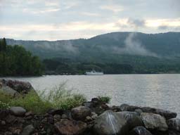
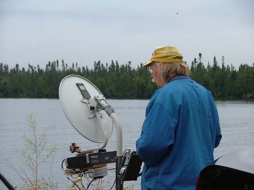
 512 x 384 1024 x 768 2048 x 1536 Photographed on 08/22/2004 at 06:01 AM by WØJT |
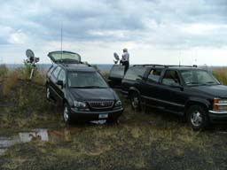
EN57DW: Grand Portage
The XYL and I were out of bed by 5 AM, packed up quickly, and hit the road for Grand Portage. We had never been there before, but we had our trusty GPS, a set of coordinates provided by the NLRS planning sessions, and a liason radio to talk with the more experienced members of the North Shore team (assuming we could raise them on the radio). Since we weren't sure how long it would take to get there, or where exactly we were going, and since we initially couldn't find any of the other team members on the liason radio, we decided to start driving without trying to find a spot for breakfast first. About 10 minutes after we passed the Outpost Motel in Hovland, we managed to raise a few of the other North Shore team members on the liason radio. (There is little to no cell phone coverage out in this wilderness!) They assured us they would be right behind us, so we pressed on ahead bravely. Shortly before 6 AM, we found the spot, with a little "talk in" help from some of the team who had been to the site before. My wife and I were the first to arrive, and I set up my system, which is visible at the left of the picture here. In a short time, we were joined by NØUK, who can be seen in the picture here, set up to my right. At this point, it is cold, foggy, windy, overcast, and no signals can be heard from across the lake. The South Shore team is supposed to be at Sunset Bay Campground at this point in time, and we start beaconing on alternate minutes, as planned in advance. |
 512 x 384 1024 x 768 2048 x 1536 Photographed on 08/22/2004 at 06:01 AM by WØJT |
EN57DW: Grand Portage
Still looking for the South Shore team. By now, we have been joined by WBØLJC, who has set up to the right of NØUK. |
 512 x 384 1024 x 768 2048 x 1536 Photographed on 08/22/2004 at 06:01 AM by WØJT |
EN57DW: Grand Portage
Now we have been joined by KCØIYT and WØZQ, who have set up their stations behind me and to my left. |
 512 x 384 1024 x 768 2048 x 1536 Photographed on 08/22/2004 at 06:02 AM by WØJT |
EN57DW: Grand Portage
KCØIYT (further from the camera) compares logs with WØZQ (closer to the camera). |
 512 x 384 1024 x 768 2048 x 1536 Photographed on 08/22/2004 at 06:02 AM by WØJT |
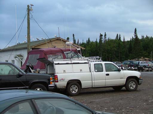
EN57DW: Grand Portage
The white pickup truck belongs to NØKP, who has a unique setup. He has an aluminum extension ladder attached to the bed of his truck, and the portion that slides out has two microwave rigs attached. Depending on circumstances, these could be two complete 10 GHz systems, or a 10 GHz and a 24 GHz system. He just slides out the ladder section, un-latches a hold-down, and swings the dish into the proper orientation, and starts working. No carrying of his system back and forth! |
 512 x 384 1024 x 768 2048 x 1536 Photographed on 08/22/2004 at 06:02 AM by WØJT |
EN57DW: Grand Portage
WØZQ checks his compass bearing. At this point, we still have not heard the other team, and we're starting to worry if we are going to succeed. This is a bit depressing, as this is the closest point of approach to the other team, and we should be able to hear them loudly at this point. |
 512 x 384 1024 x 768 2048 x 1536 Photographed on 08/22/2004 at 06:02 AM by WØJT |
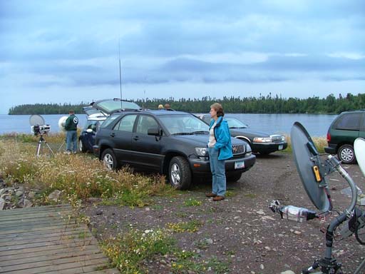
EN57DW: Grand Portage
Still waiting to hear from the other team. NØUK is in the background, behind the vehicles. My XYL is in the blue jacket standing in front of our SUV. Due to the lack of radio activity, I spent a bit of time fooling around with the camera to stay busy. |
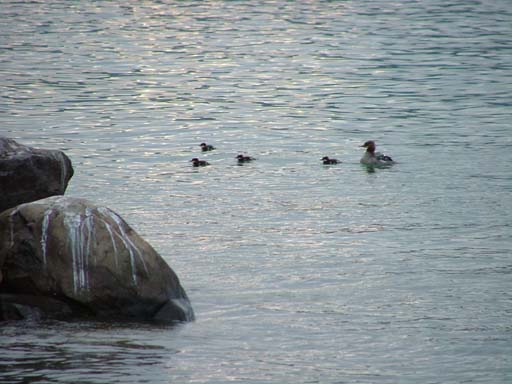
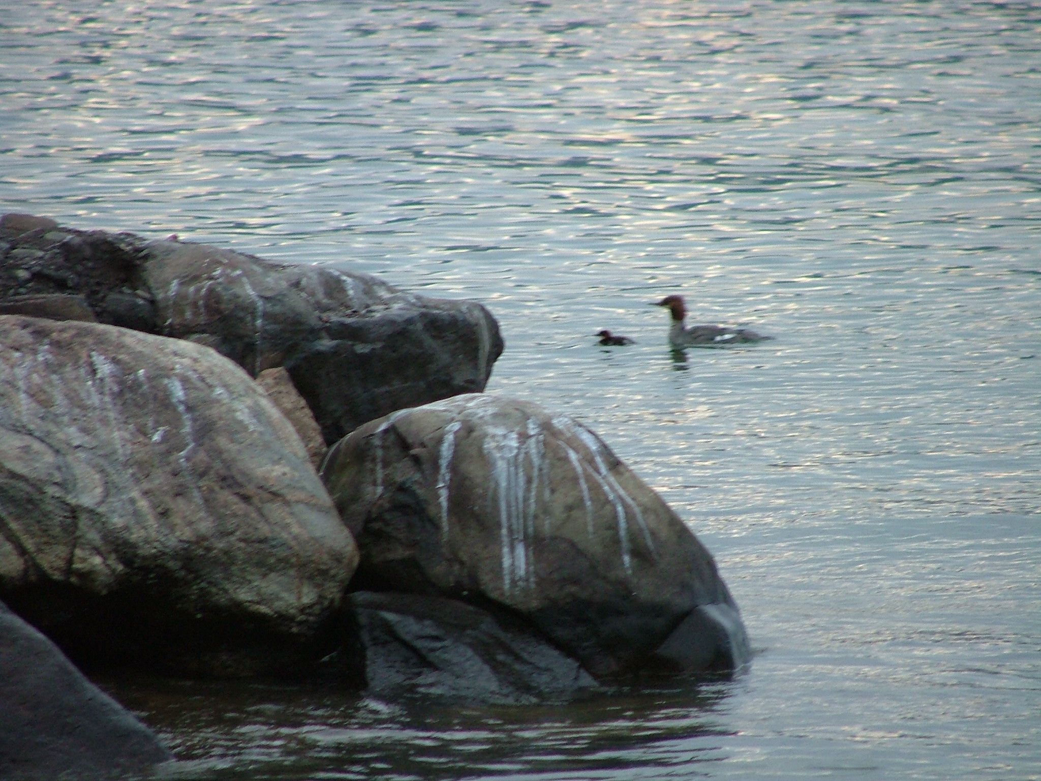
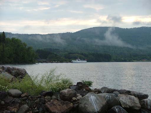
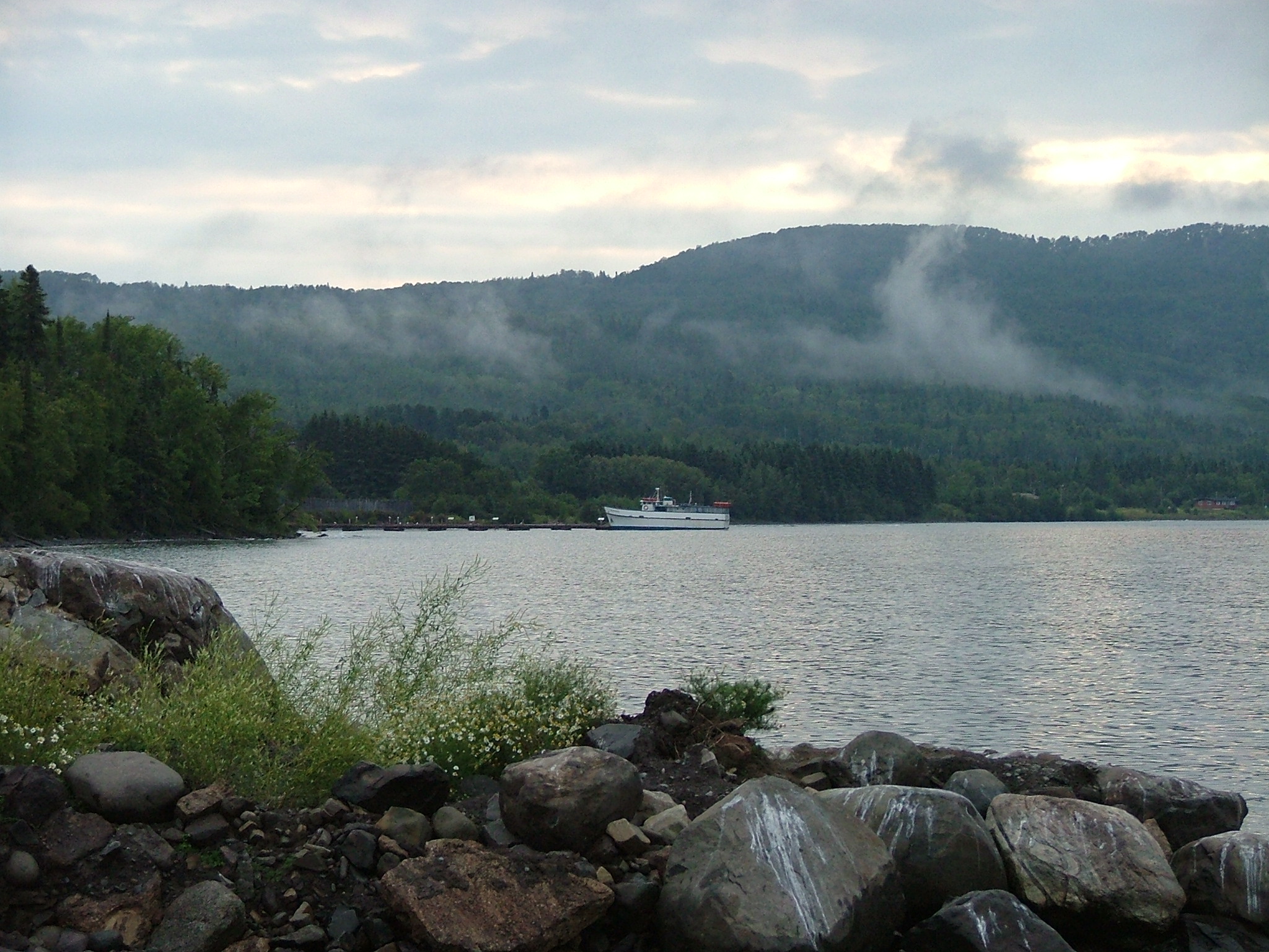
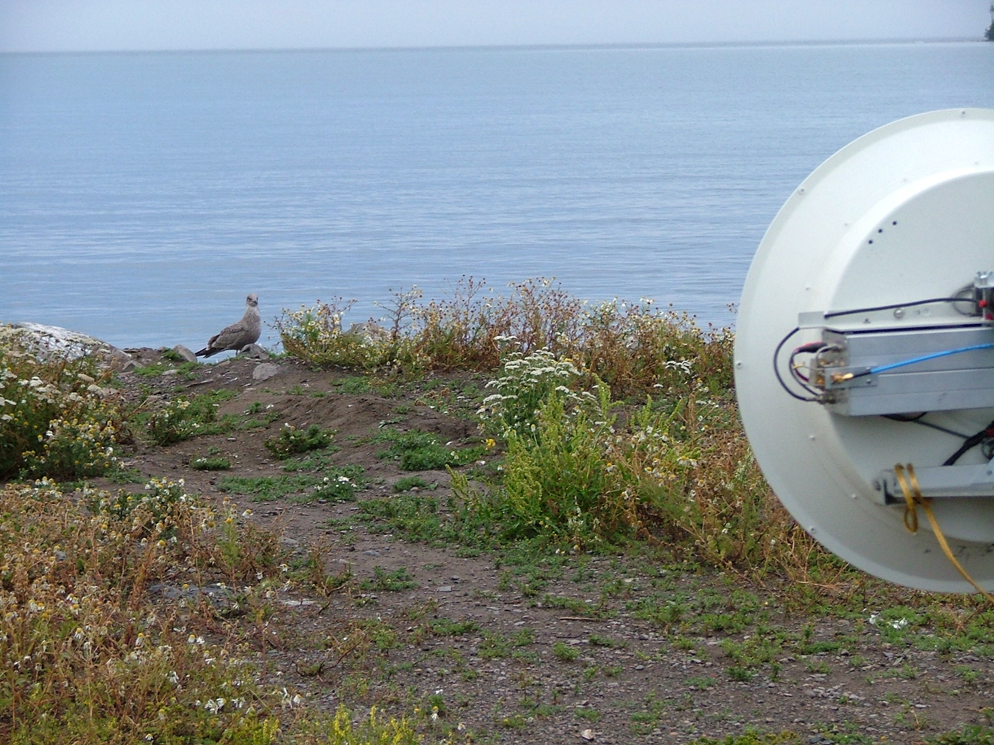
 512 x 384 1024 x 768 2048 x 1536 Photographed on 08/22/2004 at 06:07 AM by WØJT |
 512 x 384 1024 x 768 2048 x 1536 Photographed on 08/22/2004 at 06:07 AM by WØJT |
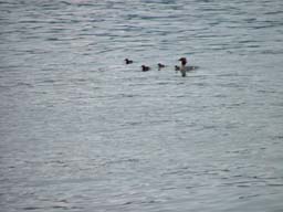
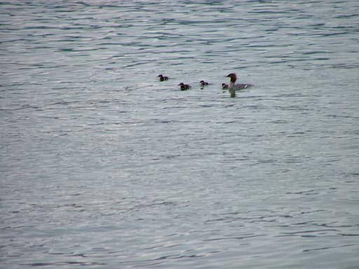
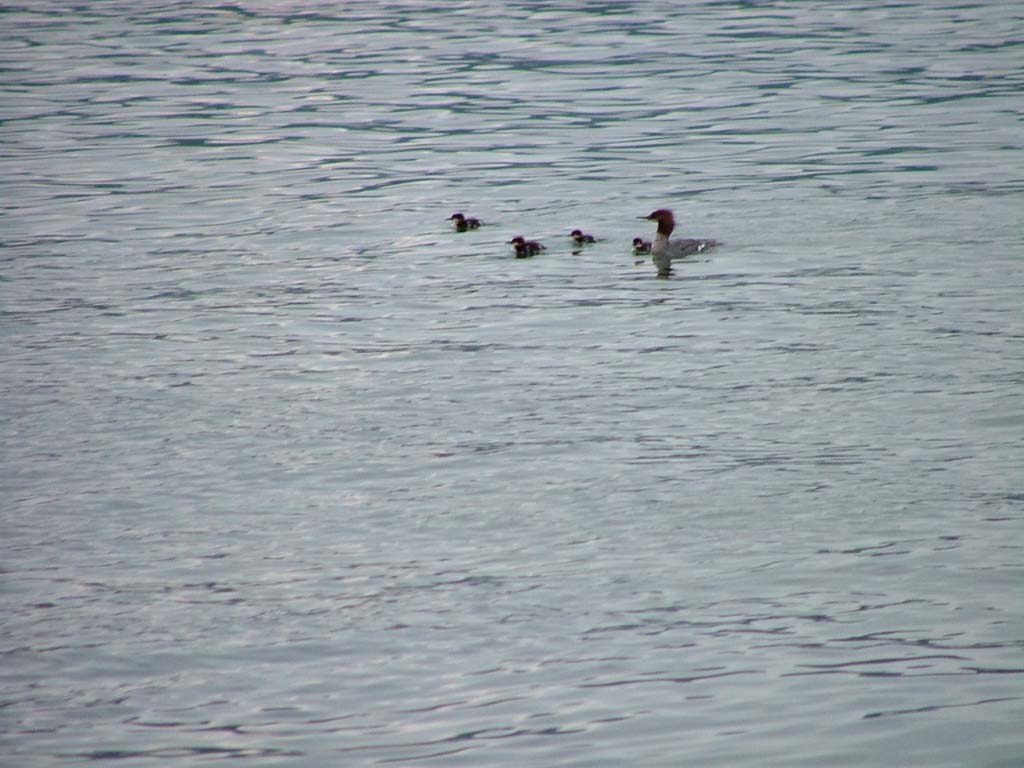
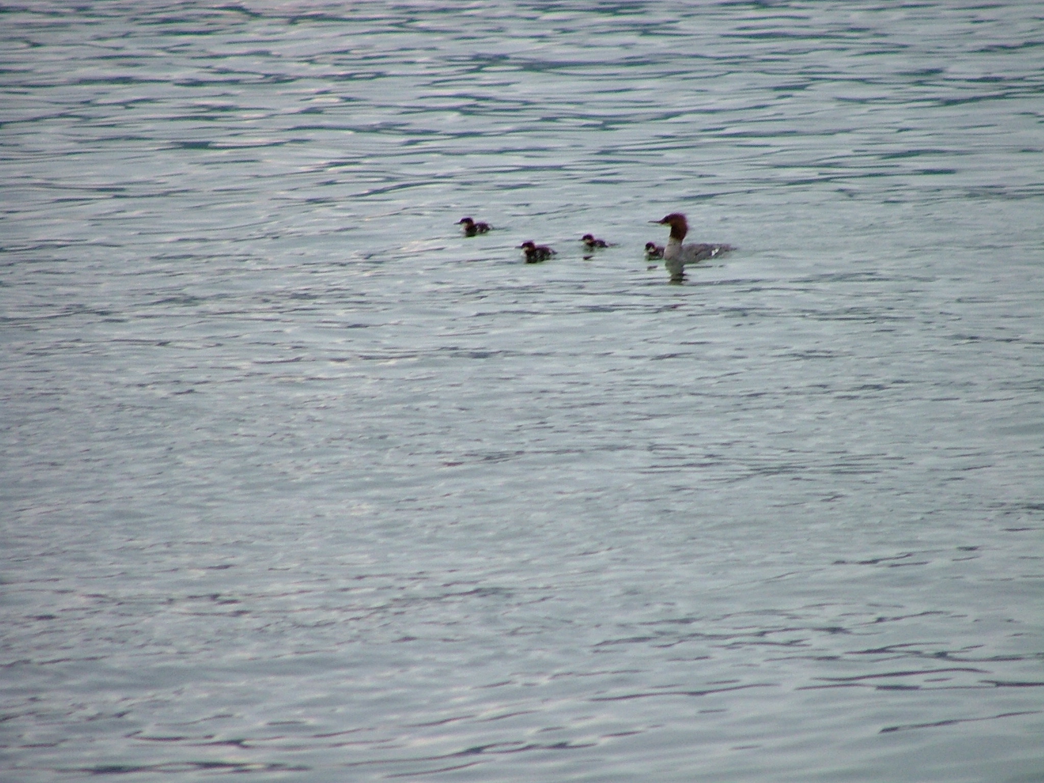
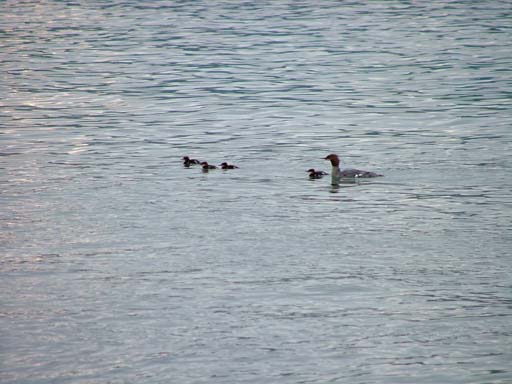
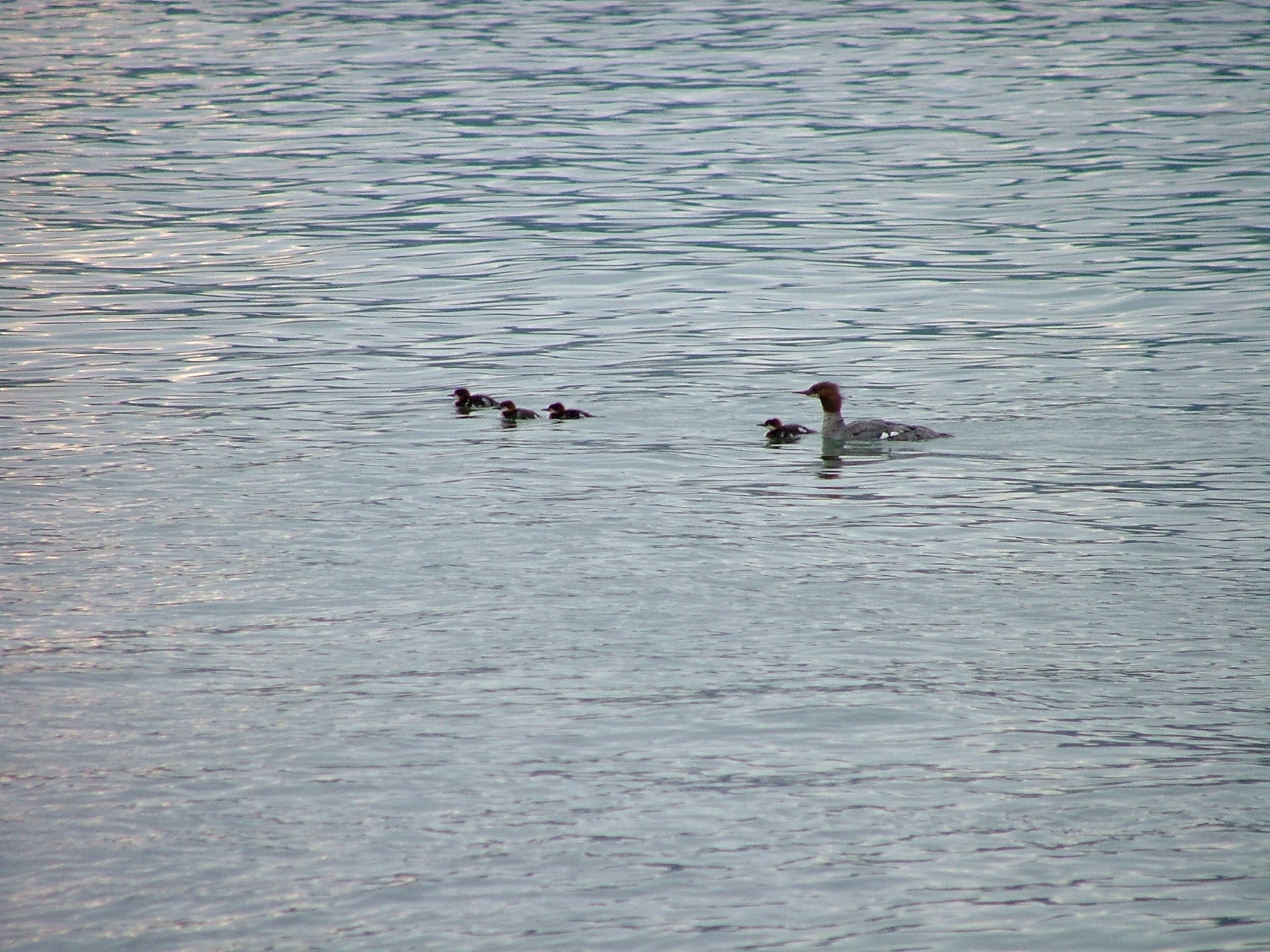
 512 x 384 1024 x 768 2048 x 1536 Photographed on 08/22/2004 at 06:07 AM by WØJT This weather is for the birds. |
 512 x 384 1024 x 768 2048 x 1536 Photographed on 08/22/2004 at 06:07 AM by WØJT But the ducks don't seem to mind it. |
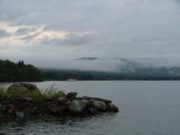
 512 x 384 1024 x 768 2048 x 1536 Photographed on 08/22/2004 at 06:07 AM by WØJT The sun is trying to show itself. |
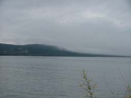 512 x 384 1024 x 768 2048 x 1536 Photographed on 08/22/2004 at 06:07 AM by WØJT But a low fog rolls in and out. . . Meanwhile, still no QSO's. |
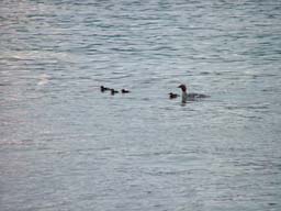
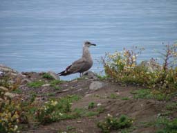 512 x 384 1024 x 768 2048 x 1536 Photographed on 08/22/2004 at 06:07 AM by WØJT Here, we get gawked at by the birds instead of crowds of humans. |
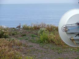 512 x 384 1024 x 768 2048 x 1536 Photographed on 08/22/2004 at 06:08 AM by WØJT Fresh microwaved poultry, anyone? |
 512 x 384 1024 x 768 2048 x 1536 Photographed on 08/22/2004 at 06:08 AM by WØJT |
EN57DW: Grand Portage
WBØLJC keeps working the beacon, trying to hook up with the South Shore team. |
 512 x 384 1024 x 768 2048 x 1536 Photographed on 08/22/2004 at 06:31 AM by WØJT |
EN57DW: Grand Portage
The WØJT station, still waiting to pick up any RF from the Michigan Upper Peninsula. |
 512 x 384 1024 x 768 2048 x 1536 Photographed on 08/22/2004 at 06:32 AM by WØJT |
EN57DW: Grand Portage
The fog rolls in, the fog rolls out. Not much else going on yet. Still no contacts. The XYL decides to take our SUV and go looking for breakfast. I stay behind to see if we can make any contacts. Awhile after this photo was shot, one of our operators reaches W9FZ on the other side of the lake. The South Shore team is taking shelter from a line of thunderstorms that is passing through their area, which is why our beacons have gone unheard and un-answered until now. |
 512 x 384 1024 x 768 2048 x 1536 Photographed on 08/22/2004 at 06:32 AM by WØJT |
EN57DW: Grand Portage
I make my QSO with W9FZ at 07:37, under horrible propagation conditions. The next South Shore team member to emerge from the shelter is WB8TGY, and the QSO is made at 07:53 with a great deal of difficulty. Most of the North Shore team decides that we have spent way too much time at this stop, and they pack up to head for the next stop, with the hopes that conditions will improve. Unfortunately, at this point, my XYL has not come back with our SUV, so I can't pack up and leave with the rest. I have no way to call her (no cell phone coverage out here, and she has no amateur radio license, so the liason radio in the SUV is turned off). Mercifully, NØNAS and KBØOZN stay behind to keep me company, since they know their way around the North Shore and I don't. Time passes and my wife is nowhere to be found. My two companions are polite about the wait, but I am feeling uneasy about holding us all up. I decide to try to make myself useful, and start beaconing towards the South Shore operators again. At 08:25, I make QSO's with KCØP and NØHZO. At 08:29, I connect with WBØVHF. Two minutes later, at 08:31, I connect with WA8VPD. We three stragglers have each been rewarded with four additional QSO's, but no other South Shore operators are expected to come on the air in the immediate future, so it is getting pretty pointless to stay here any longer, but there is still no sign of my wife or my vehicle. I pack up my gear into NØNAS's van, and we start down the road, hoping to find my SUV parked in front of a restaurant somewhere. Before we get more than a couple hundred yards down the road, my wife is seen driving back towards us. We pause to move my gear back into my vehicle, and the last three straggler North Shore team members head to the next stop. I guess I should not complain too loudly about my wife's disappearance. By getting stuck at Grand Portage for an extra half-hour, I earned 4 more QSO's, and she brought me a hot breakfast to go besides. She drove us to the next stop while I ate my nice hot breakfast! Who says Amateur Radio is not a family hobby?
Grand Portage (EN57DW) to Sunset Bay Campground (EN57TJ), 117 Km, 6 QSO's. |
 512 x 384 1024 x 768 2048 x 1536 Photographed on 08/22/2004 at 08:47 AM by WØJT |
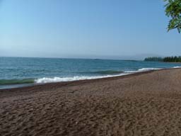
EN47XT: Beachhead 123
Heading south from Grand Portage, we found "Beachhead 133" with a little difficulty, but the rest of the North Shore team is not there. This is basically a very small beachfront pulloff from the main road, un-named, un-developed, and close to mile marker 133. We didn't know what else to call it. We presume that the rest of the North Shore team probably skipped past it, and so we continue on south. We reach the other North Shore team members on the liason radio, and they confirm that they have also bypassed Hovland and set up at "Beachhead 123", where they are working the South Shore team. So that's where we head. This, too, is an un-named, un-developed location, with a small stretch of shoreline just off the main highway, close to mile marker 123. We pull in just as the lead half of the North Shore team are packing up and pulling out.
|
 512 x 384 1024 x 768 2048 x 1536 Photographed on 08/22/2004 at 08:47 AM by WØJT |
 512 x 384 1024 x 768 2048 x 1536 Photographed on 08/22/2004 at 08:47 AM by WØJT |
 512 x 384 1024 x 768 2048 x 1536 Photographed on 08/22/2004 at 08:47 AM by WØJT |
 512 x 384 1024 x 768 2048 x 1536 Photographed on 08/22/2004 at 08:47 AM by WØJT |
 512 x 384 1024 x 768 2048 x 1536 Photographed on 08/22/2004 at 08:47 AM by WØJT |
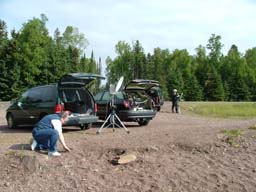
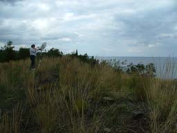
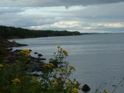
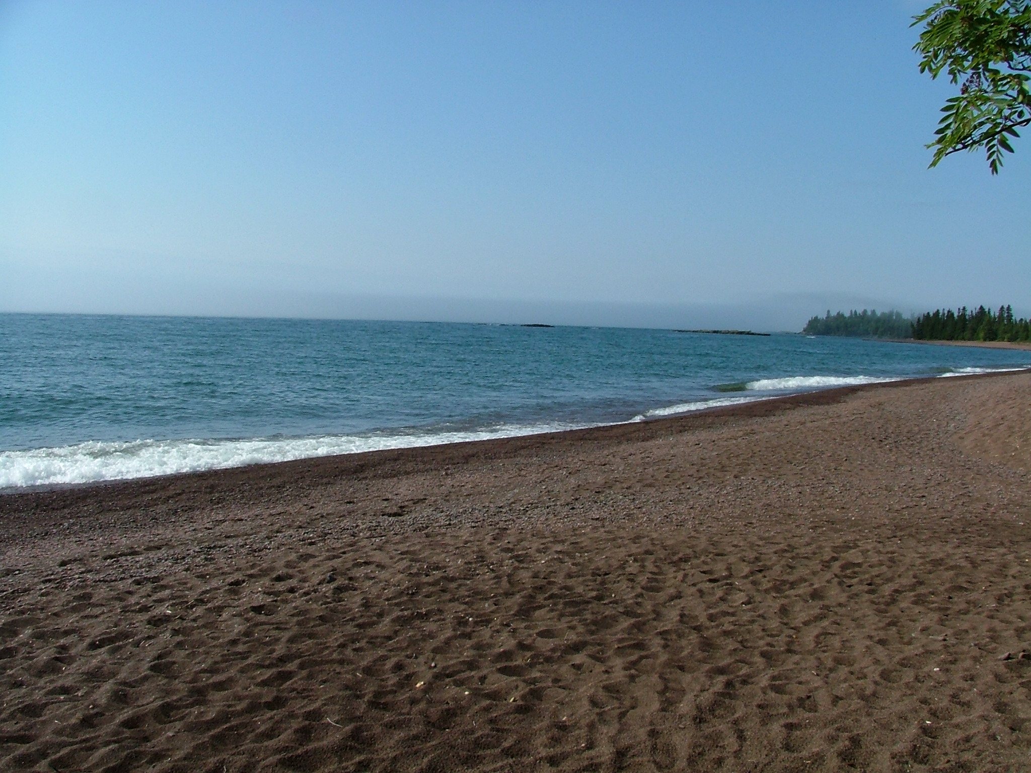
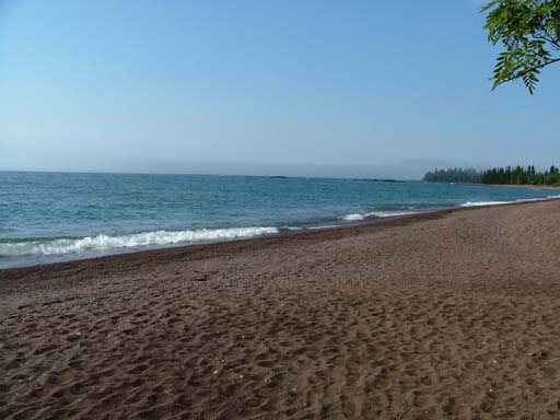
EN47XT: Beachhead 123
The scenery is too beautiful for me to ignore. I take a few minutes to walk around the beach and snap a few photos. NØNAS can be seen crouching down near his rig to examine the pebbles on the beach. |
 512 x 384 1024 x 768 2048 x 1536 Photographed on 08/22/2004 at 08:47 AM by WØJT |
 512 x 384 1024 x 768 2048 x 1536 Photographed on 08/22/2004 at 08:48 AM by WØJT |
 512 x 384 1024 x 768 2048 x 1536 Photographed on 08/22/2004 at 08:48 AM by WØJT |
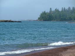
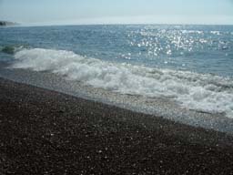
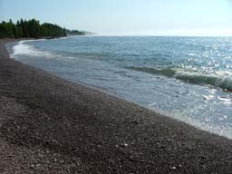
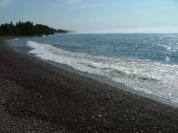
EN47XT: Beachhead 123
The beauty of the North Shore is striking. Far down the beach you can barely see a couple of other folks who are taking in the sights this early morning. |
 512 x 384 1024 x 768 2048 x 1536 Photographed on 08/22/2004 at 08:48 AM by WØJT |
EN47XT: Beachhead 123
NØNAS (foreground) is still hunting for the perfect pebble to bring back as a souvenier of the North Shore expedition. KBØOZN (background) is setting up his rig and getting it pointed. |
 512 x 384 1024 x 768 2048 x 1536 Photographed on 08/22/2004 at 08:49 AM by WØJT |
EN47XT: Beachhead 123
My XYL is in the driver's seat reading the morning paper. My 10 GHz system is all packed up for travel in the rear of my SUV, waiting for me to pull it out and set it up on the beach. But first, I have to snap a few more pictures of this beach! |
 512 x 384 1024 x 768 2048 x 1536 Photographed on 08/22/2004 at 08:49 AM by WØJT |
 512 x 384 1024 x 768 2048 x 1536 Photographed on 08/22/2004 at 08:49 AM by WØJT |
 512 x 384 1024 x 768 2048 x 1536 Photographed on 08/22/2004 at 08:49 AM by WØJT |
 512 x 384 1024 x 768 2048 x 1536 Photographed on 08/22/2004 at 08:49 AM by WØJT |
 512 x 384 1024 x 768 2048 x 1536 Photographed on 08/22/2004 at 08:49 AM by WØJT |
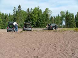
EN47XT: Beachhead 133
Okay, enough of the beauty of the North Shore wilderness. It's time for some RF. NØNAS (left) and KBØOZN (right) are set up and getting on the air with the South Shore team, and my gear is still packed in the back of my SUV. Time to get mine set up and working! WB8TGY and WA8VPD had packed up and left the South Shore team to head back home, but N8KWX was back on the air by this time, joining W9FZ, WBØVHF, KCØP, and NØHZO.
Beachhead 133 (EN47XT) to Sunset Bay Campground (EN57TJ), 134 Km, 5 QSO's. |
| (Sorry, no photo!) |
EN47UR: Grand Marais
Back in Grand Marais, signals were once again booming in full strength, which was quite a relief to yours truly, who was worried that conditions would only get worse as we travelled down the coastline further away from the South Shore folks. Unfortunately, only the same 5 hardy souls from the South Shore team who we worked from Beachhead 123 were on the air.
Grand Marais (EN47UR) to Sunset Bay Campground (EN57TJ), 155 Km, 5 QSO's. |
| (Sorry, no photo!) |
EN47MM: Taconite Harbor
Signals were still booming in, so the QSO's were quick and easy. KCØP and NØHZO were having some technical difficulties, so we missed them at this stop, but two other South Shore operators came online at this time, WØLMS and his daughter, KCØQHX (another unique!).
Taconite Harbor (EN47MM) to Sunset Bay Campground (EN57TJ), 195 Km, 5 QSO's. |
| (Sorry, no photo!) |
EN47JH: Palisade Head
Conditions here were horrible once again. The only station with whom I could complete from here was WBØVHF. My spirits began to sink once again, but I remembered that the conditions had not always gotten worse as the distances increased, so I decided to "keep the faith" and press onwards and downwards (down the North Shore coastline).
Palisade Head (EN47JH) to Sunset Bay Campground (EN57TJ), 214 Km, 1 QSO. |
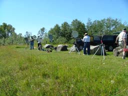
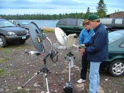
 512 x 384 1024 x 768 2048 x 1536 Photographed on 08/22/2004 at 01:56 PM by WØJT |
EN47HF: East of Split Rock
At this location, conditions were fair, which was quite a relief after the prior stop. NØNAS is setting up his system to work from here. |
 512 x 384 1024 x 768 2048 x 1536 Photographed on 08/22/2004 at 01:56 PM by WØJT |
EN47HF: East of Split Rock
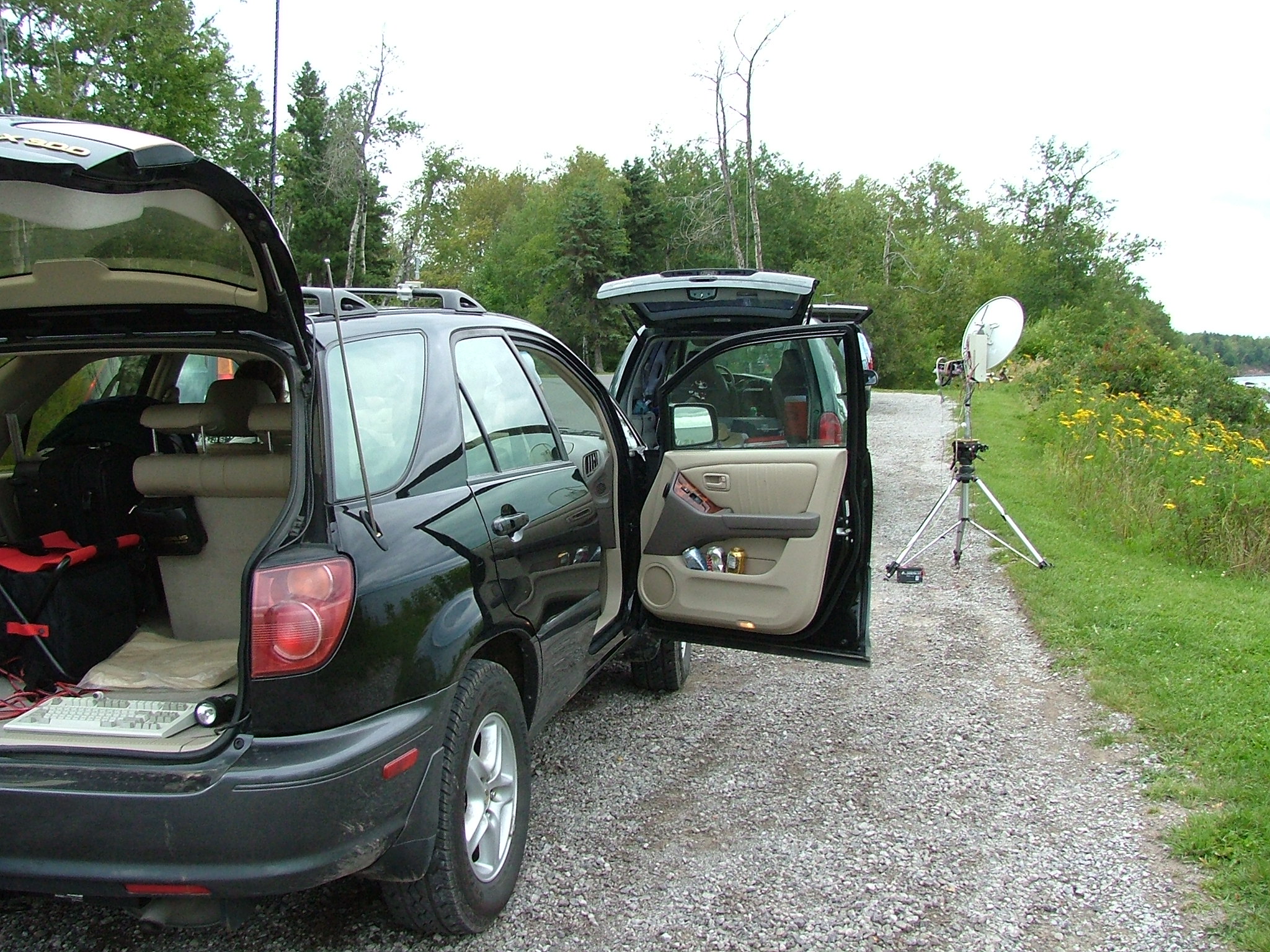
I didn't feel like parking in the mudhole, so I backed my SUV partway up the berm. Besides, that left me with a shorter distance to haul my gear and set it up. That's my rig to the left of my SUV in the photo, and KBØOZN setting up his station to the right side of the picture.
|
 512 x 384 1024 x 768 2048 x 1536 Photographed on 08/22/2004 at 01:56 PM by WØJT |
EN47HF: East of Split Rock
NØNAS tweaks his system in preparation for making his QSO's. |
 512 x 384 1024 x 768 2048 x 1536 Photographed on 08/22/2004 at 01:57 PM by WØJT |
EN47HF: East of Split Rock
Gotta love that four-wheel drive for conditions like these! |
 512 x 384 1024 x 768 2048 x 1536 Photographed on 08/22/2004 at 01:58 PM by WØJT |
EN47HF: East of Split Rock
NØNAS makes his QSO using CW. |
 512 x 384 1024 x 768 2048 x 1536 Photographed on 08/22/2004 at 01:58 PM by WØJT |
EN47HF: East of Split Rock
As soon as NØNAS finishes this QSO, it will be my turn to set down the camera and pick up the microphone. On the South Shore, KCØP and NØHZO have fixed their technical problems, so there are 7 operators to work now.
East of Split Rock (EN47HF) to Sunset Bay Campground (EN57TJ), 228 Km, 7 QSO's. |
| (Sorry, no photo!) |
EN47EA: Flood Bay
Conditions were still only fair. WBØVHF, who had the strongest South Shore signal on Sunday, has packed up and left for home, so only 6 operators were available on the South Shore team at this point. My first 5 QSO's went moderately fast, then I waited another 15 minutes for the sixth operator to return to her rig and complete the last QSO from this stop.
Flood Bay (EN47EA) to Sunset Bay Campground (EN57TJ), 250 Km, 5 QSO's. |
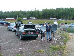
 512 x 384 1024 x 768 2048 x 1536 Photographed on 08/22/2004 at 04:27 PM by WØJT |
EN46CW: Stony Point Drive
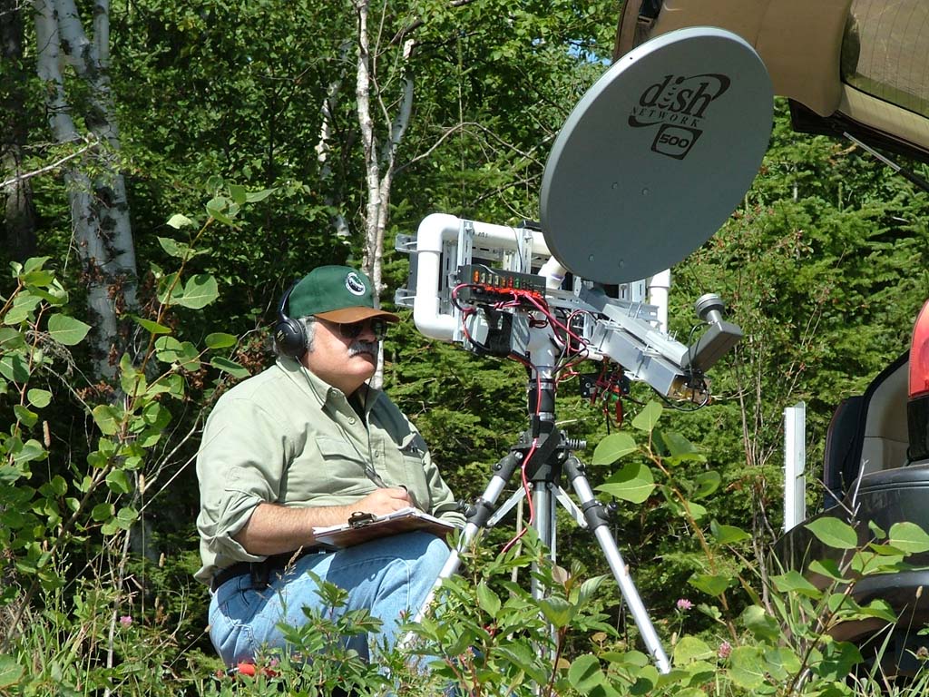
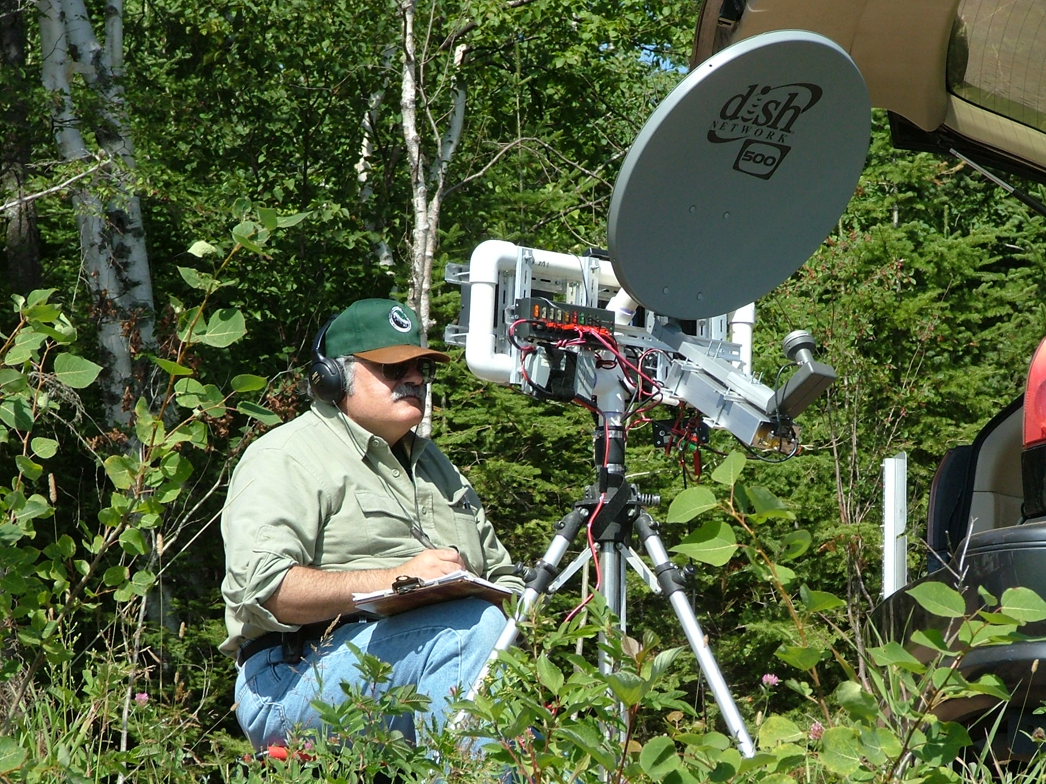
We arrived at Stony Point Drive, and were surprised to see a wedding party down below us on the stony beach, taking photos. Oddly enough, I failed to take a photo of that, even though it would have made an interesting shot. In this photo, my rig is in the foreground. You can see my clipboard with log sheet sitting sideways behind the dish. Below that is the PVC pipe mounting assembly for most of the rest of the gear. The ICOM IC-706MkII is mounted vertically on the left side of the PVC pipe support structure. On the right side of the IF radio is an MFJ electronic keyer. This comes in handy for beaconing, and is also a handy tool for those of us who are better at typing on a keyboard than sending CW with a straight key or paddles. On the top of the PVC cross - pipe, just in front of the clipboard, is a battery voltage monitor. I picked this up years ago from a local discount department store (Target) in the automotive section. It is attached with Velcro for easy re-positioning. The rig ahead of mine and to the left in the picture belongs to NØNAS. |
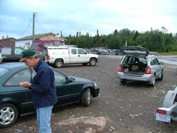
 512 x 384 1024 x 768 2048 x 1536 Photographed on 08/22/2004 at 04:27 PM by WØJT |
EN46CW: Stony Point Drive
My SUV parked on the side of the road at Stony Point Drive. Those are Diet Coke cans in the door pocket, not beer cans! We are responsible operators, and we pack out our trash. The minivan in front of my SUV, and the 10 GHz righ alongside it, belong to NØNAS. |
 512 x 384 1024 x 768 2048 x 1536 Photographed on 08/22/2004 at 04:27 PM by WØJT |
EN46CW: Stony Point Drive
Looking behind my position, you can see KCØIYT to the left (blue shirt) and WBØLJC to the right (white shirt). They were just finishing up when we arrived, so we set up, tuned up, peaked up our dishes, and waited our turns. |
 512 x 384 1024 x 768 2048 x 1536 Photographed on 08/22/2004 at 04:27 PM by WØJT |
EN46CW: Stony Point Drive
One more beautiful North Shore spot to hang out on an August weekend, enjoying the scenery, the time away from work, the company of my XYL, the company of my NLRS friends, and a good dose of RF. What more could you ask for?
Stony Point Drive (EN46CW) to Sunset Bay Campground (EN57TJ), 264 Km, 6 QSO's. |
| (Sorry, no photo!) |
EN46AU: Kitchigammi Park
By this stop, conditions were only fair, and it was getting late, so we didn't spend a lot of time for non-QSO activities (like taking photos).
Kitchigammi Park (EN46AU) to Sunset Bay Campground (EN57TJ), 278 Km, 7 QSO's. |
| (Sorry, no photo!) |
EN36VR: Thompson Rest Stop
We got back to our original starting point, the Thompson Hill Rest Stop, quite late in the day. By this time, most of the South Shore team had packed up, and so we only made four QSO's under fair conditions with South Shore team members W9FZ, N8KWX, WØLMS, and KCØQHX. After the second of those 4 QSO's, my gel cell battery finally pooped out. I had been trying to keep a trickle charge into it between uses by plugging it into a cigarette lighter style outlet in the back of my SUV, but at one point the battery had drained so low that when I plugged it into the outlet, it sucked too many amps and blew a fuse. I pulled out my box of ATO blade fuses, then opened up the fuse panel and discovered that my vehicle used mini-ATO fuses, and I had no spares! Thankfully, all my gear is connected via Anderson Power Poles, and NØNAS had an extra gel cell battery wired up with Power Poles already, so he loaned it to me for the rest of the day. At this point in time, most of the rest of the North Shore crew headed back home to the Twin Cities. However, NØKP and WBØLJC decided to skip over to the Duluth High School parking lot and re-work the Sunset Bay Campground folks from there, and we then worked them for their uniques over an 11 Km path. Their signals were so strong that I could point almost anywhere and hear them with ease. A few of the South Shore gang decided that since signals were still fair from Sunset Bay Campground to Thompson, they would trek over to Mount Brockway and see if we could eke out a few more QSO's over an even longer path. While they packed up and moved, NØKP and WBØLJC drove back to Brockway from Duluth High School and met up with NØNAS, KCØIYT, and me. My wife set off for the hotel where we had reservations for the night, and got us checked in, while I stayed at Thompson with my gear to try for the 333 Km contacts to Brockway. Signals had deteriorated to very weak by the time W9FZ and partners set up at Brockway, and while I was able to barely hear him on SSB while he worked NØKP and WBØLJC, he had faded into the noise by the time it was my turn. We switched to CW mode, and with extreme difficulty, I barely made the QSO. It was my longest QSO of the contest. What a way to finish the weekend! And yes, my XYL did come back from the hotel to Thompson to pick me up. The hotel was actually very close by, and it took her only a few minutes to make the trip back to get me. We had a very restful night, and a leisurely drive back to town the next day, since we had intentionally taken the next day off as a vacation day so we wouldn't have to rush back late Sunday night while we were tired.
Thompson Rest Stop (EN36VR) to Sunset Bay Campground (EN57TJ), 300 Km, 4 QSO's.
Thompson Rest Stop (EN36VR) to Duluth High School (EN36WT), 11 Km, 2 QSO's.
Thompson Rest Stop (EN36VR) to Mount Brockway (EN67AL), 333 Km, 1 QSO. |
|
The 2004 10 GHz and Up Cumulative Contest Weekend Two -- Fit in What I Can |
|
|
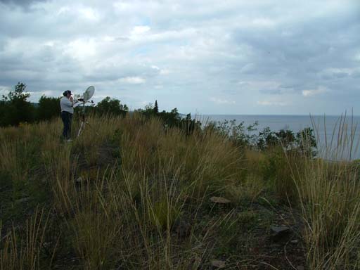
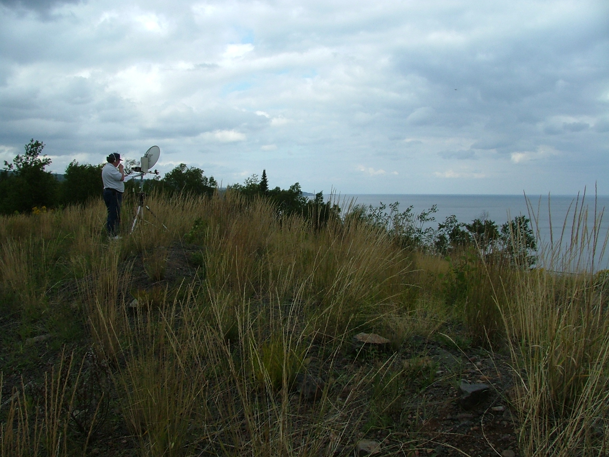
For the second weekend of the contest, the NLRS folks made plans to operate extensively so as
to drive up their scores a whole lot more. One group headed out to Sisseton, SD, and planned
to work from a relatively high spot there back to the Twin Cities metro area, as well as into
Canada, and with the rover groups.
A couple of operators decided to run up and down the Red River Valley to work whomever they could in that part of the state, including the Sisseton gang. Another group circled the Twin Cities metro area over a wide range of sites that had been scouted out in advance -- some of them years ago, and some of them quite recently added to our collection of good 10 GHz and up operating spots. My own plans? Well, no matter what the plans were, a big ugly monster reared its head and scuttled all of my plans. Please forgive my use of a four-letter word, but here it is anyway -- "WORK". Ughh! My weekend time off was cancelled, and instead I had to work two 16-hour days during the second weekend of the contest. But I packed my 10 GHz dish into the back of my SUV and decided to make at least a few QSO's before work or on my lunch break. On Saturday morning, I went to a familiar operating location in Burnsville, a few miles away from home, to work a few contacts from there before heading in to work. The site has pretty good views from SW to NE. I arrived there about 0730 CDT, and got set up. I had no idea if I'd be able to work anyone, or who that would be. Most of the plans of other NLRS folks talked about starting at 0800 or 0900. But I pointed my dish at the downtown Minneapolis buildings (excellent microwave reflectors) and started tuning around and calling, while also listening on 146.46 MHz FM and 144.200 MHz SSB for any liason activity. By 0746, I had WØAUS in the log. He was located in Monticello, MN. A few minutes later, I had WØGHZ in the log. He was located at his home. Less than 15 minutes later, WBØLJC and NØNAS arrived at Monticello, and were quickly added to the log. Off to what I thought was a good start, I next contacted NØKP via liason. He and four others were located in Sisseton, SD, 316 Km away. They hadn't expected to be up and running until 0900, but they were all set now, so we got pointed at each other and started beaconing on alternate minutes. After many back-and-forth cycles, with absolutely nothing heard on 10 GHz on either end, we reluctantly gave up the attempt. It sure would have been nice to get the 1580 distance points and 300 QSO points into the log, but it simply was not to be. Next, I contacted KØKFC via liason at Mount Tom, 151 Km away and set up an attempt to work him and WA2VOI/Ø on 10 GHz. They pointed towards me, I pointed in their direction, and we took turns beaconing on alternate minutes. Unfortunately, nothing was heard on either end once again, and we eventually gave up. Oh well, another 302 distance points and 100 QSO points that didn't go into the log. Traffic on the 2 meter liason radio started to pick up, so I decided to try to nab some of the close-in folks, since I wasn't having much luck with the distant folks. My next attempt was with KØSHF, who was in Vasa, MN, about 50 Km away. This should have been a "chip shot", as the path had been worked many times in the past by other NLRS folks, but I had no luck with it on this day. Next up was an attempt with WØAUS, WBØLJC, and NØNAS, who had moved to a new location in Maple Lake, MN. Much to my surprise, this 70 Km path was also a bust for me. I started to suspect that a problem had developed with my rig, but by now it was time for me to pack up and head in to work.
Saturday Totals The plans for Sunday were similar, in that I squeezed in a little operation time in the midst of a long work day, but different in that I took a long lunch/supper break around 4 PM and went to a nice overlook area in Mendota Heights at the north end of Pilot Knob Road. This is only a couple of miles from the VA Hospital (where I work), and I could drive right up to the operating location (not much lugging of gear to and from the vehicle and the operating site). It has a great view from roughly southwest to northeast, and an excellent view of the downtown Minneapolis skyscrapers (wonderful 10 GHz reflectors for bounce paths). I caught WØAUS on the 2 meter liason radio, and he said he was almost set up in Cannon Falls, and he would call be back as soon as he was ready to go. While I waited for him to finish setting up, I was called on liason by KØSHF. He had already "packed it in for the day", but said he was willing to haul his gear out to the end of his street for a bounce shot off of the downtown Minneapolis buildings. Since we were located in the same sub-grid, there weren't many distance points to be had, but the 100 QSO points would be welcome in both our logs, so we did it. Shortly afterwards, WØAUS was ready to go from Cannon Falls (53 Km), and he was quickly added to the log. I then heard KCØP and NØHZO call WØAUS from their current location in Nerstrand, MN. As soon as they finished with WØAUS, I called them and got KCØP in the log for 62 Km worth of distance points, and waited for NØHZO to call next. Much to my surprise, I was called by both NØHZO and WØGHZ simultaneously. Imagine that, a "pileup" on 10.3681 GHz! I quickly worked them both, for 62 Km and 16 Km points respectively. A few moments later, NØNAS and WBØLJC arrived in Cannon Falls, and as soon as they were set up, were both worked for 53 distance points each. By this time, most of the locals had "closed up shop" for the day, and we were scraping the bottom of the barrel for additional contacts. On a whim, I contacted W9FZ via liason. He and KCØIYT were roving in Northwestern Minnesota's Red River Valley. At the time I reached W9FZ, they were close to Fargo, North Dakota. They agreed to pull over at the first high location they could find and try to work us. A pair of 389 Km contacts and another 100 QSO points would have been nice, not to mention that WBØLJC and NØNAS were going to stand by in Cannon Falls to try to hook up with W9FZ and KCØIYT also, over a 440 Km path. Sadly, my beaconing on alternate minutes was not heard in Fargo, but only by the two operators in Cannon Falls. I find that pretty amazing, as I was pointed almost directly away from them, and they were 53 Km away. But that's 10 GHz for you. In any case, I never heard the two guys in Fargo, and neither did the folks in Cannon Falls. Back on liason, I let W9FZ know that if he stopped at Monticello on his way back into town, he and KCØIYT would likely be able to score a few more contacts with locals who were basically done for the day but willing to set up for one more quick shot. I, unfortunately, would not be one of those locals, as I had to head back in to work to finish my 16-hour day.
Sunday Totals Grand Totals, Both Weekends
Here are some links to web pages by other Upper Midwest participants in this year's contest: |
|
 2002 North Shore Trip, NLRS web site