Santa Monica

W6B
Los Angeles
Route 66 On the Air!
12-20 September 2009
Westside Amateur Radio Club
of Los Angeles
Along
the Route...
Through
West LA and
Santa Monica
Home
Route Map
Archive
for Prior Year's
Route 66 OTA
|
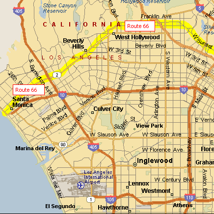
Route 66 Map - LA to Santa Monica |
|
From downtown Los Angeles Route 66 turns west to follow Sunset Blvd. onto Santa Monica Blvd. to Hollywood. Although Route 66 follows Santa Monica Blvd., in Hollywood, most of tourist attractions such as Chinese Theater are located on Hollywood Blvd. north of Santa Monica Blvd. The route travels on the south of Beverly Hills, and continues west past Westwood. In 1935 Route 66 was extended from Los Angels to Santa Monica. It follows Santa Monica Blvd. and comes to an end at Ocean Ave. by Palisades Park, a palm-lined bluff, two blocks north of the city's landmark pier. |
|
|
Old Standard Oil Map Showing Route 66 through California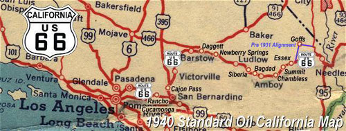 |
Copyright © 2003 All rights reserved
The Westside Amateur Radio Club of Los Angeles
Post Office Box 642072
Los Angeles, CA 90064