Page updated August 24, 2013
Weather
QuickLinks
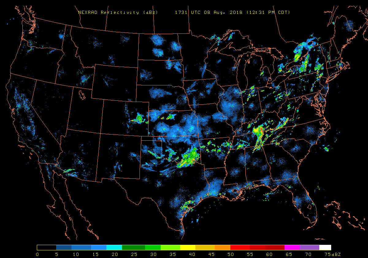
Weather Radar
US
loop - US no loop - Coastal Radars for Hurricanes
Southeast
and Florida - Terminal Doppler Weather
Radar (TDWR)
Jacksonville,
FL - Valdosta, GA - Tampa, FL
- Melbourne,
FL
Accumulated
Precip. (my local) - Radar Forecast
http://nbsp.noaaport.net:8015/ or http://www.opennoaaport.net:8015/ best to use NOAA's Weather and Climate Toolkit (WCT) software http://www.ncdc.noaa.gov/wct/install.php
Radar Status (NWS
WSR-88D)
_
http://www.roc.noaa.gov/ Radar Operations Center
http://weather.noaa.gov/monitor/radar/ Auto-Refresh 1
min.
http://140.90.23.116/spg/asp/ Terminal Doppler Weather Radar (TDWR) - Supplemental
Product Generator (SPG)s Radar Communications
Radar Nationwide loop
_
http://radar.weather.gov/Conus/index_loop.php *
http://radar.weather.gov/Conus/Loop/NatLoop_Small.gif
http://radar.weather.gov/ridge/lite/
http://www.spc.noaa.gov/
http://www.spc.noaa.gov/products/activity_loop.gif
http://www.spc.noaa.gov/exper/mesoanalysis/ java/javascript
http://www.spc.noaa.gov/exper/mesoanalysis/s4/activity_loop.gif
http://www.spc.noaa.gov/exper/mesoanalysis/sectorloop.gif
http://w1.spc.woc.noaa.gov/exper/mesoanalysis/ javascript
http://w1.spc.woc.noaa.gov/exper/mesoanalysis/sectorloop2.gif
http://www.spc.noaa.gov/exper/mesoanalysis/s4/s4_loops/rgnlrad/rgnlrad_10.gif (rgnlrad_1.gif to rgnlrad_10.gif)
http://wdssii.nssl.noaa.gov/web/wdss2/products/radar/conusloop.shtml java loops
http://aviationweather.gov/obs/radar/loop.shtml java loops
http://aviationweather.gov/data/obs/radar/frame_5_rcm_sm_tops.gif (frame_0_rcm_sm_tops.gif to frame_5_rcm_sm_tops.gif)
http://aviationweather.gov/products/ncwf/ javascript loops only shows strong
echos
http://www.hpc.ncep.noaa.gov/html/sfcloop/radsfcus_exp_test.html previous images java
loops
http://www.hpc.ncep.noaa.gov/images/wwd/radnat/ previous images
http://www.ncdc.noaa.gov/oa/radar/jnx/ java Java NEXRAD
Viewer/Exporter
?http://3.nbsp.inoaaport.net:8015/nbsprad/latest?nidsdir=digatmos/nexrad/nids&imgdir=radmap&outputname=loop.gif&loopflag=1
?http://www.opennoaaport.net:8015/nbsprad/latest?nidsdir=digatmos/nexrad/nids&imgdir=radmap&outputname=loop.gif&loopflag=1
_
http://www.accuweather.com/us/radar/sir/us_/radar.asp?play=true
http://sirocco.accuweather.com/nx_mosaic_640x480c/sir/inmasirus_.gif
http://sirocco.accuweather.com/nx_mosaic_640x480c/re/inmareus_.gif
http://sirocco.accuweather.com/sat_mosaic_640x480_public/rs/isarun.gif
http://www.wunderground.com/US/Region/US/2xpxRadar.html
http://icons.wunderground.com/data/640x480/2xus_rd_anim.gif *
http://www.intellicast.com/National/Radar/Current.aspx?animate=true
http://wxweb.meteostar.com/radar/site/SYS.shtml?SYS or http://www.ic4u-ii.net/radar/site/SYS.shtml?SYS
http://wxweb.meteostar.com/radar/nav/
http://www.ic4u-ii.net/leads_images/radar/ or http://wxweb.meteostar.com/leads_images/radar/
http://weather.unisys.com/radar/rad_us_loop.html *Auto-Refresh 30
min.
http://www.weather.com/maps/maptype/dopplerradarusnational/index_large_animated.html java loops
http://image.weather.com/looper/archive/us_radar_plus_usen/5L.jpg [1L.jpg to 5L.jpg]
http://www.weatherforyou.com/cgi-bin/hw3/hw3.cgi?forecast=pass&pass=radar_us_loop
http://www.weatherforyou.com/radar/radarmaps/usnextype_anim_640x480.gif *
http://www.geostrophy.weather.net/cgi-bin/interrad_nat_us
http://3.nbsp.inoaaport.net:8015/nbsprad/latest?nidsdir=digatmos/nexrad/nids&imgdir=radmap&outputname=latest.gif
http://www.opennoaaport.net:8015/nbsprad/latest?nidsdir=digatmos/nexrad/nids&imgdir=radmap&outputname=latest.gif
_
http://vortex.plymouth.edu/
http://vortex.plymouth.edu/psu_satrad.mpg *
http://vortex.plymouth.edu/psu_satrad_an12.gif *
http://vortex.plymouth.edu/psu_satrad_an24.gif *
http://vortex.plymouth.edu/usrad1km_an.gif *
http://vortex.plymouth.edu/usnowrad_an.html java loops
http://vortex.plymouth.edu/usrcm_an.gif *
http://vortex.plymouth.edu/psu_usrad.mpg
http://vortex.plymouth.edu/psu_usrad_an12.gif
http://vortex.plymouth.edu/psu_usrad_an24.gif
http://vortex.plymouth.edu/nids.html java loops Select your own radar
http://vortex.plymouth.edu/rcm.html java loops
http://vortex.plymouth.edu/rad.html java loops
http://www.nlmoc.navy.mil/cgi-bin/movie.pl?radar+GIF+12tttt+480+976+nrm+ushf
(Censored)
http://www.rap.ucar.edu/weather/radar/ javascript loops
http://weather.cod.edu/buildmap/regional_build.php?type=rad
http://climate.cod.edu/flanis/reg.php?loop=1&type=rad®ion=usa
http://climate.cod.edu/data/satellite/regional/usa/rad/?C=M;O=D
http://weather.niu.edu/radar/
http://hoot.metr.ou.edu/radar/
http://twister.sbs.ohio-state.edu/nexrad.php
http://twister.sbs.ohio-state.edu/loopsh.php?based=archive/radar/national&loopid=National+Mosaic javascript loops
http://wx.erau.edu/data/
http://wx.erau.edu/data/quick_select.php
http://mesonet.agron.iastate.edu/current/mcview.phtml?prod=usrad&java=script&mode=realtime&frames=13&interval=5
http://www.atmos.albany.edu/index.php?d=wx_radar
http://www.atmos.albany.edu/weather/radar/base/NEXRCOMP/animate.html
http://www.atmos.washington.edu/~ovens/loops/wxloop.cgi?radar_us+/2h/
http://www.atmo.arizona.edu/index.php?section=weather&id=radar java loops
http://www.atmo.arizona.edu/gifs/USRADCOMP.GIF *long download
http://weather.uwyo.edu/mapper/ (requires javascript)
http://cheget.msrc.sunysb.edu/npages/surfacewd.html
_
http://www.ametsoc.org/dstreme/images/smrad_sum_loop.gif
https://avweb.weather.navy.mil/cgi-bin/radar/radar_loop.cgi?SYS/BREF/
(Censored)
https://avweb.weather.navy.mil/cgi-bin/radar/radar_loop.cgi?EAn/BREF/&13
https://afweather.afwa.af.mil/weather/radar.html
Backup commercial radar
http://html.ibsys.com/sh/weather/radarsites.html
Radar Nationwide
_
http://radar.weather.gov/Conus/full_lite.php or http://www.nws.noaa.gov/radar_tab.php
http://radar.weather.gov/Conus/RadarImg/latest.gif
http://radar.weather.gov/ridge/lite/
http://w1.spc.woc.noaa.gov/exper/mesoanalysis/
http://w1.spc.woc.noaa.gov/exper/mesoanalysis/s19.gif
http://www.spc.noaa.gov/exper/mesoanalysis/s4/index2.html
http://www.spc.noaa.gov/exper/mesoanalysis/s4/rgnlrad.html
http://wdssii.nssl.noaa.gov/web/wdss2/products/radar/conus.shtml WDSS-II 2D Multi-Radar CONUS
http://aviationweather.gov/obs/radar/
http://aviationweather.gov/data/obs/radar/rcm_sm_tops.gif
http://aviationweather.gov/data/iffdp/2080.gif
http://weather.noaa.gov/fax/radar.shtml (alternative)
http://weather.noaa.gov/pub/fax/QAUA00.TIF
http://aviationweather.gov/products/ncwf/
http://aviationweather.gov/data/products/ncwf/nat/23_nat_fcst_ncwf.gif (00 to 23) only
shows strong echos
http://aviationweather.gov/data/products/ncwf/nat/23_nat_detect_ncwf.gif (00 to 23) only
shows strong echos
http://www.nws.noaa.gov/mdl/gfslamp/analysis.php [select radar javascript]
http://www.nws.noaa.gov/mdl/gfslamp/analysis/lmp_##_rad.gif
[## = UTC time 00 to 23]
http://www.hpc.ncep.noaa.gov/html/sfc2.shtml 00Z 03Z 06Z 09Z 12Z 15Z 18Z 21Z
http://www.hpc.ncep.noaa.gov/sfc/radsfcus.gif
_
http://vortex.plymouth.edu/
http://vortex.plymouth.edu/satrad.gif
http://vortex.plymouth.edu/psu_satrad.gif
http://vortex.plymouth.edu/usrad1km.gif
http://vortex.plymouth.edu/lnids_conus.html
http://vortex.plymouth.edu/ltdwr_conus.html
http://vortex.plymouth.edu/usrcm.gif
http://vortex.plymouth.edu/usrad.gif
http://vortex.plymouth.edu/rcm.html
http://vortex.plymouth.edu/cgi-bin/gen_rcm.cgi?re=us&var=all&cu=la
http://vortex.plymouth.edu/cgi-bin/gen_rcm.cgi?re=us&var=comp&cu=la
http://vortex.plymouth.edu/rad.html
http://vortex.plymouth.edu/cgi-bin/gen_rad.cgi?re=us&var=all&cu=la
http://weather.niu.edu/radar/
http://weather.admin.niu.edu/machine/radar.html
http://www.atmo.arizona.edu/index.php?section=weather&id=radar
http://www.rap.ucar.edu/weather/radar/
http://www.aos.wisc.edu/weather/wx_obs/Nexrad.html
http://whirlwind.meteor.wisc.edu/~wxp/nids/nids.html
http://tempest.aos.wisc.edu/radar/uscomp.gif
http://weather.cod.edu/buildmap/regional_build.php?type=rad
http://climate.cod.edu/flanis/reg.php?loop=0&type=rad®ion=usa
http://climate.cod.edu/data/satellite/regional/usa/rad/?C=M;O=D
http://weather.bgsu.edu/rads/conus.php?prod=dem
http://wx.erau.edu/data/
http://fltwx.db.erau.edu/images/Radar_mosaics/National/N0R/latest.gif
http://fltwx.db.erau.edu/images/Radar_mosaics/National/NCR/latest.gif
http://fltwx.db.erau.edu/images/NIDS/
http://twister.sbs.ohio-state.edu/imageg.php?dispimg=radar/national&imgname=National+Mosaic
http://twister.sbs.ohio-state.edu/archive/radar/national/?C=M;O=D
http://hoot.metr.ou.edu/radar/
http://mesonet.agron.iastate.edu/current/mcview.phtml?prod=usrad&java=none&mode=realtime&frames=1&interval=5
http://www.atmos.albany.edu/index.php?d=wx_radar
http://www.atmos.albany.edu/weather/radar/base/NEXRCOMP/latest.html
?http://mesonet.tamu.edu/LevelII/
http://cheget.msrc.sunysb.edu/npages/surfacewd.html
_
http://www.intellicast.com/National/Radar/Current.aspx
http://www.accuweather.com/us/radar/sir/us_/radar.asp
http://sirocco.accuweather.com/nx_mosaic_640x480c/re/inmreus_.gif
http://sirocco.accuweather.com/nx_mosaic_640x480c/sir/inmsirus_.gif
http://sirocco.accuweather.com/sat_mosaic_640x480_public/rs/isrun.jpg
http://wxweb.meteostar.com/radar/radar_link.shtml?map=SYS_BASE_REFL.gif or
http://www.ic4u-ii.net/radar/radar.php?map=SYS_BASE_REFL.gif
http://wxweb.meteostar.com/radar/nav/
http://www.ic4u-ii.net/leads_images/radar/ or http://wxweb.meteostar.com/leads_images/radar/
http://weather.unisys.com/radar/rad_us.html
http://www.wunderground.com/US/Region/US/Radar.html
http://icons.wunderground.com/data/640x480/2xus_rd.gif
http://www.weather.com/maps/maptype/dopplerradarusnational/index_large.html
http://i.imwx.com/web/radar/us_radar_plus_usen.jpg
http://image.weather.com/web/radar/us_radar_large_usen.jpg
http://image.weather.com/web/radar/us_winterradar_large_usen.jpg
http://www.weather.com/maps/maptype/currentweatherusnational/uscurrentweather_large.html
http://image.weather.com/images/maps/current/curwx_600x405.jpg
http://www.weatherforyou.com/cgi-bin/hw3/hw3.cgi?forecast=pass&pass=radar_us_latest
http://www.weatherforyou.com/radar/radarmaps/usnextype_640x480.png
http://www.agriculture.com/ag/weather/index.jhtml?pagenav=radar20
http://www.awis.com/samples/us_radar.gif
_
http://www.ametsoc.org/amsedu/dstreme/images/sfcumap.gif
http://www.ametsoc.org/amsedu/dstreme/images/rad_frt.gif
http://www.ametsoc.org/amsedu/dstreme/images/rad_sum.gif
https://avweb.weather.navy.mil/radar/radar_link.shtml?map=SYS_BREF
(Censored)
http://www.nlmoc.navy.mil/cgi-bin/latest.pl?radar+nrm+ushf (Censored)
https://afweather.afwa.af.mil/weather/radar.html
https://bsx.edwards.af.mil/nexrad/East.JPG
https://bsx.edwards.af.mil/nexrad/West.JPG
Backup commercial radar
http://html.ibsys.com/sh/weather/radarsites.html
Radar
Reflectivity Forecast
[select reflectivity after clicking a link listed below]
http://www.nssl.noaa.gov/wrf/
http://wwwt.emc.ncep.noaa.gov/mmb/wd20bz/SREF_aviation/web_site/html_212/fltrestr.html
http://wrf-model.org/plots/realtime_main.php
http://ruc.noaa.gov/pig.cgi?13km_oper
http://ruc.noaa.gov/pig.cgi?13km_Backup
http://ruc.noaa.gov/pig.cgi?13km_D2
http://rapidrefresh.noaa.gov/RR/
http://rapidrefresh.noaa.gov/RRchem/
http://rapidrefresh.noaa.gov/hrrrconus/
Radar [Florida and SE US]
.gov .mil - .edu - .com
_
http://radar.weather.gov/index_lite.htm
http://radar.weather.gov/ridge/Conus/southeast_lite.php
http://radar.weather.gov/ridge/Conus/RadarImg/southeast.gif
http://radar.weather.gov/Conus/southeast_lite_loop.php
http://radar.weather.gov/Conus/Loop/southeast_loop.gif
http://w1.spc.woc.noaa.gov/exper/mesoanalysis/
http://w1.spc.woc.noaa.gov/exper/mesoanalysis/s18.gif
http://w1.spc.woc.noaa.gov/exper/mesoanalysis/s18/rgnlrad/rgnlrad.gif
http://w1.spc.woc.noaa.gov/exper/mesoanalysis/new/viewsector.php?sector=18 (javascript)
http://w1.spc.woc.noaa.gov/exper/mesoanalysis/new/archiveviewer.php?sector=18&parm=pmsl (loop javascript)
http://aviationweather.gov/products/ncwf/ (javascript)
http://aviationweather.gov/data/products/ncwf/se/23_se_fcst_ncwf.gif (00 to 23) only
shows strong echoes
http://aviationweather.gov/data/products/ncwf/se/23_se_detect_ncwf.gif (00 to 23) only
shows strong echoes
http://aviationweather.gov/data/products/ncwf/zjx/23_zjx_fcst_ncwf.gif (00 to 23) only
shows strong echoes
http://aviationweather.gov/data/products/ncwf/zjx/23_zjx_detect_ncwf.gif (00 to 23) only
shows strong echoes
http://aviationweather.gov/data/products/ncwf/zma/23_zma_fcst_ncwf.gif (00 to 23) only
shows strong echoes
http://aviationweather.gov/data/products/ncwf/zma/23_zma_detect_ncwf.gif (00 to 23) only
shows strong echoes
http://my.sfwmd.gov/portal/page/portal/pg_grp_weather/pg_weather_version3 (click on Meteorological Tools then Radar)
http://my.sfwmd.gov/sfwmd/common/images/weather/noaaport/radar_flanim.gif
http://my.sfwmd.gov/sfwmd/common/images/weather/noaaport/radar_sat_anim.gif
https://avweb.weather.navy.mil/radar/radar_link.shtml?map=SER_BREF
(Censored)
https://afweather.afwa.af.mil/cgi-bin/radar_loop.cgi?RDSE2D
https://bsx.edwards.af.mil/nexrad/USGC.JPG
https://bsx.edwards.af.mil/nexrad/USSE.JPG
_
http://vortex.plymouth.edu/wxp_rad.html
http://vortex.plymouth.edu/gen_wxp_rad.cgi?re=se&yy=&mm=&dd=&hh=&nn=&loop=yes1&county=no&id=&zoom=.6
http://vortex.plymouth.edu/mcidas_rad.html
http://vortex.plymouth.edu/gen_mcidas_rad.cgi?type=1KN0R-NAT&id=29%2C-82&mag=1&size=768x1024&imgnum=&loop=yes1&county=yes
http://vortex.plymouth.edu/wxp_satrad.html
http://vortex.plymouth.edu/cgi-bin/gen_wxp_satrad.cgi?re=se&cu=la&ti=0&type=gnci11&county=yes&ge=1024x768&id=&zoom=.6
http://vortex.plymouth.edu/nids.html
http://vortex.plymouth.edu/rcm.html
http://vortex.plymouth.edu/cgi-bin/gen_rcm.cgi?re=se&var=all&cu=la&county=yes&ge=1024x768&id=&zoom=.6
http://vortex.plymouth.edu/rad.html
http://vortex.plymouth.edu/cgi-bin/gen_rad.cgi?re=se&var=all&cu=la
http://www.rap.ucar.edu/weather/radar/
http://www.rap.ucar.edu/weather/radar/displayRad.php?icao=KTBW&prod=n0r
http://www.rap.ucar.edu/weather/radar/displayRad.php?icao=KTBW&prod=n0r&duration=1 [java loop]
http://weather.cod.edu/buildmap/regional_build.php?type=rad®ion=southeast
http://climate.cod.edu/data/satellite/regional/southeast/rad/?C=M;O=D
http://climate.cod.edu/data/satellite/2km/FL/current/FL-ww.gif
http://climate.cod.edu/data/satellite/1km/S_Florida/rad/?C=M;O=D
http://hoot.metr.ou.edu/radar/n0r/SEcomp
http://hoot.metr.ou.edu/radar_data/composite/regional/n0r/SEcomp.gif [gif.016 to gif.001 to gif]
http://twister.sbs.ohio-state.edu/loopsh.php?based=archive/radar/south&loopid=Southern+Regional+Radar+Mosaic
http://twister.sbs.ohio-state.edu/archive/radar/south/?C=M;O=D
http://www.atmo.arizona.edu/gifs/
http://www.atmo.arizona.edu/gifs/RADAR_SE.GIF
http://whirlwind.meteor.wisc.edu/~wxp/nids/nids.html
http://tempest.aos.wisc.edu/radar/secomp.gif
http://wx.erau.edu/data/
http://fltwx.db.erau.edu/images/Radar_mosaics/Florida/N0R/latest.gif
http://fltwx.db.erau.edu/images/Radar_mosaics/Florida/NCR/latest.gif
http://weather2.admin.niu.edu/niurad/NIUFL_36.GIF [1.GIF to 36.GIF]
http://weather.niu.edu/niufl.html javascript loop
http://weather2.admin.niu.edu/niurad/NIUSE_36.GIF [1.GIF to 36.GIF]
http://weather.niu.edu/niuse.html javascript loop
http://cimss.ssec.wisc.edu/snaap/convinit/quicklooks2.php?products=radar&viewType=panel East US
http://weather.uwyo.edu/mapper/ (requires javascript)
_
http://www.accuweather.com/us/radar/re/fl_/radar.asp?play=true
http://sirocco.accuweather.com/nx_mosaic_640x480c/RE/inmaREFL_.gif
http://www.accuweather.com/us/radar/sir/fl_/radar.asp?play=true
http://sirocco.accuweather.com/nx_mosaic_640x480c/SIR/inmaSIRFL_.gif
http://www.accuweather.com/us/radar/rs/fl_/radar.asp?play=true
http://sirocco.accuweather.com/sat_mosaic_640x480_public/rs/isarFL_.gif
http://www.accuweather.com/us/radar/re/se/radar.asp?play=true
http://sirocco.accuweather.com/nx_mosaic_640x480c/RE/inmaRESE.gif
http://www.accuweather.com/us/radar/sir/se/radar.asp?play=true
http://sirocco.accuweather.com/nx_mosaic_640x480c/SIR/inmaSIRSE.gif
http://www.accuweather.com/us/radar/rs/se/radar.asp?play=true
http://sirocco.accuweather.com/sat_mosaic_640x480_public/rs/isarSE.gif
http://www.wunderground.com/US/Region/Southeast/2xpxRadar.html
http://icons.wunderground.com/data/640x480/2xse_rd_anim.gif
http://www.wunderground.com/radar/mixedcomposite.asp?region=d5&size=2x&type=loop
http://icons.wunderground.com/data/640x480/2xradard5_anim.gif
http://www.wunderground.com/radar/mixedcomposite.asp?region=d4&size=2x&type=loop
http://icons.wunderground.com/data/640x480/2xradard4_anim.gif
http://www.wunderground.com/radar/mixedcomposite.asp?region=c5&size=2x&type=loop
http://icons.wunderground.com/data/640x480/2xradarc5_anim.gif
http://www.intellicast.com/National/Radar/Current.aspx?location=USFL0372&animate=true
http://www.intellicast.com/National/Radar/Summary.aspx?location=USFL0372
http://www.weather.com/maps/maptype/dopplerradarusnational/southeastradar2100mile_large_animated.html
http://image.weather.com/looper/archive/us_se_4regradar_plus_usen/5L.jpg [1L to 5L.jpg overwrite se: umw ne we]
http://image.weather.com/web/radar/us_se_4regwinterradar_large_usen.jpg [overwrite se: mw ne we]
http://www.weather.com/maps/maptype/dopplerradarusnational/southeastdopplerradar1800_large_animated.html
http://image.weather.com/looper/archive/us_se_9regradar_plus_usen/5L.jpg [1L to 5L.jpg overwrite se: cn ec nc ne nw sc sw wc
alaska hawaii]
http://wxweb.meteostar.com/radar/radar_link.shtml?map=SER_BASE_REFL.gif
http://www.ic4u-ii.net/leads_images/radar/SER/ or http://wxweb.meteostar.com/leads_images/radar/SER/
http://wxweb.meteostar.com/radar/nav/
http://weather.unisys.com/radar/rad_se_loop.html Auto-Refresh 30
min.
http://wwc.stormdisplay.com/images/AWSRadars/bugradar_enlarge/28/radar1.jpg [1.jpg to 8.jpg]
http://wwc.stormdisplay.com/images/AWSRadars/bugradar_enlarge/22/radar1.jpg [1.jpg to 8.jpg]
http://www.weatherforyou.com/cgi-bin/hw3/hw3.cgi?forecast=pass&pass=radar_region_loop&state=southeast
http://www.anemometer.weather.net/cgi-bin/freesenotisinterrad?zipcode=32801 anim
Radar sites for
tracking hurricanes or storms
_
US Radar south of 35 Degrees North
Scroll down further for backup
links to .gov radar
JUA JUA TJUA JUA TJUA TJUA JUA JUA San Juan, PR
BYX BYX KBYX BYX KBYX KEYW BYX BYX Key West, FL
AMX AMX KAMX AMX KAMX KMIA AMX AMX Miami, FL
TBW TBW KTBW TBW KTBW KTPA TBW TBW Tampa, FL
MLB MLB KMLB MLB KMLB KMLB MLB MLB Melbourne, FL
TLH TLH KTLH TLH KTLH KTLH TLH TLH Tallahassee, FL
EVX EVX KEVX EVX KEVX KVPS EVX EVX Eglin AFB, FL
JAX JAX KJAX JAX KJAX KJAX JAX JAX Jacksonville,FL
MOB MOB KMOB MOB KMOB KMOB MOB MOB Mobile, AL
LIX LIX KLIX LIX KLIX KNEW LIX LIX New Orleans, LA
LCH LCH KLCH LCH KLCH KLCH LCH LCH Lake Charles, LA
HGX HGX KHGX HGX KHGX KHOU HGX HGX Houston, TX
CRP CRP KCRP CRP KCRP KCRP CRP CRP Corpus Christi, TX
BRO BRO KBRO BRO KBRO KBRO BRO BRO Brownsville, TX
CLX CLX KCLX CLX KCLX KCHS CLX CLX Charlestown, SC
LTX LTX KLTX LTX KLTX KILM LTX LTX Wilmington, NC
MHX MHX KMHX MHX KMHX KMRH MHX MHX Morehead City, NC
javascript click-on map for regional radar maps:
http://www.intellicast.com/National/Radar/Current.aspx?animate=true
Brownsville, TX (bro) - San Antonio, TX (sat) - New Orleans, LA (msy) - St. Petersburg, FL (pie) - Key West, FL (eyw) - Columbus, GA (csg) - Charlotte, NC (clt) - Staunton, VA (shd) - Binghamton, NY (bgm) - Berlin, NH (bml)
http://weather.cod.edu/buildmap/regional_build.php?type=rad *
http://mesonet.tamu.edu/products/radar/LevelII.html
?
http://mesonet.tamu.edu/products/radar/srhLII.html ?
http://weather.noaa.gov/radar/national.html
http://www.nlmoc.navy.mil/cgi-bin/main.pl?radar (censored) Coastal NEXRAD Radar Sites
Radar outside of the US
_
Antilles
http://www.meteo.fr/temps/domtom/antilles/pack-public/princ.htm
http://www.meteo.fr/temps/domtom/antilles/pack-public/animation/animMOSAIC2.html
http://www.meteo.fr/temps/domtom/antilles/pack-public/animation/liste400mosaic.js
http://www.meteo.fr/temps/domtom/antilles/pack-public/MOSAIQUE/yyyymmddhhmm-Mosaique.gif
[hh = UTC mm = 00 15 30 45]
Puerto Rico
see link
above
Bahamas
http://www.bahamasweather.org.bs/index.php?page=sat
http://www.bahamasweather.org.bs/index.php?page=bahamasradarloop
http://www.bahamasweather.org.bs/movies/radar/Bahamas_Radar_Loop.mov
https://ows.dm.af.mil/BY_SCALE/MESO/index.cfm?fuseaction=auto_loop&look_id=38&BW=L&UF=M&AOR=1 [USAF public restricted]
Jamaica
http://www.metservice.gov.jm/radarpage1.asp ?
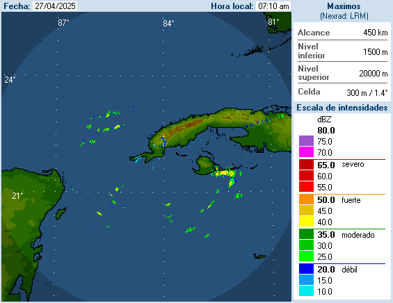
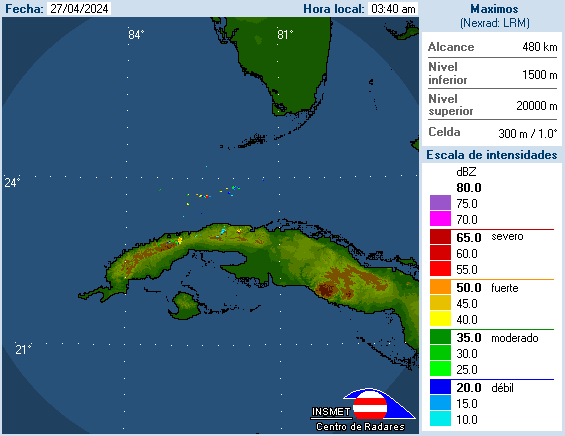
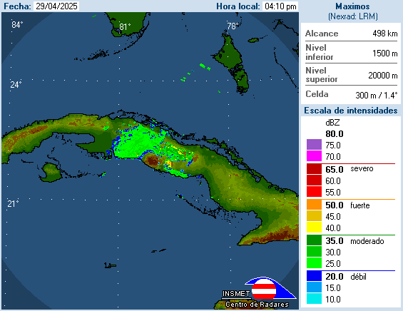
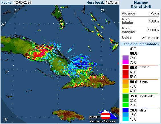
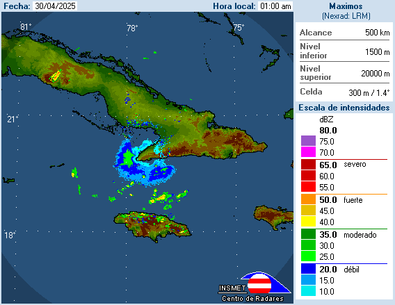
Cuba
http://www.insmet.cu/asp/genesis.asp?TB0=PLANTILLAS&TB1=RADARES [150.188.4.189./Radar/activos=/name=]
http://www.insmet.cu/Radar/NacComp200Km.gif mosiac
http://www.insmet.cu/Radar/00Pinar%20del%20Rio/lbjMAXw01a.gif La Bajada
http://www.insmet.cu/Radar/01Casablanca/csbMAXw01a.gif Casablanca
http://www.insmet.cu/Radar/02I.Juventud/pdeMAXw01a.gif Punta del Este
http://www.insmet.cu/Radar/03Cienfuegos/psjMAXw01a.gif Pico San Juan
http://www.insmet.cu/Radar/04Camaguey/cmwMAXw01a.gif Camagüey
http://www.insmet.cu/Radar/05Pilon/plnMAXw01a.gif Pilon
http://www.insmet.cu/Radar/06Gran%20Piedra/gpdMAXw01a.gif Gran Piedra
http://www.insmet.cu/Radar/07Holguin/hlgMAXw01a.gif ? Holguin
Guantanamo Bay, Cuba
http://radar.weather.gov/ridge/radar_lite.php?rid=gmo&product=N0R&loop=yes
https://detweb.weather.navy.mil/gtmo/radar.htm [restricted in
2007]
http://www.weather.navy.mil/products/animate/radar.jsp?prod=radar&id=mugm&type=cmax&frames=12>ype=JPG
[javascript ? last updated April 2007]
http://www.weather.navy.mil/products/animate/radar.jsp?prod=radar&id=mugm&type=base&frames=12>ype=JPG
http://www.weather.navy.mil/products/animate/radar.jsp?prod=radar&id=mugm&type=etops&frames=12>ype=JPG
http://www.weather.navy.mil/products/animate/radar.jsp?prod=radar&id=mugm&type=cappi&frames=12>ype=JPG
Mexico
http://smn.cna.gob.mx/
http://smn.cna.gob.mx/radares/radares.html
http://smn.cna.gob.mx/radares/rad-canc.gif Cancún
http://smn.cna.gob.mx/radares/rad-altamira.gif Altamira
http://smn.cna.gob.mx/radares/rad-alva.gif ? Alvarado
http://smn.cna.gob.mx/radares/rad-saba.jpg ? Sabancuy
Panama
http://www.pancanal.com/eng/eie/radar/radar.html
http://www.pancanal.com/eng/eie/radar/movie.gif
http://www.pancanal.com/eng/eie/radar/current_image.gif
Canada
http://weatheroffice.ec.gc.ca/radar/index_e.html
http://www.weatheroffice.gc.ca/radar/index_e.html?id=XGO Halifax, NS
_
This requires conversion software to view, download from http://www.ncdc.noaa.gov/oa/radar/jnx/
http://weather.noaa.gov/pub/SL.us008001/DF.of/DC.radar/
Radar [Jacksonville, FL (JAX) for Gainesville and
Ocala, FL]
Note: You can overwrite letters in the link
for your radar area. JAX to TLH or kjax to ktlh, etc.
_
http://radar.weather.gov/radar_lite.php?product=N0Z&rid=JAX&loop=yes
N0R: Base Reflectivity Short Range images (views out to 124 nmi)
http://radar.weather.gov/ridge/lite/N0R/JAX_loop.gif
http://radar.weather.gov/ridge/lite/N0R/JAX_0.png (7.png to 0.png)
http://radar.weather.gov/ridge/lite/N0R/JAX_1.png (7.png to 0.png)
N0S: Storm Relative Motion
http://radar.weather.gov/ridge/lite/N0S/JAX_loop.gif
http://radar.weather.gov/ridge/lite/N0S/JAX_0.png (7.png to 0.png)
http://radar.weather.gov/ridge/lite/N0S/JAX_1.png (7.png to 0.png)
N0V: Base Velocity
http://radar.weather.gov/ridge/lite/N0V/JAX_loop.gif
http://radar.weather.gov/ridge/lite/N0V/JAX_0.png (7.png to 0.png)
http://radar.weather.gov/ridge/lite/N0V/JAX_1.png (7.png to 0.png)
N0Z: Base Reflectivity Long Range image (view out to 248 nmi)
http://radar.weather.gov/ridge/lite/N0Z/JAX_loop.gif
http://radar.weather.gov/ridge/lite/N0Z/JAX_0.png (7.png to 0.png)
http://radar.weather.gov/ridge/lite/N0Z/JAX_1.png (7.png to 0.png)
N1P: One-Hour Precipitation
http://radar.weather.gov/ridge/lite/N1P/JAX_loop.gif
http://radar.weather.gov/ridge/lite/N1P/JAX_0.png (7.png to 0.png)
http://radar.weather.gov/ridge/lite/N1P/JAX_1.png (7.png to 0.png)
NCR: Composite Reflectivity
http://radar.weather.gov/ridge/lite/NCR/JAX_loop.gif
http://radar.weather.gov/ridge/lite/NCR/JAX_0.png (7.png to 0.png)
http://radar.weather.gov/ridge/lite/NCR/JAX_1.png (7.png to 0.png)
NEX: Echo Tops
http://radar.weather.gov/ridge/lite/NET/JAX_loop.gif
http://radar.weather.gov/ridge/lite/NET/JAX_0.png (7.png to 0.png)
http://radar.weather.gov/ridge/lite/NET/JAX_1.png (7.png to 0.png)
NTP: Storm Total Precipitation
http://radar.weather.gov/ridge/lite/NTP/JAX_loop.gif
http://radar.weather.gov/ridge/lite/NTP/JAX_0.png (7.png to 0.png)
http://radar.weather.gov/ridge/lite/NTP/JAX_1.png (7.png to 0.png)
NVL: Vertical Integrated Liquid
http://radar.weather.gov/ridge/lite/NVL/JAX_loop.gif
http://radar.weather.gov/ridge/lite/NVL/JAX_0.png (7.png to 0.png)
http://radar.weather.gov/ridge/lite/NVL/JAX_1.png (7.png to 0.png)
http://vortex.plymouth.edu/gen_lnids.cgi?pl=n0r&cu=1&loop=no&ident=jax
http://vortex.plymouth.edu/nids.html Enter Station Identifier: jax
http://weather.cod.edu/analysis_old/paulradar.pl?JAX
http://weather.cod.edu/nexrad/brefs/JAX/BREF1_loops/JAX.BREF1.24.gif 1.gif to 24.gif
http://www.rap.ucar.edu/weather/radar/displayRad.php?icao=KJAX&prod=bref1&bkgr=black
http://www.rap.ucar.edu/weather/radar/displayRad.php?icao=KJAX&prod=bref1&bkgr=black&duration=1 [java loop]
http://www.rap.ucar.edu/weather/radar/displayRad.php?icao=KJAX&prod=vel1&bkgr=black
http://www.rap.ucar.edu/weather/radar/displayRad.php?icao=KJAX&prod=vel1&bkgr=black&duration=1 [java loop]
http://fltwx.db.erau.edu/images/NIDS/JAX/
http://fltwx.db.erau.edu/images/NIDS/JAX/N0Z/?C=M&O=D - http://fltwx.db.erau.edu/images/NIDS/JAX/N0Z/latest.gif
http://fltwx.db.erau.edu/images/NIDS/JAX/N0R/?C=M&O=D - http://fltwx.db.erau.edu/images/NIDS/JAX/N0R/latest.gif
http://fltwx.db.erau.edu/images/NIDS/JAX/NCR/?C=M&O=D - http://fltwx.db.erau.edu/images/NIDS/JAX/NCR/latest.gif
http://fltwx.db.erau.edu/images/NIDS/JAX/N0S/?C=M&O=D - http://fltwx.db.erau.edu/images/NIDS/JAX/N0S/latest.gif
http://fltwx.db.erau.edu/images/NIDS/JAX/N0V/?C=M&O=D - http://fltwx.db.erau.edu/images/NIDS/JAX/N0V/latest.gif
http://fltwx.db.erau.edu/images/NIDS/JAX/NET/?C=M&O=D - http://fltwx.db.erau.edu/images/NIDS/JAX/NET/latest.gif
http://fltwx.db.erau.edu/images/NIDS/JAX/NTP/?C=M&O=D - http://fltwx.db.erau.edu/images/NIDS/JAX/NTP/latest.gif
http://fltwx.db.erau.edu/images/NIDS/JAX/N1P/?C=M&O=D - http://fltwx.db.erau.edu/images/NIDS/JAX/N1P/latest.gif
http://fltwx.db.erau.edu/images/NIDS/JAX/NVL/?C=M&O=D - http://fltwx.db.erau.edu/images/NIDS/JAX/NVL/latest.gif
http://mesonet.agron.iastate.edu/GIS/apps/rview/warnings.phtml?site=JAX&tz=EDT
? http://mesonet.tamu.edu/LevelII/KJAX/dz/ and http://mesonet.tamu.edu/LevelII/KJAX/dz_white/
01-05-KJAX.gif
? http://mesonet.tamu.edu/LevelII/KJAX/sw/ and http://mesonet.tamu.edu/LevelII/KJAX/sw_white/
? http://mesonet.tamu.edu/LevelII/KJAX/vr/ and http://mesonet.tamu.edu/LevelII/KJAX/vr_white/
http://www.aprsfl.net/radar/index.php?site=KJAX&mode=dz&animated=no&SubmitButton=Submit
http://www.aprsfl.net/radar/images/KJAX/dz/01-05-KJAX.gif 24-05 to 01-05
https://afweather.afwa.af.mil/cgi-bin/radar_zoom.cgi?KJAX
https://afweather.afwa.af.mil/nexrad/radar/KJAX/KJAX23.GIF [01 to 23]
https://avweb.weather.navy.mil/radar/site/JAX_PCP.shtml?JAX&20
https://avweb.weather.navy.mil/cgi-bin/radar/radar_loop.cgi?JAX/BREF/&13
http://www.nlmoc.navy.mil/cgi-bin/latest.pl?radar+kjax+crp
http://www.nlmoc.navy.mil/products/animate/radar.jsp?prod=radar&id=kjax&type=crp&frames=12>ype=gif
http://www.nlmoc.navy.mil/cgi-bin/latest.pl?radar+kjax+vel
http://www.nlmoc.navy.mil/products/animate/radar.jsp?prod=radar&id=kjax&type=vel&frames=12>ype=gif
_
http://www.accuweather.com/enhanced-radar.asp select U.S. High-Res Radar select Ocala, FL then
Animate (javascript required)
http://www.accuweather.com/us/radar/r1h/kjax/radar.asp?play=true
http://sirocco.accuweather.com/nxss_r1_h_500x620d/r1h/inxr1KJAXs_h.gif
http://sirocco.accuweather.com/nxssa_r1_h_500x620d/r1h/inxr1KJAXa_h.gif
http://sirocco.accuweather.com/nxss_R1_640x480d/R1/inxR1kjaxs.gif
http://sirocco.accuweather.com/nxssa_R1_640x480d/R1/inxR1kjaxa.gif
http://sirocco.accuweather.com/nxss_RE_640x480d/RE/inxREkjaxs.gif
http://sirocco.accuweather.com/nxssa_RE_640x480d/RE/inxREkjaxa.gif
http://sirocco.accuweather.com/nxss_CR_640x480d/CR/inxCRkjaxs.gif
http://www.intellicast.com/National/Nexrad/BaseReflectivity.aspx?region=jax
http://www.intellicast.com/National/Nexrad/BaseReflectivity.aspx?region=jax&animate=true
http://www.intellicast.com/National/Nexrad/RadialVelocity.aspx?region=jax
http://www.wunderground.com/radar/radblast.asp?ID=JAX&lat=0&lon=0&label=you&type=N0Z&zoommode=pan&map.x=400&map.y=240¢erx=400¢ery=240&prevzoom=pan&num=6&delay=5&scale=1&noclutter=0&showstorms=0&showlabels=1&rainsnow=1&smooth=1&lightning=0
http://www.wunderground.com/radar/station.asp?ID=JAX19&type=loop&clutter=
http://icons.wunderground.com/data/nids/JAX19_anim_t.gif
http://www.weather.com/weather/map/34470?mapdest=Doppler_Radar_300_Mile:ORL
http://i.imwx.com/web/radar/us_orl_ultraradar_plus_usen.jpg
http://www.weather.com/weather/map/34470
http://image.weather.com/looper/archive/us_tlh_closeradar_plus_usen/5L.jpg [1L.jpg to 5L.jpg]
http://www.weather.com/weather/map/interactive/ (requires flash)
http://wxweb.meteostar.com/radar/site/JAX.shtml?JAX
http://www.ic4u-ii.net/leads_images/radar/JAX/ or http://wxweb.meteostar.com/leads_images/radar/JAX/
http://wxweb.meteostar.com/search/getweather.php?locid=25637
Radar [Moody AFB - Valdosta, Georgia (VAX)]
Note: You can overwrite letters in the link
for your radar area. VAX to TLH or kvax to ktlh, etc.
_
http://radar.weather.gov/radar_lite.php?product=N0Z&rid=VAX&loop=yes
N0R: Base Reflectivity Short Range images (views out to 124 nmi)
http://radar.weather.gov/ridge/lite/N0R/VAX_loop.gif
http://radar.weather.gov/ridge/lite/N0R/VAX_0.png (7.png to 0.png)
http://radar.weather.gov/ridge/lite/N0R/VAX_1.png (7.png to 0.png)
N0S: Storm Relative Motion
http://radar.weather.gov/ridge/lite/N0S/VAX_loop.gif
http://radar.weather.gov/ridge/lite/N0S/VAX_0.png (7.png to 0.png)
http://radar.weather.gov/ridge/lite/N0S/VAX_1.png (7.png to 0.png)
N0V: Base Velocity
http://radar.weather.gov/ridge/lite/N0V/VAX_loop.gif
http://radar.weather.gov/ridge/lite/N0V/VAX_0.png (7.png to 0.png)
http://radar.weather.gov/ridge/lite/N0V/VAX_1.png (7.png to 0.png)
N0Z: Base Reflectivity Long Range image (view out to 248 nmi)
http://radar.weather.gov/ridge/lite/N0Z/VAX_loop.gif
http://radar.weather.gov/ridge/lite/N0Z/VAX_0.png (7.png to 0.png)
http://radar.weather.gov/ridge/lite/N0Z/VAX_1.png (7.png to 0.png)
N1P: One-Hour Precipitation
http://radar.weather.gov/ridge/lite/N1P/VAX_loop.gif
http://radar.weather.gov/ridge/lite/N1P/VAX_0.png (7.png to 0.png)
http://radar.weather.gov/ridge/lite/N1P/VAX_1.png (7.png to 0.png)
NCR: Composite Reflectivity
http://radar.weather.gov/ridge/lite/NCR/VAX_loop.gif
http://radar.weather.gov/ridge/lite/NCR/VAX_0.png (7.png to 0.png)
http://radar.weather.gov/ridge/lite/NCR/VAX_1.png (7.png to 0.png)
NEX: Echo Tops
http://radar.weather.gov/ridge/lite/NET/VAX_loop.gif
http://radar.weather.gov/ridge/lite/NET/VAX_0.png (7.png to 0.png)
http://radar.weather.gov/ridge/lite/NET/VAX_1.png (7.png to 0.png)
NTP: Storm Total Precipitation
http://radar.weather.gov/ridge/lite/NTP/VAX_loop.gif
http://radar.weather.gov/ridge/lite/NTP/VAX_0.png (7.png to 0.png)
http://radar.weather.gov/ridge/lite/NTP/VAX_1.png (7.png to 0.png)
NVL: Vertical Integrated Liquid
http://radar.weather.gov/ridge/lite/NVL/VAX_loop.gif
http://radar.weather.gov/ridge/lite/NVL/VAX_0.png (7.png to 0.png)
http://radar.weather.gov/ridge/lite/NVL/VAX_1.png (7.png to 0.png)
http://vortex.plymouth.edu/gen_lnids.cgi?pl=n0r&cu=1&loop=no&ident=vax
http://vortex.plymouth.edu/nids.html Enter Station Identifier: vax
http://weather.cod.edu/analysis_old/paulradar.pl?VAX
http://weather.cod.edu/nexrad/brefs/VAX/BREF1_loops/VAX.BREF1.24.gif 1.gif to 24.gif
http://www.rap.ucar.edu/weather/radar/displayRad.php?icao=KVAX&prod=bref1&bkgr=black
http://www.rap.ucar.edu/weather/radar/displayRad.php?icao=KVAX&prod=bref1&bkgr=black&duration=1 [java loop]
http://www.rap.ucar.edu/weather/radar/displayRad.php?icao=KVAX&prod=vel1&bkgr=black
http://www.rap.ucar.edu/weather/radar/displayRad.php?icao=KVAX&prod=vel1&bkgr=black&duration=1 [java loop]
http://fltwx.db.erau.edu/images/NIDS/VAX/
http://fltwx.db.erau.edu/images/NIDS/VAX/N0Z/?C=M&O=D - http://fltwx.db.erau.edu/images/NIDS/VAX/N0Z/latest.gif
http://fltwx.db.erau.edu/images/NIDS/VAX/N0R/?C=M&O=D - http://fltwx.db.erau.edu/images/NIDS/VAX/N0R/latest.gif
http://fltwx.db.erau.edu/images/NIDS/VAX/NCR/?C=M&O=D - http://fltwx.db.erau.edu/images/NIDS/VAX/NCR/latest.gif
http://fltwx.db.erau.edu/images/NIDS/VAX/N0S/?C=M&O=D - http://fltwx.db.erau.edu/images/NIDS/VAX/N0S/latest.gif
http://fltwx.db.erau.edu/images/NIDS/VAX/N0V/?C=M&O=D - http://fltwx.db.erau.edu/images/NIDS/VAX/N0V/latest.gif
http://fltwx.db.erau.edu/images/NIDS/VAX/NET/?C=M&O=D - http://fltwx.db.erau.edu/images/NIDS/VAX/NET/latest.gif
http://fltwx.db.erau.edu/images/NIDS/VAX/NTP/?C=M&O=D - http://fltwx.db.erau.edu/images/NIDS/VAX/NTP/latest.gif
http://fltwx.db.erau.edu/images/NIDS/VAX/N1P/?C=M&O=D - http://fltwx.db.erau.edu/images/NIDS/VAX/N1P/latest.gif
http://fltwx.db.erau.edu/images/NIDS/VAX/NVL/?C=M&O=D - http://fltwx.db.erau.edu/images/NIDS/VAX/NVL/latest.gif
? http://mesonet.tamu.edu/LevelII/KVAX/dz/ and http://mesonet.tamu.edu/LevelII/KVAX/dz_white/
01-05-KVAX.gif
? http://mesonet.tamu.edu/LevelII/KVAX/sw/ and http://mesonet.tamu.edu/LevelII/KVAX/sw_white/
? http://mesonet.tamu.edu/LevelII/KVAX/vr/ and http://mesonet.tamu.edu/LevelII/KVAX/vr_white/
https://afweather.afwa.af.mil/cgi-bin/radar_zoom.cgi?KVAX
https://afweather.afwa.af.mil/nexrad/radar/KVAX/KVAX23.GIF [01 to 23]
https://avweb.weather.navy.mil/radar/site/VAX_PCP.shtml?VAX&20
https://avweb.weather.navy.mil/cgi-bin/radar/radar_loop.cgi?VAX/BREF/&13
_
http://www.accuweather.com/us/radar/r1h/KVAD/radar.asp?play=true
http://sirocco.accuweather.com/nxss_r1_h_500x620d/r1h/inxr1KVADs_h.gif
http://sirocco.accuweather.com/nxssa_r1_h_500x620d/r1h/inxr1KVADa_h.gif
http://sirocco.accuweather.com/nxss_R1_640x480d/R1/inxR1kvads.gif
http://sirocco.accuweather.com/nxssa_R1_640x480d/R1/inxR1kvada.gif
http://sirocco.accuweather.com/nxss_RE_640x480d/RE/inxREkvads.gif
http://sirocco.accuweather.com/nxssa_RE_640x480d/RE/inxREkvada.gif
http://sirocco.accuweather.com/nxss_CR_640x480d/CR/inxCRkvads.gif
http://www.intellicast.com/National/Nexrad/BaseReflectivity.aspx?region=vax
http://www.intellicast.com/National/Nexrad/BaseReflectivity.aspx?region=vax&animate=true
http://www.intellicast.com/National/Nexrad/RadialVelocity.aspx?region=vax
http://www.wunderground.com/radar/radblast.asp?ID=VAX&lat=0&lon=0&label=you&type=N0Z&zoommode=pan&map.x=400&map.y=240¢erx=400¢ery=240&prevzoom=pan&num=6&delay=5&scale=1&noclutter=0&showstorms=0&showlabels=1&rainsnow=1&smooth=1&lightning=0
http://www.wunderground.com/radar/station.asp?ID=VAX19&type=loop&clutter=
http://icons.wunderground.com/data/nids/VAX19_anim_t.gif
http://wxweb.meteostar.com/radar/site/VAX.shtml?VAX
http://www.ic4u-ii.net/leads_images/radar/VAX/ or http://wxweb.meteostar.com/leads_images/radar/VAX/
Radar [Tampa, FL (TBW)]
Note: You can overwrite letters in the link
for your radar area. TBW to JAX or ktbw to kjax, etc.
_
http://radar.weather.gov/radar_lite.php?product=N0Z&rid=TBW&loop=yes [javascript]
N0R: Base Reflectivity Short Range images (views out to 124 nmi)
http://radar.weather.gov/ridge/lite/N0R/TBW_loop.gif
http://radar.weather.gov/ridge/lite/N0R/TBW_0.png (7.png to 0.png)
http://radar.weather.gov/ridge/lite/N0R/TBW_1.png (7.png to 0.png)
N0S: Storm Relative Motion
http://radar.weather.gov/ridge/lite/N0S/TBW_loop.gif
http://radar.weather.gov/ridge/lite/N0S/TBW_0.png (7.png to 0.png)
http://radar.weather.gov/ridge/lite/N0S/TBW_1.png (7.png to 0.png)
N0V: Base Velocity
http://radar.weather.gov/ridge/lite/N0V/TBW_loop.gif
http://radar.weather.gov/ridge/lite/N0V/TBW_0.png (7.png to 0.png)
http://radar.weather.gov/ridge/lite/N0V/TBW_1.png (7.png to 0.png)
N0Z: Base Reflectivity Long Range image (view out to 248 nmi)
http://radar.weather.gov/ridge/lite/N0Z/TBW_loop.gif
http://radar.weather.gov/ridge/lite/N0Z/TBW_0.png (7.png to 0.png)
http://radar.weather.gov/ridge/lite/N0Z/TBW_1.png (7.png to 0.png)
N1P: One-Hour Precipitation
http://radar.weather.gov/ridge/lite/N1P/TBW_loop.gif
http://radar.weather.gov/ridge/lite/N1P/TBW_0.png (7.png to 0.png)
http://radar.weather.gov/ridge/lite/N1P/TBW_1.png (7.png to 0.png)
NCR: Composite Reflectivity
http://radar.weather.gov/ridge/lite/NCR/TBW_loop.gif
http://radar.weather.gov/ridge/lite/NCR/TBW_0.png (7.png to 0.png)
http://radar.weather.gov/ridge/lite/NCR/TBW_1.png (7.png to 0.png)
NEX: Echo Tops
http://radar.weather.gov/ridge/lite/NET/TBW_loop.gif
http://radar.weather.gov/ridge/lite/NET/TBW_0.png (7.png to 0.png)
http://radar.weather.gov/ridge/lite/NET/TBW_1.png (7.png to 0.png)
NTP: Storm Total Precipitation
http://radar.weather.gov/ridge/lite/NTP/TBW_loop.gif
http://radar.weather.gov/ridge/lite/NTP/TBW_0.png (7.png to 0.png)
http://radar.weather.gov/ridge/lite/NTP/TBW_1.png (7.png to 0.png)
NVL: Vertical Integrated Liquid
http://radar.weather.gov/ridge/lite/NVL/TBW_loop.gif
http://radar.weather.gov/ridge/lite/NVL/TBW_0.png (7.png to 0.png)
http://radar.weather.gov/ridge/lite/NVL/TBW_1.png (7.png to 0.png)
http://my.sfwmd.gov/sfwmd/common/images/weather/noaaport/radar_tbw2_anim.gif
http://my.sfwmd.gov/sfwmd/common/images/weather/noaaport/radar_tbw_anim.gif
http://vortex.plymouth.edu/gen_lnids.cgi?pl=n0r&cu=1&loop=no&ident=tbw
http://vortex.plymouth.edu/nids.html Enter Station Identifier: tbw
http://weather.cod.edu/analysis_old/paulradar.pl?TBW
http://weather.cod.edu/nexrad/brefs/TBW/BREF1_loops/TBW.BREF1.24.gif 1.gif to 24.gif
http://www.rap.ucar.edu/weather/radar/displayRad.php?icao=KTBW&prod=bref1&bkgr=black
http://www.rap.ucar.edu/weather/radar/displayRad.php?icao=KTBW&prod=bref1&bkgr=black&duration=1 [java loop]
http://www.rap.ucar.edu/weather/radar/displayRad.php?icao=KTBW&prod=vel1&bkgr=black
http://www.rap.ucar.edu/weather/radar/displayRad.php?icao=KTBW&prod=vel1&bkgr=black&duration=1 [java loop]
http://fltwx.db.erau.edu/images/NIDS/TBW/
http://fltwx.db.erau.edu/images/NIDS/TBW/N0Z/?C=M&O=D - http://fltwx.db.erau.edu/images/NIDS/TBW/N0Z/latest.gif
http://fltwx.db.erau.edu/images/NIDS/TBW/N0R/?C=M&O=D - http://fltwx.db.erau.edu/images/NIDS/TBW/N0R/latest.gif
http://fltwx.db.erau.edu/images/NIDS/TBW/NCR/?C=M&O=D - http://fltwx.db.erau.edu/images/NIDS/TBW/NCR/latest.gif
http://fltwx.db.erau.edu/images/NIDS/TBW/N0S/?C=M&O=D - http://fltwx.db.erau.edu/images/NIDS/TBW/N0S/latest.gif
http://fltwx.db.erau.edu/images/NIDS/TBW/N0V/?C=M&O=D - http://fltwx.db.erau.edu/images/NIDS/TBW/N0V/latest.gif
http://fltwx.db.erau.edu/images/NIDS/TBW/NET/?C=M&O=D - http://fltwx.db.erau.edu/images/NIDS/TBW/NET/latest.gif
http://fltwx.db.erau.edu/images/NIDS/TBW/NTP/?C=M&O=D - http://fltwx.db.erau.edu/images/NIDS/TBW/NTP/latest.gif
http://fltwx.db.erau.edu/images/NIDS/TBW/N1P/?C=M&O=D - http://fltwx.db.erau.edu/images/NIDS/TBW/N1P/latest.gif
http://fltwx.db.erau.edu/images/NIDS/TBW/NVL/?C=M&O=D - http://fltwx.db.erau.edu/images/NIDS/TBW/NVL/latest.gif
http://mesonet.agron.iastate.edu/GIS/apps/rview/warnings.phtml?site=TBW&tz=EDT
? http://mesonet.tamu.edu/LevelII/KTBW/dz/ and http://mesonet.tamu.edu/LevelII/KTBW/dz_white/
01-05-KTBW.gif
? http://mesonet.tamu.edu/LevelII/KTBW/sw/ and http://mesonet.tamu.edu/LevelII/KTBW/sw_white/
? http://mesonet.tamu.edu/LevelII/KTBW/vr/ and http://mesonet.tamu.edu/LevelII/KTBW/vr_white/
http://weather2.admin.niu.edu/niurad/NIUTB_24.GIF [1.GIF to 24.GIF]
http://weather.niu.edu/niutb.html javascript loop
http://metlab.cas.usf.edu/cgi-bin/gen_mcidas_radar.cgi?type=RTNEXRAD/N0R
http://www.aprsfl.net/radar/index.php?site=KTBW&mode=dz&animated=no&SubmitButton=Submit
http://www.aprsfl.net/radar/images/KTBW/dz/01-05-KTBW.gif 24-05 to 01-05
https://afweather.afwa.af.mil/cgi-bin/radar_zoom.cgi?KTBW
https://afweather.afwa.af.mil/nexrad/radar/KTBW/KTBW23.GIF [01 to 23]
https://avweb.weather.navy.mil/radar/site/TBW_PCP.shtml?TBW&20
https://avweb.weather.navy.mil/cgi-bin/radar/radar_loop.cgi?TBW/BREF/&13
http://www.nlmoc.navy.mil/cgi-bin/latest.pl?radar+ktbw+crp
http://www.nlmoc.navy.mil/products/animate/radar.jsp?prod=radar&id=ktbw&type=crp&frames=12>ype=gif
http://www.nlmoc.navy.mil/cgi-bin/latest.pl?radar+ktbw+vel
http://www.nlmoc.navy.mil/products/animate/radar.jsp?prod=radar&id=ktbw&type=vel&frames=12>ype=gif
_
http://www.accuweather.com/us/radar/r1h/KTPA/radar.asp?play=true
http://sirocco.accuweather.com/nxss_r1_h_500x620d/r1h/inxr1KTPAs_h.gif
http://sirocco.accuweather.com/nxssa_r1_h_500x620d/r1h/inxr1KTPAa_h.gif
http://sirocco.accuweather.com/nxss_R1_640x480d/R1/inxR1ktpas.gif
http://sirocco.accuweather.com/nxssa_R1_640x480d/R1/inxR1ktpaa.gif
http://sirocco.accuweather.com/nxss_RE_640x480d/RE/inxREktpas.gif
http://sirocco.accuweather.com/nxssa_RE_640x480d/RE/inxREktpaa.gif
http://sirocco.accuweather.com/nxss_CR_640x480d/CR/inxCRktpas.gif
http://www.intellicast.com/National/Nexrad/BaseReflectivity.aspx?region=tbw
http://www.intellicast.com/National/Nexrad/BaseReflectivity.aspx?region=tbw&animate=true
http://www.intellicast.com/National/Nexrad/RadialVelocity.aspx?region=tbw
http://www.wunderground.com/radar/radblast.asp?ID=TBW&lat=0&lon=0&label=you&type=N0Z&zoommode=pan&map.x=400&map.y=240¢erx=400¢ery=240&prevzoom=pan&num=6&delay=5&scale=1&noclutter=0&showstorms=0&showlabels=1&rainsnow=1&smooth=1&lightning=0
http://www.wunderground.com/radar/station.asp?ID=TBW19&type=loop&clutter=
http://icons.wunderground.com/data/nids/TBW19_anim_t.gif
http://wxweb.meteostar.com/radar/site/TBW.shtml?TBW
http://www.ic4u-ii.net/leads_images/radar/TBW/ or http://wxweb.meteostar.com/leads_images/radar/TBW/
http://wxweb.meteostar.com/search/getweather.php?locid=26441
http://i.imwx.com/web/radar/us_tpa_closeradar_plus_usen.jpg
http://weather.yahoo.com/images/us_tpa_closeradar_medium_usen.jpg
_
Backup radar if Nexrad radar above
is out of service
http://www.myfoxtampabay.com/subindex/weather
http://weather.myfoxtampabay.com/maps/WTVT/baron/b_xm0.jpg [0.jpg to 9.jpg]
http://weather.myfoxtampabay.com/maps/WTVT/baron/c_xm0.jpg [0.jpg to 9.jpg]
http://weather.myfoxtampabay.com/maps/WTVT/metro/radar/d640x480/b_xm0.jpg [0.jpg to 9.jpg]
http://weather.myfoxtampabay.com/maps/WTVT/regional/radar/d640x480/a_xm0.jpg
http://weather.myfoxtampabay.com/maps/sector/us-southeast/radar/d640x480/m0.jpeg
http://weather.myfoxtampabay.com/maps/sector/us-national/radar/d640x480/m0.jpeg
http://weather.myfoxtampabay.com/maps/sector/us-national/infrared/d640x480/m0.jpeg
http://weather.myfoxtampabay.com/maps/sector/us-southeast/infrared/d640x480/m0.jpeg
http://weather.myfoxtampabay.com/maps/sector/us-national/visible/d640x480/m0.jpeg
http://weather.myfoxtampabay.com/maps/sector/hurricane/infrared/d640x480/m0.jpeg
http://www2.tbo.com/weather/
http://www2.tbo.com/weather/local/animated-radar/
http://www.tbo.com/weather//radar/75basest_image.htm
http://doppler.tbo.com/75base1.jpg [1.jpg 3.jpg 5.jpg 7.jpg]
http://doppler.tbo.com/polk1.jpg [1.jpg to 10.jpg]
http://doppler.tbo.com/citrushernando1.jpg
http://doppler.tbo.com/pasco1.jpg
http://doppler.tbo.com/nwhillsb1.jpg
http://doppler.tbo.com/brandon1.jpg
http://doppler.tbo.com/newtampa1.jpg
http://doppler.tbo.com/centraltampa1.jpg
http://doppler.tbo.com/stampa1.jpg
http://doppler.tbo.com/npinellas1.jpg
http://doppler.tbo.com/spinellas1.jpg
http://doppler.tbo.com/shore1.jpg
http://doppler.tbo.com/heartland1.jpg
http://doppler.tbo.com/sarasota1.jpg
http://doppler.tbo.com/manatee1.jpg
http://www2.tbo.com/weather/local/doppler/
http://doppler.tbo.com/wfla_nowrad_fl.jpg
http://doppler.tbo.com/wfla_nowrad_se.jpg
http://doppler.tbo.com/wfla_nowrad_us.jpg
http://doppler.tbo.com/wfla_satir_fl.jpg
http://doppler.tbo.com/wfla_satir_us.jpg
http://www.baynews9.com/Weather.html
http://www.baynews9.com/Klystron9Radar.html
http://www.baynews9.com/images/wx/BayAreaDoppler.jpg
http://media2.www.baynews9.com/images/wx/BayAreaDoppler.jpg
http://www.baynews9.com/images/wx/FloridaDoppler.jpg
http://media2.www.baynews9.com/images/wx/FloridaDoppler.jpg
http://www.baynews9.com/images/wx/CitrusDoppler.jpg
http://www.baynews9.com/content/Doppler.xml [overwrite # below from this list]
http://www.baynews9.com/images/wx/doppler/barons/#.jpg
http://www.baynews9.com/images/wx/doppler/State/#.jpg
http://www.baynews9.com/content/CountyDoppler.xml [overwrite # below from this list]
http://www.baynews9.com/images/wx/doppler/Citrus/#.jpg
http://www.baynews9.com/images/wx/doppler/Hernando/#.jpg
http://www.baynews9.com/images/wx/doppler/Hillsborough/#.jpg
http://www.baynews9.com/images/wx/doppler/Manatee/#.jpg
http://www.baynews9.com/images/wx/doppler/Pasco/#.jpg
http://www.baynews9.com/images/wx/doppler/Pinellas/#.jpg
http://www.baynews9.com/images/wx/doppler/Polk/#.jpg
http://www.baynews9.com/content/Tropical.xml [overwrite # below from this list]
http://www.baynews9.com/images/wx/doppler/Gulf/#.jpg
http://www.baynews9.com/images/wx/doppler/Caribbean/#.jpg
http://www.baynews9.com/images/wx/doppler/Atlantic/#.jpg
http://www.baynews9.com/StateDoppler.html
http://www.baynews9.com/PolkDoppler.html
http://www.baynews9.com/images/wx/RAIN.JPG
http://www.baynews9.com/images/wx/TROPICAL1.JPG
http://www.baynews9.com/images/wx/TROPICAL2.JPG
http://www.baynews9.com/images/wx/TROPICAL3.JPG
http://www.wtsp.com/weather/
http://www.wtsp.com/video/weather/radar/
http://www.wtsp.com/weather/wx_images/bigdoppler1.jpg
http://www.wtsp.com/weather/radar/local_loop/
http://www.wtsp.com/weather/wx_images/doppler01.jpg [01.jpg to 20.jpg]
http://www.wtsp.com/video/weather/radar/
http://www.wtsp.com/video/weather/radar/doppler.asx
http://www.abcactionnews.com/weather/
http://www.abcactionnews.com/weather/maps.aspx
Radar [Melbourne, FL (MLB) and Orlando, FL]
Note: You can overwrite letters in the link
for your radar area. MLB to JAX or kmlb to kjax, etc.
_
http://radar.weather.gov/radar_lite.php?product=N0Z&rid=MLB&loop=yes
N0R: Base Reflectivity Short Range images (views out to 124 nmi)
http://radar.weather.gov/ridge/lite/N0R/MLB_loop.gif
http://radar.weather.gov/ridge/lite/N0R/MLB_0.png (7.png to 0.png)
http://radar.weather.gov/ridge/lite/N0R/MLB_1.png (7.png to 0.png)
N0S: Storm Relative Motion
http://radar.weather.gov/ridge/lite/N0S/MLB_loop.gif
http://radar.weather.gov/ridge/lite/N0S/MLB_0.png (7.png to 0.png)
http://radar.weather.gov/ridge/lite/N0S/MLB_1.png (7.png to 0.png)
N0V: Base Velocity
http://radar.weather.gov/ridge/lite/N0V/MLB_loop.gif
http://radar.weather.gov/ridge/lite/N0V/MLB_0.png (7.png to 0.png)
http://radar.weather.gov/ridge/lite/N0V/MLB_1.png (7.png to 0.png)
N0Z: Base Reflectivity Long Range image (view out to 248 nmi)
http://radar.weather.gov/ridge/lite/N0Z/MLB_loop.gif
http://radar.weather.gov/ridge/lite/N0Z/MLB_0.png (7.png to 0.png)
http://radar.weather.gov/ridge/lite/N0Z/MLB_1.png (7.png to 0.png)
N1P: One-Hour Precipitation
http://radar.weather.gov/ridge/lite/N1P/MLB_loop.gif
http://radar.weather.gov/ridge/lite/N1P/MLB_0.png (7.png to 0.png)
http://radar.weather.gov/ridge/lite/N1P/MLB_1.png (7.png to 0.png)
NCR: Composite Reflectivity
http://radar.weather.gov/ridge/lite/NCR/MLB_loop.gif
http://radar.weather.gov/ridge/lite/NCR/MLB_0.png (7.png to 0.png)
http://radar.weather.gov/ridge/lite/NCR/MLB_1.png (7.png to 0.png)
NEX: Echo Tops
http://radar.weather.gov/ridge/lite/NET/MLB_loop.gif
http://radar.weather.gov/ridge/lite/NET/MLB_0.png (7.png to 0.png)
http://radar.weather.gov/ridge/lite/NET/MLB_1.png (7.png to 0.png)
NTP: Storm Total Precipitation
http://radar.weather.gov/ridge/lite/NTP/MLB_loop.gif
http://radar.weather.gov/ridge/lite/NTP/MLB_0.png (7.png to 0.png)
http://radar.weather.gov/ridge/lite/NTP/MLB_1.png (7.png to 0.png)
NVL: Vertical Integrated Liquid
http://radar.weather.gov/ridge/lite/NVL/MLB_loop.gif
http://radar.weather.gov/ridge/lite/NVL/MLB_0.png (7.png to 0.png)
http://radar.weather.gov/ridge/lite/NVL/MLB_1.png (7.png to 0.png)
http://my.sfwmd.gov/sfwmd/common/images/weather/noaaport/radar_mlb2_anim.gif
http://my.sfwmd.gov/sfwmd/common/images/weather/noaaport/radar_mlb_anim.gif
http://vortex.plymouth.edu/gen_lnids.cgi?pl=n0r&cu=1&loop=no&ident=mlb
http://vortex.plymouth.edu/nids.html Enter Station Identifier: mlb
http://weather.cod.edu/analysis_old/paulradar.pl?MLB
http://weather.cod.edu/nexrad/brefs/MLB/BREF1_loops/MLB.BREF1.24.gif 1.gif to 24.gif
http://www.rap.ucar.edu/weather/radar/displayRad.php?icao=KMLB&prod=bref1&bkgr=black
http://www.rap.ucar.edu/weather/radar/displayRad.php?icao=KMLB&prod=bref1&bkgr=black&duration=1 [java loop]
http://www.rap.ucar.edu/weather/radar/displayRad.php?icao=KMLB&prod=vel1&bkgr=black
http://www.rap.ucar.edu/weather/radar/displayRad.php?icao=KMLB&prod=vel1&bkgr=black&duration=1 [java loop]
http://fltwx.db.erau.edu/images/NIDS/MLB/
http://fltwx.db.erau.edu/images/NIDS/MLB/N0Z/?C=M&O=D - http://fltwx.db.erau.edu/images/NIDS/MLB/N0Z/latest.gif
http://fltwx.db.erau.edu/images/NIDS/MLB/N0R/?C=M&O=D - http://fltwx.db.erau.edu/images/NIDS/MLB/N0R/latest.gif
http://fltwx.db.erau.edu/images/NIDS/MLB/NCR/?C=M&O=D - http://fltwx.db.erau.edu/images/NIDS/MLB/NCR/latest.gif
http://fltwx.db.erau.edu/images/NIDS/MLB/N0S/?C=M&O=D - http://fltwx.db.erau.edu/images/NIDS/MLB/N0S/latest.gif
http://fltwx.db.erau.edu/images/NIDS/MLB/N0V/?C=M&O=D - http://fltwx.db.erau.edu/images/NIDS/MLB/N0V/latest.gif
http://fltwx.db.erau.edu/images/NIDS/MLB/NET/?C=M&O=D - http://fltwx.db.erau.edu/images/NIDS/MLB/NET/latest.gif
http://fltwx.db.erau.edu/images/NIDS/MLB/NTP/?C=M&O=D - http://fltwx.db.erau.edu/images/NIDS/MLB/NTP/latest.gif
http://fltwx.db.erau.edu/images/NIDS/MLB/N1P/?C=M&O=D - http://fltwx.db.erau.edu/images/NIDS/MLB/N1P/latest.gif
http://fltwx.db.erau.edu/images/NIDS/MLB/NVL/?C=M&O=D - http://fltwx.db.erau.edu/images/NIDS/MLB/NVL/latest.gif
http://mesonet.agron.iastate.edu/GIS/apps/rview/warnings.phtml?site=MLB&tz=EDT
? http://mesonet.tamu.edu/LevelII/KMLB/dz/ and http://mesonet.tamu.edu/LevelII/KMLB/dz_white/
01-05-KMLB.gif
? http://mesonet.tamu.edu/LevelII/KMLB/sw/ and http://mesonet.tamu.edu/LevelII/KMLB/sw_white/
? http://mesonet.tamu.edu/LevelII/KMLB/vr/ and http://mesonet.tamu.edu/LevelII/KMLB/vr_white/
http://www.aprsfl.net/radar/index.php?site=KMLB&mode=dz&animated=no&SubmitButton=Submit
http://www.aprsfl.net/radar/images/KMLB/dz/01-05-KMLB.gif 24-05 to 01-05
https://afweather.afwa.af.mil/cgi-bin/radar_zoom.cgi?KMLB
https://afweather.afwa.af.mil/nexrad/radar/KMLB/KMLB23.GIF [01 to 23]
https://avweb.weather.navy.mil/radar/site/MLB_PCP.shtml?MLB&20
https://avweb.weather.navy.mil/cgi-bin/radar/radar_loop.cgi?MLB/BREF/&13
_
http://www.accuweather.com/us/radar/r1h/KMLB/radar.asp?play=true
http://sirocco.accuweather.com/nxss_r1_h_500x620d/r1h/inxr1KMLBs_h.gif
http://sirocco.accuweather.com/nxssa_r1_h_500x620d/r1h/inxr1KMLBa_h.gif
http://sirocco.accuweather.com/nxss_R1_640x480d/R1/inxR1kmlbs.gif
http://sirocco.accuweather.com/nxssa_R1_640x480d/R1/inxR1kmlba.gif
http://sirocco.accuweather.com/nxss_RE_640x480d/RE/inxREkmlbs.gif
http://sirocco.accuweather.com/nxssa_RE_640x480d/RE/inxREkmlba.gif
http://sirocco.accuweather.com/nxss_CR_640x480d/CR/inxCRkmlbs.gif
http://www.intellicast.com/National/Nexrad/BaseReflectivity.aspx?region=mlb
http://www.intellicast.com/National/Nexrad/BaseReflectivity.aspx?region=mlb&animate=true
http://www.intellicast.com/National/Nexrad/RadialVelocity.aspx?region=mlb
http://www.wunderground.com/radar/radblast.asp?ID=MLB&lat=0&lon=0&label=you&type=N0Z&zoommode=pan&map.x=400&map.y=240¢erx=400¢ery=240&prevzoom=pan&num=6&delay=5&scale=1&noclutter=0&showstorms=0&showlabels=1&rainsnow=1&smooth=1&lightning=0
http://www.wunderground.com/radar/station.asp?ID=MLB19&type=loop&clutter=
http://icons.wunderground.com/data/nids/MLB19_anim_t.gif
http://www.weather.com/weather/map/32801
http://image.weather.com/looper/archive/us_tpa_closeradar_plus_usen/5L.jpg [1L.jpg to 5L.jpg]
http://image.weather.com/looper/archive/us_orl_ultraradar_plus_usen/5L.jpg
http://image.weather.com/looper/archive/us_orl_metroradar_plus_usen/5L.jpg
http://wxweb.meteostar.com/radar/site/MLB.shtml?MLB
http://www.ic4u-ii.net/leads_images/radar/MLB/ or http://wxweb.meteostar.com/leads_images/radar/MLB/
http://wxweb.meteostar.com/search/getweather.php?locid=25715
http://weather.yahoo.com/images/us_orl_metroradar_medium_usen.jpg
_
Backup radar if Nexrad radar above
is out of service
http://www.wftv.com/weather/
http://www.wftv.com/local-radar/1877642/detail.html
http://images.ibsys.com/orlc/images/weather/auto/doppler_640x480.jpg
http://images.ibsys.com/orlc/images/weather/auto/doppler_loop_640x480.xml
http://images.ibsys.com/orlc/images/weather/auto/iris1_640x480.jpg
http://images.ibsys.com/orlc/images/weather/auto/iris2_640x480.jpg
http://images.ibsys.com/orlc/images/weather/auto/iris3_640x480.jpg
http://images.ibsys.com/sh/images/weather/auto/radar_gulf_640x480.jpg
http://images.ibsys.com/sh/images/weather/auto/radar_gulf_loop_640x480.xml
http://images.ibsys.com/sh/images/weather/auto/radar_us_640x480.jpg
http://images.ibsys.com/sh/images/weather/auto/radar_us_loop_640x480.xml
http://images.ibsys.com/sh/images/weather/auto/ir_atl_640x480.jpg
http://images.ibsys.com/sh/images/weather/auto/ir_at_640x480.jpg
http://images.ibsys.com/sh/images/weather/auto/ir_at_loop_640x480.xml
http://images.ibsys.com/sh/images/weather/auto/vis_atl_640x480.jpg
http://images.ibsys.com/sh/images/weather/auto/ir_g4_640x480.jpg
http://images.ibsys.com/sh/images/weather/auto/vis_g4_640x480.jpg
http://images.ibsys.com/sh/images/weather/auto/ir_gulf_640x480.jpg
http://images.ibsys.com/sh/images/weather/auto/ir_gulf_loop_640x480.xml
http://images.ibsys.com/sh/images/weather/auto/sat_us_640x480.jpg
http://images.ibsys.com/sh/images/weather/auto/sat_us_loop_640x480.xml
http://www.wesh.com/weather/
http://www.wesh.com/mapsandradar/
http://images.ibsys.com/orl/images/weather/auto/radar_640x480.jpg
http://images.ibsys.com/orl/images/weather/auto/radar_loop_640x480.xml
http://images.ibsys.com/orl/images/weather/auto/marion_radar_640x480.jpg
http://images.ibsys.com/orl/images/weather/auto/marion_radar_loop_640x480.xml
http://images.ibsys.com/orl/images/weather/auto/volusia_radar_640x480.jpg
http://images.ibsys.com/orl/images/weather/auto/volusia_radar_loop_640x480.xml
http://images.ibsys.com/orl/images/weather/auto/flagler_radar_640x480.jpg
http://images.ibsys.com/orl/images/weather/auto/flagler_radar_loop_640x480.xml
http://images.ibsys.com/orl/images/weather/auto/lake_radar_640x480.jpg
http://images.ibsys.com/orl/images/weather/auto/lake_radar_loop_640x480.xml
http://images.ibsys.com/orl/images/weather/auto/sumter_radar_640x480.jpg
http://images.ibsys.com/orl/images/weather/auto/sumter_radar_loop_640x480.xml
http://images.ibsys.com/orl/images/weather/auto/seminole_radar_640x480.jpg
http://images.ibsys.com/orl/images/weather/auto/seminole_radar_loop_640x480.xml
http://images.ibsys.com/orl/images/weather/auto/orange_radar_640x480.jpg
http://images.ibsys.com/orl/images/weather/auto/orange_radar_loop_640x480.xml
http://images.ibsys.com/orl/images/weather/auto/brevard_radar_640x480.jpg
http://images.ibsys.com/orl/images/weather/auto/brevard_radar_loop_640x480.xml
http://images.ibsys.com/orl/images/weather/auto/polk_radar_640x480.jpg
http://images.ibsys.com/orl/images/weather/auto/polk_radar_loop_640x480.xml
http://images.ibsys.com/orl/images/weather/auto/oceola_radar_640x480.jpg
http://images.ibsys.com/orl/images/weather/auto/oceola_radar_loop_640x480.xml
http://images.ibsys.com/orl/images/weather/auto/wxplus_radar_fl_640x480.jpg
http://images.ibsys.com/orl/images/weather/auto/fl_doppler_640x480.gif
http://images.ibsys.com/orl/images/weather/auto/wxplus_radar_orlando_640x480.jpg
http://images.ibsys.com/orl/images/weather/auto/wxplus_ir_orlando_640x480.jpg
http://images.ibsys.com/orl/images/weather/auto/wxplus_radar_us_640x480.jpg
http://images.ibsys.com/orl/images/weather/auto/wxplus_ir_nat_640x480.jpg
http://images.ibsys.com/orl/images/weather/auto/wxplus_ir_atlantic_640x480.jpg
http://www.myfoxorlando.com/subindex/weather
http://weather.myfoxorlando.com/maps/WOFL/radar/seminole/seminole.jpg [seminole_9.jpg to seminole_1.jpg to seminole.jpg]
http://weather.myfoxorlando.com/maps/WOFL/radar/ocala/ocala.jpg [ocala_9.jpg to ocala_1.jpg to ocala.jpg]
http://weather.myfoxorlando.com/maps/WOFL/radar/orange/orange.jpg
http://weather.myfoxorlando.com/maps/WOFL/radar/osceola/osceola.jpg
http://weather.myfoxorlando.com/maps/WOFL/radar/daytona/daytona.jpg
http://weather.myfoxorlando.com/maps/WOFL/radar/melbourne/melb.jpg
http://www.cfnews13.com/Weather/Default.aspx
http://www.cfnews13.com/Weather/Radar/Default.aspx
http://www.cfnews13.com/images/weather/loop/WEB_RADAR_CF//image12.jpg 0 to 12.jpg
http://www.cfnews13.com/images/weather/loop/WEB_RADAR_FULLSTATE//image12.jpg 0 to 12.jpg
http://www.cfnews13.com/images/weather/loop/WEB_RADAR_MARION//image12.jpg 0 to 12.jpg
http://www.cfnews13.com/images/weather/loop/WEB_RADAR_LAKE//image12.jpg 0 to 12.jpg
http://www.cfnews13.com/images/weather/loop/WEB_RADAR_SUMTER//image12.jpg 0 to 12.jpg
http://www.cfnews13.com/images/weather/loop/WEB_RADAR_SEMINOLE//image12.jpg 0 to 12.jpg
http://www.cfnews13.com/images/weather/loop/WEB_RADAR_VOLUSIA//image12.jpg 0 to 12.jpg
http://www.cfnews13.com/images/weather/loop/WEB_RADAR_FLAGLER//image12.jpg 0 to 12.jpg
http://www.cfnews13.com/images/weather/loop/WEB_RADAR_ORANGE//image12.jpg 0 to 12.jpg
http://www.cfnews13.com/images/weather/loop/WEB_RADAR_BREVARD//image12.jpg 0 to 12.jpg
http://www.cfnews13.com/images/weather/loop/WEB_RADAR_OSCEOLA//image12.jpg 0 to 12.jpg
http://www.cfnews13.com/images/weather/loop/WEB_RADAR_POLK//image12.jpg 0 to 12.jpg
http://orlando.justweather.com/
http://orlando.justweather.com/radar/
overwrite
470_268_yymmddhhmmss.jpeg to 728_410_yymmddhhmmss.jpeg for larger
image
http://images.ibsys.com/orlpn/images/weather/auto/radar_640x480.jpg
http://images.ibsys.com/orlpn/images/weather/auto/radar_loop_640x480.xml
http://images.ibsys.com/jax/images/weather/auto/radar_640x480.jpg
http://images.ibsys.com/mia/images/weather/auto/radar_640x480.jpg
Radar Accumulated
Precipitation [TBW, MLB, FL, SE US]
Note: You can overwrite letters in the
link for your radar area. MLB to JAX or kmlb to kjax, etc.
_
http://radar.weather.gov/radar_lite.php?product=NTP&rid=JAX&loop=yes Storm total rainfall JAX
http://radar.weather.gov/radar_lite.php?rid=jax&product=N1P&loop=yes 1-Hour Total JAX
http://radar.weather.gov/radar_lite.php?product=NTP&rid=VAX&loop=yes Storm total rainfall VAX
http://radar.weather.gov/radar_lite.php?rid=vax&product=N1P&loop=yes 1-Hour Total VAX
http://radar.weather.gov/radar_lite.php?product=NTP&rid=TBW&loop=yes Storm total rainfall TBW
http://radar.weather.gov/radar_lite.php?rid=tbw&product=N1P&loop=yes 1-Hour Total TBW
http://radar.weather.gov/radar_lite.php?product=NTP&rid=MLB&loop=yes Storm total rainfall MLB
http://radar.weather.gov/radar_lite.php?rid=mlb&product=N1P&loop=yes 1-Hour Total MLB
_
http://www.wunderground.com/radar/radblast.asp?ID=JAX&lat=0&lon=0&label=you&type=N0Z&zoommode=pan&map.x=400&map.y=240¢erx=400¢ery=240&prevzoom=pan&num=6&delay=5&scale=1&noclutter=0&showstorms=1&showlabels=1&rainsnow=1&smooth=1&lightning=1
http://www.wunderground.com/radar/radblast.asp?zoommode=pan&prevzoom=pan&num=6&frame=0&delay=5&scale=1.000&noclutter=0&ID=JAX&type=N1P&showstorms=1&lat=0&lon=0&label=you&map.x=400&map.y=240&scale=1.000¢erx=400¢ery=240&showlabels=1&rainsnow=1&smooth=1&lightning=1&lerror=20&num_stns_min=2&num_stns_max=9999&avg_off=9999
http://www.wunderground.com/radar/radblast.asp?ID=VAX&lat=0&lon=0&label=you&type=N0Z&zoommode=pan&map.x=400&map.y=240¢erx=400¢ery=240&prevzoom=pan&num=6&delay=5&scale=1&noclutter=0&showstorms=1&showlabels=1&rainsnow=1&smooth=1&lightning=1
http://www.wunderground.com/radar/radblast.asp?zoommode=pan&prevzoom=pan&num=6&frame=0&delay=5&scale=1.000&noclutter=0&ID=VAX&type=N1P&showstorms=1&lat=0&lon=0&label=you&map.x=400&map.y=240&scale=1.000¢erx=400¢ery=240&showlabels=1&rainsnow=1&smooth=1&lightning=1&lerror=20&num_stns_min=2&num_stns_max=9999&avg_off=9999
http://www.wunderground.com/radar/radblast.asp?ID=TBW&lat=0&lon=0&label=you&type=N0Z&zoommode=pan&map.x=400&map.y=240¢erx=400¢ery=240&prevzoom=pan&num=6&delay=5&scale=1&noclutter=0&showstorms=1&showlabels=1&rainsnow=1&smooth=1&lightning=1
http://www.wunderground.com/radar/radblast.asp?zoommode=pan&prevzoom=pan&num=6&frame=0&delay=5&scale=1.000&noclutter=0&ID=TBW&type=N1P&showstorms=1&lat=0&lon=0&label=you&map.x=400&map.y=240&scale=1.000¢erx=400¢ery=240&showlabels=1&rainsnow=1&smooth=1&lightning=1&lerror=20&num_stns_min=2&num_stns_max=9999&avg_off=9999
http://www.wunderground.com/radar/radblast.asp?ID=MLB&lat=0&lon=0&label=you&type=N0Z&zoommode=pan&map.x=400&map.y=240¢erx=400¢ery=240&prevzoom=pan&num=6&delay=5&scale=1&noclutter=0&showstorms=1&showlabels=1&rainsnow=1&smooth=1&lightning=1
http://www.wunderground.com/radar/radblast.asp?zoommode=pan&prevzoom=pan&num=6&frame=0&delay=5&scale=1.000&noclutter=0&ID=MLB&type=N1P&showstorms=1&lat=0&lon=0&label=you&map.x=400&map.y=240&scale=1.000¢erx=400¢ery=240&showlabels=1&rainsnow=1&smooth=1&lightning=1&lerror=20&num_stns_min=2&num_stns_max=9999&avg_off=9999
http://www.intellicast.com/IcastPage/LoadPage.aspx?loc=kmco&seg=LocalWeather&prodgrp=HistoricWeather&product=Precipitation 24 hr from 12Z (cookie)
http://www.intellicast.com/IcastPage/LoadPage.aspx?loc=kmco&seg=LocalWeather&prodgrp=HistoricWeather&product=WeeklyPrecipitation weekly from 12Z (cookie)
http://vortex.plymouth.edu/nids.html Enter Station Identifier: tbw or mlb then select
Precipitation
http://weather.cod.edu/analysis/analysis.radar.html
http://wxweb.meteostar.com/leads_images/radar/JAX/PRECIP/
http://wxweb.meteostar.com/leads_images/radar/VAX/PRECIP/
http://wxweb.meteostar.com/leads_images/radar/TBW/PRECIP/
http://wxweb.meteostar.com/leads_images/radar/MLB/PRECIP/
http://wxweb.meteostar.com/leads_images/radar/SER/PRECIP/
? http://wwwa.accuweather.com/adcbin/local_radar.asp?nav=home&nxtype=op&nxsite=kjax
1hr JAX
http://sirocco.accuweather.com/nxss_OP_640x480d/OP/inxOPkjaxs.gif
? http://wwwa.accuweather.com/adcbin/local_radar.asp?nav=home&nxtype=op&nxsite=ktpa
1hr TBW
http://sirocco.accuweather.com/nxss_OP_640x480d/OP/inxOPktpas.gif
? http://wwwa.accuweather.com/adcbin/local_radar.asp?nav=home&nxtype=op&nxsite=kmlb
1hr MLB
http://sirocco.accuweather.com/nxss_OP_640x480d/OP/inxOPkmlbs.gif
? http://wwwa.accuweather.com/adcbin/mosaic_radar.asp?nav=meteo&type=op&loop=&getarea=FL_
1hr
http://sirocco.accuweather.com/nx_mosaic_640x480c/OP/inmOPFL_.gif
? http://wwwa.accuweather.com/adcbin/mosaic_radar.asp?nav=meteo&type=tp&loop=&getarea=FL_
3 hr
http://sirocco.accuweather.com/nx_mosaic_640x480c/TP/inmTPFL_.gif
? http://wwwa.accuweather.com/adcbin/mosaic_radar.asp?nav=meteo&type=24hr&loop=&getarea=FL_
24 hr
http://sirocco.accuweather.com/nx_mosaic_640x480c/24HR/inm24HRFL_.gif
? http://wwwa.accuweather.com/adcbin/mosaic_radar.asp?nav=meteo&type=op&loop=&getarea=SE_REG
1hr
http://sirocco.accuweather.com/nx_mosaic_640x480c/OP/inmOPSE.gif
? http://wwwa.accuweather.com/adcbin/mosaic_radar.asp?nav=meteo&type=tp&loop=&getarea=SE_REG
3 hr
http://sirocco.accuweather.com/nx_mosaic_640x480c/TP/inmTPSE.gif
http://wwwa.accuweather.com/radar-large.asp?level=regional&site=SE&anim=STILL&type=24HR 24 hr
http://sirocco.accuweather.com/nx_mosaic_640x480c/24HR/inm24HRSE.gif
http://wwwa.accuweather.com/radar-large.asp?level=regional&site=SE&type=24HR&anim=loop
Terminal Doppler Weather Radar (TDWR) are high-definition radars near certain airports with a range of only 48 nautical miles.
http://www.weather.gov/tg/tdwr-radar-list.pdf
TDWR radar list Update Date: March 25, 2010
TDWR Radar List (45 sites)
http://vortex.plymouth.edu/ltdwr_conus.html
http://vortex.plymouth.edu/tdwr.html
Alphabetical by Site Name
Name of TDWR Site ID WFO Elevation
Andrews Air Force Base (ADW),
MD TADW LWX 346
Atlanta (ATL),
GA TATL FFC 1,075
Baltimore/Wash (BWI),
MD TBWI LWX 342
Boston (BOS),
MA TBOS BOX 264
Charlotte (CLT),
NC TCLT GSP 871
Chicago Midway (MDW),
IL TMDW LOT 763
Chicago O'Hare (ORD),
IL TORD LOT 744
Cleveland (CLE),
OH TLVE CLE 931
Columbus (CMH),
OH TCMH ILN 1,148
Covington (CVG),
OH TCVG ILN 1,053
Dallas Love Field (DAL),
TX TDAL FWD 622
Dallas/Ft. Worth (DFW),
TX TDFW FWD 585
Dayton (DAY),
OH TDAY ILN 1,019
Denver (DEN),
CO TDEN BOU 5,701
Detroit (DTW),
MI TDTW DTX 772
Dulles (IAD),
VA TIAD LWX 473
Fort Lauderdale (FLL),
FL TFLL MFL 120
Houston Hobby (HOU),
TX THOU HGX 116
Houston International (IAH),
TX TIAH HGX 253
Indianapolis (IND),
IN TIDS IND 847
Kansas City (MCI),
MO TMCI EAX 1,090
Las Vegas (LAS),
NV TLAS VEF 2,058
Louisville (SDF),
KY TSDF LMK 731
Memphis (MEM),
TN TMEM MEG 483
Miami (MIA),
FL TMIA MFL 125
Milwaukee (MKE),
WI TMKE MKX 933
Minneapolis (MSP),
MN TMSP MPX 1,120
Nashville (BNA),
TN TBNA OHX 817
New Orleans (MSY),
LA TMSY LIX 99
New York City (JFK),
NY TJFK OKX 112
Newark (EWR),
NJ TEWR OKX 136
Oklahoma City (OKC),
OK TOKC OUN 1,308
Orlando International (MCO),
FL TMCO MLB 169
Philadelphia (PHL),
PA TPHL PHI 153
Phoenix (PHX),
AZ TPHX PSR 1,089
Pittsburgh (PIT),
PA TPIT PBZ 1,386
Raleigh Durham (RDU),
NC TRDU RAH 515
Salt Lake City (SLC),
UT TSLC SLC 4,295
San Juan (SJU),
PR TSJU SJU 157
St Louis (STL),
MO TSTL LSX 647
Tampa Bay (TPA),
FL TTPA TBW 93
Tulsa (TUL),
OK TTUL TSA 823
Washington National (DCA),
MD TDCA LWX 345
West Palm Beach (PBI),
FL TPBI MFL 133
Wichita (ICT),
KS TICH ICT 1,350