
|
|
|
|
|
|
|
|
|
|
|
|
|
|
|
 |
It doesn't look it, but this hill is about 20 feet high. 20 feet isn't much I know but it's classified as a hill in South Jersey, where the highest elevation is about 220 Ft ASL. This is one of the wider roads. I picked up quite a few "battle scars" on this trip. When the topo map says "Jeep Trail"...you'd better believe it! The Hummer barely fits on most of these trails. After I got up this hill and proceeded on the trail got much narrower. I was stopping to cut low limbs that were too large to push through without doing damage to the beast. Much of the area I traversed had been burnt out by a fire recently. I still had that smokey smell. There were many fallen trees across the road. |
| The skeletal remains of a Dodge Omni. You can see that there are some mucky areas here. The water where the Omni sits is about 24" deep, and it has been very dry this year(1999). This vehicle is usually almost completely under water a local told me. |  |
 |
|
I had traveled about 2 miles on this road and had to
turn back when I got to this gate. I backtracked south the 2 miles and
went west another 10 miles before I got out of the woods and onto hard
pavement.  The
boundary for the bombing range didn't show on my map or I would have known
before hand not to go up this road. The
boundary for the bombing range didn't show on my map or I would have known
before hand not to go up this road. |
 |
 |
|
|
|
 |
|
Waypoint info for Apple Pie Hill.
|
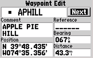 |
| All the GPS-III screen shots were captured with Waypoint+, only
the smaller screen image is shown at normal size, the others 3 were doubled
in size using Paint Shop Pro 5.01
Waypoint+ is the intellectual property of , and all rights are retained by Brent Hildebrand. Do you have a Garmin GPS-III or Street Pilot?
|
|
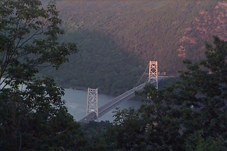 |
The Bear Mountain Bridge, looking East across the Hudson River, taken from atop a mountain in Bear Mountain State Park. |
|
|
All photographs and graphics on this page are Copyright � 1999, Robert F. Derderian, all rights reserved. |