| Weather Data | |||
|---|---|---|---|
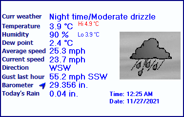
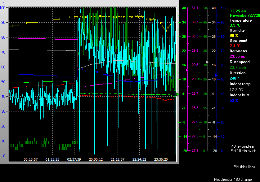
| LAST READING AT TIME: 12:25 AM DATE: November 27 2021, time of next update: 12:30 am | |||
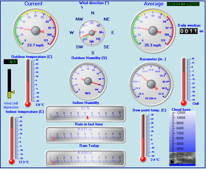
| Current Weather | Night time/Moderate drizzle | Current Temperature | 3.9°C (39.0°F), Apparent temp -4.6°C |
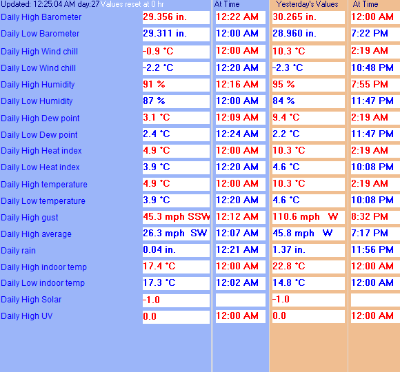
| Maximum Temperature (since midnight) | 4.9°C at: 12:00 AM | Minimum Temperature (since midnight) | 3.9°C at: 12:20 AM |
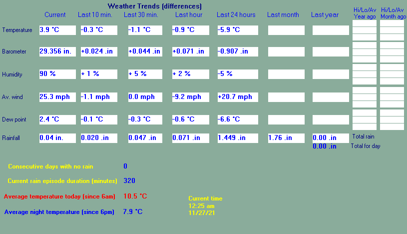
| Average windspeed (ten minute) | 25.6 mph | Wind Direction (ten minute) | WSW (243°) |
| Windchill Temperature | -2.2°C | Maximum Gust (last hour) | 55.2 mph at: 11:28 PM |
| Maximum Gust (since midnight) | 45.3 mph at: 12:12 AM | Maximum 1 minute average (since midnight) | 26.3 mph at: 12:07 AM |
| Rainfall (last hour) | 0.07 in. (1.8 mm) | Rainfall (since midnight) | 0.04 in. (1.0 mm) at 12:21 AM |
| Rainfall This month | 3.17 in. (80.5 mm) | Rainfall To date this year | 11.75 in. (298.6 mm) |
| Maximum rain per minute (last hour) | 0.00 in/min | Maximum rain per hour (last 6 hours) | 0.00 in/hour |
| Yesterdays rainfall | 1.37 in | DewPoint | 2.4°C (Wet Bulb :3.3°C ) |
| Humidity | 90 %, Humidex 2.4°C | Barometer corrected to msl | 29.356 in. (994.1 hPa) |
| Pressure change | +0.07 in. (last hour) | Trend (last hour) | RISING SLOWLY |
| Pressure change (last 12 hours) | -0.94 in | Pressure change (last 6 hours) | -0.89 in |


Use the RELOAD facility on your browser to retrieve the latest data.