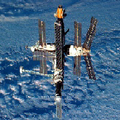
Space Station MIR
APRS Test
You are Visitor Number
Since July 5, 1999
In March 1998 an experiment was conducted by a group of Amateur Radio Operators using the Packet Radio Station aboard the Space Station MIR. The amateurs "digipeted" their latitude and longitude coordinants through the Space Station, Packet Radio System back to Earth. The window below shows the stations heard by Mir during each orbit that the experiment was active.
APRS is a Packet Radio Protocol developed by Bob Bruninga WB4APR in the early 1990s when GPS (Global Positiong System) Receivers became affordable to the average Radio Amateur. The APRS software that Bob originally developed captures NMEA Data from the GPS which is imbedded with latitude and longitude information and allows this to be broadcast via radio and radio modem called a TNC (Terminal Node Controller). When this signal is received the program running on the Earth Station displays the broadcast station location as an icon on a map. This has become a very popular mode of operation.
The map below indicates all of the Amateur Radio Stations in North America who participated in this test.
| zooms up/down (you may also use PGup/dn) | |
| List stations, Show Status or Messages to Java console | |
| Centers or Zooms map on clicked location | |
| scrolls map |
Satellite Tracking on the Internet.
More information on Amateur Radio in Space.
Other digital modes on the Amateur Bands.