![]()
![]()
![]()
![]()
![]()
![]()
![]()
![]()
![]()
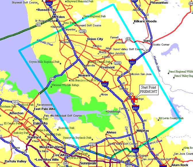
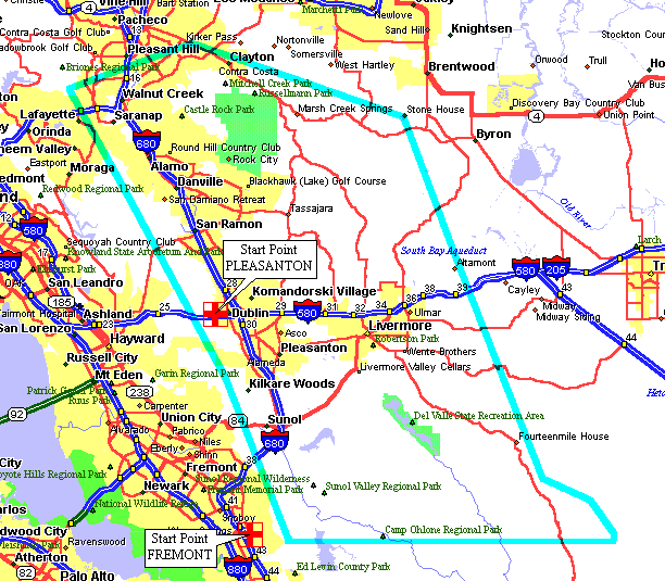
|
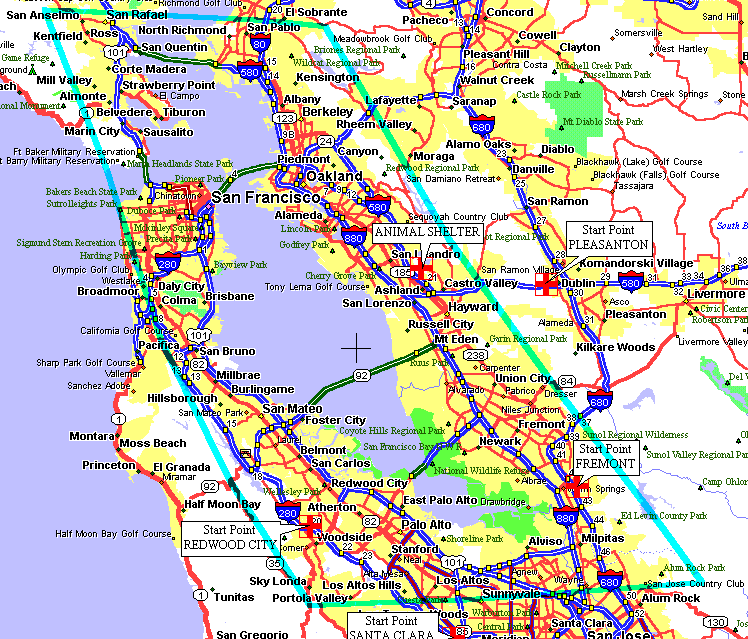
Pleasanton Start Point.
|

|
Start Point |
Boundary Map |
 |
|
|
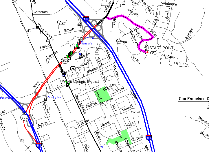
The S.F. Bay Hunt.
You can start from anywhere.
Starts 5 PM Pacific Standard time or 6 PM
Pacific Daylight savings time.
Try using 442.625+ PL94.8 for a talk-in frequency.
|
Boundary Map |
|
|
![]()
The Pack a Lunch Hunt.
Starts at 10 AM from the Pleasanton Start Point,
unless specified.
Use 147.12+ PL100.0 or 442.625+ PL94.8 or 145.350+ PL100.0 talk-in frequencies.
Bring some snack foods and a cooler full of water.
Lately,
hunters have been starting from the
Altamont Pass.
![]()
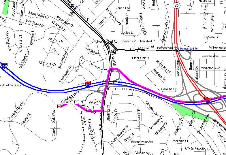
Santa Clara Start Point.
Cristo Rey Dr., in Cupertino, California. Starts 5 PM Pacific
Standard or 6 PM Pacific Daylight.
Talk-in, try 147.015+ PL103.5
|
Start Point |
Boundary Map |
 |
|

|
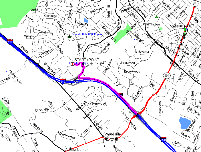
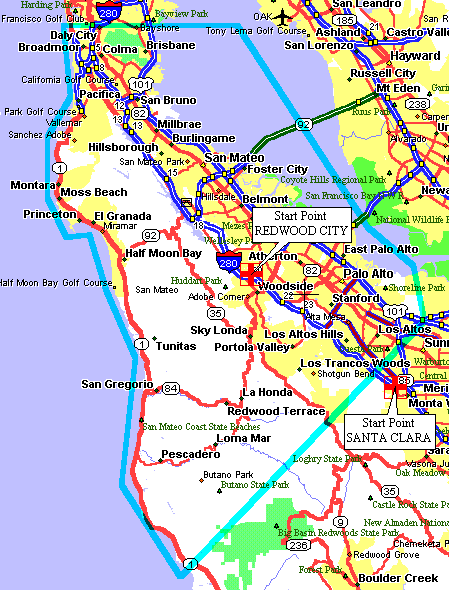
Redwood City Start Point.
At Canada College, Redwood City, California. Starts 5 PM Pacific
Standard or 6 PM Pacific Daylight.
Talk-in, try 147.015+ PL103.5 or 442.625+ PL94.8
|
Start Point |
Boundary Map |
 |
|
|
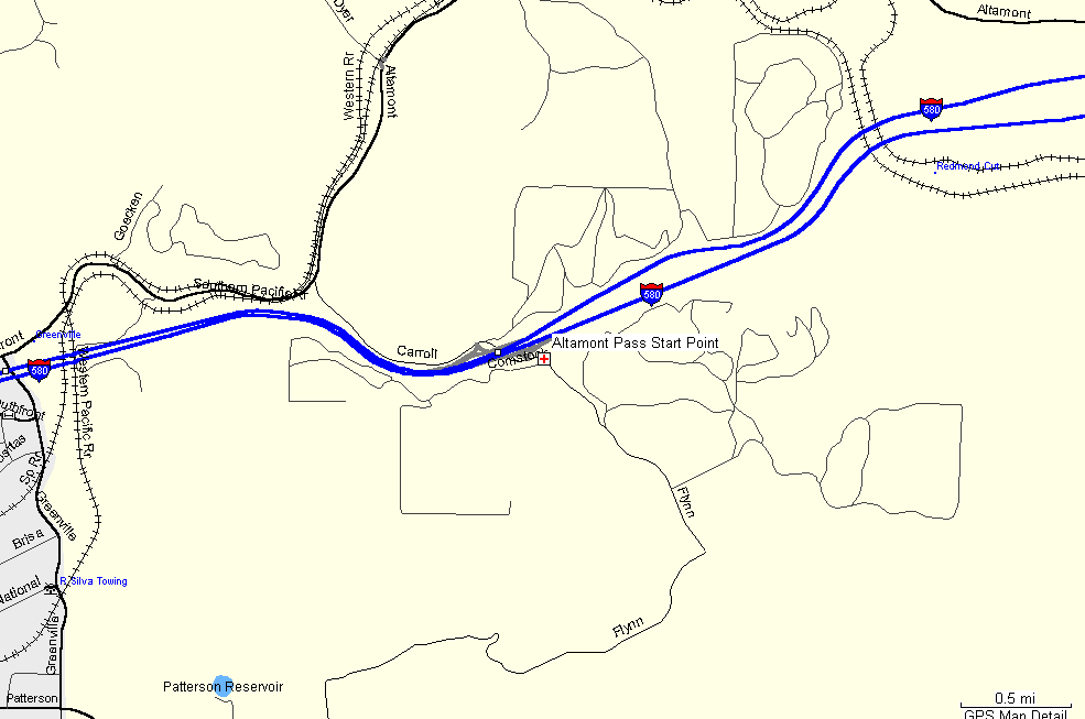
Altamont Pass Start Point.
On TOP of the
Altamont Pass, take the North Flynn Rd. Exit and stay on the South
side of Hwy-580. There is a parking area above the truck/brake
inspection area.
Start times are
usually 10:00 AM because of the large hunt area.
Talk-in; Try 147.12(+)PL100.0, 147.06(+)PL100.0, 145.35(-)Pl100.0
or 147.945(-) PL100.0
|
Start Point |
 |
![]()
The
Stockton, Lodi, Manteca, Tracy, Discovery Bay
and Brentwood, Central Valley T-Hunt.
|
|
|
Start Point |
From the intersection of Hwy-680 / 580. Head East on Hwy-580 for 21 minutes, 20 miles. Continue heading East on Hwy-205 for 14 minutes, 14 miles. Head North on Hwy-5 for 20 minutes, 17 miles. Take the W.March Ln Exit Head West on W.March Ln for 7 minutes, 2 miles. Take the last right before the marina. (Tenmile Slough or Brookside Rd.) to the top of the levy. Park by the gate, Buckeye Cove. Total time 1hr. 3mins. 53miles (from Hwy-680/580) |
|
Boundary Map |
|


![]()