![]()
![]()
![]()
![]()
![]()
![]()
![]()
![]()
![]()
![]()
![]()
![]()
![]()
![]()
![]()
![]()
![]()
![]()
![]()
![]()
![]()
![]()
![]()
![]()
Transmitter Hunting in the San Francisco Bay
Area
|
THE FOX PARTICIPATING HUNTERS
|


Participants |
|
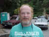
Fox: Rich - KN6FW |
|
| TEAMS (3) |
Notes |
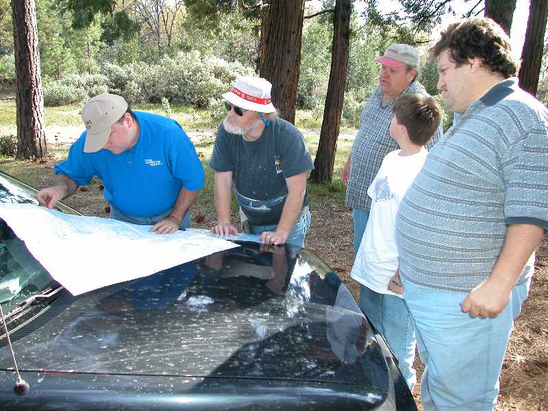
| Chris-KF6VFU, Johnathan-KG6KWT, Nicholas | Winner. Only team to start from the official start point. |
| Henry-KF6PCE, Joan-KF6QGJ, Bill-KF6QGK, Susan | First team to find the fox, without hints. |
| Jim-KD6DX, Kathleen-N6DOB | Second team to find the fox, with hints. |
| Paul Shinn | Workday for Paul, he made it to Groveland but, had to get back to work in Stockton. |
 |
I had so many
track points (lots of miles) on this hunt that my GPS erased my tracks
from waypoint #1 to waypoint #4. What you see on the "track2.gif" map is 5 hours and about 110 miles of driving. |
|||||
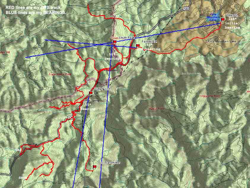 topo-1.jpg |
This TOPOGRAPHICAL map shows mountains blocking any direct signals from the fox transmitter all along hwy-120 except from Buck Meadows to San Jose Camp. If you didn't trust bearings between these two points, you would swear the signal was coming from the south. (Note: Map top is south/west). Also, the Doppler pointed behind us, 90% of the time we drove towards the fox on Cherry Oil Rd. (the last leg of our hunt). | |||||
|
|
What a learning experience, I started my hunt from Groveland and still
had a very difficult time finding the Fox. I was told getting to
Groveland was the easy part. Isolating the Fox from all the reflections
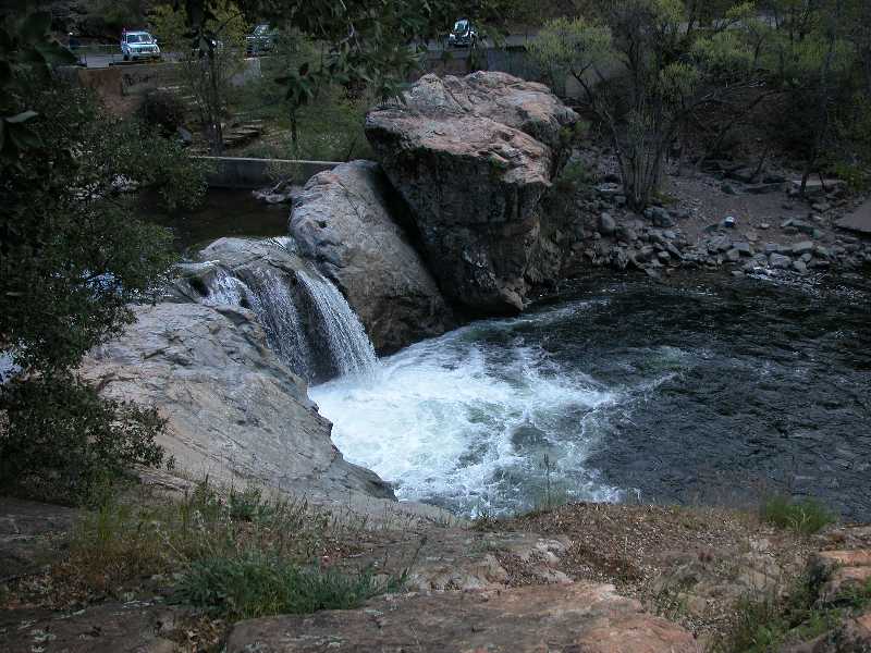
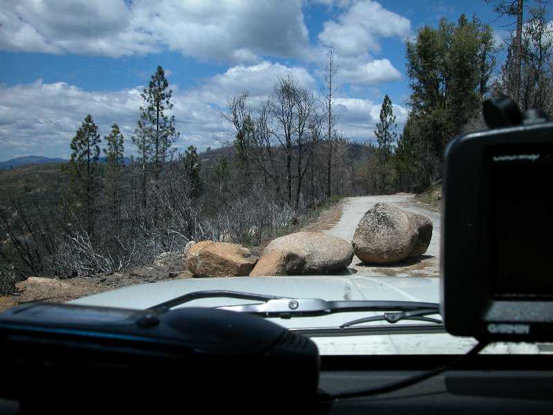
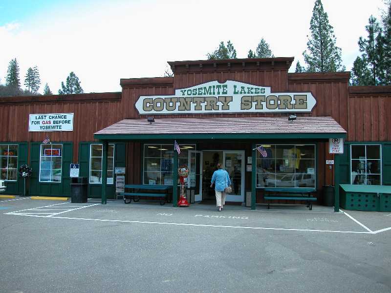
was the hard part. Thanks Henry-KF6PCE, now I don't feel so bad. Kathleen-N6DOB and I had a great time looking at all the scenery. We drove into places we would have never trekked on our own. Great views of the mountains, natural water falls, boulders on the road, we even drove high and east enough to see snow on the ground. Four Wheel Drive and slow mountain traveling used up all our fuel. We even had to fill-up with gas (last gas before entering Yosemite) at $2.12 per gallon. T-Hunting Equipment I Used: 2) AHHA MicroFinder Doppler: Using "Digital Filtering" my Doppler pointed to any strong signal, including reflections. Since most of the time I received reflections, my display would generally point to these reflections. I found by turning off my Doppler filter and viewing raw Doppler directions I could use the 'Human Brain Filter". The Doppler display would point to reflections for a shorter duration and the true direction a few moments longer (most of the time). Reflections were also 'Scattered' so the displayed direction was wide. The true direction seemed to be a narrow displayed direction which stuck moments longer. 3) Garmin StreetPilot-III: This street and trail level GPS mapping system worked great, except for plotting all my bearings. I really needed to plot my (good and bad) dozen or so bearings on a paper map so I could use my under powered brain to figure out what was good and what was bad. CONCLUSION: Great advanced hunt. Rich-KN6FW should
have been on this hunt but, since he was the Fox, he just had to wait 5
hours for the first hunter to show up. James Sakane (KD6DX) |
||||
|
|
|||||
|
|
|||||
|
|
|||||
|
|
|||||
|
|
|||||
|
||||||