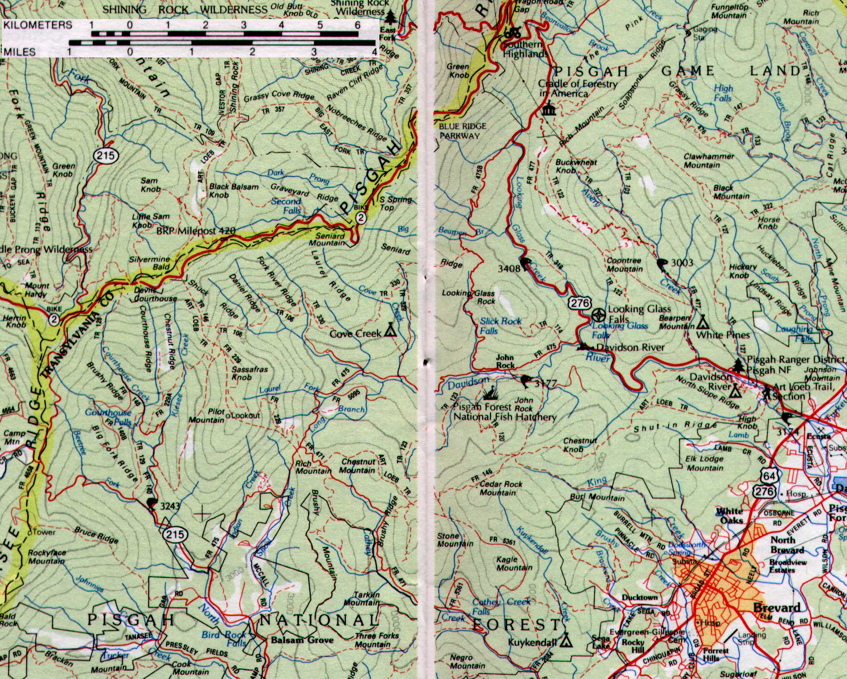
The area of interest extends from Brevard, north up US 276 to the Blue Ridge Parkway (Hwy. 2) and west to Hwy. 215. Much of the activity has been on or around Pilot Mountain, about 3 miles southeast of the junction of Hwy 2 and Hwy 215.
Brevard is near the bottom right corner of this map. Follow US 276 North from Brevard. Turn left (West) on FR 475 just before Looking Glass Falls. Continue west past the Pisgah Forest National Fish Hatchery to Pilot Mountain. Other activity has been heard around the Hatchery and nearby Looking Glass Rock.
The Blue Ridge Parkway (Hwy 2) extends from West to East across the map. Some activity has been heard around the Devil's Courthouse (elevation over 5600 ft) and the nearby Graveyard Fields. Both are just north of Pilot Mountain. Refer to this map as you read the Interference Log.