|
|
|
|
|
|
|
|
|
|
|
As I develop the site, you'll be able to come to this page and get free stuff like operating aids, text files of useful information, and goodies like that. Right now the page is still under construction, so there still isn't much here. For example, here's a handy Morse Code chart for those of you who haven't learned the code yet. Right click on the chart, then select the option to "save image" and dump it on your hard drive somewhere handy. Then, next time you're prowling the ham bands and hear someone ID with dahdidah dahdidahdit dididahdahdah didididit dahdah dahdahdidit, you can look it up and "decode" it to KC2HMZ. Since I'm not a CW op, you'll know you caught someone bootlegging my call. Let me know ASAP if this happens! --... ...-- -.. . -.- -.-. ..--- .... -- --.. .-.-. |
 |
|
|
 |
| Here's a map of worldwide time zones for ya! The "zero" line represents coordinated universal time (UTC), and the other numbers across the top show how far ahead of or behind UTC each time zone is. The little clock faces along the bottom show the local time at midnight UTC in each time zone. Same drill as for the code chart - right click on the map then choose the option to save image. |
|
|
 |
|
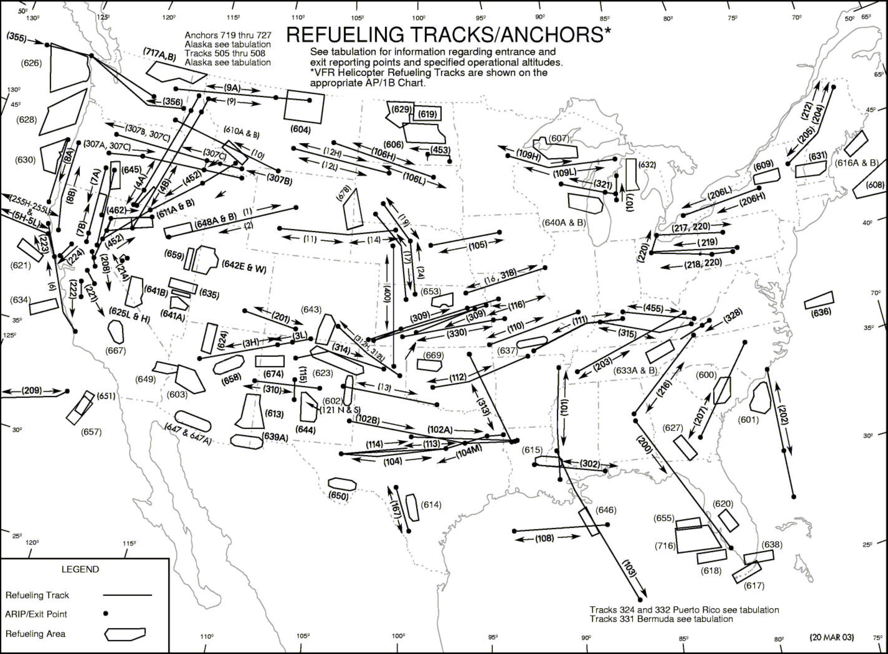
Thumbnail above of a map showing all CONUS aerial refueling tracks and anchors. |
| Each has its own ARCP, Exit, and boom frequencies, lists of which are available on the internet - although a list will appear on these pages soon. ARCP = Air Refueling Control Point. The tanker orbits the ARCP until the receiver(s) arrive. ARCP and Exit frequencies carry comms between the tankers or receivers and the ground facility that controls traffic for that track. The boom frequencies are where the tankers and receivers talk to one another. Much of this work takes place at high altitude, so if you live in the continental US, chances are you're within listening range of one or more of these. Click the links below to grab a map of where they're located, then you can look up the frequencies and start listening: |
| Click here for smaller version (950x700x16M JPG, 159Kb) |
| Click here for larger version (2851x2101x16M JPG, 785Kb) |
|
|